|
|
REFINE
Browse All : Images by Mitchell, Samuel Augustus of Mexico
1-23 of 23
Author
Mitchell, Samuel Augustus
Full Title
Mexico & Guatemala. Published by Thomas, Cowperthwait & Co. No. 253 Market Street, Philadelphia. Entered ... 1850, by Thomas, Cowperthwait & Co. ... Pennsylvania. (with four inset maps) Valley of Mexico, Guatemala ..., The Isthmus of Tehuantepec ..., Isthmus of Nicaragua ...
Publisher
Thomas, Cowperthwait & Co.
Author
Mitchell, Samuel Augustus
Full Title
Mexico & Guatemala. Published by Thomas, Cowperthwait & Co., no. 253 Market Street, Philadelphia. Entered ... 1850 by Thomas, Cowperthwait & Co. ... Pennsylvania. (with four inset maps) The Isthmus of Tehuantepec showing Proposed Route from the Gulf of Mexico to the Pacific Ocean, The Isthmus of Nicaragua Showing the Proposed Routes from the Caribbean Sea to the Pacific Ocean, Guatemala or Central America, and the Valley of Mexico.
Publisher
Cowperthwait, Desilver & Butler
Author
[Mitchell, Samuel Augustus, Dorby & Miller]
Full Title
Map Of Mexico, Including Yucatan & Upper California, exhibiting The Chief Cities And Towns, The Principal Travelling Routes &c. Philadelphia. Published by Dorby & Miller. Auburn, New York. 1850. Entered ... 1847 by S. Augustus Mitchell ... Pennsylva. (inset map) Battle Field Of Monterey.
Publisher
Dorby & Miller
Author
Mitchell, Samuel Augustus
Full Title
Map Of The Seat Of War Gen. Taylor's Field Of Operations In Mexico. Philadelphia. Pubd. by S. Augustus Mitchell, N.E. Corr. of Market & 7th Sts. ... (inset map) The Late Battlefield. (inset) Map of the Seat Of War.
Publisher
S.A. Mitchell
Author
[Bourquin, Frederick, Mitchell, Samuel Augustus, Tanner, Henry S.]
Full Title
Mexico & Guatemala: Entered according to Act of Congress in the 1846 by H.N. Burroughs, in the Clerk's Office of the Eastern District of Pennsylvania. 36.
Publisher
S. Augustus Mitchell.
Author
Mitchell, Samuel Augustus
Full Title
Mexico & Guatemala: Published By S. Augustus Mitchell. N.E. corner of Market & 7th. Streets. Philadelphia. (2 inset maps) Valley of Mexico, and Guatemala.
Publisher
S.A. Mitchell
Author
Mitchell, Samuel Augustus
Full Title
Mexico & Guatemala. (insets) Guatemala. Valley of Mexico.
Publisher
Thomas, Cowperthwait & Co.
Author
Mitchell, Samuel Augustus
Full Title
Mexico & Guatemala. Published by Charles Desilver, No. 251 Market Street, Philadelphia. Entered ... 1856 by Charles Desilver ... Pennsylvania. (with four inset maps) The Isthmus of Tehuantepec showing Proposed Route from the Gulf of Mexico to the Pacific Ocean, The Isthmus of Nicaragua Showing the Proposed Routes from the Caribbean Sea to the Pacific Ocean, Guatemala or Central America, and the Valley of Mexico.
Publisher
Charles DeSilver
Author
Mitchell, Samuel Augustus
Full Title
Map of the United States. Engraved to illustrate Mitchell's school and family geography. (with) Map of Mexico and Guatimala engraved to illustrate Mitchell's school and family geography. Engraved by W. Williams. Entered ... 1839 by S. Augustus Mitchell ... Connecticut.
Publisher
Thomas, Cowperthwait & Co.
Author
Mitchell, Samuel Augustus
Full Title
Map of Mexico, Central America, and the West Indies. (with) Map of the Sandwich Islands. Discovered by Captn. Cook in 1778. (with) Map of the island of Jamaica. (with) Map of the Bermuda Islands. (with) Map of the Panama Railroad. Entered ... 1879 by S. Augustus Mitchell ... Washington. (1880)
Publisher
S.A. Mitchell
Full Title
Map of Mexico, Central America, and the West Indies. (with) Map of the Bermuda Islands. (with) Map of the island of Jamaica. (with) Map of the proposed ship rail road route across the isthmus of Tehuantepec. (with) Map of the Panama Railroad and proposed canal. (with) Map of the proposed Nicaragua Canal route. Copyright 1887 by Wm. M. Bradley & Bro. (1890)
Publisher
John Y. Huber & Co.
Author
[Mitchell, Samuel Augustus, Williams, W. (Wellington)]
Full Title
Map of Mexico, Central America, and the West Indies. (with) Map of the island of Cuba. (with) Map of the island of Jamaica. (with) Map of the Bermuda Islands. (with) Map of the Panama Railroad. Constructed & engraved by W. Williams, Philadelphia. Entered ... 1870 by S. Augustus Mitchell, Jr. ... Pennsylvania.
Publisher
[R.A. Campbell, S.A. Mitchell, Jr.]
Author
Mitchell, Samuel Augustus
Full Title
Map of the Republic of Mexico Compiled by W.H. Holmes. Published By C. Desilver, No. 714 Chesnut Street, Philadelphia. Entered according to Act of Congress in the year 1859 by Charles Desilver in the Clerk's office if the District Court of the Eastern District of Pennsylvania.
Publisher
Charles Desilver.
Author
Mitchell, Samuel Augustus
Full Title
Map Of Mexico, Including Yucatan & Upper California, exhibiting The Chief Cities and Towns, The Principal Travelling Routes &c. Philadelphia: Published by S. Augustus Mitchell N.E. Corner Of Market And Seventh Sts. 1847. Entered ... 1846 by S. Augustus Mitchell ... Pennsylvania. (inset) The Late Battlefield.
Publisher
S.A. Mitchell
Author
[Mitchell, Samuel Augustus, Stealey, Geo.]
Full Title
(Covers to) Map Of Mexico, Including Yucatan & Upper California, exhibiting The Chief Cities and Towns, The Principal Travelling Routes &c. Philadelphia: Published by S. Augustus Mitchell N.E. Corner Of Market And Seventh Sts. 1847. Entered ... 1847 by S. Augustus Mitchell ... Pennsylvania. (inset) The Late Battlefield. (with) Map of the Principal Roads from Vera Cruz and Alvarado to the City of Mexico ... Compiled from the latest and best Authorities. By Geo. Stealey, Civil Engineer.
Publisher
S.A. Mitchell
Author
[Mitchell, Samuel Augustus, Stealey, Geo.]
Full Title
Map Of Mexico, Including Yucatan & Upper California, exhibiting The Chief Cities and Towns, The Principal Travelling Routes &c. Philadelphia: Published by S. Augustus Mitchell N.E. Corner Of Market And Seventh Sts. 1847. Entered ... 1847 by S. Augustus Mitchell ... Pennsylvania. (inset) The Late Battlefield. (with) Map of the Principal Roads from Vera Cruz and Alvarado to the City of Mexico ... Compiled from the latest and best Authorities. By Geo. Stealey, Civil Engineer.
Publisher
S.A. Mitchell
Author
Mitchell, Samuel Augustus
Full Title
Mexico & Guatemala: By H.S. Tanner. (with) two inset maps: Guatemala and Valley of Mexico. Entered ... 1846 by H.N. Burroughs ... Pennsylvania.
Publisher
S.A. Mitchell
Author
Mitchell, Samuel Augustus
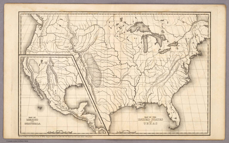
Full Title
Map of the United States and Texas Engraved to Illustrate Mitchell's School and Family Geography. No. 4. (with) Map of Mexico and Guatimala ... No. 5. Engraved by W. Williams. Entered ... 1839, by S. Augustus Mitchell ... Connecticut.
Publisher
Thomas, Cowperthwait & Co.
Author
Mitchell, Samuel Augustus
Full Title
Map of the United States and Texas. (with) Map of Mexico and Guatimala. Entered ... 1839, by S. Augustus Mitchell ... Pennsylvania.
Publisher
Thomas, Cowperthwait & Co.
Author
Mitchell, Samuel Augustus
Full Title
Mitchell's New National Map Exhibiting The United States With The North American British Provinces, Sandwich Islands, Mexico And Central America, Together with Cuba and other West India Islands. Philadelphia, Published By S. Augustus Mitchell. 1858. Engraved by W. Williams, Map Engraver Philadelphia. Constructed And Engraved By W. Williams, 33 South Fifth St. Philadelphia. Entered ... 1856 by S. Augustus Mitchell ... Pennsylvania. (inset) Map Of The World On The Mercator Projection ... (inset) Map Of The World On The Globular Projection ... (inset) Map Of The Sandwich Islands.
Publisher
S. Augustus Mitchell
Author
Mitchell, Samuel Augustus
Full Title
Mexico & Guatemala: Published By Charles Desilver, Philadelphia. Entered according to Act of Congress in the year 1856 by Charles Desilver in the Clerk's office if the District Court of the Eastern District of Pennsylvania. 39.
Publisher
Charles Desilver.
Full Title
Map of Mexico, Central America, and the West Indies. (with) Map of the Bermuda Islands. (with) Map of the island of Jamaica. (with) Map of the proposed ship rail road route across the isthmus of Tehuantepec. (with) Map of the Panama Railroad and proposed canal. (with) Map of the proposed Nicaragua Canal route. Copyright 1886 by Wm. M. Bradley & Bro.
Publisher
Wm. M. Bradley & Bro.
1-23 of 23
|