Who What Where WhenREMOVE |
REFINE
Browse All : Images by William H. Bartlett II of Liberia
1-2 of 2
Author
Prang, L. & Co.
Full Title
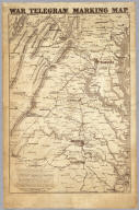
Map of the Atlantic States, Showing Distances From Washington (In BeeLine) By 50 Mile Circles. (The Traveling Distance is about 1/6 to 1/3 more than the BeeLine.) (with) Map of the Battle Ground (with) Map of Norfolk Harbor, Fort Monroe, and Vicinity. (with two insets) Position of Forces at Bull Run and Fortress Monroe. Published By L. Prang & Co. - No. 84 Merchants Row, Boston, Mass. Entered ... 1861 by L. Prang & Co. ... Massachusetts.
Publisher
L. Prang & Co.
1-2 of 2
|