Who What Where WhenREMOVEWHATWHERE |
REFINE
Browse All : Pocket Map by S.H. Colesworthy
1-4 of 4
Author
Colesworthy, S.H.
Full Title
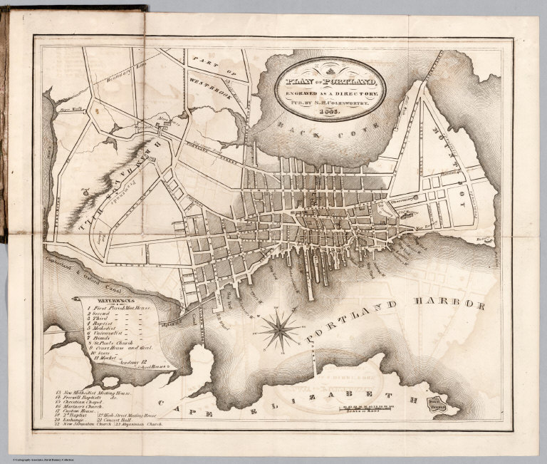
A Plan Of Portland, Engraved As A Directory. Pub. By S.H. Colesworthy. 1846.
Publisher
S.H. Colesworthy
Author
Anson, W.
Full Title
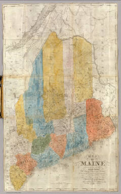
Map Of Maine Constructed from the most Correct Surveys With Sectional Distances and Elevations or Level, of the St. Croix River from Calais Bridge. Deduced from the States Survey, Made by W. Anson, Civil Engineer, In 1836. Engraved & Published by by S.H. Colesworthy, Portland. 1843. Revised Edition.
Publisher
S.H. Colesworthy
Author
Colesworthy, S.H.
Full Title
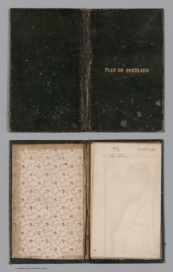
(Covers to) A Plan Of Portland, Engraved As A Directory. Pub. By S.H. Colesworthy. 1846.
Publisher
S.H. Colesworthy
Author
Anson, W.
Full Title
(Covers to) Map Of Maine Constructed from the most Correct Surveys With Sectional Distances and Elevations or Level, of the St. Croix River from Calais Bridge. Deduced from the States Survey, Made by W. Anson, Civil Engineer, In 1836. Engraved & Published by by S.H. Colesworthy, Portland. 1843. Revised Edition.
Publisher
S.H. Colesworthy
1-4 of 4
|