Who What Where WhenWHATWHERE |
REFINE
Browse All : World Atlas and Index Page by Tanner, Henry S.
1-10 of 10
Author
Tanner, Henry S.
Full Title
(Contents to) A New American Atlas Containing Maps Of The Several States of the North American Union, Projected and drawn on a Uniform Scale from Documents found in the public Offices of the United States and State Governments, and other Original and Authentic Information, By Henry S. Tanner ... Philadelphia: Published By Henry S. Tanner. 1825. Index.
Publisher
Henry Tanner
Author
Tanner, Henry S.
Full Title
(Contents to) A new general atlas, comprising a complete set of maps representing the grand divisions of the globe, together with the several empires, kingdoms and states in the world; compiled from the best authorities, and corrected by the most recent discoveries. New York, Published at Tanner's Geographical Establishment, 1845. Written and engraved by Jos. Perkins.
Publisher
Tanner's Geographical Establishment
Author
Tanner, Henry S.
Full Title
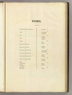
(Index Page to) A New American Atlas Containing Maps Of The Several States of the North American Union, Projected and drawn on a Uniform Scale from Documents found in the public Offices of the United States and State Governments, and other Original and Authentic Information, By Henry S. Tanner ... Philadelphia: Published By H.S. Tanner. 1823. (title page only) Writing Drawn and Engraved by Joseph Perkins. Barralet del. Humphrys sc.
Publisher
Henry Tanner
Author
Tanner, Henry S.
Full Title
(Index Page to) A New American Atlas Containing Maps Of The Several States of the North American Union, Projected and drawn on a Uniform Scale from Documents found in the public Offices of the United States and State Governments, and other Original and Authentic Information, By Henry S. Tanner ... Philadelphia: Published By H.S. Tanner. 1825. (title page only). Barralet del. Humphrys sc. Joseph Perkins, Philadelphia.
Publisher
Henry Tanner
Author
Tanner, Henry S.
Full Title
(Index Page to) A New American Atlas Containing Maps Of The Several States of the North American Union, Projected and drawn on a Uniform Scale from Documents found in the public Offices of the United States and State Governments, and other Original and Authentic Information, By Henry S. Tanner ... Philadelphia: Published By H.S. Tanner. 1825. (title page only) Writing Drawn and Engraved by Joseph Perkins. Barralet del. Humphrys sc.
Publisher
Henry Tanner
Author
Tanner, Henry S.
Full Title
(Index Page to) A New American Atlas Containing Maps Of The Several States of the North American Union, Projected and drawn on a Uniform Scale from Documents found in the public Offices of the United States and State Governments, and other Original and Authentic Information, By Henry S. Tanner ... Philadelphia: Published By H.S. Tanner. 1823. (title page only) Writing Drawn and Engraved by Joseph Perkins. Barralet del. Humphrys sc.
Publisher
Henry Tanner
Author
Tanner, Henry S.
Full Title
(Contents to) A New Universal Atlas Containing Maps of the various Empires, Kingdoms, States and Republics Of The World. With a special map of each of the United States, Plans of Cities &c. Comprehended in seventy sheets and forming a series of One Hundred And Seventeen Maps, Plans And Sections, By H.S. Tanner ... Philadelphia, Published By The Author. 1836. (title page by) J. Knight Sc.
Publisher
H.S. Tanner
Author
Tanner, Henry S.
Full Title
(Index to) A New Universal Atlas Containing Maps of the various Empires, Kingdoms, States and Republics Of The World. With a special map of each of the United States, Plans of Cities &c. Comprehended in seventy sheets and forming a series of One Hundred And Seventeen Maps, Plans And Sections, By H.S. Tanner ... Philadelphia, Published By The Author. 1836. (title page by) J. Knight Sc.
Publisher
H.S. Tanner
Author
Tanner, Henry S.
Full Title
(Contents to) A New Universal Atlas Containing Maps of the various Empires, Kingdoms, States and Republics Of The World. With a special map of each of the United States, Plans of Cities &c. Comprehended in seventy sheets and forming a series of One Hundred And Seventeen Maps, Plans And Sections, By H.S. Tanner ... Philadelphia, Published By Carey & Hart. 1844. Entered ... 1844, by Carey & Hart ... Pennsylvania. (title page by) J. Knight Sc.
Publisher
Carey and Hart
1-10 of 10
|