Browse All

1817 Europe. World Atlas Europe. J. & G. Menzies sculpt. (1817) |

1817 Remote British islands. World Atlas Remote British islands. Drawn & engraved … |

1817 Scandinavia. World Atlas Scandinavia, or Sweden, Denmark & Norway … |

1817 France. World Atlas France. Engd. by Kirkwood & Son, Edinr. … |

1817 Mediterranean Sea. World Atlas Chart of the Mediterranean Sea. (with) B … |

1817 Prussian Dominions. World Atlas Prussian Dominions. Engd. by W. Dassauvi … |

1817 Poland. World Atlas Poland as divided. J. & G. Menzies sculp … |

1817 Asia. World Atlas Asia. J. & G. Menzies sculpt. (Drawn & e … |

1817 East India Isles. World Atlas East India Isles. T. Clerk sculpt., Edin … |

1817 Hindoostan. World Atlas Hindoostan. (with) Isle of Ceylon. J. & … |

1817 N. Hindostan. World Atlas Northern Hindostan. (with) Cabul. (with) … |

1817 Birman Empire. World Atlas Birman Empire. Engd. by Moffat & Smellie … |
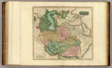
1817 Persia. World Atlas Persia. J. & G. Menzies sculpt., Edinr. … |

1817 Turkey in Asia. World Atlas Turkey in Asia. Engd. by W. Dassauville. … |

1817 Africa. World Atlas Africa. Drawn and engraved for Thomson's … |

1817 Egypt, Abyssinia. World Atlas Egypt. Abyssinia. Engraved by N.R. Hewit … |

1817 N. Atlantic Ocean. World Atlas Chart of North Atlantic Ocean with track … |

1817 Canada, Nova Scotia. World Atlas Canada and Nova Scotia. Engd. by W. Dass … |

1817 United States of America. World Atlas United States of America. (with) The cou … |

1817 N. United States. World Atlas Northern provinces of the United States. … |

1817 S. United States. World Atlas Southern provinces of the United States. … |

1817 Jamaica. World Atlas Jamaica. (with) The harbour of Bluefield … |

1817 St. Christophers. World Atlas St. Christophers. (with) St. Lucia. (wit … |

1817 Guadaloupe. World Atlas Guadaloupe. (with) Mariegalante &c. (wit … |

1817 Martinico, Dominica. World Atlas Martinico. (with) Dominica. (with) Cul d … |

1817 St. Vincent, Barbadoes. World Atlas St. Vincent. Barbadoes. West India Islan … |

1817 Caraccas, Guiana. World Atlas Caraccas and Guiana. Engd. by J. Moffat, … |

1817 Pacific islands. World Atlas Map of the islands in the Pacific Ocean. … |

1814 Hydrographical chart of the World. World Atlas Hydrographical chart of the World on Wri … |

1814 N. Hemisphere. World Atlas Northern Hemisphere. Kirkwood sculp. Dra … |

1814 S. Hemisphere. World Atlas Southern Hemisphere. Kirkwood sculp. Dra … |

1815 E. Hemisphere. World Atlas Eastern Hemisphere. Drawn & engraved for … |

1815 W. Hemisphere. World Atlas Western Hemisphere. Drawn & engraved for … |

1816 N. Hemisphere, plane of London. World Atlas Northern Hemisphere projected on the pla … |

1816 S. Hemisphere, plane of London. World Atlas Southern Hemisphere projected on the pla … |

1815 British Isles. World Atlas British Isles. Drawn & engraved by Hewit … |

1815 Ireland. World Atlas Ireland. Neale (i.e. Neele) sculpt., Str … |

1815 Scotland. World Atlas Scotland. Drawn & engraved by Hewitt, Br … |

1814 England. World Atlas England. Neele sculpt., Strand, London. … |

1814 British Channel. World Atlas The British Channel. J. & G. Menzies scu … |

1816 North, Baltic seas. World Atlas Chart of the North and Baltic seas, &c. … |

1814 Denmark, Iceland, Feroe Islands. World Atlas Denmark. (with) Iceland. (with) Feroe Is … |

1816 Germany N. of Mayne. World Atlas Germany north of the Mayne. Neele sc., S … |

1814 Holland. World Atlas Holland. Neele sculpt., London. Drawn & … |

1815 Belgium. World Atlas Belgium or the Netherlands. Drawn and en … |

1814 France, provinces. World Atlas France, in provinces. Kirkwood sculpt. D … |

1815 Spain, Portugal. World Atlas Spain & Portugal. J. & G. Menzies sculpt … |

1815 Attica, Turkey in Europe. World Atlas Attica. Turkish dominions in Europe. E. … |

1814 Italy. World Atlas Italy. (with) Island of Elba. R. Scott, … |

1816 Venetian States. World Atlas Venetian States. Drawn & engraved by N.R … |