Browse All

1850 Map of the United States. Separate Map Map Of The United States And Their Terri … |

1862 Map Of N. Eastern Virginia And Vicinity … Separate Map "Surveys For Military Defences" Map Of N … |

1847 Siege Of Vera Cruz, by the U.S. Troops Separate Map Siege Of Vera Cruz, by the U.S. Troops u … |

1862 Part of Washington County, MD. Separate Map Part of Washington County, MD. Bureau of … |

1862 Sketch Of Country Between Haxall's Landi … Separate Map Sketch Of Country Between Haxall's Landi … |

1877 Map Of The United States. Case Map Map Of The United States. Prepared by au … |

1859 Department of Oregon. Map of the state o … Separate Map Department of Oregon. Map of the state o … |
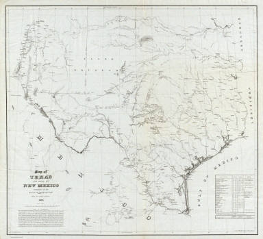
1857 Map of Texas and part of New Mexico. Separate Map Map of Texas and part of New Mexico comp … |

1895 N.E. Virginia, Washington 1. Military Atlas Surveys for military defenses. Map of no … |
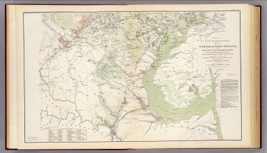
1895 N.E. Virginia, Washington 2. Military Atlas Surveys for military defenses. Map of no … |

1895 SE Virginia, Ft. Monroe. Military Atlas Part of the map of the Military Departme … |

1895 SE Virginia, Ft. Monroe, approaches to R … Military Atlas Part of the map of the Military Departme … |

1895 Mil. depts. of Wash., Penn., Annapolis, … Military Atlas Part of map of portions of the military … |