|
Author
[Bache, A. D., Hassler, F. R.]
Full Title
(Map of Delaware Bay and River). Sheet no. 3. (Founded upon a trigonometrical survey under the direction of F.R. Hassler and A.D. Bache, Superintendents of the Survey of the Coast of the United States. Triangulation by F.R. Hassler, assts. J. Ferguson, E. Blunt, C.M. Eakin, F.H. Gerdes, J.J.S. Hassler & J.E. Johnstone, Capt. Topl. Engrs. Topography by assistants W.M. Boyce, F.H. Gerdes, J.J.S. Hassler, H.L. Whiting, G.D. Wise & B.F. Sands, U.S.N. Hydrography by the party under the command of G.S. Blake, Lieutenant U.S. Navy. Soundings outside the capes under the direction of T.R. Gedney and G.M. Bache, Lieutenants U.S. Navy. Published in 1848. A.D. Bache, Superintendent). Final reduction for engraving of topography by W.M.C. Fairfax, asstist. & of hydrography by Lt. J.B. Dale, U.S.N. & J.B. Gluck, assistant. Engraved by F. Dankworth, assisted by O.A. Lawson. Lettering by F. Dankworth & J. Knight. Electrotype copy no. 4 by G. Mathiot, U.S.C.S.
Publisher
U.S.
Author
Bache, A. D.
Full Title
Sea Coast of Delaware, Maryland and part of Virginia. From a trigonometrical survey under the direction of A.D. Bache, Superintendent of the Survey of the Coast of the United States. Triangulation by J. Farley, E. Blunt & J.E. Johnstone, Capt. Top. Engrs., assistants. Topography by J.J.S. Hassler & G.D. Wise, assts. & W.M. Johnson, sub. asst. Hydrography by the parties under the command of T.R. Gedney, Lieuts. G.M. Bache, S.P. Lee, R. Bache & J.J. Almy, U.S. Navy, assistants U.S. Coast Survey. Published in 1852.
Publisher
U.S.
Author
Bache, A. D.
Full Title
The Harbor of Annapolis. Founded upon a trigonometrical survey under the direction of A.D. Bache, Superintendent of the Survey of the Coast of the United States. Triangulation by James Ferguson and Ferd. H. Gerdes, assistants. The hydrography under the direction of George M. Bache, Lieutenant, U.S. Navy. Topography by F.H. Gerdes, assistant. Published in 1846. Final reduction for engraving by R.D. Cutts, assistant. Topography engd. by J.H. Young, Phila. & the views by O. Lawson, Washn. Electrotype copy no. 1 by G. Mathiot, U.S.C.S. (with logo) U.S. Coast Survey Depot.
Publisher
U.S.
Author
Bache, A. D.
Full Title
Mouth of Chester River. (Harbor of refuge no.). From a trigonometrical survey under the direction of A.D. Bache, Superintendent of the Survey of the Coast of the United States. Triangulation by J. Ferguson and J.E. Johnston(e), Capt. Topl. Engrs., assistants. Topography by H.L. Whiting, R.D. Cutts and J.C. Neilson, assts. Hydrography by the party under the command of W.P. McArthur, Lieutenant, U.S. Navy. Published in 1849. Final reduction for engraving by Wm. Luce and C. Mahon, draughtsmen. Engraving by F. Dankworth, O.A. Lawson, W. Smith and S.T. Pettit. Printed by H. Benner. Electrotype copy no. 2 by G. Mathiot, U.S.C.S. (with logo) U.S. Coast Survey Office.
Publisher
U.S.
Author
Bache, A. D.
Full Title
Pasquotank River. From a trigonometrical survey under the direction of A.D. Bache, Superintendent of the Survey of the Coast of the United States. Triangulation by W.M. Boyce and J.C. Neilson, assistants. Topography by J.C. Neilson, assistant. Hydrography by the party under the command of W.P. McArthur, Lieutenant, U.S. Navy. Published in 1850. Drawn by J.H. Adams, draughtsman. Engraved by W. Smith and S.T. Pettit. Electrotype copy no. 1 by G. Mathiot, U.S.C.S. (with logo) U.S. Coast Survey Depot.
Publisher
U.S.
Author
Bache, A. D.
Full Title
Reconnaissance of Hatteras Inlet, North Carolina. U.S. Coast Survey, A.D. Bache, Superintendent. By the hydrography party under the command of Lieut. R. Wainwright, U.S.N., assistant. 1853. Fourth Edition.
Publisher
U.S.
Author
Bache, A. D.
Full Title
Savannah River. Reconnaissance of the approaches to the city of Savannah including Front & Back Rivers. U.S. Coast Survey. A.D. Bache, Superintendent. By the hydrographic party under the command of Lieut. J.N. Maffitt, U.S.N. & asst. U.S.C.S. 1851. (with logo) U.S. Coast Survey Office.
Publisher
U.S.
Author
Bache, A. D.
Full Title
Preliminary chart of Key-West Harbor and approaches. From a trigonometrical survey under the direction of A.D. Bache, Superintendent of the Survey of the Coast of the United States. Triangulation by J.E. Hilgard, assistant. Topography by I.H. Adams, asst. Hydrography by the party under the command of Lt. John Rodgers, U.S.N. & asst. U.S.C.S. 1852. Second edition. Reduction for engraving by E.K. Knorr. Outlines & topography engraved by A. Rolle; lettering by Edw. Yeager. Electrotype copy no. 1 by G. Mathiot, U.S.C.S. (with logo) U.S. Coast Survey Office.
Publisher
U.S.
Author
Bache, A. D.
Full Title
Reconnoissance of vicinity of Cedar Keys, coast of Florida by F.H. Gerdes, assist. U.S. Coast Survey. U.S. Coast Survey. A.D. Bache, Superintendent. Sketch F. No. 4. 1851.
Publisher
U.S.
Author
Bache, A. D.
Full Title
Reconnaissance of Channel No. IV, Cedar-Keys, Florida. U.S. Coast Survey, A.D. Bache, Superintendent. By F.H. Gerdes, Assistant U.S.C.S. 1852. Topography engraved by Tho. H. Oehlschlager; outlines and lettering by Saml. E. Stull.
Publisher
U.S.
Author
Bache, A. D.
Full Title
Entrance to Mobile Bay. From a trigonometrical survey under the direction of A.D. Bache, Superintendent of the Survey of the Coast of the United States. Main triangulation by F.H. Gerdes, assistant. Secondary triangulation by R.H. Fauntleroy, assistant. Topography by W.E. Greenwell, assistant. Hydrography by the party under the command of C.P. Patterson, Lt. U.S. Navy and assist. Published in 1851. Final reduction for engraving by J.J. Ricketts, draughtsman. Topography engraved by R.T. Knight and S.T. Pettit. Lettering by W. Smith. Electrotype copy no. 3 by G. Mathiot, U.S.C.S. (with logo) U.S. Coast Survey Office.
Publisher
U.S.
Author
Bache, A. D.
Full Title
Preliminary sketch of Mobile Bay. U.S. Coast Survey. A.D. Bache, Superintendent. Published in 1852. Second edition. Reduction for engraving--topography by J. Lambert and J.J. Ricketts; hydrography by M.C. Gritzner. Outlines engraved by H. Evens; topography by H.M. Knight; lettering by Saml. E. Stull. Electrotype copy no. 1 by G. Mathiot, U.S.C.S. (with logo) U.S. Coast Survey Office.
Publisher
U.S.
Author
Bache, A. D.
Full Title
Horn Island Pass, Mississippi Sound. U.S. Coast Survey. A.D. Bache, Superintendent. Triangulation by F.H. Gerdes, assistant, U.S.C.S. Topography by W.E. Greenwell, assist. Hydrography by the party under the command of B.F. Sands, Lieut. U.S.N., assistant. Resurvey in 1853. 1853. Redd. drng. by J.J. Ricketts. Engg. by J.H. Goldthwaite & app. J.S. Pettit. Electrotype copy no. 1 by G. Mathiot, U.S.C.S.
Publisher
U.S.
Author
Bache, A. D.
Full Title
Cat and Ship Island harbors. From a trigonometrical survey under the direction of A.D. Bache, Superintendent of the Survey of the Coast of the United States. Main triangulation by F.H. Gerdes, assistant. Secondary triangulation by J.E. Hilgard, assistant. Topography by W.E. Greenwell, assistant. Hydrography by the party under the command of C.P. Patterson, Lieut. U.S. Navy. Published in 1850. Reduction for engraving by Chas. Mahon, draughtsman. Engraved by Sherman & Smith, N.Y. Title & sailing directions &c. by J. Knight U.S.C.S. Electrotype copy no. 1 by G. Mathiot, U.S.C.S. (with logo) U.S. Coast Survey Office.
Publisher
U.S.
Author
Bache, A. D.
Full Title
Reconnoissance of the passes of the Delta of the Mississippi, Louisiana showing the changes since 1839 by the party under the command of Lieut. B.F. Sands, U.S. Navy & asst. U.S. Coast Survey. U.S. Coast Survey. A.D. Bache, Superintendent. Published in 1852. (with logo) U.S. Coast Survey Office.
Publisher
U.S.
Author
Bache, A. D.
Full Title
Preliminary sketch of Galveston Bay, Texas. (with) Clopper's Bar. (with) Red Fish Bar. U.S. Coast Survey. A.D. Bache, Superintendent. 1852. Second edition. (with logo) U.S. Coast Survey Office.
Publisher
U.S.
Author
Bache, A. D.
Full Title
Reconnaissance of the Western Coast of the United States from San Francisco to San Diego by the hydrographic party under the command of Lieut. James Alden, U.S.N., assistant. U.S. Coast Survey. A.D. Bache, Superintendent. Drawn by W.B. McMurtrie; reduction for engraving by W.M.C. Fairfax. Outlines & topography engraved by G. McCoy; views by G. McCoy & S.V. Hunt; lettering by W. Smith. Electrotype copy no. 6 by G. Mathiot, U.S.C.S. (with logo) U.S. Coast Survey Office.
Publisher
U.S.
Author
Bache, A. D.
Full Title
San Diego Entrance and approaches, California. From a trigonometrical survey under the direction of A.D. Bache, Superintendent of the Survey of the Coast of the United States. R.D. Cutts & Geo. Davidson, assistants and A.M. Harrison, sub assistant. Published in 1853. (with) General sketch of San Diego Bay and Los Coronados. Redd. drng. by F. Herbst. Engg. by S. Siebert, G. McCoy & E. Yeager. Electrotype copy no. 1 by G. Mathiot, U.S.C.S. No. 45. (with logo) U.S. Coast Survey Office.
Publisher
U.S.
Author
Bache, A. D.
Full Title
Reconnaissance of Catalina Harbor and the anchorage on the N.E. side of the island, California. J. No. 4. U.S. Coast Survey, A.D. Bache, Superintendent. By the hydrographic party under the command of Lieut. James Alden, U.S.N., assistant. 1852. (with) View of Catalina Harbor. Topography and view by W.B. McMurtrie. Topography engraved by A. Rolle, view by G. McCoy, lettering by E.F. Woodward. Electrotype copy no. 1 by G. Mathiot, U.S.C.S. (with logo) U.S. Coast Survey Office.
Publisher
U.S.
Author
Bache, A. D.
Full Title
Preliminary sketch of Santa Barbara, California. U.S. Coast Survey. A.D. Bache, Superintendent. Topography by A.M. Harrison sub-assistant. Hydrography by the party under the command of Lieut. James Alden, U.S.N., assistant. 1853. (with) View of the town and mission of Santa Barbara. Reduction for engraving by J. Lambert, draughtsman. Topography engraved by M.F.O. Strobel, view of J. Jung, lettering by W. Smith. Electrotype copy no. 1 by G. Mathiot, U.S.C.S. (with logo) U.S. Coast Survey Office. No. 45.
Publisher
U.S.
Author
Bache, A. D.
Full Title
Reconnaissance of the harbors of Santa Cruz, San Simeon, Coxo and San Luis Obispo, California. U.S. Coast Survey. A.D. Bache, Superintendent. By the hydrographic party under the command of Lieut. James Alden, U.S. Navy, assistant. 1852. Reduction for engraving by Frs. Herbst and E. Hergesheimer. Outlines and topography engraved by H.C. Evens and Max. F.O. Strobel, lettering by H.M. Knight. (with logo) U.S. Coast Survey Depot.
Publisher
U.S.
Author
Bache, A. D.
Full Title
Monterey Harbor, California. From a trigonometrical survey under the direction of A.D. Bache, Superintendent of the Survey of the Coast of the United States. Triangulation by R.D. Cutts, assistant. Topography by R.D. Cutts, asst. and A.M. Harrison, sub-asst. Hydrography by the party under the command of Lieut. James Alden, N.S.N (sic), asst. Published in 1852. (with) View of Pt. Pinos N. 3/4 (by compass) 5 miles. View of W.B. McMurtrie, reduction of topography for engraving by J. Lambert. Topography engraved by S. Siebert, view by S.V. Hunt, lettering by E.F. Woodward. Electrotype copy no. 2 by G. Mathiot, U.S.C.S. (with logo) U.S. Coast Survey Office.
Publisher
U.S.
Author
Bache, A. D.
Full Title
Reconnaissance of San Pedro Harbor, California. U.S. Coast Survey. A.D. Bache, Superintendent. By the hydrographic party under the command of Lieut. Comdg. James Alden, U.S.N., assistant. 1852. (with) View of San Pedro, Pt. Fermin bearing W.N.W. (compass) 4 miles. Reduction for engraving by Frs. Herbst. Outlines & topography engraved by H.C. Evens; view by S.V. Hunt; lettering by S.E. Stull. Electrotype copy no. 1 by G. Mathiot, U.S.C.S. (with logo) U.S. Coast Survey Office.
Publisher
U.S.
Author
Bache, A. D.
Full Title
U.S. Coast Survey A.D. Bache, Superintendent, city of San Francisco and its vicinity, California. From a trigonometrical survey by R.D. Cutts, assistant. Topography by A.F. Rodgers sub-assistant. Hydrography by the party under the command of Lieut. James Alden U.S.N. Asst. 1853. U.S. Coast Survey Office. Verified I.I. Stevens ... Outlines and Topography engraved by Max. F.O. Strobel; Lettering by E.F. Woodward. Electrotype copy no. 1 by G. Mathiot, U.S.C.S.
Publisher
U.S.
Author
Bache, A. D.
Full Title
Mare Island Straits, California. U.S. Coast Survey, A.D. Bache, Superintendent. Triangulation by J.S. Williams and R.D. Cutts, assts., U.S.C.S. and Lt. S.F. Blunt, U.S.N., Joint Commn. Army & Navy officers. Topography by R.D. Cutts, asst., U.S.C.S. Hydrography by the party under the command of W.P. McArthur, Lieut U.S.N. and asst. U.S.C.S. 1851.
Publisher
U.S.
Author
Bache, A. D.
Full Title
Preliminary survey of Humboldt Bay, California. U.S. Coast Survey. A.D. Bache, Superintendent. (with) Sketch of Humboldt Bay. (with) View of Red Bluff, entrance Humboldt Bay ... By the hydrographic party under the command of Lieut. James Alden, U.S.N. and assist. U.S.C.S. 1852. Second edition. Topography engraved by G. McCoy and H.M. Knight, view by G. McCoy, outlines by T. Donohoo, lettering by W. Smith. Topography & view by W.B. McMurtrie, reduction for engraving-outlines by M.I. McClery, topography by Frs. Herbst, hydrography by M.C. Gritzner. (with logo) U.S. Coast Survey Office.
Publisher
U.S.
Author
Bache, A. D.
Full Title
Reconnaissance of Trinidad Bay, California. U.S. Coast Survey, A.D. Bache, Superintendent. By the hydrographic party under the command of Lieut. James Alden, U.S.N. and asst. U.S.C.S. 1851. (with) View of Trinidad Head and city. Topography & view by W.B. McMurtrie.
Publisher
U.S.
Author
Bache, A. D.
Full Title
Preliminary survey of Shoalwater Bay, Washington. U.S. Coast Survey. A.D. Bache, Superintendent. By the hydrographic party under the command of Lieut. James Alden, U.S.N., asst. 1853. Redd. drng. by A. Boschke. Engg. by J. Young & S.E. Stull. Electrotype copy no. 1 by G. Mathiot, U.S.C.S. (with logo) U.S. Coast Survey Office.
Publisher
U.S.
Author
Bache, A. D.
Full Title
Reconnaissance of the western coast of the United States from Gray's Harbor to the entrance of Admiralty Inlet. U.S. Coast Survey. A.D. Bache, Superintendent. By the hydrographic party under the command of Lieut. James Alden, U.S.N., asst. Redd. drng. by E. Hergesheimer. Engg. by G. McCoy, E.F. Woodward & W. Smith. (with logo) U.S. Coast Survey Office.
Publisher
U.S.
Author
Bache, A. D.
Full Title
Cape Flattery and Nee-ah Harbor, Washington. U.S. Coast Survey. A.D. Bache, Superintendent. Topography by G. Davidson, assistant U.S.C.S. Hydrography by the party under the command of Lieut. James Alden, U.S.N. assistant. (with) View of Cape Flattery, Tatoosh I. bearing North (compass) 3 miles. 1853. Redd. drng. by J. Lambert. Engg. by S. Siebert & J. Young. Electrotype copy no. 1 by G. Mathiot, U.S.C.S. (with logo) U.S. Coast Survey Office.
Publisher
U.S.
Author
Bache, A. D.
Full Title
False Dungeness Harbor, Washington. U.S. Coast Survey. A.D. Bache, Superintendent By the hydrographic party under the command of Lieut. James Alden, U.S.N., assist. 1853. Redd. drng. by J.R. Key. Engg. by W. Smith, & App. J.S. Pettit. Electrotype copy no. 1 by G. Mathiot, U.S.C.S. (with logo) U.S. Coast Survey Office.
Publisher
U.S.
Author
Wheeler, G.M.
Full Title
Land Classification Map Of Part Of Central Colorado, Atlas Sheet No. 52(D). Weyss, Nell & Rock, Del. Expeditions of 1873, 1876 & 1879 Under the Command of 1st. Lieut. Geo. M. Wheeler, Corps of Engineers, U.S. Army. Executive Officers & Field Astronomers: 1st. Lieuts., Corps of Engr's. W.L. Marshall and Eric Bergland. Topographical Assistants: Louis Nell and Jno. J. Young. U.S. Geographical Surveys West Of The 100th Meridian.
Publisher
U.S.
Author
Wheeler, G.M.
Full Title
Part Of Central Colorado. Atlas Sheet No. 53(C.). Issued May 7th 1877. Weyss, Herman & Lang Del. Expeditions of 1873 and 1876, Under the Command of 1st. Lieut. Geo. M. Wheeler, Corps of Engineers, U.S. Army. Executive Officers & Field Astronomers: 1st. Lieuts., Corps of Engr's. Wm. L. Marshall and Eric Bergland. Topographical Assistants: Louis Nell and J.J. Young. U.S. Geographical Surveys West Of The 100th Meridian.
Publisher
U.S.
Author
Wheeler, G.M.
Full Title
Parts Of Eastern California And Western Nevada. Atlas Sheet No. 56B. Issued March 31st 1883. Weyss, Rock & Spiller, Del. Expeditions of 1876 & 1877 Under the Command of 1st. Lieut. Geo. M. Wheeler, Corps of Engineers, U.S. Army. Executive Officer & Field Astronomer: 2nd. Lieut. M.M. Macomb, 4th Artillery, U.S. Army. Topographical Assistants: F. Carpenter, W.A. Cowles. U.S. Geographical Surveys West Of The 100th Meridian.
Publisher
U.S.
Author
Wheeler, G.M.
Full Title
S.W. Colorado, San Juan Mining Region. Atlas Sheet 61 (C.). Louis Nell, Del. Expeditions of 1874 and 1875 under the Command of 1st. Lieut. Geo. M. Wheeler, Corps of Engineers, U.S. Army. Executive Officer and Field Astronomer: 1st. Lieut. W.L. Marshall, Corps of Engineers, U.S. Army. Topographical Assistants: Louis Nell and J.C. Spiller. U.S. Geographical Surveys West Of The 100th Meridian (1876?)
Publisher
U.S.
Author
Wheeler, G.M.
Full Title
Economical Features Of S.W. Colorado, San Juan Mining Region. [Atlas Sheet No. 61 (C.)]. Louis Nell, Del. Expeditions of 1874, & 1875. Under the Command of 1st. Lieut. Geo. M. Wheeler, Corps of Engineers, U.S. Army in Charge. U.S. Geographical Surveys West Of The 100th Meridian. (1877)
Publisher
U.S.
Author
Wheeler, G.M.
Full Title
Part Of South Western Colorado, Atlas Sheet 61 (D.). Issued Jan. 10th 1878. Weyss, Lang & Herman Del. Expeditions of 1873, 74, 75 & 76, Under the Command of 1st. Lieut. Geo. M. Wheeler, Corps of Engineers, U.S. Army. Executive Officers and Field Astronomers: 1st. Lts., Corps of Engrs. W.L. Marshall and Eric Bergland. Topographical Assistants: J.C. Spiller and Louis Nell. U.S. Geographical Surveys West Of The 100th Meridian.
Publisher
U.S.
Author
Wheeler, G.M.
Full Title
Land Classification Map Of Part Of South Western Colorado, Atlas Sheet 61 (D). Issued Jan. 10th 1878. Reissued June 30th 1879. Weyss, Lang & Herman Del. Expeditions of 1873, '74, '75 & '76 Under the Command of 1st. Lieut. Geo. M. Wheeler, Corps of Engineers, U.S. Army. U.S. Geographical Surveys West Of The 100th Meridian.
Publisher
U.S.
Author
Wheeler, G.M.
Full Title
Parts Of Central California. Atlas Sheet No. 56(D). Weyss, Rock & Spiller, Del. Expeditions of 1878, '79, Under the Command of Capt. Geo. M. Wheeler, Corps of Engineers, U.S. Army. Executive Officer & Field Astronomer: 1st. Lieut. M.M. Macomb, 4th Artillery, U.S. Army. Topographical Assistants: J.C. Spiller, F.O. Maxson. Geographical Surveys West Of The 100th Meridian.
Publisher
U.S.
Author
Wheeler, G.M.
Full Title
Parts Of Southern Nevada And Eastern California, Atlas Sheet No. 57. The Graphic Co. Photo-Lith. 39 & 41 Park Place N.Y. Weyss, Herman & Lang Del. Expedition Of 1871 Under the Command of 1st. Lieut. Geo. M. Wheeler, Corps of Engineers. Geographical Explorations & Surveys West Of The 100th Meridian.
Publisher
U.S.
Author
Wheeler, G.M.
Full Title
Parts Of Eastern And Southern Nevada And Southern Utah, Atlas Sheet No. 58. The Graphic Co. Photo-Lith. 39 & 41 Park Place N.Y. Weyss, Herman & Aguirre Del. Expeditions Of 1869, 1871 & 1872 Under the Command of 1st. Lieut. Geo. M. Wheeler, Corps of Engineers. Geographical Explorations & Surveys West Of The 100th Meridian.
Publisher
U.S.
Author
Wheeler, G.M.
Full Title
Parts Of Eastern & Southern Nevada And Southwestern Utah. Atlas Sheet No. 58. Weyss, Herman & Aguirre Del. Expeditions of 1869, 1871 & 1872 Under the Command of 1st. Lieut. Geo. M. Wheeler, Corps of Engineers, U.S. Army. Explorations & Surveys West Of The One-Hundredth Meridian.
Publisher
U.S.
Author
Wheeler, G.M.
Full Title
Atlas Sheet Number 58. Parts Of E. California, S.E. Nevada, N.W. Arizona & S.W. Utah. Atlas Sheet Number 66. Weyss, Herman & Aguirre, Del. Expeditions of 1872 & 1873, Under the Command of 1st. Lieut. Geo. M. Wheeler, Corps of Engineers, U.S. Army. Geological Assistants: G.K. Gilbert, A.R. Marvine and E.E. Howell. U.S. Geographical Surveys West Of The One-Hundredth Meridian.
Publisher
U.S.
Author
Wheeler, G.M.
Full Title
Part Of Eastern California, Atlas Sheet No. 65 (D.). Issued May 7th 1877. The Graphic Co. Photo-Lith. 39 & 41 Park Place, N.Y. Weyss, Nell & Lang, Del. Expeditions of 1871 & 75. Under the Command of 1st. Lieut. Geo. M. Wheeler, Corps of Engineers, U.S. Army. Executive Officers and Field Astronomers: 2nd Lt. D.A. Lyle 2nd Art'y U.S. Army and 1st Lt. R. Birnie Jr. 13th Inf'y U.S. Army. Topographical Assistants: 1871, P.W. Hamel and 1871-75, Louis Nell. U.S. Geographical Surveys West Of The 100th Meridian.
Publisher
U.S.
Author
Wheeler, G.M.
Full Title
Land Classification Of Eastern California, Atlas Sheet No. 65 (D.). Issued May 7th 1877. Weyss, Nell & Lang, Del. Expeditions of 1871 & 75. Under the Command of 1st. Lieut. Geo. M. Wheeler, Corps of Engineers, U.S. Army. U.S. Geographical Surveys West Of The 100th Meridian.
Publisher
U.S.
Author
Wheeler, G.M.
Full Title
Parts Of Eastern & Southeastern Nevada & Southwestern Utah. Atlas Sheet Number 66. Expeditions of 1869, 1872 & 1873. 1st. Lieut. Geo. M. Wheeler, Corps of Engineers, Com'd'g. Explorations & Surveys West Of The One-Hundredth Meridian. War Department Corps Of Engineers. U.S. Army. (1876?)
Publisher
U.S.
Author
Wheeler, G.M.
Full Title
Parts Of Eastern & Southeastern Nevada & Southwestern Utah. Atlas Sheet Number 66. Weyss, Herman & Aguirre, Del's. Expeditions of 1869, 1871, 1872. 1st. Lieut. Geo. M. Wheeler, Corps of Engineers, Com'd'g. Explorations & Surveys West Of The One-Hundredth Meridian.
Publisher
U.S.
Author
Wheeler, G.M.
Full Title
Central Colorado. Atlas Sheet 61(B). Weyss, Rock & Nell, Del. Expeditions of 1873, 74, 75, 76 & 79 Under the Command of Capt. Geo. M. Wheeler, Corps of Engineers, U.S. Army. Executive Officers & Field Astronomers: 1st. Lith., Corps of Eng'rs. W.L. Marshall and Eric Belgrade. Topographical Assistants: Louis Nell and J.S. Young 1873,74, 76 & 79 and J.S. Spiller, 1875. U.S. Geographical Surveys West Of The 100th Meridian.
Publisher
U.S.
Author
Wheeler, G.M.
Full Title
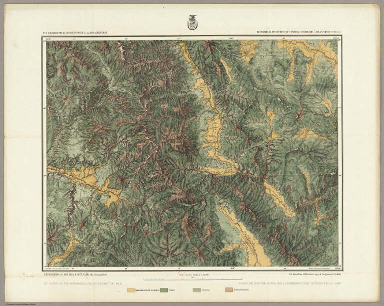
Economical Features Of Central Colorado, [Atlas Sheet No. 61(B)]. Issued Mar. 3d 1876. Weyss, Herman & Lang, Del. Expeditions of 1873, 1874 & 1875 Under the Command of 1st. Lieut. Geo. M. Wheeler, Corps of Engineers, U.S. Army. U.S. Geographical Surveys West Of The 100th Meridian.
Publisher
U.S.
Author
Wheeler, G.M.
Full Title
Southwestern Colorado, Atlas Sheet 61 C. J.C. Spiller, Del. Expeditions of 1874-1875, under the Command of 1st. Lieut. Geo. M. Wheeler, Corps of Engineers, U.S. Army. Executive Officer and Field Astronomer: 1st. Lieut. W.L. Marshall, Corps of Engineers, U.S. Army. Topographical Assistants: 1874 Louis Nell, 1875 J.C. Spiller. U.S. Geographical Surveys West Of The 100th Meridian.
Publisher
U.S.
|