Who What Where WhenREMOVE |
Author
United States Coast Survey
Full Title
Map of New-York Bay And Harbor And The Environs. Founded upon a Trigonometrical Survey under the direction of F.R. Hassler Superintendent of the Survey Of The Coast Of The United States. Triangulation by James Ferguson and Edmund Blunt Assistants. The Hydrology ... Thomas R. Gedney ... Topography by C. Renard and T.A. Jenkins ... Published in 1844. Presented to The University of Vermont ... A.D. Bache Superintendent, Coast Survey.
Publisher
U.S.
Author
United States Coast Survey
Full Title
U.S. Coast Survey A.D. Bache, Superintendent, City Of San Francisco And Its Vicinity California. From a Trigonometrical Survey by R.D. Cutts, Assistant. Topography by A.F. Rodgers Sub-assistant. Hydrography by the Party under the command of Lieut. James Alden U.S.N. Asst. 1853. U.S. Coast Survey Office. Price 50 Cents. Verified I.I. Stevens ... No. 627. Outlines and Topography engraved by Max. F.O. Strobel; Lettering by E.F. Woodward.
Publisher
U.S. Coast Survey
Author
United States Coast Survey
Full Title
Boston Harbor, Massachusetts. From a Trigonometrical Survey under the direction of A.D. Bache Superintendent of the Survey Of The Coast Of The United States. Triangulation by A.D. Bache Supdt. and C.O. Boutelle Assistant. Topography by J.B. Gluck, H.L. Whiting, J.S. Williams Assists. & S.A. Gilbert Sub-Asst. Hydrography by the Party under the command of C.H. Davis Lieut. U.S. Navy Assistant. Published in 1857. U.S. Coast Survey Office. Price one dollar. Verified M.L. Smith ... Redd. Drng. by J. Welch, J. Robertson & C. Mahon. Engd. by A. Rolle, J. Knight & G. McCoy. Electrotype Copy No. 7 by G. Mathiot U.S.C.S.
Publisher
U.S. Coast Survey
Author
United States Coast Survey
Full Title
U.S. Coast Survey A.D. Bache, Superintendent. City Of San Francisco And Its Vicinity California. Topography by A.F. Rodgers, Sub-assistant. Hydrography by the Party under the command of Lieut. R.M. Cuyler N.S.N. Assistant. Published in 1859. U.S. Coast Survey Office. Price 40 cents. Verified W.R. Palmer Capt. Topl. Engrs. Asst. C.S. In charge of Office. Lith. of J. Bien 60 Fulton St. N.Y.
Publisher
U.S. Coast Survey
Author
United States Coast Survey
Full Title
Coast Chart No. 20 New York Bay And Harbor, New York. From a Trigonometric Survey under the direction of A.D. Bache Superintendent of the Survey Of The Coast Of The United States ... Published in 1866. Verified J.E. Hilgard Assist. Coast Survey In charge of Office. Electrotype Copy No. 3 by G. Mathiot U.S.C.S. Redd. Drng. by E. Hergesheimer, M.H. McClery and A. Balbach. Engd. by J. Enthoffer, J. Knight, H.S. Barnard and J.C. Kondrup.
Publisher
U.S.
Author
United States Coast Survey
Full Title
San Francisco Peninsula. U.S. Coast Survey. Benjamin Peirce, Superintendent. 1869. Price $1.50. Verified J.E. Hilgard. Assist Coast Survey. In Charge of Office.
Publisher
U.S.
Author
United States Coast Survey
Full Title
Drake's Bay, California. United States Coast And Geodetic Survey. Treasury Department. From a Trigonometrical Survey under the direction of A.D. Bache Superintendent of the Survey Of The Coast Of The United States. Triangulation by A.F. Rodgers and G. Davidson Assistants. Topography by J.S. Lawson and A.F. Rodgers Assists. Hydrography by the Party under the command of Commander James Alden U.S.N. Assist. ... Reissued June 1883, J.E. Hilgard Superintendent. Verified: R.D. Cutts, Assistant in charge of Office. (Date of first publication 1860).
Publisher
U.S. Coast Survey
Full Title
(Map of Delaware Bay and River). Sheet no. 1. (Founded upon a trigonometrical survey under the direction of F.R. Hassler and A.D. Bache, Superintendents of the Survey of the Coast of the United States. Triangulation by F.R. Hassler, assts. J. Ferguson, E. Blunt, C.M. Eakin, F.H. Gerdes, J.J.S. Hassler & J.E. Johnstone, Capt. Topl. Engrs. Topography by assistants W.M. Boyce, F.H. Gerdes, J.J.S. Hassler, H.L. Whiting, G.D. Wise & B.F. Sands, U.S.N. Hydrography by the party under the command of G.S. Blake, Lieutenant U.S. Navy. Soundings outside the capes under the direction of T.R. Gedney and G.M. Bache, Lieutenants U.S. Navy. Published in 1848. A.D. Bache, Superintendent). Final reduction for engraving of topography by W.M.C. Fairfax, asstist. & of hydrography by Lt. J.B. Dale, U.S.N. Engraved by F. Dankworth, assisted by O.A. Lawson. Views engraved by O.A. Lawson. Lettering by J. Knight. (Electrotype copy no. 4 by G. Mathiot, U.S.C.S.)
Publisher
U.S.
Author
United States Coast Survey
Full Title
Coast Survey charts published. Coast Survey Office, Washington, March 15, 1853.
Publisher
U.S.
Author
[United States Coast Survey, Rodgers, A.F.]
Full Title
U.S. Coast Survey A.D. Bache, Superintendent. City Of San Francisco And Its Vicinity California. From a plane label survey by A.F. Rogers Sub-assistant. Verified W.R. Palmer Capt. Topl. Engrs. Asst. C.S. In charge of Office. Lith. of J. Bien 60 Fulton St. N.Y.
Publisher
U.S. Coast Survey
Author
United States Coast Survey
Full Title
San Francisco entrance, California : 1884. Issued Aug. 1884, J.E. Hilgard, Superintendent, Verified: C.O. Boutelle, Assiatant in charge of office. Price 50 cents. Redd. Drng. by A. Lindenkohl, C. Junken, E. Molkow and E.J. Sommer. Engd. by J. Enthoffer, E. A. Maedel, J.J. Young, W. Thompson, H.M. Knight, A. Petersen and J.G. Thompson. Triangulation by R.D. Cutts, A.F. Rodgers ... ; topography by R.D. Cutts, A.F. Rogers, A.M. Harrison ... ; hydrography by J. Alden, R,M. Cuyler ...
Publisher
U.S. Coast Survey
Author
United States Coast Survey
Full Title
Map of New - York Bay And Harbor And The Environs. Founded upon a Trigonometrical Survey under the direction of F.R. Hassler Superintendent of the Survey Of The Coast Of The United States. Triangulation by James Ferguson and Edmund Blunt Assistants. The Hydrography under the direction of Thomas R. Gedney Lieutenant U.S. Navy. The Topography by C. Renard, T.A. Jenkins & B.F. Sands Assists. Published in 1845. A.D. Bache Superintendent. Verified by Lieut. A.A. Humphreys ... Topography Engraved by S. Siebert & A. Rolle, Views Engraved by O.A. Lawson. Engraving supervised & Views of the Coast drawn by J. Farley. Hydrography Engraved by F. Dankworth, Lettering by F. Dankworth & J. Knight.
Publisher
U.S.
Author
United States Coast Survey
Full Title
(Covers to) Map of New - York Bay And Harbor And The Environs. Founded upon a Trigonometrical Survey under the direction of F.R. Hassler Superintendent of the Survey Of The Coast Of The United States. Triangulation by James Ferguson and Edmund Blunt Assistants. The Hydrography under the direction of Thomas R. Gedney Lieutenant U.S. Navy. The Topography by C. Renard, T.A. Jenkins & B.F. Sands Assists. Published in 1845. A.D. Bache Superintendent. Verified by Lieut. A.A. Humphreys ... Topography Engraved by S. Siebert & A. Rolle, Views Engraved by O.A. Lawson. Engraving supervised & Views of the Coast drawn by J. Farley. Hydrography Engraved by F. Dankworth, Lettering by F. Dankworth & J. Knight.
Publisher
U.S.
Author
United States Coast Survey
Full Title
Entrance to San Francisco Bay California. From a Trigonometrical Survey under the direction of A.D. Bache Superintendent of the Survey Of The Coast Of The United States. Triangulation by R.D. Cutts Asst. & A.F. Rodgers Sub-Assts. Hydrography by the Party under the command of Lieut. Comdg. James Alden U.S.N. Asst. 1859. U.S. Coast Survey Office. Verified W.R. Palmer ... No. 36. Redd. Drng. by W.M.C. Fairfax, J. Lambert, & J.J. Ricketts. Engd. by J. Knight, A. Blondeau & G.B. Metzeroth. Electrotype Copy No. 2 by G. Mathiot U.S.C.S. (inset map) Sub-Sketch Of Entrance To San Francisco Bay. 1859.).
Publisher
U.S. Coast Survey
Author
Sumner, Charles
Full Title
(Title Page to) Speech of Hon. Charles Sumner, Of Massachusetts, On The Cession Of Russian America to the United States. Washington: Printed at the Congressional Globe Office. (with Alaska map) Northwestern America Showing The Territory Ceded By Russia To The United States Compiled For The Department of State at the U.S. Coast Survey Office... Second Edition May 1867.
Publisher
Congressional Globe Office
Author
Sumner, Charles
Full Title
Northwestern America Showing The Territory Ceded By Russia To The United States Compiled For The Department of State at the U.S. Coast Survey Office. B. Peirce, Supt. Second Edition, May 1867. Drawn by A. Lindenkohl. Chas. G. Krebs, Lith.
Publisher
Congressional Globe Office
Author
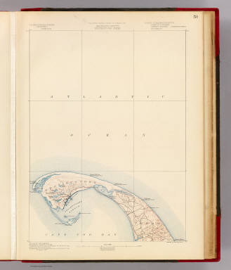
[Geological Survey (U.S.), Massachusetts. Topographical Survey Commission]
Full Title
Massachusetts. Provincetown sheet. Preliminary edition subject to corrections. U.S. Geological Survey, J.W. Powell, Director. State of Massachusetts ... commissioners. Henry Gannett, Chief Geographer. Marcus Baker, geographer in charge. Triangulation by the U.S. Coast and Geodetic and Borden surveys. Coast line by the U.S. Coast Survey. Topography by the U.S. Geological Survey and U.S. Coast Survey. Surveyed in 1887. Forbes Co., Boston & N.Y. (1890)
Publisher
Topographical Survey Commission
Author
United States Coast Survey
Full Title
New York to Norwalk Islands, Long Island Sound. United States Coast Survey. (D.H. Hurd & Co., Boston. 1893)
Publisher
D.H. Hurd & Co.
Author
United States Coast Survey
Full Title
Norwalk Islands to Southwest Ledge, Long Island Sound. United States Coast Survey. (D.H. Hurd & Co., Boston. 1893)
Publisher
D.H. Hurd & Co.
Author
United States Coast Survey
Full Title
Southwest Ledge to Niantic Bay, Long Island Sound. United States Coast Survey. (D.H. Hurd & Co., Boston. 1893)
Publisher
D.H. Hurd & Co.
Author
United States Coast Survey
Full Title
Niantic Bay to Rocky Point, Long Island Sound. United States Coast Survey. (D.H. Hurd & Co., Boston. 1893)
Publisher
D.H. Hurd & Co.
Author
[Soederquist, Oscar, United States. War Department]
Full Title
Military map of Suffolk and vicinity for Brig. Gen. E.L. Viele. Surveyed and drawn by Oscar Soederquist ... (with) Plan of Fort Esperanza, Tex. (with) Map of Morris Island and the adjacent creeks. From U.S. Coast Survey 1823-4. Sand hills from a survey 6th June 1862 ... indorsement (sic) of Gen. G.T. Beauregard ... (with) Proposed secondary line of defense on the peninsula between Ashepoo and Combahee Rivers, S.C., November 4, 1863 ... letter from Brig. Gen. W.S. Walker ... ... Julius Bien & Co., Lith., N.Y. (1891-1895)
Publisher
U.S. Government Printing Office
Author
[Bache, A. D., Nicholson, W. L.]
Full Title
Map of the state of Virginia. Compiled from the best authorities at the Coast Survey Office. A.D. Bache, Supdt. July 1863. Compiled by W.L. Nicholson. Lith. by Chas. G. Krebs.
Publisher
U.S. Coast Survey
Author
[Bache, A. D., Nicholson, W. L.]
Full Title
(Covers to) Map of the state of Virginia. Compiled from the best authorities at the Coast Survey Office. A.D. Bache, Supdt. July 1863. Compiled by W.L. Nicholson. Lith. by Chas. G. Krebs.
Publisher
U.S. Coast Survey
Author
Bache, A. D.
Full Title
Richmond's Island Harbor (Harbor of Refuge no. ). From a trigonometrical survey under the direction of A.D. Bache, Superintendent of the Survey of the Coast of the United States. Triangulation by A.D. Bache & C.O. Boutelle, assistant. Topography by A.W. Longfellow, assistant. Hydrography by the party under the command of M. Woodhull, Lieutenant U.S. Navy. Published in 1851. Topography reduced by J. Lambert, draughtsman. Hydrography reduced by John R. Barker. Topography engraved by S. Siebert. Title by J.V.N. Throop, remaining lettering by W. Smith. Electrotype copy no. 2 by G. Mathiot, U.S.C.S. (with logo) U.S. Coast Survey Office.
Publisher
U.S.
Author
Bache, A. D.
Full Title
Wellfleet Harbor, Massachusetts. From a trigonometrical survey under the direction of A.D. Bache, Superintendent of the Survey of the Coast of the United States. Triangulation by Capt. T.J. Cram, Topl. Engs. & C.M. Eakin assts. Topography by H.L. Whiting and J.B. Gluck, assistants. Hydrography by the party under the command of Lieut. C.H. McBlair, U.S.N. assistant. Published in 1853. Drng. by W.M.C. Fairfax, asst. J.J. Ricketts and M.C. Gritzner. Eng. by S. Siebert, E.F. Woodward and S.E. Stull. Electrotype copy no. 1 by G. Mathiot, U.S.C.S. (with logo) U.S. Coast Survey Office.
Publisher
U.S.
Author
Bache, A. D.
Full Title
Nantucket Harbor. From a trigonometrical survey under the direction of A.D. Bache, Superintendent of the Survey of the Coast of the United States. Triangulation by A.D. Bache and C.M. Eakin assistant. Topography by H.L. Whiting assistant. Hydrography by the party under the command of C.H. Davis Lieutenant, U.S. Navy. Published in 1848. Reduction by J.M. Wampler, draughtsman. Views by J. Robertson. Engraving of topography by F. Dankworth & O.A. Lawson, assisted by J.H. Young. Views by A.O. Lawson. Lettering by J. Knight & W. Smith. Printed by H. Benner. Electrotype copy no. 1 by G. Mathiot, U.S.C.S. (with logo) U.S. Coast Survey Office.
Publisher
U.S.
Author
Bache, A. D.
Full Title
Preliminary sketch showing the positions of Davis' Shoal and other dangers recently discovered by the Coast Survey and the soundings on the Old South Shoal, Bass Rip, Old Man, Pochick Rip &c. By the hydrographic parties under the command of Lieut. C.H. Davis, U.S. Navy in 1846, '47 & '48, Lieut. C.H. McBlair, U.S.N. in 1849, '50, '51 & '52 and Lieut. H.S. Stellwagen, U.S.N. in 1853, assistants U.S.C.S. A.D. Bache Superintendent. 1853. (with logo) U.S. Coast Survey Office.
Publisher
U.S.
Author
Bache, A. D.
Full Title
The Harbor of Hyannis. From a trigonometrical survey under the direction of A.D. Bache, Superintendent of the Survey of the Coast of the United States. Triangulation by C.M. Eakin assistant. Topography by W.M. Boyce assistant. Hydrography by J.N. Maffitt, Lieut. U.S. Navy, under the direction of Chas. H. Davis, Lieutenant U.S. Navy. Published in 1850. Reduction by Wm. Luce draughtsman. Engraved by Sherman & Smith, N.Y. Sailing directions &c. by W. Smith U.S.C.S. Electrotype copy no. 1 by G. Mathiot, U.S.C.S. (with logo) U.S. Coast Survey Office.
Publisher
U.S.
Author
Bache, A. D.
Full Title
Edgartown Harbor. Founded upon a trigonometrical survey under the direction of A.D. Bache, Superintendent of the Survey of the Coast of the United States. Triangulation by C.M. Eakin assistant. Topography by H.L. Whiting assistant. Hydrography by the party under the command of Lieutenant C.H. Davis, U.S. Navy. Published in 1848. Reduction of topography by M.I. McClery assistant ... hydrography by Jno. Robertson. Views by O.A. Lawson. Printed by H. Benner. Electrotype copy no. 2 by G. Mathiot, U.S.C.S. (with logo) U.S. Coast Survey Office.
Publisher
U.S.
Author
Bache, A. D.
Full Title
The harbor of Holmes' Hole ... The harbor of Tarpaulin Cove. Founded upon a trigonometrical survey under the direction of A.D. Bache, Superintendent of the Survey of the Coast of the United States. Triangulation by C.M. Eakin assistant. Topography by H.L. Whiting assistant. Hydrography by the party under the command of G.S. Blake, Lieutenant, U.S. Navy. Published in 1847. Final reduction for engineering by M.I. McClery, draughtsman. Engraved by Sherman & Smith, N.Y. Printed by H. Benner. Electrotype copy no. 1 by G. Mathiot, U.S.C.S. (with logo) U.S. Coast Survey Depot.
Publisher
U.S.
Author
Bache, A. D.
Full Title
The harbor of New Bedford. Founded upon a trigonometrical survey under the direction of Alex. D. Bache, Superintendent of the Survey of the Coast of the United States. Triangulation by C.M. Eakin assistant. Topography by H.L. Whiting assistant. Hydrography under the direction of G.S. Blake, Lieut. Comg., U.S. Navy. Published in 1846. Republished in 1850. Drawn by H.L. Whiting assistant. Engraved by Sherman & Smith, New York. Printed by H. Benner. Electrotype copy no. 5 by G. Mathiot, U.S.C.S. (with logo) U.S. Coast Survey Depot.
Publisher
U.S.
Author
[Bache, A. D., Hassler, F. R.]
Full Title
General chart of the coast from Gay Head to Cape Henlopen. From a trigonometrical survey under the direction of F.R. Hassler and A.D. Bache, Superintendents of the Survey of the Coast of the United States. Published in 1852. A.D. Bache, Superintendent. Reduction for engraving by J. Farley asst., W.M.C. Fairfax asst., C. Mahon, J.J. Ricketts & J. Lambert draughtsmen. Views by J. Farley asst. Topography engraved by F. Dankworth & O.A. Lawson. Lettering by John Knight. Views by O.A. Lawson. Soundings by J. Knight & W. Smith. Sections by G. McCoy & O.A. Lawson. Electrotype copy no. 2 by G. Mathiot, U.S.C.S. (with logo) U.S. Coast Survey Office.
Publisher
U.S.
Author
[Bache, A. D., Hassler, F. R.]
Full Title
Fisher's Island Sound. Founded upon a trigonometrical survey under the direction of F.R. Hassler, Superintendent of the Survey of the Coast of the United States. Triangulation by W.H. Swift, Captain Topl. Engineers. Hydrography by the party under the command of G.S. Blake, Lieutenant, U.S. Navy. Topography by F.H. Gerdes assistant. Republished in 1847 with additions. A.D. Bache Superintendent. Final reduction for engraving by J.B. Gluck, draughtsman. Engraved by J.V.N. Throop, Washington, D.C. and corrected at the Coast Survey Office. Electrotype copy no. 2 by G. Mathiot, U.S.C.S. (with logo) U.S. Coast Survey Depot.
Publisher
U.S.
Author
[Bache, A. D., Hassler, F. R.]
Full Title
The Harbor of New London. Founded upon a trigonometrical survey under the direction of F.R. Hassler, Superintendent of the Survey of the Coast of the United States. Triangulation by E. Blunt assistant. Topography by F.H. Gerdes and J.B. Gluck assistants. Hydrography by the party under the command of G.S. Blake, Lieutenant, U.S. Navy. Published in 1848. A.D. Bache, Superintendent. Final reduction for engraving by J.B. Gluck, draughtsman. Topography engraved by A. Rolle. Lettering by J. Knight. Electrotyped by S. Siebert. Printed by H. Benner. Electrotype copy no. 2 by G. Mathiot, U.S.C.S. (with logo) U.S. Coast Survey Depot.
Publisher
U.S.
Author
[Bache, A. D., Hassler, F. R.]
Full Title
Mouth of Connecticut River. From a trigonometrical survey under the direction of F.R. Hassler and A.D. Bache, Superintendents of the Survey of the Coast of the United States. Triangulation by Capt. W.H. Swift, U.S.A. and E. Blunt, assistants. Topography by H.L. Whiting, assistant. Hydrography by the parties under the command of Lieuts. J.R. Goldsborough and M. Woodhull, U.S.N., assts. Published in 1853. A.D. Bache, Superintendent. Red(uce)d dr(awi)ng by A. Boschke. Eng(ravin)g by S. Siebert, O.A. Lawson & W. Smith. Electrotype copy no. 1 by G. Mathiot, U.S.C.S. (with logo) U.S. Coast Survey Office.
Publisher
U.S.
Author
[Bache, A. D., Hassler, F. R.]
Full Title
New Haven Harbor. Founded upon a trigonometrical survey under the direction of F.R. Hassler, Superintendent of the Survey of the Coast of the United States. Triangulation by James Ferguson and Edmund Blunt, assistants. Topography by C.M. Eakin, W.M. Boyce & J. Farley, assistants. Hydrography by the party under the command of G.S. Blake, Lieut., U.S. Navy. Published in 1846. A.D. Bache, Superintendent. Final reduction for engraving by Jno. B. Gluck, draughtsman. Engraved by Sherman & Smith, N.Y. Electrotype copy no. 3 by S. Siebert, U.S.C.S. (with logo) U.S. Coast Survey Depot.
Publisher
U.S.
Author
[Bache, A. D., Hassler, F. R.]
Full Title
Harbors of Black Rock and Bridgeport. Founded upon a trigonometrical survey under the direction of F.R. Hassler, Superintendent of the Survey of the Coast of the United States. Triangulation by J. Ferguson, assistant. Topography by C.M. Eakin. Hydrography by the party under the command of Lieutenant G.S. Blake, U.S. Navy. Published in 1848. A.D. Bache, Superintendent. Reduction for engraving by M.I. McClery, assistant, with some additions by J.M. Wampler, draughtsman. Topography engraved by S.T. Pettit, apprentice, finished by F. Dankworth, O.A. Lawson & A. Rolle. Lettering by F. Dankworth and J. Knight. Electrotype copy no. 1 by G. Mathiot, U.S.C.S. (with logo) U.S. Coast Survey Office.
Publisher
U.S.
Author
[Bache, A. D., Hassler, F. R.]
Full Title
Huntington Bay. Founded upon a trigonometrical survey under the direction of F.R. Hassler, Superintendent of the Survey of the Coast of the United States. Triangulation by E. Blunt, assistant. Topography by F.H. Gerdes, assist. Hydrography by the party under the command of G.S. Blake, Lieutenant, U.S. Navy. Published in 1849. A.D. Bache, Superintendent. Final reduction for engraving by J.B. Gluck, assistant. Engraved by Geo. G. Smith, Boston. Electrotype copy no. 1 by G. Mathiot, U.S.C.S. (with logo) U.S. Coast Survey Office.
Publisher
U.S.
Author
[Bache, A. D., Hassler, F. R.]
Full Title
Oyster or Syosset Bay. Founded upon a trigonometrical survey under the direction of F.R. Hassler, Superintendent of the Survey of the Coast of the United States. Triangulation by E. Blunt, assistant. Topography by A.D. Mackay, Lt. U.S.A. and F.H. Gerdes, assts. Hydrography by the party under the command of Lieutenant G.S. Blake, U.S. Navy. Published in 1847. A.D. Bache, Superintendent. Final reduction for engraving by Jno. B. Gluck, draughtsman. Engraved by Sherman & Smith, N.Y. Printed by H. Benner. Electrotype copy no. 1 by G. Mathiot, U.S.C.S. (with logo) U.S. Coast Survey Depot.
Publisher
U.S.
Author
[Bache, A. D., Hassler, F. R.]
Full Title
Harbors of Captain's Island East and Captain's Island West. From a trigonometrical survey under the direction of F.R. Hassler, Superintendent of the Survey of the Coast of the United States. Triangulation by J. Ferguson, assistant. Topography by C.M. Eakin, assistant. Hydrography by the party under the command of Lieutenant G.S. Blake, U.S. Navy. Published in 1849. A.D. Bache, Superintendent. Topography reduced by W. Luce, draughtsman. Hydrography reduced by W.C. Barney, Lt. U.S. Navy. Hills by A. Rolle. Title by W. Smith, and the rest by S.T. Pettit. Electrotype copy no. 2 by G. Mathiot, U.S.C.S. (with logo) U.S. Coast Survey Office.
Publisher
U.S.
Author
[Bache, A. D., Hassler, F. R.]
Full Title
Hart & City Island. From a trigonometrical survey under the direction of F.R. Hassler, Superintendent of the Survey of the Coast of the United States. Triangulation by E. Blunt, assistant. Topography by T.W. Werner and H.L. Whiting, assistants. Hydrography by the parties under the command of Lieut. G.S. Blake & Lieut. J.R. Goldsborough, U.S.N. ... Sachem's Head Harbor. From a trigonometrical survey under the direction of F.R. Hassler, Superintendent of the Survey of the Coast of the United States. Triangulation by E. Blunt, assistant. Topography by W.M. Boyce, assistant. Hydrography by the party under the command of Lieutenant G.S. Blake, U.S. Navy. Published in 1851. A.D. Bache, Superintendent. Reduction for engraving by M. McClery, J. Lambert & J. Robertson. Eng. principally by R.T. Knight & S.T. Pettit. Electrotype copy no. 2 by G. Mathiot, U.S.C.S. (with logo) U.S. Coast Survey Office.
Publisher
U.S.
Author
[Bache, A. D., Hassler, F. R.]
Full Title
Hell Gate and its approaches. From a trigonometrical survey under the direction of F.R. Hassler and A.D. Bache, Superintendents of the Survey of the Coast of the United States. Triangulation by Edmund Blunt, assistant. Topography by H.L. Whiting, assistant. Hydrography by the parties under the command of D.D. Porter & M. Woodhull, Lts., U.S. Navy. Published in 1851. A.D. Bache, Superintendent. Reduction of topography for engraving by C. Mahon, of hydrography by J.R.P. Mechlin. Topography engraved by A. Rolle, F. Dankworth & G. McCoy; lettering by J. Knight. Electrotype copy no. 1 by G. Mathiot, U.S.C.S. (with logo) U.S. Coast Survey Office.
Publisher
U.S.
Author
[Bache, A. D., Hassler, F. R.]
Full Title
Map of New-York Bay and Harbor and the environs. From a trigonometrical survey under the direction of F.R. Hassler, Superintendent of the Survey of the Coast of the United States. Triangulation by James Ferguson and Edmund Blunt, assistants. The hydrography under the direction of Thomas R. Gedney, Lieutenant, U.S. Navy. The topography by C. Renard, T.A. Jenkins & B.F. Sands, assists. Published in 1845. A.D. Bache, Superintendent. Topography engraved by S. Siebert & A. Rolle, views engraved by O.A. Lawson. Engraving supervised & views of the coast drawn by J. Farley. Hydrography engraved by F. Dankworth, lettering by F. Dankworth & J. Knight. Electrotype copy no. 5 by G. Mathiot, U.S.C.S. (with logo) U.S. Coast Survey Depot.
Publisher
U.S.
Author
[Bache, A. D., Hassler, F. R.]
Full Title
Little Egg Harbor. Founded upon a trigonometrical survey under the direction of F.R. Hassler, Superintendent of the Survey of the Coast of the United States. Triangulation by C. Renard, assistant. Topography by G.M. Bache & B.F. Sands, U.S.N. & C. Renard, assistant. Hydrography by G.M. Bache, Lieut., U.S. Navy. Published in 1846. A.D. Bache, Superintendent. Final reduction for engraving by M.I. McClery, draughtsman. Topography engd. by O.A. Lawson, & lettering by J. Knight. Printed by H. Benner. (with logo) U.S. Coast Survey Depot.
Publisher
U.S.
Author
[Bache, A. D., Hassler, F. R.]
Full Title
Map of Delaware Bay and River. Sheet no. 2. Founded upon a trigonometrical survey under the direction of F.R. Hassler and A.D. Bache, Superintendents of the Survey of the Coast of the United States. Triangulation by F.R. Hassler, assts. J. Ferguson, E. Blunt, C.M. Eakin, F.H. Gerdes, J.J.S. Hassler & J.E. Johnstone, Capt. Topl. Engrs. Topography by assistants W.M. Boyce, F.H. Gerdes, J.J.S. Hassler, H.L. Whiting, G.D. Wise & B.F. Sands, U.S.N. Hydrography by the party under the command of G.S. Blake, Lieutenant U.S. Navy. Soundings outside the capes under the direction of T.R. Gedney and G.M. Bache, Lieutenants U.S. Navy. Published in 1848. A.D. Bache, Superintendent. Final reduction for engraving of topography by W.M.C. Fairfax, asstist. & of hydrography by Lt. J.B. Dale, U.S.N. Engraved by F. Dankworth, assisted by O.A. Lawson. Views engraved by O.A. Lawson. Lettering by J. Knight. (with logo) U.S. Coast Survey Depot. (Electrotype copy no. 4 by G. Mathiot, U.S.C.S.)
Publisher
U.S.
Author
[Bache, A. D., Hassler, F. R.]
Full Title
(Map of Delaware Bay and River). Sheet no. 3. (Founded upon a trigonometrical survey under the direction of F.R. Hassler and A.D. Bache, Superintendents of the Survey of the Coast of the United States. Triangulation by F.R. Hassler, assts. J. Ferguson, E. Blunt, C.M. Eakin, F.H. Gerdes, J.J.S. Hassler & J.E. Johnstone, Capt. Topl. Engrs. Topography by assistants W.M. Boyce, F.H. Gerdes, J.J.S. Hassler, H.L. Whiting, G.D. Wise & B.F. Sands, U.S.N. Hydrography by the party under the command of G.S. Blake, Lieutenant U.S. Navy. Soundings outside the capes under the direction of T.R. Gedney and G.M. Bache, Lieutenants U.S. Navy. Published in 1848. A.D. Bache, Superintendent). Final reduction for engraving of topography by W.M.C. Fairfax, asstist. & of hydrography by Lt. J.B. Dale, U.S.N. & J.B. Gluck, assistant. Engraved by F. Dankworth, assisted by O.A. Lawson. Lettering by F. Dankworth & J. Knight. Electrotype copy no. 4 by G. Mathiot, U.S.C.S.
Publisher
U.S.
Author
[Bache, A. D., Hassler, F. R.]
Full Title
(Composite of) Map of Delaware Bay and River. Founded upon a trigonometrical survey under the direction of F.R. Hassler and A.D. Bache, Superintendents of the Survey of the Coast of the United States. Triangulation by F.R. Hassler, assts. J. Ferguson, E. Blunt, C.M. Eakin, F.H. Gerdes, J.J.S. Hassler & J.E. Johnstone, Capt. Topl. Engrs. Topography by assistants W.M. Boyce, F.H. Gerdes, J.J.S. Hassler, H.L. Whiting, G.D. Wise & B.F. Sands, U.S.N. Hydrography by the party under the command of G.S. Blake, Lieutenant U.S. Navy. Soundings outside the capes under the direction of T.R. Gedney and G.M. Bache, Lieutenants U.S. Navy. Published in 1848. A.D. Bache, Superintendent. Final reduction for engraving of topography by W.M.C. Fairfax, asstist. & of hydrography by Lt. J.B. Dale, U.S.N. Engraved by F. Dankworth, assisted by O.A. Lawson. Views engraved by O.A. Lawson. Lettering by J. Knight. (with logo) U.S. Coast Survey Depot. Electrotype copy no. 4 by G. Mathiot, U.S.C.S.
Publisher
U.S.
Author
Bache, A. D.
Full Title
Sea Coast of Delaware, Maryland and part of Virginia. From a trigonometrical survey under the direction of A.D. Bache, Superintendent of the Survey of the Coast of the United States. Triangulation by J. Farley, E. Blunt & J.E. Johnstone, Capt. Top. Engrs., assistants. Topography by J.J.S. Hassler & G.D. Wise, assts. & W.M. Johnson, sub. asst. Hydrography by the parties under the command of T.R. Gedney, Lieuts. G.M. Bache, S.P. Lee, R. Bache & J.J. Almy, U.S. Navy, assistants U.S. Coast Survey. Published in 1852.
Publisher
U.S.
Author
Bache, A. D.
Full Title
The Harbor of Annapolis. Founded upon a trigonometrical survey under the direction of A.D. Bache, Superintendent of the Survey of the Coast of the United States. Triangulation by James Ferguson and Ferd. H. Gerdes, assistants. The hydrography under the direction of George M. Bache, Lieutenant, U.S. Navy. Topography by F.H. Gerdes, assistant. Published in 1846. Final reduction for engraving by R.D. Cutts, assistant. Topography engd. by J.H. Young, Phila. & the views by O. Lawson, Washn. Electrotype copy no. 1 by G. Mathiot, U.S.C.S. (with logo) U.S. Coast Survey Depot.
Publisher
U.S.
|