Who What Where WhenREMOVE |
REFINE
Browse All : Images by Viele, Egbert L.
1-16 of 16
Author
Viele, Egbert L.
Full Title
(Covers to) The West End Plateau Of New York. Herman K. Viele Civil Engineer & City Surveyor. Johnson & Pratt Print. New York. (with text titled) The West End Plateau Of The City Of New York. By Egbert L. Viele.
Publisher
Johnson & Pratt
Author
Viele, Egbert L.
Full Title
(Title Page) (text title) The West End Plateau Of The City Of New York. By Egbert L. Viele. (to accompany) The West End Plateau Of New York. Herman K. Viele Civil Engineer & City Surveyor. Johnson & Pratt Print. New York.
Publisher
Johnson & Pratt
Author
Viele, Egbert L.
Full Title
The West End Plateau Of The City Of New York. By Egbert L. Viele. (to accompany) The West End Plateau Of New York. Herman K. Viele Civil Engineer & City Surveyor. Johnson & Pratt Print. New York.
Publisher
Johnson & Pratt
Author
Viele, Egbert L.
Full Title
(Covers to) The Transval Of New York.
Publisher
Johnson & Co., Printers
Author
Viele, Egbert L.
Full Title
(Title Page to) (text) the Transval of the City of New York, By Egbert L. Viele. New York: Johnson & Co., Printers, 2 Liberty Street. 1880. (to accompany) The Transval Of New York.
Publisher
Johnson & Co., Printers
Author
Viele, Egbert L.
Full Title
The Transval Of New York.
Publisher
Johnson & Co., Printers
Author
Viele, Egbert L.
Full Title
Sanitary & Topographical Map of the City and Island of New York Prepared for the Council of Hygiene and Public Health of the Citizens Association. Under the direction of Egbert L. Viele, Topographical Engineer. Entered ... 1865 by Egbert L. Viele ... New York. Ferd. Mayer & Co. Lithographers, 96 Fulton St. N.Y. (with 1 inset map and 3 profiles).
Publisher
Ferd. Mayer & Co. Lithographers
Author
[Haskins, Charles, Lloyd, H.H., Viele, Egbert L.]
Full Title
H.H. Lloyd & Co's Campaign Military Charts Showing The Principal Strategic Places Of Interest. Engraved Expressly To Meet A Public Want During The Present War. Compiled From Official Data By Egbert L. Viele, Military and Civil Engineer; and Charles Haskins. Published Under The Auspices Of The American Geographical And Statistical Society. Entered ... 1861 by H.H. Lloyd & Co. H.H. Lloyd & Co's Military Charts. Sixteen Maps On One Sheet.
Publisher
H.H. Lloyd & Co.
Author
Viele, Egbert L.
Full Title
(Covers to) Topographical Atlas Of The City Of New York Including The Annexed Territory. Showing original water courses and made land. Prepared Under The Direction Of Egbert L. Viele, Civil and Topographical Engineer. 234 Broadway, N.Y. 1874. Eugene Quackenbush, C.E. Entered ... 1874, by Egbert L. Viele in the Office of the Librarian of Congress. Julius Bien, Photo Lith.
Publisher
E.L. Viele
Author
Viele, Egbert L.
Full Title
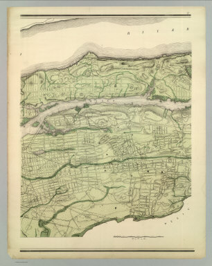
Topographical Atlas Of The City Of New York Including The Annexed Territory. I. (Southernmost portion). Showing original water courses and made land. Prepared Under The Direction Of Egbert L. Viele, Civil and Topographical Engineer. 234 Broadway, N.Y. 1874. Eugene Quackenbush, C.E. Entered ... 1874, by Egbert L. Viele in the Office of the Librarian of Congress. Julius Bien, Photo Lith.
Publisher
E.L. Viele
Author
Viele, Egbert L.
Full Title
Topographical Atlas Of The City Of New York Including The Annexed Territory. II. (Next to southernmost portion). Showing original water courses and made land. Prepared Under The Direction Of Egbert L. Viele, Civil and Topographical Engineer. 234 Broadway, N.Y. 1874. Eugene Quackenbush, C.E. Entered ... 1874, by Egbert L. Viele in the Office of the Librarian of Congress. Julius Bien, Photo Lith.
Publisher
E.L. Viele
Author
Viele, Egbert L.
Full Title
Topographical Atlas Of The City Of New York Including The Annexed Territory. III. (Central portion). Showing original water courses and made land. Prepared Under The Direction Of Egbert L. Viele, Civil and Topographical Engineer. 234 Broadway, N.Y. 1874. Eugene Quackenbush, C.E. Entered ... 1874, by Egbert L. Viele in the Office of the Librarian of Congress. Julius Bien, Photo Lith.
Publisher
E.L. Viele
Author
Viele, Egbert L.
Full Title
Topographical Atlas Of The City Of New York Including The Annexed Territory. IV. (Next to northernmost portion). Showing original water courses and made land. Prepared Under The Direction Of Egbert L. Viele, Civil and Topographical Engineer. 234 Broadway, N.Y. 1874. Eugene Quackenbush, C.E. Entered ... 1874, by Egbert L. Viele in the Office of the Librarian of Congress. Julius Bien, Photo Lith.
Publisher
E.L. Viele
Author
Viele, Egbert L.
Full Title
Topographical Atlas Of The City Of New York Including The Annexed Territory. V. (Northernmost portion). Showing original water courses and made land. Prepared Under The Direction Of Egbert L. Viele, Civil and Topographical Engineer. 234 Broadway, N.Y. 1874. Eugene Quackenbush, C.E. Entered ... 1874, by Egbert L. Viele in the Office of the Librarian of Congress. Julius Bien, Photo Lith.
Publisher
E.L. Viele
Author
Viele, Egbert L.
Full Title
(Composite of) Topographical Atlas Of The City Of New York Including The Annexed Territory. Showing original water courses and made land. Prepared Under The Direction Of Egbert L. Viele, Civil and Topographical Engineer. 234 Broadway, N.Y. 1874. Eugene Quackenbush, C.E. Entered ... 1874, by Egbert L. Viele in the Office of the Librarian of Congress. Julius Bien, Photo Lith.
Publisher
E.L. Viele
Author
[Soederquist, Oscar, United States. War Department]
Full Title
Military map of Suffolk and vicinity for Brig. Gen. E.L. Viele. Surveyed and drawn by Oscar Soederquist ... (with) Plan of Fort Esperanza, Tex. (with) Map of Morris Island and the adjacent creeks. From U.S. Coast Survey 1823-4. Sand hills from a survey 6th June 1862 ... indorsement (sic) of Gen. G.T. Beauregard ... (with) Proposed secondary line of defense on the peninsula between Ashepoo and Combahee Rivers, S.C., November 4, 1863 ... letter from Brig. Gen. W.S. Walker ... ... Julius Bien & Co., Lith., N.Y. (1891-1895)
Publisher
U.S. Government Printing Office
1-16 of 16
|