Search Results:

1899 West Farmington Village. Deforest P.O., … County Atlas West Farmington Village. Deforest P.O. |

1899 Plats East of Vienna Center. Map of Leav … County Atlas Plats East of Vienna Center. Map of Leav … |

1893 Cortlandt town. County Atlas Town of Cortlandt. Copyrighted by Julius … |

1899 Brookfield Center. (Other areas in Trumb … County Atlas Map of Brookfield Center. (Other areas i … |

1899 Orangeville Village. Hartford Centre. Vi … County Atlas Map of Orangeville Village. Map of Hartf … |

1893 Peekskill. County Atlas Village of Peekskill. Copyrighted by Jul … |
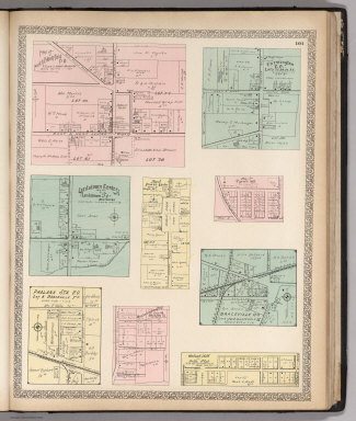
1899 North Bloomfield P.O. Farmington P.O. Lo … County Atlas Map of North Bloomfield P.O. Farmington … |

1899 West Metts. Mesopotamia. Bristolvill. Bo … County Atlas Map of West Metts P.O. Mesopotamia P.O. … |

1893 Yorktown town. County Atlas Town of Yorktown. Copyrighted by Julius … |

1899 Church Hill. Ohlton, Meander. Coalburg. … County Atlas Map of Church Hill P.O. Map of Ohlton, M … |

1899 Congressional Districts and Senatorial D … County Atlas Map Showing Congressional Districts of t … |

1893 North Castle town. County Atlas Town of North Castle. Copyrighted by Jul … |

1899 Map of Ohio. Showing System of Governmen … County Atlas Map of Ohio. Showing System of Governmen … |

1899 Ohio. County Atlas Ohio. |

1899 Alaska. County Atlas Alaska (insets) Cook Inlet and Vicinity. … |

1893 New Castle town. County Atlas Town of New Castle. (with) Village of Mt … |

1893 Bedford, Somers towns. County Atlas Towns of Bedford and Somers. (with) Vill … |

1893 Poundridge, Lewisboro, N. Salem towns. County Atlas Towns of Poundridge, Lewisboro and North … |

1893 Westchester Co., Yonkers-state line. County Atlas Westchester County, Yonkers to Dobbs Fer … |

1899 South Part of the City of Warren, Ohio. County Atlas Map of South Part of the City of Warren. |

1899 East Part of the City of Niles, Ohio. County Atlas Map of East Part of the City of Niles. |

1899 Hubbard Village, Ohio. County Atlas Map of Hubbard Village. |

1877 Map of the States of California and Neva … County Atlas Map of the States of California and Neva … |

1877 Map of Sonoma County California. County Atlas Map of Sonoma County California. 1877. ( … |

1877 Salt Point, Mendocino, and Cloverdale To … County Atlas Map of Occidental (with) Plan of Geyserv … |

1877 Salt Point, Ocean, Mendocino, Redwood, B … County Atlas Plat of Sebastopol. (with) Map of Guerne … |

1877 Santa Rosa and Sonoma Townships. (and) V … County Atlas Plat of Windsor (with) Plat of Town of F … |

1877 Russian River, Santa Rosa, Analy Townshi … County Atlas Map Number Six. (Russian River, Santa Ro … |

1877 Ocean, Bodega, and Analy Townships. County Atlas Map of the City of Healdsburg, Sonoma Co … |

1877 Analy, Santa Rosa, Vallejo, and Petaluma … County Atlas Map Number Eight. (Analy, Santa Rosa, Va … |

1877 Santa Rosa, Vallejo, and Sonoma Township … County Atlas Map of Sonoma City, Sonoma Co. Cal. 1877 … |

1877 Petaluma, Vallejo, and Sonoma Townships. County Atlas Map Number Ten. (Petaluma, Vallejo, and … |

1877 Petaluma and Vallejo Townships. County Atlas Cypress Hill Cemetery, Petaluma. Map Num … |

1877 Map of Petaluma City. 1877. County Atlas Map of Petaluma City. 1877. |

1877 Map of The City of Santa Rosa, 1876. County Atlas Map of The City of Santa Rosa, 1876, Son … |