Search Results:

1845 Asia. World Atlas Asia. Engraved by J. & W.W. Warr. Publis … |

1845 Russia In Asia and Tartary. World Atlas Russia In Asia and Tartary. Engraved by … |

1845 Turkey in Asia. World Atlas Turkey In Asia. Engraved by J. & W.W. Wa … |

1845 Persia, Arabia &c. World Atlas Persia, Arabia &c. Engraved by W. Havila … |

1845 Hindoostan. World Atlas Hindoostan. Engraved by J. & W.W. Warr. … |

1845 China. World Atlas China. Engraved by E.B. Dawson. Philadel … |

1845 Africa. World Atlas Africa. By H.S. Tanner. Entered ... 1834 … |

1845 Egypt &c. World Atlas Egypt &c. Engraved by J. & W.W. Warr. Pu … |

1845 Oceana Or Pacific Ocean. World Atlas Oceana Or Pacific Ocean. Published by Ca … |

1845 Palestine & Adjacent Countries. World Atlas Palestine & Adjacent Countries. Publishe … |
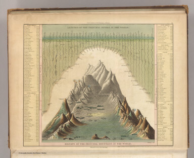
1845 Heights Of The Principal Mountains In Th … World Atlas Heights Of The Principal Mountains In Th … |

1845 City Of New York. World Atlas City of New York. Entered ... 1835 by H. … |

1845 New Map Of Maryland and Delaware. World Atlas A New Map Of Maryland and Delaware with … |

1845 City of Washington. World Atlas City of Washington. Entered ... 1836 ... … |

1845 Wisconsin. World Atlas Wisconsin. Published by Carey & Hart Phi … |

1845 Iowa. World Atlas Iowa. Published by Carey & Hart Philada. |

1845 Texas. World Atlas Map of Texas from the most recent author … |

1812 Western Hemisphere. World Atlas Western Hemisphere. Drawn under the dire … |

1812 Eastern Hemisphere. World Atlas Eastern Hemisphere. Drawn under the dire … |

1812 Northern Hemisphere. World Atlas Northern Hemisphere. Neele sculpt. 352 S … |

1812 Southern Hemisphere. World Atlas Southern Hemisphere. Drawn under the dir … |

1814 Europe. World Atlas Europe. Drawn under the direction of Mr. … |

1812 British Isles. World Atlas British Isles. (with inset map) Shetland … |

1811 England, southern part. World Atlas England, southern part. Drawn under the … |

1811 England, northern part. World Atlas England, northern part. Drawn under the … |

1812 Scotland, southern part. World Atlas Scotland, southern part. Drawn under the … |

1812 Scotland, northern part. World Atlas Scotland, northern part. (with inset map … |

1813 Ireland. World Atlas Ireland. Drawn under the direction of Mr … |

1814 Remote British Isles: Jersey and Guernse … World Atlas Remote British Isles: Jersey and Guernse … |

1809 France. World Atlas France. (with inset map) Island of Corsi … |

1811 Russia In Europe. World Atlas Russia in Europe. Drawn under the direct … |

1810 Austrian Dominions. World Atlas Austrian Dominions. Drawn under the dire … |

1810 Prussian Dominions. World Atlas Prussian Dominions. Drawn under the dire … |
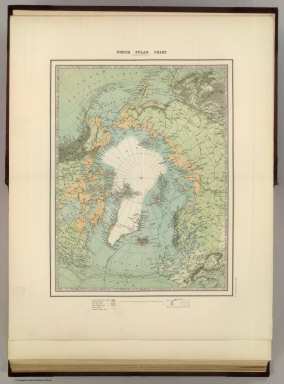
1893 Frontispiece: North Pole Chart. World Atlas (Frontispiece to) North Pole Chart by Ke … |

1893 World in Hemispheres. World Atlas The World in Hemispheres. Western Hemisp … |

1893 World on Mercators Projection. World Atlas Chart of the World on Mercators Projecti … |

1893 Europe. World Atlas Europe. By Keith Johnston, F.R.S.E. Keit … |

1893 North Atlantic Ocean. World Atlas Basin of the North Atlantic Ocean. By Ke … |

1810 Spain and Portugal. World Atlas Spain and Portugal. Drawn under the dire … |

1893 England and Wales (northern sheet). World Atlas England and Wales (northern sheet). By K … |

1893 England and Wales (southern sheet). World Atlas England and Wales (southern sheet). (wit … |

1893 Scotland (northern sheet). World Atlas Scotland (northern sheet). (with) Shetla … |

1893 Empire of Germany (northern portion). World Atlas Empire of Germany (northern portion). (w … |

1893 Austro-Hungarian Monarchy (western sheet … World Atlas Austro-Hungarian Monarchy (western sheet … |

1893 Austro-Hungarian Monarchy (eastern sheet … World Atlas Austro-Hungarian Monarchy (eastern sheet … |

1893 Turkey In Europe. World Atlas Turkey in Europe. (with) The Bosporus & … |

1893 Greece. World Atlas Greece. (with) The Cyclades. (with) Corc … |

1814 Turkey In Europe. World Atlas Turkey in Europe. Drawn under the direct … |

1893 Sweden & Norway (Scandanavia) World Atlas Sweden & Norway (Scandanavia). (with) St … |

1893 Basin of the Baltic. World Atlas Basin of the Baltic. (with) St. Peterbur … |