Search Results:

1865 Map of the United States, and Territorie … World Atlas Map of the United States, and Territorie … |
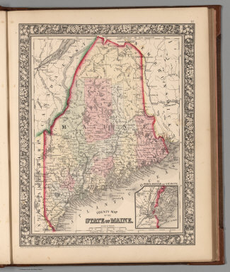
1865 County map of the State of Maine World Atlas County map of the State of Maine. Entere … |

1865 New Hampshire and Vermont World Atlas New Hampshire and Vermont. Drawn and Eng … |

1865 County map of Massachusetts, Connecticut … World Atlas County map of Massachusetts, Connecticut … |

1865 County map of the State of New York, New … World Atlas County map of the State of New York, New … |

1865 Plan of New York &c. World Atlas Plan of New York &c. Entered ... 1860 by … |

1865 Plan of Boston World Atlas Plan of Boston. Entered ... 1860 by S. A … |

1865 County map of the State of Pennsylvania World Atlas County map of the State of Pennsylvania. … |

1865 Plan of Philadelphia World Atlas Plan of Philadelphia. Entered ... 1865 b … |

1865 New Jersey, Maryland, Delaware World Atlas County map of New Jersey. (Scale: 1:1,10 … |

1865 Plan of Baltimore World Atlas Plan of Baltimore. Entered ... 1860 by S … |

1865 Plan of the City of Washington. The Capi … World Atlas Plan of the City of Washington. The Capi … |

1865 County map of Virginia and West Virginia World Atlas County map of Virginia and West Virginia … |

1865 County map of Kentucky and Tennessee World Atlas County map of Kentucky, and Tennessee. E … |

1865 County map of Georgia, and Alabama World Atlas County map of Georgia, and Alabama. Ente … |

1865 County map of North Carolina. Map of sou … World Atlas County map of North Carolina. (Scale: 1: … |

1865 Map of Louisiana, Mississippi. And Arkan … World Atlas Map of Louisiana, Mississippi. And Arkan … |

1865 Plan of New Orleans World Atlas Plan of New Orleans. Entered ... 1860 by … |

1865 County map of Texas World Atlas County map of Texas. (inset map) 35. Gal … |

1865 County map of Ohio and Indiana World Atlas County map of Ohio and Indiana. Drawn & … |

1865 Plan of Cincinnati and Vicinity World Atlas Plan of Cincinnati and Vicinity. Entered … |

1865 County map of the State of Illinois World Atlas County map of the State of Illinois. (in … |

1865 County map of the States of Iowa and Mis … World Atlas County map of the States of Iowa and Mis … |

1865 County map of Michigan and Wisconsin World Atlas County map of Michigan and Wisconsin. Dr … |

1865 County map of Minnesota World Atlas County map of Minnesota. Drawn & Engrave … |

1865 Map of Kansas, Nebraska, Colorado, Dakot … World Atlas Map of Kansas, Nebraska and Colorado. Sh … |

1865 County map of Utah and Nevada World Atlas County map of Utah and Nevada. Drawn & E … |

1865 Map of Oregon, Washington, Idaho, and Pa … World Atlas Map of Oregon, Washington, Idaho, and Pa … |

1865 County map of California World Atlas County map of California. (with two inse … |

1865 Map of Mexico, Central America, and the … World Atlas Map of Mexico, Central America, and the … |

1865 Map of South America World Atlas Map of South America, Showing its politi … |

1865 Map of New Granada, Venezuela, and Guian … World Atlas Map of New Granada, Venezuela, and Guian … |

1865 Map of Brazil, Bolivia, Paraguay, and Ur … World Atlas Map of Brazil, Bolivia, Paraguay, and Ur … |

1865 Map of Europe, Showing its Gt. Political … World Atlas Map of Europe, Showing its Gt. Political … |

1865 Russia in Europe, Sweden and Norway World Atlas Russia in Europe, Sweden and Norway. (wi … |

1865 Map of France, Spain, and Portugal World Atlas Map of France, Spain, and Portugal. (wit … |

1865 County map of England and Wales World Atlas County map of England and Wales. Entered … |

1865 County map of Scotland World Atlas County map of Scotland. (with two inset … |

1865 Prussia, and the German States World Atlas Prussia, and the German States. Entered … |

1865 Map of the Austrian Empire, Italian Stat … World Atlas Map of the Austrian Empire, Italian Stat … |

1865 Brasher, Saint Lawrence County, New York … County Atlas Brasher. |

1865 Canton, Saint Lawrence County, New York. County Atlas Canton. |

1865 Canton, Saint Lawrence County, New York. County Atlas Canton. |

1865 Brasher Falls. Morley. Brasher Iron Work … County Atlas Brasher Falls. Morley. Brasher Iron Work … |

1865 Colton, Saint Lawrence County, New York. County Atlas Part of Colton including the original To … |

1865 Dekalb, Saint Lawrence County, New York. County Atlas Dekalb. Dekalb. |

1865 Heuvelton. Nicholville, Saint Lawrence C … County Atlas Heuvelton. Nicholville. |

1865 Morristown. Brier Hill, Saint Lawrence C … County Atlas Morristown. Brier Hill. |

1865 Edwards, Saint Lawrence County, New York … County Atlas Edwards. Edwards. |

1865 Fine, Saint Lawrence County, New York. County Atlas Part of Fine comprising Scriba and a par … |