Search Results:

1874 Vital statistics, United Census, 1870: D … State Atlas Vital statistics, United Census, 1870: D … |

1874 Plan of the City of St. Paul and vicinit … State Atlas Plan of the City of St. Paul and vicinit … |

1874 Map of Ramsey County, Minn. State Atlas Map of Ramsey County, Minn. (Published b … |

1874 Plan of the City of Minneapolis and vici … State Atlas Plan of the City of Minneapolis and vici … |

1874 Map of Hennepin County, Minn. State Atlas Map of Hennepin County, Minn. (Published … |

1874 Map of Washington County, Minn., St. Cro … State Atlas Map of Washington County, Minn. (with) S … |

1874 Map of Hastings, Dakota Co., Minn. State Atlas Map of Hastings, Dakota Co., Minn. (Publ … |

1874 Map of Dakota County, Minn. State Atlas Map of Dakota County, Minn. (Published b … |

1874 Shakopee, Scott Co., Minn. State Atlas Shakopee, Scott Co., Minn. Drawn by W.P. … |

1874 Map of Scott County, Minn. State Atlas Map of Scott County, Minn. (Published by … |

1874 Map of Carver County, Minn. State Atlas Map of Carver County, Minn. (Published b … |

1874 Map of Chaska and Map of Carver, Carver … State Atlas Map of Chaska, county seat of Carver Co. … |

1874 Map of the City of St. Peter, Minn. State Atlas Map of the City of St. Peter, Oshawa Tow … |

1874 Counties of Brown and Nicollet, Minn. wi … State Atlas Counties of Brown and Nicollet, Minnesot … |

1874 Map of Blue Earth County, Minn. State Atlas Map of Blue Earth County, Minn. (Publish … |

1874 Map of the City of Mankato, Blue Earth C … State Atlas Map of the City of Mankato, Blue Earth C … |

1874 Map of Le Sueur County, Minn. State Atlas Map of Le Sueur County, Minn. (Published … |

1874 Western Hemisphere. National Atlas Western Hemisphere. Entered ... 1874 by … |

1874 Map of the World on the Mercator Project … National Atlas Map of the World on the Mercator Project … |
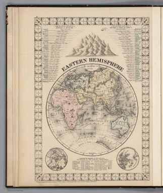
1874 Eastern Hemisphere. National Atlas Eastern Hemisphere. Entered ... 1874 by … |
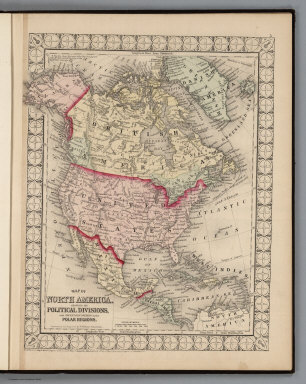
1874 North America. National Atlas Map of North America Showing its Politic … |

1874 United States, and Territories together … National Atlas Map of the United States, and Territorie … |

1874 City of Washington, the Capitol of the U … National Atlas Plan of the City of Washington, the Capi … |

1874 County Map of Maine. National Atlas County Map of the State of Maine. (inset … |

1874 County and Township Map of the States of … National Atlas County and Township Map of the States of … |

1874 New Hampshire and Vermont. National Atlas New Hampshire and Vermont. Entered ... 1 … |

1874 County Map of Virginia and West Virginia … National Atlas County Map of Virginia and West Virginia … |

1874 Plan of Boston. National Atlas Plan of Boston. Entered ... 1874 by S. A … |

1874 Plan of Baltimore. National Atlas Plan of Baltimore. Entered ... 1874 by S … |

1874 Counties of Cottonwood, Murray, Pipeston … State Atlas Counties of Cottonwood, Murray, Pipeston … |

1874 County Map of Maryland and Delaware. Cou … National Atlas County Map of Maryland and Delaware. Cou … |

1874 County Map of the State of New York. National Atlas County Map of the State of New York. (in … |

1874 Chicago. National Atlas Chicago. Entered ... 1874 by S. Augustus … |

1874 County Map of the State of Illinois. National Atlas County Map of the State of Illinois. (in … |

1874 New York City and Brooklyn. National Atlas New York and Brooklyn. (inset) Northern … |

1874 North and South Carolina. National Atlas North and South Carolina. (inset) Plan o … |

1874 County Map of the State of Pennsylvania. National Atlas County Map of the State of Pennsylvania. … |

1874 Plan of the City of Philadelphia and Cam … National Atlas Plan of the City of Philadelphia and Cam … |

1874 Plan of Cincinnati. National Atlas Plan of Cincinnati. Entered ... 1874 by … |

1874 Map of Rice County, Minn. State Atlas Map of Rice County, Minn. (Published by … |

1874 County Map of Ohio and Indiana. National Atlas County Map of Ohio and Indiana. |

1874 County Map of the States of Georgia and … National Atlas County Map of the States of Georgia and … |

1874 St. Louis. National Atlas St. Louis. Entered ... 1874 by S. August … |

1874 Map of Faribault, Rice County, Minn. State Atlas Map of Faribault, laid out in 1855 by Al … |

1874 County and Township Map of the States of … National Atlas County and Township Map of the States of … |

1874 County Map of the States of Arkansas, Mi … National Atlas County Map of the States of Arkansas, Mi … |

1874 Plan of New Orleans. National Atlas Plan of New Orleans. Entered ... 1874 by … |

1874 County Map of Florida. Mobile. National Atlas County Map of Florida. (inset) Mobile. |

1874 County Map of the State of Texas. Plan o … National Atlas County Map of the State of Texas, Showin … |

1874 County Map of Minnesota. National Atlas County Map of Minnesota. Entered ... 187 … |