Search Results:

1873 (Map of Sanilac County, Michigan) State Atlas (Map of Sanilac County, Michigan. Drawn, … |

1873 (Map of St. Clair County, Michigan) State Atlas (Map of St. Clair County, Michigan. Draw … |

1873 (Map of Lapeer County, Michigan) State Atlas (Map of Lapeer County, Michigan. Drawn, … |

1873 (Map of Genesee County, Michigan) State Atlas (Map of Genesee County, Michigan. Drawn, … |

1873 (Map of Shiawassee County, Michigan) State Atlas (Map of Shiawassee County, Michigan. Dra … |

1873 (Map of Clinton County, Michigan) State Atlas (Map of Clinton County, Michigan. Drawn, … |

1873 (Map of Ionia County, Michigan) State Atlas (Map of Ionia County, Michigan. Drawn, c … |

1873 (Map of Kent County, Michigan) State Atlas (Map of Kent County, Michigan. Drawn, co … |

1873 (Map of Ottawa County, Michigan) State Atlas (Map of Ottawa County, Michigan. Drawn, … |

1873 (Map of Allegan County, Michigan) State Atlas (Map of Allegan County, Michigan. Drawn, … |

1873 (Map of Barry County, Michigan) State Atlas (Map of Barry County, Michigan. Drawn, c … |

1873 (Map of Eaton County, Michigan) State Atlas (Map of Eaton County, Michigan. Drawn, c … |
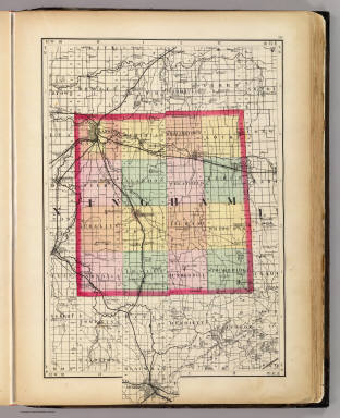
1873 (Map of Ingham County, Michigan) State Atlas (Map of Ingham County, Michigan. Drawn, … |

1873 (Map of Livingston County, Michigan) State Atlas (Map of Livingston County, Michigan. Dra … |

1873 (Map of Oakland County, Michigan) State Atlas (Map of Oakland County, Michigan. Drawn, … |
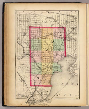
1873 (Map of Macomb County, Michigan) State Atlas (Map of Macomb County, Michigan. Drawn, … |

1873 (Map of Wayne County, Michigan) State Atlas (Map of Wayne County, Michigan. Drawn, c … |

1873 (Map of Washtenaw County, Michigan) State Atlas (Map of Washtenaw County, Michigan. Draw … |

1873 (Map of Jackson County, Michigan) State Atlas (Map of Jackson County, Michigan. Drawn, … |

1873 (Map of Calhoun County, Michigan) State Atlas (Map of Calhoun County, Michigan. Drawn, … |

1873 (Map of Kalamazoo County, Michigan) State Atlas (Map of Kalamazoo County, Michigan. Draw … |

1873 (Map of Van Buren County, Michigan) State Atlas (Map of Van Buren County, Michigan. Draw … |

1873 (Map of Berrien County, Michigan) State Atlas (Map of Berrien County, Michigan. Drawn, … |

1873 (Map of Cass County, Michigan) State Atlas (Map of Cass County, Michigan. Drawn, co … |

1873 (Map of St. Joseph County, Michigan) State Atlas (Map of St. Joseph County, Michigan. Dra … |

1873 (Map of Branch County, Michigan) State Atlas (Map of Branch County, Michigan. Drawn, … |

1873 (Map of Hillsdale County, Michigan) State Atlas (Map of Hillsdale County, Michigan. Draw … |

1873 (Map of Lenawee County, Michigan) State Atlas (Map of Lenawee County, Michigan. Drawn, … |

1873 (Map of Monroe County, Michigan) State Atlas (Map of Monroe County, Michigan. Drawn, … |

1873 Upper Peninsula, scale six miles to an i … State Atlas Upper Peninsula, scale six miles to an i … |

1873 Upper Peninsula, scale six miles to an i … State Atlas Upper Peninsula, scale six miles to an i … |

1873 Upper Peninsula, scale six miles to an i … State Atlas Upper Peninsula, scale six miles to an i … |

1873 Upper Peninsula, scale six miles to an i … State Atlas Upper Peninsula, scale six miles to an i … |

1873 Upper Peninsula, scale six miles to an i … State Atlas Upper Peninsula, scale six miles to an i … |

1873 Upper Peninsula, scale six miles to an i … State Atlas Upper Peninsula scale six miles to an in … |

1873 Upper Peninsula, scale six miles to an i … State Atlas Upper Peninsula scale six miles to an in … |

1873 Upper Peninsula, scale six miles to an i … State Atlas Upper Peninsula scale six miles to an in … |

1873 Map of the City of Detroit. State Atlas Map of the City of Detroit, 1873. Compil … |

1873 City of Grand Rapids, Kent County. State Atlas City of Grand Rapids, Kent County. Reduc … |

1873 Maps showing the congressional districts … State Atlas Map showing the congressional districts … |

1873 Maps showing the senatorial and represen … State Atlas Map showing the senatorial districts of … |

1853 A New Map of Michigan World Atlas A New Map of Michigan, with its Canals, … |

1874 County and Township Map of the States of … National Atlas County and Township Map of the States of … |

1845 Michigan. World Atlas Neueste Karte von Michigan. Nach den bes … |

1864 Wisconsin And Michigan World Atlas Johnson's Wisconsin And Michigan Publish … |

1855 A new map of Michigan World Atlas A new map of Michigan, with its Canals, … |

1873 Michigan showing contour lines. State Atlas Michigan showing contour lines by Alexan … |

1873 Map of the State of Michigan showing cou … State Atlas Map of the State of Michigan showing cou … |

1873 Map of the State of Michigan colored to … State Atlas Map of the State of Michigan colored to … |

1873 Climatology of Michigan ... isothermals … State Atlas Climatology of Michigan by Alex. Winchel … |