Search Results:

1832 Argyllshire N. National Atlas Southern part of Argyllshire. (with) Cam … |

1832 Perthshire NW. National Atlas North west part of Perthshire. From Mr. … |

1832 Perthshire NE. National Atlas North east part of Perthshire. From Mr. … |

1832 Perthshire SW. National Atlas South west part of Perthshire. From Mr. … |

1832 Perthshire SE. National Atlas South east part of Perthshire with Clack … |

1832 Fife W. National Atlas Western part of Fife with Kinross-Sh(ire … |

1832 Fife E. National Atlas Eastern part of Fife-Sh(ire). Compiled f … |

1832 Angusshire N. National Atlas Northern part of Angusshire. Engraved by … |

1832 Angusshire S. National Atlas Southern part of Angusshire. Engraved by … |

1832 Kincardine Shire. National Atlas Kincardine Shire. (with) A north east vi … |

1832 Aberdeen, Banff 1 N. National Atlas Northern part of Aberdeen & Banff-Shrs. … |

1832 Aberdeen, Banff 2 N. National Atlas (Northern part of Aberdeen & Banff-Shrs. … |

1832 Aberdeen, Banff 3 S. National Atlas (Southern part of Aberdeen & Banff-Shrs. … |

1832 Aberdeen, Banff 4 S. National Atlas Southern part of Aberdeen & Banff-Shrs. … |

1832 Nairn, Elgin. National Atlas Nairn and Elgin. Compiled by William Joh … |

1832 Skye Island &c. National Atlas Part of Inverness Shire. Skye Island &c. … |

1832 Western Isles Middle. National Atlas Middle part of Western Isles. Part of In … |

1832 Western Isles S. National Atlas Southern part of Western Isles. Part of … |

1832 Inverness Shire 4 N. National Atlas Northern part of Inverness Shire. Compil … |

1832 Inverness Shire 5 N. National Atlas (Northern part of Inverness Shire. Compi … |

1832 Inverness Shire 6 S. National Atlas (Southern part of Inverness Shire. Compi … |

1832 Inverness Shire 7 S. National Atlas Southern part of Inverness Shire. Compil … |

1832 Western Isles N. National Atlas Northern part of Western Isles. Part of … |

1832 Ross, Cromarty Shires N. National Atlas Northern part of Ross and Cromarty Shire … |

1832 Ross, Cromarty Shires S. National Atlas Southern part of Ross and Cromarty Shire … |

1832 Sutherland Shire. National Atlas Sutherland Shire. Engraved by S.I. Neele … |

1832 Caithness Shire. National Atlas Caithness Shire. Drawn by Wm. Campbell, … |

1832 Orkney Islands. National Atlas Orkney Islands. Engraved by T. Clerk. Pu … |

1832 Shetland Islands. National Atlas Shetland Islands. Drawn by William Johns … |

1820 British Empire. Historical Atlas Geographical and Historical Map of the B … |

1820 Scotland. Historical Atlas Geographical and Statistical Map of Scot … |

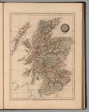
1834 Scotland. World Atlas Scotland, by J. Arrowsmith. London, pubd … |

1872 Railway Map of the British Isles. World Atlas Railway Map of the British Isles exhibit … |

1822 Scotland. World Atlas Scotland. Sam Harrison, Scl. Phia. (1822 … |

1892 Les Britannique. World Atlas Les Britannique. Grave par L. Smith. Dre … |

1892 Ecosse. World Atlas Ecosse. Grave par L. Smith. Dresse Sous … |

1790 A new and correct map of Scotland or Nor … World Atlas A new and correct map of Scotland or Nor … |

1837 Ecosse. World Atlas Ecosse, 1831. No. 41. Grave par Thierry. … |

1837 Iles Britanniques. World Atlas Iles Britanniques or Royaume Uni de la G … |

1854 Die Britischen Inseln 1066 bis 1485. Historical Atlas Die Britischen Inseln, von Wilhelm den E … |

1854 Die Britischen Inseln seit 1485. Historical Atlas Die Britischen Inseln seit 1485. (with) … |

1864 Scotland World Atlas Scotland. J.W. del. (engraved by) Stockl … |
1825 Scotland World Atlas Scotland. London, Published Jany. 4.1825 … |

1906 British Isles. Geological Map of the Bri … World Atlas British Isles. Geological Map of the Bri … |

1906 English Lake District. Environs of Londo … World Atlas English Lake District. Environs of Londo … |

1906 Index Map: Scotland. Scotland (Section 1 … World Atlas (Index Map to) Scotland. Scotland (Secti … |

1906 Scotland (Section 2). World Atlas Scotland (Section 2). |

1906 Scotland (Section 3). World Atlas Scotland (Section 3). |

1906 Scotland (Section 4). Scotland (Section … World Atlas Scotland (Section 4). Scotland (Section … |

1906 Scotland (Section 6). World Atlas Scotland (Section 6). |