Search Results:

1882 View: Residence & Store of H.C. Kimble, … County Atlas (View) Residence & Store of H.C. Kimble, … |

1882 Bath Township and Fairfield Township, Fr … County Atlas Map of Bath Township. Map of Fairfield T … |

1882 Blooming Grove Township, Franklin County … County Atlas Map of Blooming Grove Township. Blooming … |

1882 View: Residence of J.M. Wawter, Franklin … County Atlas (View) Residence of J.M. Wawter. |

1882 View: Residence of James McClure, Frankl … County Atlas (View) Residence of James McClure, Brook … |

1882 View: Residence of Charles Samoniel, Bro … County Atlas (View) Hardware Stores & Warehouses of C … |

1882 View: Residence & Tenant House of Alliso … County Atlas (View) Residence & Tenant House of Allis … |

1882 Laurel Township, Franklin County, Indian … County Atlas Map of Laurel Township. |

1882 Posey Township, Franklin County, Indiana … County Atlas Map of Posey Township. Andersonville (Fo … |

1882 View: Residence of Celia Wright, Frankli … County Atlas (View) Residence of Mrs. Celia Wright, B … |

1882 View: Residence of William H. Likeley, F … County Atlas (View) Residence of William H. Likeley, … |

1882 View: Farm Residence of Thomas Johnston, … County Atlas (View) Farm Residence of Thomas Johnston … |

1882 View: Residences of Eliphalet Allen and … County Atlas (View) Residence of Eliphalet Allen, Bat … |

1882 Laurel, Indiana. County Atlas Laurel. |

1882 View: Residence of Edward Goff, Franklin … County Atlas (View) Residence of Edward Goff, Bath To … |

1882 View: Residence of A.B. Jones, Franklin … County Atlas (View) Residence of A.B. Jones, Bath Tow … |

1882 View: Residence of John W. Smolley, Bath … County Atlas (View) Residence of John W. Smolley, Bat … |

1882 View: Residence of Thomas Gifford, M.D., … County Atlas (View) Residence of Thomas Gifford, M.D. … |

1882 View: Residence of Benjamin Smith, Frank … County Atlas (View) Residence of Benjamin Smith, Spri … |

1882 View: Business Property Alf. Blacklidge, … County Atlas (View) Business Property & General Store … |

1882 Salt Creek Township, Franklin County, In … County Atlas Map of Salt Creek Township. |

1882 Ray Township. Oldenburg. Enochsburg. Hun … County Atlas Map of Ray Township. Oldenburg. Enochsbu … |

1882 Butler Township. County Atlas Map of Butler Township. |

1882 View: Homestead & Property of Mrs. Agnes … County Atlas (View) Homestead & Property of Mrs. Agne … |

1882 View: Residence and Portraits of Mr. & M … County Atlas (View) Residence of P.T. Jones, Bath Tow … |

1882 View: Cloper & Sons, Carriage Manufactur … County Atlas (View) Cloper & Sons, Carriage Manufactu … |

1882 View: Residence of Isaac C. Howell, Fran … County Atlas (View) Residence of Isaac C. Howell, Bat … |

1882 View: Residence of A. Fischesser, Hotel … County Atlas (View) Residence of A. Fischesser, Hotel … |

1882 View: Residences of E.W. High and of Sol … County Atlas (View) Residence of E.W. High, Metamora, … |

1882 View: Crescent Mills, W. McClure, Propri … County Atlas (View) Crescent Mills, Metamora, Frankli … |

1882 Highland Township. Village and Catholic … County Atlas Map of Highland Township. Village and Ca … |

1882 Map of White Water Township, Franklin Co … County Atlas Map of White Water Township. |

1882 View: General Store, Property and Reside … County Atlas (View) General Store & Property of M.B. … |

1882 View: Residence of C.T. Gordon, Franklin … County Atlas (View) Residence of C.T. Gordon, Metamor … |

1882 View: Residence of M.M. More, Blooming G … County Atlas (View) Residence of M.M. More, Blooming … |
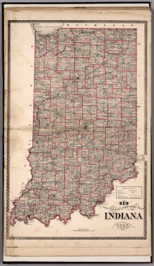
1882 Sectional and Township Map of Indiana. 1 … County Atlas Sectional and Township Map of Indiana. 1 … |

1882 New Railroad Map of the United States. County Atlas New Railroad Map of the United States. |

1882 Western Hemisphere. Eastern Hemisphere. County Atlas Western Hemisphere. Eastern Hemisphere. |

1897 Cady, Saint Croix County, Wisconsin. County Atlas Plat of Cady. |

1897 Springfield, Saint Croix County, Wiscons … County Atlas Plat of Springfield. |

1897 Glenwood, Saint Croix County, Wisconsin. County Atlas Plat of Glenwood. |

1897 Forest, Saint Croix County, Wisconsin. County Atlas Plat of Forest. |

1897 Eau Galle, Saint Croix County, Wisconsin … County Atlas Plat of Eau Galle. |

1897 Baldwin, Saint Croix County, Wisconsin. County Atlas Plat of Baldwin. |

1897 Emerald, Saint Croix County, Wisconsin. County Atlas Plat of Emerald. |

1897 Cylon, Saint Croix County, Wisconsin. County Atlas Plat of Cylon. |

1897 Pleasant Valley. Rush River, Saint Croix … County Atlas (Plat of) Pleasant Valley. (Plat of) Rus … |

1897 Hammond, Saint Croix County, Wisconsin. County Atlas Plat of Hammond. |

1897 Erin, Saint Croix County, Wisconsin. County Atlas Plat of Erin. |

1897 Stanton, Saint Croix County, Wisconsin. County Atlas Plat of Stanton. |