Search Results:

1889 Maine. World Atlas Railroad and County Map of Maine. Geo. F … |

1901 Maine. World Atlas Maine. |

1894 Railroad map of Maine. State Atlas Railroad map of Maine. (1894) |

1885 Maine Central Railroad. State Atlas Map of the Maine Central Railroad. All r … |

1855 Covers: State Of Maine Pocket Map (Covers to) Colton's Railroad & Township … |

1855 State Of Maine Pocket Map Colton's Railroad & Township Map Of The … |

1934 Index: Maine, Railway Distance Maps Guide Book (Index to) Leahy's Hotel Guide and Railw … |

1934 Railway Distance Map of the State of Mai … Guide Book Leahy's Hotel Guide and Railway Distance … |

1900 Covers: State Of Maine Pocket Map (Covers to) Map Of The State Of Maine Sh … |

1900 Title Page: Map Of Maine Pocket Map (Title Page to) Farrington's Map Of Main … |
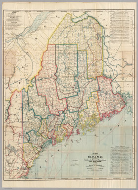
1900 Map Of Maine Pocket Map Farrington's Map Of Maine, Together with … |

1878 New England. National Atlas Cram's Rail Road & County Map of New Eng … |

1891 (Quebec, New England) Railroad Map of th … Case Map Rand, McNally & Co.'s New Shippers' Rail … |

1891 Covers: (Quebec, New England) Railroad M … Case Map (Covers to) Rand, McNally & Co.'s New Sh … |

1924 Maine. National Atlas Commercial Atlas of America. Rand McNall … |

1924 Maine. National Atlas Commercial Atlas of America. Rand McNall … |