Search Results:

1889 New York. World Atlas Railroad and County Map of New York. Geo … |

1921 Covers: New York Pocket Map (Covers to) Rand McNally Standard Map Of … |

1921 Title Page: New York Pocket Map (Title Page to) Rand McNally Standard Ma … |

1921 New York Pocket Map Rand McNally Standard Map Of New York. T … |

1921 Main Highway Map Of New York Pocket Map Rand McNally Standard Map Of New York. T … |

1901 New York, Western Half. World Atlas New York, Western Half. (inset) (Long Is … |

1901 New York, Eastern Half. World Atlas New York, Eastern Half. |

1901 Composite: New York. World Atlas (Composite of) New York. (inset) (Long I … |
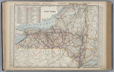
1901 New York. World Atlas New York. |

1864 Engineers Map Of The State Of New York Separate Map Engineers Map Of The State Of New York S … |

1870 Asher & Adams' New York, Railroads. State Atlas Asher & Adams' New Topographical Atlas A … |

1875 New York. National Atlas Cram's Rail Road & Township Map of New Y … |

1845 Map Exhibiting The ... Lines for the New … Separate Map Map Exhibiting The Experimental and Loca … |

1934 Index: New York. Railway Distance Maps Guide Book (Index to) Leahy's Hotel Guide and Railw … |

1934 Railway Distance Map of the State of New … Guide Book Leahy's Hotel Guide and Railway Distance … |

1934 Index: New York (Continues). Railway Dis … Guide Book (Index to) Leahy's Hotel Guide and Railw … |

1934 (Continues) Railway Distance Map of the … Guide Book Leahy's Hotel Guide and Railway Distance … |

1934 Index: New York (Continues). Railway Dis … Guide Book (Index to) Leahy's Hotel Guide and Railw … |

1934 (Continues) Railway Distance Map of the … Guide Book Leahy's Hotel Guide and Railway Distance … |

1845 Map Of The State Of New York With the La … Guide Book Map Of The State Of New York With the La … |

1868 Covers: State Of New York Pocket Map (Covers to) Colton's Railroad & Township … |

1868 State Of New York Pocket Map Colton's Railroad & Township Map Of The … |

1855 Covers: State Of New York Pocket Map (Covers to) Colton's Railroad & Township … |

1855 State Of New York Pocket Map Colton's Railroad & Township Map Of The … |

1887 Covers: Map Of New York Pocket Map (Covers to) New Railroad, County and Tow … |

1887 Map Of New York Pocket Map New Railroad, County and Township Map Of … |

1837 Route of the Western railroad. West of C … Pamphlet Route of the Western railroad. West of C … |

1837 Route of the Western railroad. East of C … Pamphlet Route of the Western railroad. East of C … |

1840 A new map of New York with its canals, r … Guide Book A new map of New York with its canals, r … |

1840 Profile of the Erie Canal. Profile of th … Guide Book Profile of the Erie Canal N.Y. ; Profile … |

1885 Map Peoples Line of Steamers. Timetable Map Peoples Line New Jersey Steamboat Co. be … |

1885 Text Page: Peoples Line. Timetable Map (Text Page to) Peoples Line New Jersey S … |

1918 Grand Central Terminal. Guide Book Grand Central Terminal of the New York C … |

1918 Heart of New York. Guide Book The heart of New York Grand Central Term … |

1918 Cover: Guide New York City. Guide Book (Covers to) A guide to New York City iss … |

1878 New York. National Atlas Cram's Rail Road & County Map of New Yor … |

1891 Covers: (Penn., N.Y., New England) Railr … Case Map (Covers to) Rand, McNally & Co.'s New Sh … |

1891 (Penn., N.Y., New England) Railroad Map … Case Map Rand, McNally & Co.'s New Shippers' Rail … |

1891 (Quebec, New England) Railroad Map of th … Case Map Rand, McNally & Co.'s New Shippers' Rail … |

1891 Covers: (Quebec, New England) Railroad M … Case Map (Covers to) Rand, McNally & Co.'s New Sh … |

1845 Map Exhibiting The ... Lines for the New … Separate Map Map Exhibiting The Experimental and Loca … |

1924 New York (eastern section). National Atlas Commercial Atlas of America. Rand McNall … |

1924 New York (western and northern sections) … National Atlas Commercial Atlas of America. Rand McNall … |

1924 New York. National Atlas Commercial Atlas of America. Rand McNall … |

1924 New York-Philadelphia District. National Atlas Commercial Atlas of America. Rand McNall … |