Search Results:

1858 California, Oregon, Washington, Utah, Ne … World Atlas A new map of the state of California, th … |

1875 Grossbritannien. Sudliches Blatt: Englan … World Atlas Grossbritannien Im Maassstabe Von 1:1.50 … |

1858 California, Oregon, Washington, Utah, Ne … World Atlas A new map of the state of California, th … |

1875 Grossbritannien. Nordliches Blatt: Schot … World Atlas Grossbritannien Im Maassstabe Von 1:1.50 … |

1968 World Physical. [School Atlas, World Atlas] World Physical. |

1968 World Political. [School Atlas, World Atlas] World Political. |

1968 World Land Transportation. [School Atlas, World Atlas] World Land Transportation. |

1968 World Religions; Races. World Languages; … [School Atlas, World Atlas] World Religions; Races. World Languages; … |

1968 World Climate; Agriculture. World Precip … [School Atlas, World Atlas] World Climate; Agriculture. World Precip … |

1968 World Agriculture. [School Atlas, World Atlas] World Agriculture. |

1968 World Agriculture. [School Atlas, World Atlas] World Agriculture. |

1968 World Coal; Oil. World Natural Gas; Hydr … [School Atlas, World Atlas] World Coal; Oil. World Natural Gas; Hydr … |

1968 World Iron Ore; Ferro-Alloy. World Iron; … [School Atlas, World Atlas] World Iron Ore; Ferro-Alloy. World Iron; … |

1968 World Metals; Minerals. [School Atlas, World Atlas] World Metals; Minerals. |

1968 World Precious Metals. World Gems; Semip … [School Atlas, World Atlas] World Precious Metals. World Gems; Semip … |

1968 North America. [School Atlas, World Atlas] North America. |

1968 North America Thematic Maps. [School Atlas, World Atlas] North America Thematic Maps. |

1968 Canada Physical. [School Atlas, World Atlas] Canada Physical. |

1968 Canada Minerals; Energy. Canada Agricult … [School Atlas, World Atlas] Canada Minerals; Energy. Canada Agricult … |

1968 United States Physical. [School Atlas, World Atlas] United States Physical. |

1968 United States Land Use. [School Atlas, World Atlas] United States Land Use. |

1968 United States Agriculture. [School Atlas, World Atlas] United States Agriculture. |

1968 United States Mineral Fuels. United Stat … [School Atlas, World Atlas] United States Mineral Fuels. United Stat … |

1968 South America. [School Atlas, World Atlas] South America. |

1968 South America Thematic Maps. [School Atlas, World Atlas] South America Thematic Maps. |

1968 Atlantic Ocean. [School Atlas, World Atlas] Atlantic Ocean. |

1968 Europe. [School Atlas, World Atlas] Europe. |

1968 Europe (not including U.S.S.R.) Thematic … [School Atlas, World Atlas] Europe (not including U.S.S.R.) Thematic … |

1968 Union of Soviet Socialist Republics. [School Atlas, World Atlas] Union of Soviet Socialist Republics. |

1875 Composite: Grossbritannien. World Atlas (Composite of) Grossbritannien Im Maasss … |

1968 Union of Soviet Socialist Republics Them … [School Atlas, World Atlas] Union of Soviet Socialist Republics Them … |

1968 Asia (excluding U.S.S.R.). [School Atlas, World Atlas] Asia (excluding U.S.S.R.). |

1968 Asia Thematic Maps. [School Atlas, World Atlas] Asia Thematic Maps. |

1968 Africa. [School Atlas, World Atlas] Africa. |

1968 Africa Thematic Maps. [School Atlas, World Atlas] Africa Thematic Maps. |

1968 Indian and Pacific Oceans Physical. [School Atlas, World Atlas] Indian and Pacific Oceans Physical. |

1968 Oceania Thematic Maps. [School Atlas, World Atlas] Oceania Thematic Maps. |

1968 Antarctica, Australia and New Zealand. [School Atlas, World Atlas] Antarctica, Australia and New Zealand. |
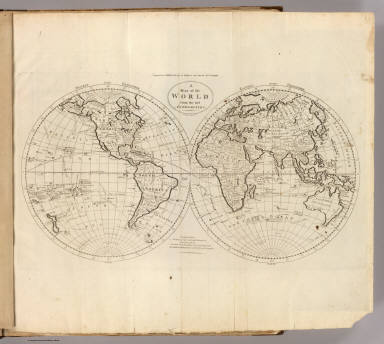
1811 Map of the World. World Atlas A Map of the World from the best Authori … |

1811 Chart of the World, According to Mercato … World Atlas A Chart of the World, According to Merca … |

1811 Map of Europe. World Atlas An Accurate Map of Europe from the Best … |

1811 Sweden, Denmark, Norway and Finland. World Atlas Sweden, Denmark, Norway and Finland. fro … |

1811 Russian Empire, in Europe and Asia. World Atlas The Russian Empire, in Europe and Asia. … |

1811 Scotland. World Atlas Scotland with the Principal Roads from t … |

1811 England and Wales. World Atlas An Accurate Map of England and Wales Wit … |

1875 Ireland. World Atlas Ireland Im Maassstabe Von 1:1.500.000. V … |

1811 Ireland. World Atlas A Map of Ireland According to the best A … |

1811 Holland, Friesland, Groningen, Overyssel … World Atlas The Seven United Provinces of Holland, F … |

1811 Austrian French and Dutch Netherlands. World Atlas The Austrian French and Dutch Netherland … |

1811 Empire of Germany and the 13 Cantons of … World Atlas The Empire of Germany and the 13 Cantons … |