Search Results:

1815 Bellum Trojanum. World Atlas Bellum Trojanum. |

1801 Romani Imperii Primordia et Recentiora. World Atlas Romani Imperii Primordia et Recentiora. |

1817 Imperium Persicum Antiquum. World Atlas Imperium Persicum Antiquum. |

1819 World according to the Idea of Herodotus … World Atlas The World according to the Idea of Herod … |

1815 Reditus Decem Millium Graecorum. World Atlas Reditus Decem Millium Graecorum. |

1807 Alexandri Magni Itinera in Expeditione i … World Atlas Alexandri Magni Itinera in Expeditione i … |

1807 Imperium Parthicum Tempore Arsacidum. World Atlas Imperium Parthicum Tempore Arsacidum. |

1875 Frankreich und die Schweiz. World Atlas Frankreich und die Schweiz bearbeitet vo … |

1822 Expeditio Hannibalis Poenorum Ducis, World Atlas Expeditio Hannibalis Poenorum Ducis, |

1818 Romanum Imperium. World Atlas Romanum Imperium. |

1800 Britannia Romana. World Atlas Britannia Romana. |

1817 Eslam or the Countries which have profes … World Atlas Eslam or the Countries which have profes … |

1819 Saxon England. World Atlas Saxon England. |

1801 The Empire of Charlemagne, A.D. D,CCC (8 … World Atlas The Empire of Charlemagne, A.D. D,CCC (8 … |

1807 The Kingdom of Jerusalem with Its Enviro … World Atlas The Kingdom of Jerusalem with Its Enviro … |

1827 Das Planeten - System. (The Planetary Sy … World Atlas No. II. Stielers Hand-Atlas (No. 4).Das … |

1837 Westliche Halbkugel. (Western Hemisphere … World Atlas No. IV. Stieler's Hand-Atlas No. 6. West … |

1832 Oestliche Halbkugel. (Eastern Hemisphere … World Atlas No. V. Stieler's Hand-Atlas No. 7. Oestl … |

1837 Die bekannteren Hohwn uber der Meeresfla … World Atlas No.IX. Stieler's Hand-Atlas No. 10. Die … |

1833 Europa. (Europe}. World Atlas No. XI. Stieler's Hand-Atlas No. 12. Eur … |

1835 Spanien und Portugal. (Spain and Portuga … World Atlas No. XII. Stieler's Hand-Atlas No. 13. Sp … |

1829 Frankreich und Umgebungen von Paris. (Fr … World Atlas No. XIII. Stieler's Hand-Atlas (No. 14.) … |

1823 Die Brittischen Inseln. (British Isles). World Atlas No. XVII. Stielers Hand-Atlas (No. 15). … |

1822 Danemark, Island u. Faroer, Schweden und … World Atlas Stielers Hand-Atlas (No. 16). Danemark, … |

1835 Daenemark mit Schleswig, Holstein, und L … World Atlas No. XXI. Stieler's Hand-Atlas (No. 16b.) … |

1831 Germany. Netherlands. Belgium. World Atlas No. XXVII. Stieler's Hand-Atlas (No. 21. … |

1831 Nord-Ostliches Deutschland. (Northeast G … World Atlas No. XXVIII. Stieler's Hand-Atlas (No. 22 … |

1833 Die Preussischen Provinzen, Preussen und … World Atlas No. XXIX. Stielers Hand-Atlas (No. 22b). … |

1834 Mittel-Ostliches Deutschland. (East Cent … World Atlas No. XXX. Stieler's Hand-Atlas (No. 23). … |

1835 Sudwestliches Deutschland ... Schweiz. ( … World Atlas No. XXXI. Stieler's Hand-Atlas (No. 24). … |

1836 Sud-Ostliches Deutschland .... (Southeas … World Atlas No. XXXII. Stieler's Hand-Atlas (No. 25) … |

1833 Der Rhein .... (Rhine). World Atlas Stieler's Hand-Atlas (No. 30 und 31). De … |
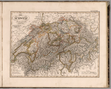
1834 Die Schweiz. (Switzerland). World Atlas No. XXXIV. Stieler's Hand-Atlas (No. 32) … |

1828 Jtalien. (Italy). World Atlas No. XXXV. Stieler's Hand-Atlas (No. 33). … |

1835 Galizien, Ungarn mit Slavonien und Croat … World Atlas No. XXXVIII. Stieler's Hand-Atlas (No. 3 … |

1834 Ostsee-Laender und Inneres Russland bis … World Atlas No. XXXIX. Stieler's Hand-Atlas (No. 36) … |

1833 Europaeisches Russland auch Schweden u. … World Atlas No. XL. Stieler's Hand-Atlas (No. 37). E … |

1832 Des Osmanischen Reichs europaqischer The … World Atlas No. XLI. Stieler's Hand-Atlas (No. 38). … |

1831 Griechenland mit Beachtung der Klassisch … World Atlas No. XLIII. Stieler's Hand-Atlas (No. 38c … |

1834 Asia. World Atlas No. XLV. Stieler's Hand-Atlas (No. 39). … |

1834 Afrika. (Africa). World Atlas No. LI. Stieler's Hand-Atlas (No. 40). A … |

1835 Nord-Amerika. (North America). World Atlas No. LIV. Stieler's Hand-Atlas (No. 46). … |

1831 Sud-Amerika. (South America). World Atlas No. LV. Stieler's Hand-Atlas (No. 49). S … |

1835 Australien nach Krusenstern u.A. in Merc … World Atlas No. LXII. Stieler's Hand-Atlas (No. 50). … |

1872 Mayr's Alpenkarte I. No. 1. World Atlas Mayr's Alpenkarte I. No. 1. Karte der Al … |

1875 Frankreich In 4 Blattern, Blatt 1. World Atlas Frankreich In 4 Blattern, Blatt 1. C. Vo … |

1872 Mayr's Alpenkarte I. No. 2. World Atlas Mayr's Alpenkarte I. No. 2. Karte der Al … |

1872 Mayr's Alpenkarte I. No. 3. World Atlas Mayr's Alpenkarte I. No. 3. Karte der Al … |

1872 Composite: Mayr's Alpenkarte 1 - 3 World Atlas (Composite of) Mayr's Alpenkarte 1 - 3 K … |

1869 Planeten_System der Sonne. (Our Solar Sy … World Atlas Stieler's Hand-Atlas ... No. 4. Planeten … |