Search Results:

1871 Bancroft's Map Of California, Nevada, Ut … Separate Map Bancroft's Map Of California, Nevada, Ut … |

1886 Page's Map of Arizona, 1886. County Atlas Page's Map of Arizona, 1886. Copyrighted … |

1878 (Map 14 - California, Arizona, Nevada). Case Map (Map 14 - California, Arizona, Nevada). |

1880 Arizona Mining Atlas Arizona. (to accompany) Pocket Mining At … |

1874 County map Arizona and New Mexico World Atlas County map of Arizona and New Mexico. En … |

1903 Map Of Territory Of Arizona. Separate Map Department Of The Interior General Land … |

1877 County map of Arizona and New Mexico World Atlas County map of Arizona and New Mexico. En … |

1868 Arizona and New Mexico World Atlas Arizona and New Mexico. Entered ... 1867 … |

1860 California, Territories of New Mexico An … World Atlas Johnson's California, Territories of New … |

1927 Arizona and New Mexico National Atlas Arizona and New Mexico. (Copyrighted by) … |

1929 Legend: 140-41. Calif., Nev., Utah, Ariz … World Atlas (Legend to) Stati Uniti, United States o … |

1929 140-41. Calif., Nev., Utah, Ariz. World Atlas Stati Uniti, United States of America, C … |

1929 142. Colo., Kans. World Atlas Stati Uniti, United States of America, C … |

1879 XX. Ruins, Canon de Chelle, New Mexico. Exploration Book Ruins in the Canon de Chelle, New Mexico … |

1889 Dripping Pool, Kanab Canyon. Exploration Book Dripping Pool, Kanab Canyon, near the Co … |

1889 Crossing, Colorado River near Paria Cree … Exploration Book Crossing of the Colorado River near mout … |

1889 Aboriginal life, Navajo Country, Old For … Exploration Book Aboriginal life in the Navajo Country ne … |

1889 Canon de Chelle, N.M. Exploration Book Sandstone walls in Canon de Chelle, N.M. … |

1889 Cooley's Park, Sierra Blanca Range. Exploration Book Cooley's Park, Sierra Blanca Range, near … |

1889 River party, Camp Mohave. Exploration Book The start of the river party from Camp M … |

1889 Black Canon, Colorado River. Exploration Book Black Canon, Colorado River, from Camp 8 … |

1889 Maimun, a Mohave Indian. Exploration Book Maimun--a Mohave Indian of the river par … |

1889 Black Canon, Colorado River. Exploration Book Black Canon of the Colorado River, from … |

1889 Mouth of the Lower Grand Canon. Exploration Book Mouth of the Lower Grand Canon of the Co … |

1889 Grand Canon from Sheavwitz Crossing. Exploration Book View looking south into the Grand Canon … |

1889 Grand Canon near Kanab Wash. Exploration Book Grand Canon of the Colorado River, near … |

1889 Grand Canon near Paria Creek. Exploration Book Grand Canon of the Colorado, near Paria … |

1889 Colorado River party, Diamond Creek. Exploration Book Colorado River party reaching mouth of D … |

1889 Map, river and land parties, exploring G … Exploration Book Map showing routes of the river and land … |

1877 Diurnal barometric curves. Exploration Book Diurnal barometric curves. Trinidad, Col … |

1877 Diurnal barometric curves. Exploration Book Diurnal barometric curves. Prescott, Ari … |

1877 Diurnal temperature. Exploration Book Diurnal temperature. Trinidad, Col. Pres … |

1877 Differences, wet, dry bulb thermometers. Exploration Book Mean differences, wet and dry bulb therm … |

1890 Arizona, New Mexico. World Atlas County and township map of Arizona and N … |

1870 Arizona, New Mexico. [State Atlas, World Atlas] Arizona and New Mexico. Entered ... 1870 … |

1880 Arizona, New Mexico. World Atlas County map of Arizona and New Mexico. En … |

1966 Horizontal Strata. Bright angel Ariz. Physical Atlas Horizontal Strata. Bright Angel Ariz. |

1966 Fault Block. Old Age. Antelope Peak, Ari … Physical Atlas Fault Block. Old Age. Antelope Peak, Ari … |

1966 Streams. Desert Streams. Casa Grande, Ar … Physical Atlas Streams. Desert Streams. Casa Grande, Ar … |

1940 Road map of Arizona, New Mexico National Atlas Rand McNally Road map, Arizona, New Mexi … |

1875 Die Vereinigten Staaten Von Nord-Amerika … World Atlas Die Vereinigten Staaten Von Nord-Amerika … |

1882 2nd Operating Division of the Western Di … Manuscript Map Map of the 2nd Operating Division of the … |

1882 Third Operating Division of the Western … Manuscript Map Map of the Third Operating Division of t … |

1882 4th Operating Division of the Western Di … Manuscript Map Map of the 4th Operating Division of the … |

1882 5th Operating Division of the Western Di … Manuscript Map Map of the 5th Operating Division of the … |
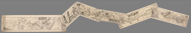
1882 Composite: 1st through 6th Operating Div … Manuscript Map (Composite of) Maps of the First through … |

1938 Highway Map State of Arizona. [State Atlas, Statistical Atlas] Highway Map State of Arizona. |

1885 Arizona National Atlas Arizona. (to accompany) Bradstreet's Poc … |

1970 Upper Verde River, Arizona. Geologic Atlas Upper Verde River, Arizona. |

1883 Arizona. World Atlas Arizona. |