Search Results:

1852 Entrance, San Francisco. Chart Map Entrance to San Francisco. C. Ringgold, … |

1852 View, Sacramento City. Chart Map View of Sacramento City from the west ba … |

1852 View, Benicia. Chart Map View of Benicia from the anchorage east … |

1920 (California) Wall Map (California) Eureka. Native Sons of the … |

1852 Views, Mt. Diablo. Chart Map View of Monte Diablo from Garnet Island. … |

1852 Invincible buoy, Angel I., Marin Is. Chart Map Mark for Invincible buoy, Point Smith, e … |

1852 Tongue Shoal, Sacramento R. entrance. Chart Map Mark for Tongue Shoal. Entrance to the S … |

1852 Marks, Sacramento R. entering. Chart Map Marks for entering the Sacramento and it … |

1852 General chart, San Francisco Bay. Chart Map General chart embracing surveys of the F … |

1852 Farallones, San Francisco Bay. Chart Map Chart of the Farallones and entrance to … |

1852 Suisun, Vallejo bays. Chart Map Chart of Suisun & Vallejo bays with the … |

1852 Sacramento River. Chart Map Chart of the Sacramento River from Suisu … |

1852 Carquines Straits, Vallejo Bay, other an … Chart Map Straits of Carquines and Vallejo Bay by … |

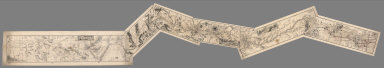
1852 Cover: Series of charts, sailing directi … Chart Map (Covers to) A Series of charts, with sai … |

1852 Title Page: Series of Charts, sailing di … Chart Map (Title Page to) A Series of charts, with … |

1882 5th Operating Division of the Western Di … Manuscript Map Map of the 5th Operating Division of the … |

1882 6th Operating Division of the Western Di … Manuscript Map Map of the 6th Operating Division of the … |
1882 Composite: 1st through 6th Operating Div … Manuscript Map (Composite of) Maps of the First through … |

1882 Map of California and Nevada. Case Map Bancroft's new map of California and Nev … |

1882 Covers: Map of California and Nevada. Case Map Bancroft's new map of California and Nev … |

1900 Map of Part of California Separate Map Map of Part of California Compiled from … |

1873 Topographical Map of Central California … Separate Map Topographical Map of Central California … |

1873 Topographical Map of Central California … Separate Map Topographical Map of Central California … |

1873 Topographical Map of Central California … Separate Map Topographical Map of Central California … |

1873 Topographical Map of Central California … Separate Map Topographical Map of Central California … |

1873 Composite: Topographical Map of Central … Separate Map (Composite) Topographical Map of Central … |

1873 Composite: Topographical Map of Central … Separate Map (Composite) Topographical Map of Central … |

1938 (County and Road) Map of California. [State Atlas, Statistical Atlas] (County and Road) Map of California. |

1892 California. County Atlas Map of the state of California, compiled … |

1892 Tulare Co. Ct. House. County Atlas Tulare County Court House, Visalia. (189 … |

1892 Tulare County, California. County Atlas Map of Tulare County, California. 1892. … |

1892 Tulare School. County Atlas Tulare Public School, Tulare Co., Cal. ( … |

1892 T.15S R.25E. County Atlas Township 15 South, Range 25 East, Tulare … |

1892 T.15S R.26E. County Atlas Township 15 South, Range 26 East, Tulare … |

1892 Tulare Co. Bank. County Atlas Tulare County Bank, cor. K and Kern St., … |

1892 T.15S R.27E. County Atlas Township 15 South, Range 27 East, Tulare … |

1892 T.14-15S R.28-29E. County Atlas Township 15 South, Township 14 South, Ra … |

1892 Tulare Co. Bank. County Atlas J. Goldman & Co., general merchandise, c … |

1892 T.14-15S R.30-31E. County Atlas Township 15 South, Township 14 South, Ra … |

1892 T.14-17S R.32-35E. County Atlas Township 17 South ... Township 14 South, … |

1892 Woody res., Bank of Tulare. County Atlas Residence of J.H. Woody, Tulare, Cal. Ba … |

1892 T.16S R.22E. County Atlas Township 16 South, Range 22 East, Tulare … |

1892 T.16S R.23E. County Atlas Township 16 South, Range 23 East, Tulare … |

1892 Railsback, Hackett ranches. County Atlas Residence and ranch of Charles Railsback … |

1892 T.16S R.24E. County Atlas Township 16 South, Range 24 East, Tulare … |

1892 T.16S R.24E. County Atlas Map of the town of Monson, Tulare County … |

1892 Ranches, Tulare Co., Cal. County Atlas Fruit ranch of Routt Bros., Lemoore ... … |

1892 T.16S R.25E. County Atlas Township 16 South, Range 25 East, Tulare … |

1892 T.16S R.26E. County Atlas Township 16 South, Range 26 East, Tulare … |

1892 Ranches, stables, Tulare Co., Cal. County Atlas Ranch of B.B. Smith, Bellville, Tulare C … |