Search Results:

1892 T.16S R.27E. County Atlas Township 16 South, Range 27 East, Tulare … |
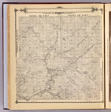
1892 T.16-17S R.28-29E. County Atlas Township 16 South, Township 17 South, Ra … |

1892 Bertch ranch. County Atlas Ranch and residence of Geo. Bertch, 9 1/ … |

1892 T.16-17S R.30-31E. County Atlas Township 16 South, Township 17 South, Ra … |

1892 T.17S R.21E. County Atlas Township 17 South, Range 21 East, Tulare … |

1892 Hotel, vineyard, Tulare. County Atlas Cosmopolitan Hotel, Tulare City, Cal. I. … |

1892 T.17S R.22E. County Atlas Township 17 South, Range 22 East, Tulare … |

1892 T.17S R.23E. County Atlas Township 17 South, Range 23 East, Tulare … |

1892 Vineyards, ranches, Tulare Co., Calif. County Atlas Vineyard of E. Barris, Traver, Tulare Co … |

1892 Traver, Tulare County. County Atlas Map of Traver, Tulare County. (with) Map … |
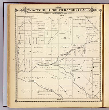
1892 T.17S R.24E. County Atlas Township 17 South, Range 24 East, Tulare … |

1892 Harrell ranches, bank, Visalia, Cal. County Atlas Scene on J(asper) Harrell's 6000 acre ra … |

1892 T.17S R.25E. County Atlas Township 17 South, Range 25 East, Tulare … |

1892 T.17S R.26E. County Atlas Township 17 South, Range 26 East, Tulare … |

1892 Cove Ranch, Tulare Co., Cal. County Atlas Scene on the Cove Ranch of J.W.C. Pogue, … |

1892 T.17S R.27E. County Atlas Township 17 South, Range 27 East, Tulare … |

1869 Sierra Nevada adjacent to the Yosemite V … Wall Map Geological Survey Of California, J.D. Wh … |

1885 California National Atlas California. (to accompany) Bradstreet's … |

1969 Eastern Murray Fracture Zone and Transve … Geologic Atlas Eastern Murray Fracture Zone and Transve … |

1979 Oblique Map of the Northern California C … Geologic Atlas Oblique Map of the Northern California C … |

1970 Southern California Borderland. Geologic Atlas Southern California Borderland. |

1982 Oblique Map of Southern California, Sant … Geologic Atlas Oblique Map of Southern California, Sant … |

1978 Southern California Borderland Oblique M … Geologic Atlas Southern California Borderland Oblique M … |

1972 Ventura-Oxnard Offshore. Geologic Atlas Ventura-Oxnard Offshore. |

1887 Cover: Guide to San Diego Bay Region, Ca … [Separate Map, View] (Covers to) Guide to San Diego Bay Regio … |

1887 Text Page: Guide to San Diego Bay Region … [Separate Map, View] (Text Page to) Guide to San Diego Bay Re … |

1868 San Francisco, surrounding country. [Separate Map, View] Birds eye view of the city of San Franci … |

1911 Title: California Guide Book (Title page to) Clason's Map Of Californ … |

1868 Map of Lands of the Saucelito Land and F … Separate Map Map of Lands of the Saucelito Land and F … |

1886 Covers: Government And Railroad Lands in … Real Estate (Covers to) A List of Government And Rai … |

1886 Great Sunset Route Real Estate The Great Sunset Route. Shortest Line be … |

1886 Text Page: Government And Railroad Lands … Real Estate (Text page to) A List of Government And … |

1886 Text Page: Government And Railroad Lands … Real Estate (Text page to) A List of Government And … |

1886 Text Page: Government And Railroad Lands … Real Estate (Text page to) A List of Government And … |

1886 Text Page: Government And Railroad Lands … Real Estate (Text page to) A List of Government And … |

1886 Central & Southern Pacific railroads in … Real Estate Map of summer & winter resorts and other … |

1844 Cover Vol 1: Exploration du Territoire d … Exploration Book (Covers to Vol 1) Exploration Du Territo … |

1844 Title Page Vol 1: Exploration du Territo … Exploration Book (Title Page to Vol 1) Exploration Du Ter … |

1844 Vue du Port De Monterey Capitale de la N … Exploration Book Vue du Port De Monterey Capitale de la N … |

1844 R.P. Narcisco Duran Exploration Book Le R.P. Narcisco Duran, prefet apostoliq … |

1844 Ranchero Californien Jetant le Lazo. Exploration Book Ranchero Californien Jetant le Lazo. |

1844 Isba. Maison des Colonies de L'Amerique … Exploration Book Isba. Maison des Colonies de L'Amerique … |

1844 Cover Vol 2: Exploration du Territoire d … Exploration Book (Covers to Vol 2) Exploration Du Territo … |

1844 Title Page Vol 2: Exploration du Territo … Exploration Book (Title Page to Vol 2) Exploration Du Ter … |

1844 Indiens Kodiaks Chassant La Baleine.. Exploration Book Indiens Kodiaks Chassant La Baleine. |

1844 Vue de la Nouvelle Archangel. Exploration Book Vue de la Nouvelle Archangel. |

1844 Temascal, Bain des Indiens. Exploration Book Temascal, Bain des Indiens. |

1844 Sculptures Indiennes, Cote Nord Ouest de … Exploration Book Sculptures Indiennes, Cote Nord Ouest de … |

1939 San Francisco - Reno (upper map). Los An … [Ephemera, Pamphlet] San Francisco - Reno (upper map). Los An … |

1883 California. World Atlas California. |