Search Results:

1889 Text Page: Connecticut. National Atlas (Text Page) Connecticut. |

1889 Text Page: Connecticut. National Atlas (Text Page) Connecticut. |

1859 Connecticut. World Atlas Map of Connecticut. Philadelphia, Publis … |

1845 Connecticut. World Atlas Connecticut By H.S. Tanner. Engraved by … |

1903 Connecticut. Rhode Island. National Atlas (Rand, McNally & Co.'s Connecticut. Rhod … |

1886 Mass., Conn., R.I. World Atlas County and township map of the states of … |

1889 Connecticut. National Atlas Rand, McNally & Co.'s Connecticut. |

1854 New York and New England. World Atlas New York, Vermont, New Hampshire, Rhode … |

1903 Text Page: Connecticut. National Atlas (Text Page) Rand, McNally Co.'s Connecti … |

1903 Text Page: Connecticut. National Atlas (Text Page) The Rand, McNally Co.'s Conn … |

1822 Map Of Connecticut. National Atlas Geographical, Historical, And Statistica … |

1858 Vermont, Massachusetts, Rhode Island, an … World Atlas Vermont, Massachusetts, Rhode Island, an … |

1824 Connecticut. World Atlas Connecticut. Young & Delleker Sc. Publis … |

1886 Massachusetts, Connecticut, and Rhode Is … World Atlas Johnson's Massachusetts, Connecticut, an … |

1818 Connecticut. World Atlas Connecticut From the best Authorities. D … |
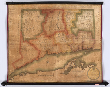
1813 Connecticut, From Actual Survey Wall Map Connecticut, From Actual Survey, Made in … |

1897 Connecticut, R.I. World Atlas Rand, McNally & Co.'s New business atlas … |

1878 Massachusetts, Rhode Island, and Connect … World Atlas Gray's New Map of Massachusetts, Rhode I … |

1879 Connecticut. National Atlas Rand, McNally & Co.'s Connecticut. Rand, … |