Search Results:

1868 110. Berwick. National Atlas 110. Berwick. |

1796 Map of England and Wales. World Atlas An Accurate Map Of England and Wales Wit … |

1795 Map Of England and Wales. World Atlas An Accurate Map Of England and Wales Wit … |

1758 England And Wales World Atlas England And Wales. (to accompany) Atlas … |

1905 Ubersichtskarte von Groszbritannien und … World Atlas Ubersichtskarte von Groszbritannien und … |

1905 England und Wales, Sudliche Halfte World Atlas England und Wales, Sudliche Halfte. Juni … |

1905 England und Wales, Nordliche Halfte World Atlas England und Wales, Nordliche Halfte. Sep … |

1859 England. World Atlas Map of England. Entered according to Act … |

1854 Palaeontological map (British Islands). Physical Atlas Palaeontological map (British Islands. B … |

1856 Ethnographic, Gt. Brit., Ireland. Physical Atlas Ethnographic map of Great Britain and Ir … |

1855 Britischen Inseln. World Atlas Die Britischen Inseln, oder die Vereinig … |

1856 England. World Atlas England. (with) London mit seinen nachst … |
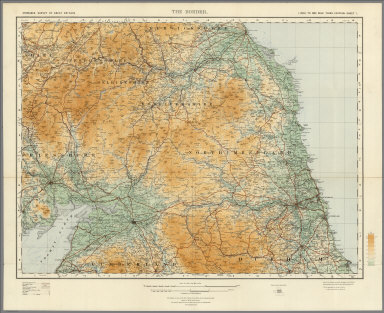
1921 Sheet 1. The Border. National Atlas Sheet 1. The Border. |

1921 Sheet 2. England North West. National Atlas Sheet 2. England North West. |

1924 Sheet 3. England North East. National Atlas Sheet 3. England North East. |

1923 Sheet 5. Midlands (N). National Atlas Sheet 5. Midlands (N). |

1920 Sheet 6. Eastern Counties (N). National Atlas Sheet 6. Eastern Counties (N). |

1924 Sheet 8. Midlands (S). National Atlas Sheet 8. Midlands (S). |

1921 Sheet 9. Eastern Counties (S). National Atlas Sheet 9. Eastern Counties (S). |

1924 Sheet 10. South-West England. National Atlas Sheet 10. South-West England. |

1924 Sheet 11. England South. National Atlas Sheet 11. England South. |

1922 Sheet 12. England South-East & London. National Atlas Sheet 12. England South-East & London. |

1919 Sheet 1. Northumberland, Cumberland, Dur … National Atlas Sheet 1. Northumberland, Cumberland, Dur … |

1919 Sheet 2. Lancashire & Isle of Man. New S … National Atlas Sheet 2. Lancashire & Isle of Man. New S … |

1919 Sheet 3. Yorkshire. National Atlas Sheet 3. Yorkshire. |

1921 Sheet 4. North Wales. National Atlas Sheet 4. North Wales. |

1921 Sheet 5. Liverpool, Stafford, Nottingham … National Atlas Sheet 5. Liverpool, Stafford, Nottingham … |

1918 Sheet 6. Norfolk & Lincoln. New Series. National Atlas Sheet 6. Norfolk & Lincoln. New Series. |

1918 Sheet 7. South Wales. New Series. National Atlas Sheet 7. South Wales. New Series. |

1920 Sheet 8. Birmingham, Oxford, Bristol, &c … National Atlas Sheet 8. Birmingham, Oxford, Bristol, &c … |

1919 Sheet 9. Middlesex, Essex, Suffolk, &c. National Atlas Sheet 9. Middlesex, Essex, Suffolk, &c. |
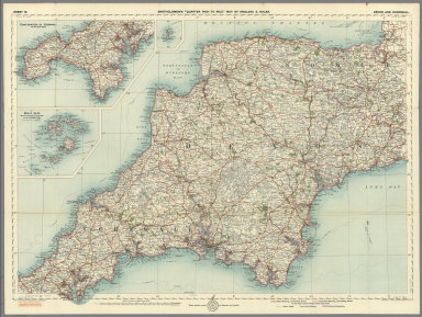
1921 Sheet 10. Devon and Cornwall. National Atlas Sheet 10. Devon and Cornwall. |

1919 Sheet 11. Somerst, Dorset, Wilts & Hamps … National Atlas Sheet 11. Somerst, Dorset, Wilts & Hamps … |

1919 Sheet 12. Surrey, Sussex & Kent. National Atlas Sheet 12. Surrey, Sussex & Kent. |

1901 Covers: Ordnance Survey Revised Map of E … National Atlas (Covers to) Ordnance Survey Revised Map … |

1901 Index Map: Index to the Ordnance Survey … National Atlas (Index Map) Index to the Ordnance Survey … |

1901 Sheet 1 and 2. National Atlas Sheet 1 and 2. |

1901 Sheet 3. National Atlas Sheet 3. |

1901 Sheet 4. National Atlas Sheet 4. |

1901 Sheet 5 and 6. National Atlas Sheet 5 and 6. |

1901 Sheet 7. National Atlas Sheet 7. |

1901 Sheet 8. National Atlas Sheet 8. |

1901 Sheet 9 and 10. National Atlas Sheet 9 and 10. |

1901 Sheet 11. National Atlas Sheet 11. |

1901 Sheet 12. National Atlas Sheet 12. |

1901 Sheet 14. National Atlas Sheet 14. |

1901 Sheet 15. National Atlas Sheet 15. |

1901 Sheet 16. National Atlas Sheet 16. |

1901 Sheet 17. National Atlas Sheet 17. |

1901 Sheet 18. National Atlas Sheet 18. |