Search Results:

1901 Sheet 19. National Atlas Sheet 19. |

1901 Sheet 20 and 24. National Atlas Sheet 20 and 24. |

1901 Sheet 21 and 25. National Atlas Sheet 21 and 25. |

1901 Sheet 22. National Atlas Sheet 22. |

1901 Sheet 23. National Atlas Sheet 23 |

1901 Stanford's Useful Maps, England, Outline … National Atlas Stanford's Useful Maps, England, Outline … |

1801 England, Wales, Scotland. World Atlas A map of England, Wales & Scotland, desc … |

1794 British Channel, Bay of Biscay. World Atlas A chart of the British Channel and the B … |

1852 Sheet 1: Plan of York, 1852 [City Atlas, Survey Map] Sheet 1: York. Surveyed in 1850, by Capt … |

1852 Sheet 2: Plan of York, 1852 [City Atlas, Survey Map] Sheet 2: York. Surveyed in 1850, by Capt … |

1852 Sheet 3: Plan of York, 1852 [Survey Map, City Atlas] Sheet 3: York. Surveyed in 1850, by Capt … |

1852 Sheet 4: Plan of York, 1852 [Survey Map, City Atlas] Sheet 4: York. Surveyed in 1850, by Capt … |

1852 Sheet 5: Plan of York, 1852 [Survey Map, City Atlas] Sheet 5: York. Surveyed in 1850, by Capt … |

1852 Sheet 6: Plan of York, 1852 [Survey Map, City Atlas] Sheet 6: York. Surveyed in 1850, by Capt … |

1852 Sheet 7: Plan of York, 1852 [City Atlas, Survey Map] Sheet 7: York. Surveyed in 1850, by Capt … |

1852 Sheet 8: Plan of York, 1852 [Survey Map, City Atlas] Sheet 8: York. Surveyed in 1850, by Capt … |

1852 Sheet 9: Plan of York, 1852 [City Atlas, Survey Map] Sheet 9: York. Surveyed in 1850, by Capt … |

1852 Sheet 10: Plan of York, 1852 [Survey Map, City Atlas] Sheet 10: York. Surveyed in 1850, by Cap … |

1852 Sheet 11: Plan of York, 1852 [City Atlas, Survey Map] Sheet 11: York. Surveyed in 1850, by Cap … |

1852 Sheet 12: Plan of York, 1852 [Survey Map, City Atlas] Sheet 12: York. Surveyed in 1850, by Cap … |

1852 Sheet 13: Plan of York, 1852 [City Atlas, Survey Map] Sheet 13: York. Surveyed in 1850, by Cap … |

1852 Sheet 14: Plan of York, 1852 [Survey Map, City Atlas] Sheet 14: York. Surveyed in 1850, by Cap … |

1852 Sheet 15: Plan of York, 1852 [Survey Map, City Atlas] Sheet 15: York. Surveyed in 1850, by Cap … |

1852 Sheet 16: Plan of York, 1852 [Survey Map, City Atlas] Sheet 16: York. Surveyed in 1850, by Cap … |

1852 Sheet 17: Plan of York, 1852 [Survey Map, City Atlas] Sheet 17: York. Surveyed in 1850, by Cap … |

1852 Sheet 18: Plan of York, 1852 [Survey Map, City Atlas] Sheet 18: York. Surveyed in 1850, by Cap … |

1852 Sheet 19: Plan of York, 1852 [Survey Map, City Atlas] Sheet 19: York. Surveyed in 1850, by Cap … |

1852 Sheet 20: Plan of York, 1852 [Survey Map, City Atlas] Sheet 20: York. Surveyed in 1850, by Cap … |

1852 Sheet 21: Plan of York, 1852 [City Atlas, Survey Map] Sheet 21: York. Surveyed in 1850, by Cap … |
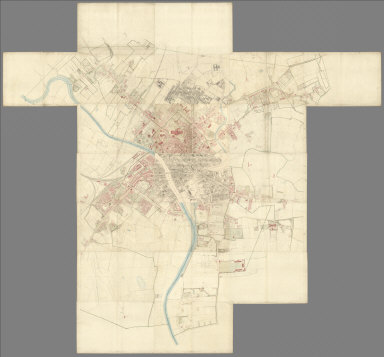
1852 Composite: Sheets 1 - 21, Plan of York, … [City Atlas, Survey Map] (Composite to) (Sheets 1 - 21) York. Sur … |

1865 Die Britischen Inseln und das Umliegende … World Atlas Stieler's Hand-Atlas ... No. 15a. Die Br … |

1829 Meteorological diagrams. State Atlas Meteorological diagrams. Monthly means o … |

1825 England, Schottland und Ireland World Atlas England, Schottland und Ireland; entw. u … |

1817 England World Atlas England; ohne die nordl spitze wetche No … |

1823 Die Britischen Inseln World Atlas Die Britischen Jnseln England, Schotland … |

1824 Composite: England, Schotland, Ireland World Atlas (Composite of) England, Schotland, Irela … |

1807 G: Untitled outline map of England School Atlas G: (Untitled outline map of England). |

1879 Grossbritannien. (Great Britain, Souther … World Atlas Stieler's Hand-Atlas No. 46. Grossbritan … |

1880 Grossbritannien. (Great Britain, Norther … World Atlas Stieler's Hand-Atlas No. 47. Grossbritan … |

1880 Composite:Grossbritannien, Ireland. World Atlas (Composite of) Stieler's Hand-Atlas No. … |

1875 Die Britischen Inseln Und Das Umliegende … World Atlas Die Britischen Inseln Und Das Umliegende … |

1875 Grossbritannien. Sudliches Blatt: Englan … World Atlas Grossbritannien Im Maassstabe Von 1:1.50 … |

1875 Composite: Grossbritannien. World Atlas (Composite of) Grossbritannien Im Maasss … |

1811 England and Wales. World Atlas An Accurate Map of England and Wales Wit … |

1850 Die Brittischen Inseln und Die Nord-See. … World Atlas No. XVII. Stieler's Hand-Atlas (No. 15a. … |

1850 England und Wales. (England and Wales). World Atlas No. XVIII. Stieler's Hand-Atlas (No. 15b … |

1822 England and Wales School Atlas England & Wales. (to accompany) The Juve … |

1907 British Isles, Comparative Value of Land … Statistical Atlas British Isles, Comparative Value of Land … |

1907 British Isles - Industrial. Agricultural … Statistical Atlas British Isles - Industrial. Agricultural … |

1852 The Mountains, Table Lands, Plains & Val … Physical Atlas The Mountains, Table Lands, Plains & Val … |