Search Results:

1838 Index page: Das Koenigreich Wuerttemberg … National Atlas (Index Page to) Das Koenigreich Wuerttem … |

1836 Text Page: Vergleichungs- Tabelle der Me … National Atlas (Text Page to) Vergleichungs- Tabelle de … |

1831 Darmstadt National Atlas Darmstadt. Entworfen und bearbeitet von … |

1834 Wurzburg National Atlas Wurzburg. Entworfen und bearbeitet von W … |

1833 Zweybrucken National Atlas Zweybrucken. Entworfen und bearbeitet vo … |

1834 Carlsruhe - Stuttgart National Atlas Carlsruhe - Stuttgart. Entworfen und bea … |

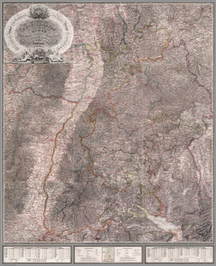
1834 Ellwangen National Atlas Ellwangen. Entworfen und bearbeitet von … |

1833 Strasburg National Atlas Strasburg. Entworfen und bearbeitet von … |

1831 Tubingen National Atlas Tubingen. Entworfen und bearbeitet von W … |

1831 Ulm National Atlas Ulm. Entworfen und bearbeitet von Woerl … |

1831 Freiburg National Atlas Freiburg. Entworfen und bearbeitet von W … |
1831 Composite: Sheets 1 - 12 Das Koenigreich … National Atlas (Composite of) Sheets 1 - 12 Das Koenigr … |

1838 Nurnberg National Atlas Nurnberg. Entworfen und bearbeitet von W … |

1837 Amberg National Atlas Amberg. Entworfen und bearbeitet von Woe … |

1837 Klattau National Atlas Klattau. Entworfen und bearbeitet von Wo … |

1837 Ingolstadt National Atlas Ingolstadt. Entworfen und bearbeitet von … |

1837 Regensburg National Atlas Regensburg. Entworfen und bearbeitet von … |

1838 Passau National Atlas Passau. Entworfen und bearbeitet von Woe … |

1838 Augsburg National Atlas Augsburg. Entworfen und bearbeitet von W … |

1837 Munchen National Atlas Munchen. Entworfen und bearbeitet von Wo … |

1837 Salzburg National Atlas Salzburg. Entworfen und bearbeitet von W … |

1838 Hallein National Atlas Hallein. Entworfen und bearbeitet von Wo … |

1838 Lienz National Atlas Lienz. Entworfen und bearbeitet von Woer … |

1838 Padua National Atlas Padua. Entworfen und bearbeitet von Woer … |

1831 Assemblage zur karte von Sudwest-Deutsch … National Atlas Assemblage zur karte von Sudwest-Deutsch … |

1846 Fluss u. Berg-Karte von Deutschland. (Ri … World Atlas No. XXIV. Stieler's Hand-Atlas (No. 18.) … |

1850 Deutschland (Germany, Netherlands, Belgi … World Atlas No. XXV. Stieler's Hand-Atlas (No. 19.) … |

1850 Nord-Ostliches Deutschland. (Northeast G … World Atlas No. XXVIII. Stieler's Hand-Atlas (No. 22 … |

1850 Mittel-Ostliches Deutschland. (East Cent … World Atlas No. XXX. Stieler's Hand-Atlas (No. 23). … |

1850 Sudwestliches Deutschland ... Schweiz. ( … World Atlas No. XXXI. Stieler's Hand-Atlas (No. 24). … |

1850 Sachsen, Thuringen und Benachbarte Laend … World Atlas Stieler's Hand-Atlas (No. 27 u. 28). Sac … |

1850 Der Rhein .... (Rhine). World Atlas Stieler's Hand-Atlas (No. 30 und 31). De … |

1788 German Empire. World Atlas A new map of the German Empire, and the … |

1788 German Empire. World Atlas A new map of the German Empire, and the … |

1789 Brunswick-Luneburg. World Atlas A new map of the King of Great Britain's … |

1790 Denmark. World Atlas A map of the Kingdom of Denmark, with th … |

1804 Holstein. World Atlas A map of the Dutchy of Holstein, with th … |

1822 Germany School Atlas Germany. (to accompany) The Juvenile Atl … |

1851 11. Deutschland, Schweiz und Theile der … Physical Atlas 11. Deutschland, Schweiz und Theile der … |

1851 23. Deutschland, Schweiz und Theile der … Physical Atlas 23. Deutschland, Schweiz und Theile der … |

1851 24. Die bedeutendsten Hohen Deutschlands … Physical Atlas 24. Die bedeutendsten Hohen Deutschlands … |

1875 Composite: Sud-West Deutschland, Schweiz … World Atlas (Composite of) Sud-West Deutschland Und … |

1808 Northern Part of Germany. World Atlas Northern Part of Germany. |

1808 Germany. World Atlas Germany. |

1875 Ostliches Deutschland oder Bohmen, Mahre … World Atlas Ostliches Deutschland oder Bohmen, Mahre … |

1817 Prussia. World Atlas Prussia. |

1817 Germany North of the Mayn. World Atlas Germany North of the Mayn. |

1817 Germany South of the Mayn. World Atlas Germany South of the Mayn. |

1875 Sud-Ostliches Deutschland nebst einem Th … World Atlas Sud-Ostliches Deutschland nebst einem Th … |

1791 Germany. World Atlas A New Map of Germany divided into Circle … |