Search Results:

1940 Road map of Maritime Provinces National Atlas Rand McNally Road map, Maritime Province … |

1829 Upper & Lower Canada, Gaspe. State Atlas Sketch from Bouchette's maps of Upper & … |
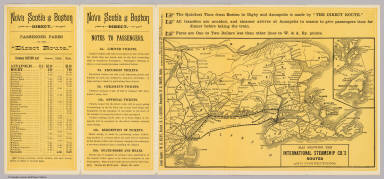
1888 Intl. Steamship Co.'s routes. Timetable Map Map showing the International Steamship … |

1888 Cover: Nova Scotia excursion route. Timetable Map (Covers to) Nova Scotia excursion route. … |

1888 Text Page: Nova Scotia excursion route. Timetable Map (Text Page to) Nova Scotia excursion rou … |

1879 Map Boston & Maine Railroad. Timetable Map Map of the Boston & Maine Railroad and i … |

1888 Map Boston & Maine Railroad. Timetable Map Map of the Boston and Maine Railroad and … |

1814 A Map Of Cabotia. Case Map A Map Of Cabotia; Comprehending The Prov … |

1814 Cover: Cabotia. Case Map (Covers to) A Map Of Cabotia; Comprehend … |

1845 Nova-Scotia, New Brunswick &c. National Atlas Nova-Scotia, New Brunswick &c. Entered . … |

1845 Title Page/Contents: Morse's Cerographic … National Atlas (Title Page/Contents to) Morse's Cerogra … |

1884 New Brunswick, Nova Scotia, Newfoundland … National Atlas New Brunswick, Nova Scotia, Newfoundland … |

1891 Map of New Brunswick, Nova Scotia, Princ … World Atlas Map of New Brunswick, Nova Scotia and Pr … |

1939 Rand McNally Road map: Maritime Province … National Atlas Rand McNally Road map: Maritime Province … |

1925 Road Map of the Maritime Provinces. Prin … [State Atlas, World Atlas] Road Map of the Maritime Provinces. (ins … |

1925 Province of New Brunswick and Part of Qu … [State Atlas, World Atlas] Province of New Brunswick and Part of Qu … |

1846 State Of Maine With The Province Of New … Wall Map Map Of The State Of Maine With The Provi … |

1844 State Of Maine With The Province Of New … Wall Map Map Of The State Of Maine With The Provi … |

1866 Chart From Cape Cod To Belle Isle. Wall Map Eldridge's Chart From Cape Cod To Belle … |

1860 County Map Of Nova Scotia New Brunswick … World Atlas County Map Of Nova Scotia New Brunswick … |

1913 Nova Scotia, New Brunswick, Canada. Coal … Geologic Atlas Coal Resources of the World. Canada. Map … |

1865 New Brunswick, Nova Scotia. Prince Edwar … World Atlas Colton's New Brunswick, Nova Scotia. Pri … |

1865 New Brunswick, Nova Scotia, Newfoundland … World Atlas Colton's New Brunswick, Nova Scotia, New … |

1869 Dominion of Canada. Provinces of Quebec … World Atlas Colton's Dominion of Canada, No. 1. The … |

1869 Dominion of Canada. Provinces of New Bru … World Atlas Colton's Dominion of Canada, No. 3. The … |

1869 New Brunswick, Nova Scotia, Newfoundland … World Atlas Colton's New Brunswick, Nova Scotia, New … |

1852 Quebec, New Brunswick, Maine, Vermont, N … National Atlas (Quebec, New Brunswick, Maine, Vermont, … |

1967 Canada - Ontario, Quebec, and Maritime P … World Atlas Canada - Ontario, Quebec, and Maritime P … |

1948 Nova Scotia, New Brunswick, and Prince E … World Atlas Nova Scotia, New Brunswick, and Prince E … |

1865 New Brunswick, Nova Scotia, Newfoundland … World Atlas Johnson's New Brunswick, Nova Scotia, Ne … |

1886 New Brunswick and Quebec. World Atlas Johnson's New Brunswick and Quebec of th … |

1886 New Brunswick and Nova Scotia. World Atlas Johnson's New Brunswick and Nova Scotia … |

1924 Nova Scotia, New Brunswick, and Prince E … National Atlas Commercial Atlas of America. Rand McNall … |

1924 Text Page: Nova Scotia, New Brunswick - … National Atlas (Text Page) Nova Scotia - Dominion and P … |

1924 Text Page: New Brunswick - Geographical … National Atlas (Text Page) New Brunswick - Dominion and … |

1924 Nova Scotia, New Brunswick, and Prince E … National Atlas Commercial Atlas of America. Rand McNall … |

1778 Parte Orientale del Canada, Nuova Scozia … Geography Book Parte Orientale del Canada, Nuova Scozia … |

1856 Canada, New Brunswick, Nova Scotia, &c., … National Atlas Canada, New Brunswick, Nova Scotia, &c., … |

1879 Eastern Canada. World Atlas Dominion of Canada (Eastern Sheet) Showi … |

1884 Nova Scotia, New Brunswick, Pr. Edward's … World Atlas County Map of Nova Scotia, New Brunswick … |

1859 Canada East (Lower). World Atlas Canada East, formerly Lower Canada. 3. P … |

1903 Text Page: Manitoba. New Brunswick. National Atlas (Text Page) Rand, McNally Co.'s Manitoba … |

1903 Text Page: New Brunswick. National Atlas (Text Page) Rand, McNally Co.'s New Brun … |

1903 Maritime Provinces. National Atlas Rand, McNally & Co.'s Maritime Provinces … |

1893 Eastern Canada. World Atlas Dominion of Canada (Eastern Sheet) Compr … |

1886 Nova Scotia, New Brunswick, Pr. Edward's … World Atlas County map of Nova Scotia, New Brunswick … |

1889 New Brunswick, Nova Scotia and Prince Ed … National Atlas Rand, McNally & Co.'s New Brunswick, Nov … |

1736 Bay of Fundy and harbour of Annapolis Ro … World Atlas A description of the Bay of Fundy shewin … |

1912 Eastern Canada. World Atlas Dominion of Canada (Eastern Sheet) Compr … |

1851 East Canada And New Brunswick. World Atlas East Canada And New Brunswick. The Illus … |