Search Results:

1899 Plate CXLII. Map of Indian Territory, Sh … [Geologic Atlas, Geology Book] Plate CXLII. Map of Indian Territory, Sh … |

1859 A New Map of Kansas. World Atlas A New Map of Kansas by W.H. Holmes. Publ … |

1859 Nebraska, Kansas, New Mexico, and Indian … World Atlas A New Map of Nebraska, Kansas, New Mexic … |

1940 Road map of Oklahoma National Atlas Rand McNally Road map, Oklahoma. Copyrig … |

1892 Post Route Map of the State of Texas Wall Map Post Route Map of the State of Texas wit … |

1935 Oklahoma. National Atlas Oklahoma. |

1883 Indian Territory (Oklahoma). World Atlas Indian Ty. |

1873 Indian Territory. World Atlas Gray's Atlas Map of Indian Territory. |

1827 Missouri and the Territory of Arkansas. National Atlas Map of the State of Missouri and the Ter … |

1876 Texas and the Indian Territory. National Atlas Gray's Map of Texas and the Indian Terri … |

1878 Indian Territory (Oklahoma). National Atlas Cram's Rail Road & Township Map of India … |

1891 Map of Texas, Oklahoma and Indian Territ … World Atlas Map of Texas, Oklahoma and Indian Territ … |

1939 Rand McNally Road map: Oklahoma National Atlas Rand McNally Road map: Oklahoma. Copyrig … |

1846 Map Of Texas. World Atlas Map Of Texas From the most recent author … |

1891 (Missouri, Arkansas) Railroad Map of the … Case Map Rand, McNally & Co.'s New Shippers' Rail … |

1891 Covers: (Missouri, Arkansas) Railroad Ma … Case Map (Covers to) Rand, McNally & Co.'s New Sh … |

1909 Shippers' Railroad Map. Case Map The Rand McNally Shippers' Railroad Map … |

1869 Indian Territories. World Atlas Colton's Indian Territory. Drawn from ma … |

1852 Arkansas, Oklahoma, Texas. National Atlas (Arkansas, Oklahoma, Texas). |

1948 Nebraska. Oklahoma. World Atlas Nebraska. 1366. Oklahoma. 5357. |

1874 Indian Territory (Oklahoma). Nebraska. World Atlas Gray's Atlas Map of Indian Territory (Ok … |

1924 Text Page: Industrial Statistics of the … National Atlas (Text Page) Industrial Statistics of the … |

1924 Oklahoma. National Atlas Commercial Atlas of America. Rand McNall … |

1924 Text Page: Oklahoma - Geographical Featu … National Atlas (Text Page) Oklahoma - Counties, Creeks, … |

1924 Text Page: Oklahoma - Geographical Featu … National Atlas (Text Page) Oklahoma - Counties, Creeks, … |

1924 Oklahoma. National Atlas Commercial Atlas of America. Rand McNall … |

1924 AutoTrails Map, Texas, Oklahoma, Louisia … National Atlas Commercial Atlas of America. Rand McNall … |

1854 Texas. National Atlas Texas. H. Lange's Atlas v. Nord Amerika … |

1884 Texas. World Atlas County map of the state of Texas. Showin … |

1884 Indian Territory. World Atlas Indian Territory. Copyright by S. August … |

1859 Nebraska, Kansas, New Mexico, and Indian … World Atlas A New Map of Nebraska, Kansas, New Mexic … |

1903 Text Page: Texas. Indian Territory (Okla … National Atlas (Text Page) Rand, McNally Co.'s Texas. R … |

1903 Text Page: Texas. Indian Territory (Okla … National Atlas (Text Page) Rand, McNally Co.'s Indian T … |

1903 Text Page: Oklahoma. Kansas. National Atlas (Text Page) Rand, McNally Co.'s Oklahoma … |

1903 Oklahoma and Indian Territory. National Atlas Rand, McNally & Co.'s Oklahoma and India … |

1886 Texas. World Atlas County map of the state of Texas. Showin … |

1886 Indian Territory. World Atlas Indian Territory. Copyright 1886 by Wm. … |

1889 Text Page: Indian Territory. (Oklahoma). … National Atlas (Text Page) Indian Territory. (Oklahoma) … |

1889 Indian Territory. (Oklahoma). National Atlas Rand, McNally & Co.'s Indian Territory. |

1823 Arkansas Ter. World Atlas Arkansas Ter. B.T. Welch & Co. Sc. Drawn … |

1886 Colorado. Indian Territory (Oklahoma). World Atlas Johnson's Colorado. Johnson's Indian Ter … |

1878 Texas and the Indian Territory (Oklahoma … World Atlas Gray's New Map of Texas and the Indian T … |

1897 Indian Territory, Oklahoma. World Atlas Rand, McNally & Co.'s New business atlas … |

1879 (Texas and Indian Territory) National Atlas (Texas and Indian Territory). Engraved a … |
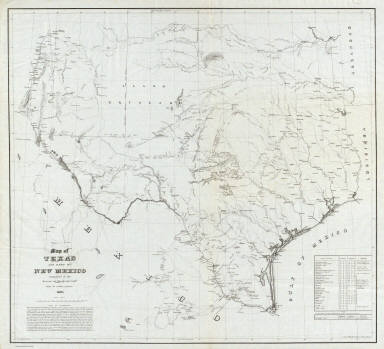
1857 Map of Texas and part of New Mexico. Separate Map Map of Texas and part of New Mexico comp … |