|
|
REFINE
Search Results:
1-9 of 9
Author
Lewis, Samuel
Full Title
United States. Drawn by S. Lewis. Tanner sc. (Published by John Conrad & Co., Philadelphia. 1804)
Publisher
J. Conrad
Author
Lewis, Samuel
Full Title
Louisiana. Drawn by S. Lewis. Tanner sc. (Published by John Conrad & Co., Philadelphia. 1804)
Publisher
J. Conrad
Full Title
Spanish dominions in North America. From various authorities. (Published by John Conrad & Co., Philadelphia. 1804)
Publisher
J. Conrad
Author
Patteson, Edward
Full Title
United States of America. E.P. delin. Hewitt, sc., Bloomsbury. (1804)
Publisher
Patteson
Author
Patteson, Edward
Full Title
United States of America. E.P. delin. Hewitt, sculp., Litt. Russel St., Bloomsbury. Published June 15th, 1804, by the Rev. E. Patteson, M.A., Richmond, Surrey.
Publisher
Patteson
Author
Robert Laurie & James Whittle
Full Title
A new and correct map of the British colonies in North America. Comprehending Eastern Canada with the province of Quebec, New Brunswick, Nova Scotia, and the government of Newfoundland; with the adjacent states of New England, Vermont, New York, Pennsylvania and New Jersey. London, Publish'd by Laurie & Whittle, 53 Fleet Street, 12th May, 1794.
Publisher
Laurie & Whittle
Author
Robert Laurie & James Whittle
Full Title
A new and general map of the middle dominions belonging to the United States of America, viz. Virginia, Maryland, the Delaware-Counties, Pennsylvania, New Jersey &c., with the addition of New York, & of the greatest part of New England &c., as also of the bordering parts of the British possessions in Canada. (with) A sketch of the upper parts to shown the remainder of the lakes. London, Published by Laurie & Whittle, No. 53, Fleet Street, as the act directs 12th May, 1794.
Publisher
Laurie & Whittle
Author
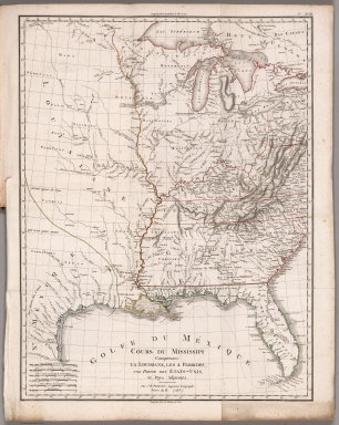
[Poirson, J.B., Herbin de Halle, Etienne de.]
Full Title
Cours du Mississippi comprenant la Louisiane, les 2 Florides, une partie des Etats-Unis et pays adjacents. Par J. B. Poirson, ingenieur geographe ; Nivose An XI (1803), grave par Tardieu l'aine rue de Sorbonne, no. 385. (on upper right margin) No.XVIII. (to accompany) Statistique Generale et Particuliere De La France et De Ses Colonies, avec une Nouvelle Description ... 1804.
Publisher
F. Buisson
Author
[Paullin, Charles O., Wright, John K.]
Full Title
Plate 28. Cartography 1492-1867. Lewis Map, 1804. (Facsimile).
Publisher
[Carnegie Institution of Washington, American Geographical Society of New York]
1-9 of 9
|