Who What Where WhenREMOVE |
REFINE
Search Results:
1-31 of 31
Author
[Finley, Anthony, Vance, David H.]
Full Title
(Covers to) Map Of The United States Of North America. Compiled from the Latest And Most Authentic Information By David H. Vance. Philadelphia Published by Anthony Finley. Entered ... July 12th, 1825. Engraved by J.H. Young. (inset) Map Of North America Including All The Recent Geographical Discoveries 1825. (inset profile) Comparative Elevation of the Principal Mountains and Hills in the United States.
Publisher
Anthony Finley
Author
[Finley, Anthony, Vance, David H.]
Full Title
Map Of The United States Of North America. Compiled from the Latest And Most Authentic Information By David H. Vance. Philadelphia Published by Anthony Finley. Entered ... July 12th, 1825. Engraved by J.H. Young. (inset) Map Of North America Including All The Recent Geographical Discoveries 1825. (inset profile) Comparative Elevation of the Principal Mountains and Hills in the United States.
Publisher
Anthony Finley
Author
Tanner, Henry S.
Full Title
(Covers to) The Traveller's Guide. A Map Of The Roads, Canals And Steam Boat Routes Of The United States ... Designed for the use of Travellers, By H.S. Tanner. Published by H.S. Tanner, 177 Chestnut St. Philadelphia. Entered ... 21st day of May 1825, by H.S. Tanner ... Pennsylvania.
Publisher
H.S. Tanner
Author
Tanner, Henry S.
Full Title
The Traveller's Guide. A Map Of The Roads, Canals And Steam Boat Routes Of The United States ... Designed for the use of Travellers, By H.S. Tanner. Published by H.S. Tanner, 177 Chestnut St. Philadelphia. Entered ... 21st day of May 1825, by H.S. Tanner ... Pennsylvania.
Publisher
H.S. Tanner
Full Title
Etats-Unis d'Amerique. La lettre gravee par H. Mardelet, Rue St. Jacques No. 27, a Paris. Graves par (Auguste Francois?) Ales, Rue de Noyers, No. 50, a Paris. A Paris, chez J. Carez, Rue Haute-Feuille No. 18. (1825)
Publisher
J. Carez
Full Title
Carte de l'adjonction progressive des divers etats au territoire et a l'union constitutionnelle des Etats-Unis de l'Amerique du Nord. 1825.
Publisher
J. Carez
Full Title
Carte chronologique des Etats-Unis, presentant les principaux evenements de leurs annales, depuis leur etablissement jusqu'a la Declaration de l'Independance. Fonderie et Imprimerie de J. Carez. (1825)
Publisher
J. Carez
Full Title
Tableau compare des constitutions des Etats-Unis. Fonderie et Imprimerie de J. Carez. (1825)
Publisher
J. Carez
Author
Arrowsmith, Aaron Jr.
Full Title
United States. London, Published Jany. 4.1825 by A. & S. Arrowsmith, No.10 Soho Square. (inset: Continuation map).
Publisher
A. & S. Arrowsmith
Author
Schoyer, Solomon
Full Title
(Covers to) Map Of The United States Drawn from the most approved Surveys. 1825.
Publisher
No publisher.
Author
Schoyer, Solomon
Full Title
Map Of The United States Drawn from the most approved Surveys. 1825.
Publisher
No publisher.
Full Title
United States. J.G. Melish, del. (Philadelphia: Published by M. Carey & Son, 1825)
Publisher
Carey & Lea
Author
Tanner, Henry S.
Full Title
(Covers to) A New American Atlas Containing Maps Of The Several States of the North American Union, Projected and drawn on a Uniform Scale from Documents found in the public Offices of the United States and State Governments, and other Original and Authentic Information, By Henry S. Tanner ... Philadelphia: Published By H.S. Tanner. 1825. (title page only) Writing Drawn and Engraved by Joseph Perkins. Barralet del. Humphrys sc.
Publisher
Henry Tanner
Author
Tanner, Henry S.
Full Title
(Half Title Page to) A New American Atlas Containing Maps Of The Several States of the North American Union, Projected and drawn on a Uniform Scale from Documents found in the public Offices of the United States and State Governments, and other Original and Authentic Information, By Henry S. Tanner ... Philadelphia: Published By H.S. Tanner. 1825. (title page only) Writing Drawn and Engraved by Joseph Perkins. Barralet del. Humphrys sc.
Publisher
Henry Tanner
Author
Tanner, Henry S.
Full Title
(Title Page to) A New American Atlas Containing Maps Of The Several States of the North American Union, Projected and drawn on a Uniform Scale from Documents found in the public Offices of the United States and State Governments, and other Original and Authentic Information, By Henry S. Tanner ... Philadelphia: Published By H.S. Tanner. 1825. (title page only) Writing Drawn and Engraved by Joseph Perkins. Barralet del. Humphrys sc.
Publisher
Henry Tanner
Author
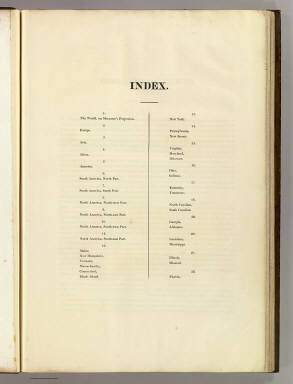
Tanner, Henry S.
Full Title
(Index Page to) A New American Atlas Containing Maps Of The Several States of the North American Union, Projected and drawn on a Uniform Scale from Documents found in the public Offices of the United States and State Governments, and other Original and Authentic Information, By Henry S. Tanner ... Philadelphia: Published By H.S. Tanner. 1825. (title page only) Writing Drawn and Engraved by Joseph Perkins. Barralet del. Humphrys sc.
Publisher
Henry Tanner
Author
Tanner, Henry S.
Full Title
(Geographical Memoir, pg. 1 in) A New American Atlas Containing Maps Of The Several States of the North American Union, Projected and drawn on a Uniform Scale from Documents found in the public Offices of the United States and State Governments, and other Original and Authentic Information, By Henry S. Tanner ... Philadelphia: Published By H.S. Tanner. 1825. (title page only) Writing Drawn and Engraved by Joseph Perkins. Barralet del. Humphrys sc.
Publisher
Henry Tanner
Author
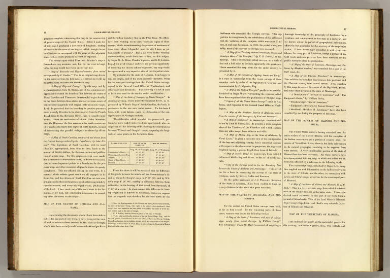
Tanner, Henry S.
Full Title
(Geographical Memoir, pgs. 2-3 in) A New American Atlas Containing Maps Of The Several States of the North American Union, Projected and drawn on a Uniform Scale from Documents found in the public Offices of the United States and State Governments, and other Original and Authentic Information, By Henry S. Tanner ... Philadelphia: Published By H.S. Tanner. 1825. (title page only) Writing Drawn and Engraved by Joseph Perkins. Barralet del. Humphrys sc.
Publisher
Henry Tanner
Author
Tanner, Henry S.
Full Title
(Geographical Memoir, pgs. 4-5 in) A New American Atlas Containing Maps Of The Several States of the North American Union, Projected and drawn on a Uniform Scale from Documents found in the public Offices of the United States and State Governments, and other Original and Authentic Information, By Henry S. Tanner ... Philadelphia: Published By H.S. Tanner. 1825. (title page only) Writing Drawn and Engraved by Joseph Perkins. Barralet del. Humphrys sc.
Publisher
Henry Tanner
Author
Tanner, Henry S.
Full Title
(Geographical Memoir, pgs. 6-7 in) A New American Atlas Containing Maps Of The Several States of the North American Union, Projected and drawn on a Uniform Scale from Documents found in the public Offices of the United States and State Governments, and other Original and Authentic Information, By Henry S. Tanner ... Philadelphia: Published By H.S. Tanner. 1825. (title page only) Writing Drawn and Engraved by Joseph Perkins. Barralet del. Humphrys sc.
Publisher
Henry Tanner
Author
Tanner, Henry S.
Full Title
(Geographical Memoir, pgs. 8-9 in) A New American Atlas Containing Maps Of The Several States of the North American Union, Projected and drawn on a Uniform Scale from Documents found in the public Offices of the United States and State Governments, and other Original and Authentic Information, By Henry S. Tanner ... Philadelphia: Published By H.S. Tanner. 1825. (title page only) Writing Drawn and Engraved by Joseph Perkins. Barralet del. Humphrys sc.
Publisher
Henry Tanner
Author
Tanner, Henry S.
Full Title
(Geographical Memoir, pgs. 10-11 in) A New American Atlas Containing Maps Of The Several States of the North American Union, Projected and drawn on a Uniform Scale from Documents found in the public Offices of the United States and State Governments, and other Original and Authentic Information, By Henry S. Tanner ... Philadelphia: Published By H.S. Tanner. 1825. (title page only) Writing Drawn and Engraved by Joseph Perkins. Barralet del. Humphrys sc.
Publisher
Henry Tanner
Author
Tanner, Henry S.
Full Title
(Geographical Memoir, pgs. 12-13 in) A New American Atlas Containing Maps Of The Several States of the North American Union, Projected and drawn on a Uniform Scale from Documents found in the public Offices of the United States and State Governments, and other Original and Authentic Information, By Henry S. Tanner ... Philadelphia: Published By H.S. Tanner. 1825. (title page only) Writing Drawn and Engraved by Joseph Perkins. Barralet del. Humphrys sc.
Publisher
Henry Tanner
Author
Tanner, Henry S.
Full Title
(Geographical Memoir, pgs. 14-15 in) A New American Atlas Containing Maps Of The Several States of the North American Union, Projected and drawn on a Uniform Scale from Documents found in the public Offices of the United States and State Governments, and other Original and Authentic Information, By Henry S. Tanner ... Philadelphia: Published By H.S. Tanner. 1825. (title page only) Writing Drawn and Engraved by Joseph Perkins. Barralet del. Humphrys sc.
Publisher
Henry Tanner
Author
Tanner, Henry S.
Full Title
(Geographical Memoir, pgs. 16-17 in) A New American Atlas Containing Maps Of The Several States of the North American Union, Projected and drawn on a Uniform Scale from Documents found in the public Offices of the United States and State Governments, and other Original and Authentic Information, By Henry S. Tanner ... Philadelphia: Published By H.S. Tanner. 1825. (title page only) Writing Drawn and Engraved by Joseph Perkins. Barralet del. Humphrys sc.
Publisher
Henry Tanner
Author
Tanner, Henry S.
Full Title
(Geographical Memoir, pg. 18 in) A New American Atlas Containing Maps Of The Several States of the North American Union, Projected and drawn on a Uniform Scale from Documents found in the public Offices of the United States and State Governments, and other Original and Authentic Information, By Henry S. Tanner ... Philadelphia: Published By H.S. Tanner. 1825. (title page only) Writing Drawn and Engraved by Joseph Perkins. Barralet del. Humphrys sc.
Publisher
Henry Tanner
Author
Ruhle von Lilienstern, August
Full Title
Nordliches America. Berlin 1824 von R.v.L.
Publisher
C.G. Luderitz
Author
Brue, Adrien Hubert, 1786-1832
Full Title
Carte generale des Etats-Unis, du Canada et d'une partie des pays adjacents; par A. Brue, Geographe du Roi. Paris, 1825. Chez l'Auteur, rue des Macons-Sorbonne, no. 9, et chez les principaux marchands de geographie.
Publisher
A. Brue
Author
Brue, Adrien Hubert, 1786-1832
Full Title
Carte generale des Etats-Unis Mexicains et des Provinces-Unies de l'Amerique Centrale. (with) Guatemala ou Provinces-Unies de l'Amerique Centrale. Redigee par Brue, Geographe. Paris, 1825. Chez l'Auteur, rue des Macons-Sorbonne, no. 9, et chez les principaux m(archan)ds de cartes geographiques.
Publisher
A. Brue
Author
Stieler, Adolf
Full Title
Vereinigte Staaten von Nord-America. entw. u. gez. v. Heinr. Hubbe. 1825. Gestochen von Joh. Carl Ausfeld, in Schnepfenthal bey Gotha. (on upper right margin) Stielers Hand-Atlas No. 46b. (to accompany) Hand-Atlas uber alle Theile der Erde, nach dem neuesten Zustande und uber das Weltgebaude.
Publisher
Justus Perthes
Author
[Paullin, Charles O., Wright, John K.]
Full Title
Plate 41. Lands. Possessions of European States in Eastern North America after the Treaty of Paris, 1763. Plat of ... the United States N.W. of the River Ohio (Facsimile). Colonies or States Proposed or Organized by Settlers West of the Allegheny Mountains,1775-1785. A Colonial Town: Wethersfield, Connecticut, 1641 (Facsimile). Specimen Surveys in the Virginia Military Reserve, Ross County, Ohio, 1799-1825 (Facsimile).
Publisher
[Carnegie Institution of Washington, American Geographical Society of New York]
1-31 of 31
|