|
|
REFINE
Search Results:
1-28 of 28
Author
Sargent, C.S.
Full Title
Map Showing the Distribution of the Genera Carya & Umbellularia [The Hickories & California Laurel (or California Bay).] in North America exclusive of Mexico. Prepared under the direction of C.S. Sargent, Special Agent. (inset) Aleutian Islands. Julius Bien & Co. lith. N.Y. Compiled under the Direction of Henry Gannett, E.M. Harry King, Draughtsman.
Publisher
Julius Bien
Author
Sargent, C.S.
Full Title
Map Showing the Distribution of the Genus Juglans [The Walnuts.] in North America exclusive of Mexico. Prepared under the direction of C.S. Sargent, Special Agent. (inset) Aleutian Islands. Julius Bien & Co. lith. N.Y. Compiled under the Direction of Henry Gannett, E.M. Harry King, Draughtsman.
Publisher
Julius Bien
Author
Sargent, C.S.
Full Title
Map Showing the Distribution of the Genera Castanea & Castanopsis [The Chestnuts & Chinquapins] in North America exclusive of Mexico. Prepared under the direction of C.S. Sargent, Special Agent. (inset) Aleutian Islands. Julius Bien & Co. lith. N.Y. Compiled under the Direction of Henry Gannett, E.M. Harry King, Draughtsman.
Publisher
Julius Bien
Author
Sargent, C.S.
Full Title
Map Showing the Distribution of Liriodendron Tulipifera and Pinus Lambertiana in North America exclusive of Mexico. Prepared under the direction of C.S. Sargent, Special Agent. (inset) Aleutian Islands. Julius Bien & Co. lith. N.Y. Compiled under the Direction of Henry Gannett. E.M. Harry King, Draughtsman.
Publisher
Julius Bien
Author
Sargent, C.S.
Full Title
Map Showing the Distribution of Prosopsis Juliflora, Quercus Alba and Q. (Quercus) Densiflora in North America exclusive of Mexico. Prepared under the direction of C.S. Sargent, Special Agent. (inset) Aleutian Islands. Julius Bien & Co. lith. N.Y. Compiled under the Direction of Henry Gannett. E.M. Harry King, Draughtsman.
Publisher
Julius Bien
Author
Sargent, C.S.
Full Title
Map of the United States showing the Relative Average Density of Existing Forests. Prepared under the direction of C.S. Sargent, Special Agent. (inset) Aleutian Islands. Julius Bien & Co. lith. N.Y. Compiled under the Direction of Henry Gannett, E.M. Harry King, Draughtsman.
Publisher
Julius Bien
Author
Southern Pacific Company
Full Title
Correct map of the railway & steamship lines operated by the Southern Pacific Company. (with) County map of Texas showing the Atlantic System of the Southern Pacific Company. (with) New Orleans. (with) Houston, Texas. (with) San Antonio, Texas. (with) Galveston, Texas. (1884)
Publisher
Poole Brothers.
Author
Southern Pacific Company
Full Title
(Covers to) "Sunset Route" The Southern Pacific Company Atlantic System. West. Poole Bros. Printers and Engravers, Chicago. (1884)
Publisher
Poole Brothers.
Author
Southern Pacific Company
Full Title
(Text Page to) "Sunset Route" The Southern Pacific Company Atlantic System. West. Poole Bros. Printers and Engravers, Chicago. (1884)
Publisher
Poole Brothers.
Author
Rand McNally and Company
Full Title
Pennsylvania Railroad Great Trunk Line, and United States mail route ... copyright, 1881, by Rand, McNally & Co., Chicago ... (inset) Vicinity of Boston. (inset) Vicinity of New York and Philadelphia.
Publisher
Rand McNally & Co.
Author
Rand McNally and Company
Full Title
(Covers to) Pocket railroad map and business guide for Philadelphia, Pa., 1883, 1884.
Publisher
Rand McNally & Co.
Author
Rand McNally and Company
Full Title
(Text Page to) Pocket railroad map and business guide for Philadelphia, Pa., 1883, 1884.
Publisher
Rand McNally & Co.
Author
[Gray, Frank A., Gray, O.W.]
Full Title
Gray's Historical Maps of the United States by Frank A. Gray.
Publisher
Stedman & Brown
Author
Blodget, Lorin
Full Title
Climatological Map of the United States Showing Average Temperature, Amount of Rain Fall &c. by Lorin Blodget.
Publisher
Stedman & Brown
Author
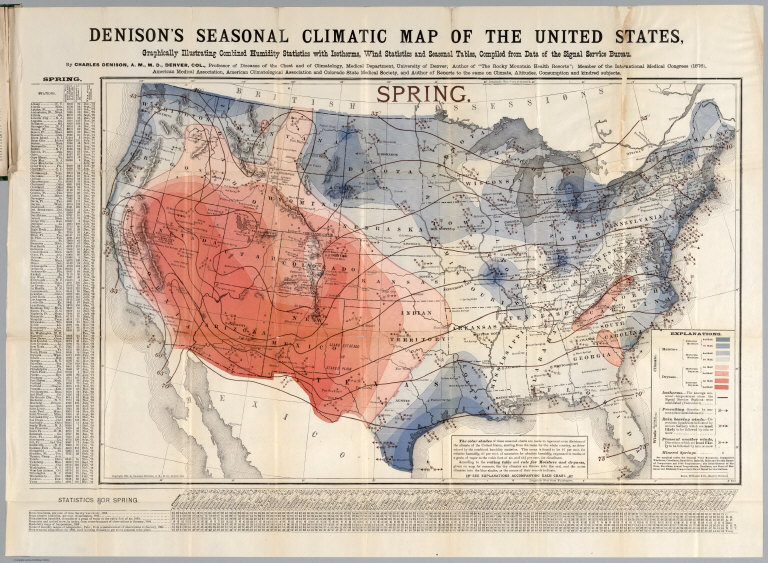
Denison, Charles
Full Title
Spring. Denison's seasonal climatic map of the United States, Graphically illustrating combined humidity statistics with isotherms, wind statistics and seasonal tables, compiled from data of the Signal Service Bureau. By Charles Denison, A.M.M.D, Denver, Col. ... Copyright, 1884, by Charles Denison, A.M.M.D, Denver, Col. Rand McNally & Co. Engr's., Chicago. (to accompany) Descriptive circular of the annual and seasonal climatic maps of the United States.
Publisher
Rand, McNally & Co.
Author
Denison, Charles
Full Title
Summer. Denison's seasonal climatic map of the United States, Graphically illustrating combined humidity statistics with isotherms, wind statistics and seasonal tables, compiled from data of the Signal Service Bureau. By Charles Denison, A.M.M.D, Denver, Col. ... Copyright, 1884, by Charles Denison, A.M.M.D, Denver, Col. Rand McNally & Co. Engr's., Chicago. (to accompany) Descriptive circular of the annual and seasonal climatic maps of the United States.
Publisher
Rand, McNally & Co.
Author
Denison, Charles
Full Title
Autumn. Denison's seasonal climatic map of the United States, Graphically illustrating combined humidity statistics with isotherms, wind statistics and seasonal tables, compiled from data of the Signal Service Bureau. By Charles Denison, A.M.M.D, Denver, Col. ... Copyright, 1884, by Charles Denison, A.M.M.D, Denver, Col. Rand McNally & Co. Engr's., Chicago. (to accompany) Descriptive circular of the annual and seasonal climatic maps of the United States.
Publisher
Rand, McNally & Co.
Author
Denison, Charles
Full Title
Winter. Denison's seasonal climatic map of the United States, Graphically illustrating combined humidity statistics with isotherms, wind statistics and seasonal tables, compiled from data of the Signal Service Bureau. By Charles Denison, A.M.M.D, Denver, Col. ... Copyright, 1884, by Charles Denison, A.M.M.D, Denver, Col. Rand McNally & Co. Engr's., Chicago. (to accompany) Descriptive circular of the annual and seasonal climatic maps of the United States.
Publisher
Rand, McNally & Co.
Author
Denison, Charles
Full Title
Denison's annual climatic map of the United States, Graphically illustrating cloudiness with isotherms, precipitation lines, winds (arrows) and annual tables. Compiled from data of the Signal Service Bureau. by Charles Denison, A.M.M.D, Denver, Col. ... Copyright, 1884, by Charles Denison, A.M.M.D, Denver, Col. Rand McNally & Co. Engr's., Chicago. (to accompany) Descriptive circular of the annual and seasonal climatic maps of the United States.
Publisher
Rand, McNally & Co.
Author
[Gray, Frank A., Gray, O.W.]
Full Title
Gray's New Map of the United States. By Frank A. Gray. (insets) Alaska. Sketch Showing the Westward Movement of the Centre of Population. Copyright 1879 by O.W. Gray & Son.
Publisher
Stedman & Brown
Author
[Gray, O.W., Hitchcock, Charles H.]
Full Title
Gray's Geological Map of the United States by Prof. Charles H. Hitchcock. Copyright 1882 by O.W. Gray & Son.
Publisher
Stedman & Brown
Author
[Gray, Frank A., Gray, O.W.]
Full Title
Gray's Botanical and Zoological Maps of the United States. Copyright 1877 by O.W.Gray & Son.
Publisher
Stedman & Brown
Author
[Alaskan Boundary Tribunal, Mohun, Edward]
Full Title
(Facsimile) Map of the Province of British Columbia, Compiled and drawn by Edward Mohun, C.E. by Direction of the Honorable W. Smithe. Chief Commissioner of Lands and Works. Victoria, B.C. 1884. Dawson Brothers, Montreal. Photo. Lith. by A. Hoen & Co. Baltimore, MD. Engraved & Printed by Bartholomew Edinburgh.
Publisher
(U.S.) Government Printing Office
Author
[Alaskan Boundary Tribunal, Selwyn, Alfred R.C.]
Full Title
(Facsimile) Geological and Natural History Survey of Canada (portion). Alfred R.C. Selwyn L.L.D., F.R.S., Director. Map of the Dominion of Canada. Geologically Colored from Surveys made by the Geological Corps, 1842-1882. Photo. Lith. by A. Hoen & Co. Baltimore, MD.
Publisher
(U.S.) Government Printing Office
Author
[Alaskan Boundary Tribunal, British Admiralty]
Full Title
(Facsimile) Part of British Admiralty Chart. No. 2431. Cordova Bay to Cross Sound. 1865 Corrections to 1884. Photo. Lith. by A. Hoen & Co. Baltimore, MD.
Publisher
(U.S.) Government Printing Office
Author
Alaskan Boundary Tribunal
Full Title
(Facsimiles) (Eight Comparison Maps Southern Alaskan Coast 1884-1903 (portions)): Official British Columbia map, 1884; Official British Columbia map, 1895; Official British Columbia map, 1884; Map of Year Book of British Columbia, 1897; Dawson's map, 1887; Map presented to Joint High Commission in 1898 by British Commissioners; Official British Columbia map, 1893; Map 37, Case of Great Britain, Appendix, Vol. II, 1903. Alaskan Boundary Tribunal, 1903. 28. Andrew B. Graham. Photo-Litho. Washington.D.C.
Publisher
Government Printing Office
Author
Mitchell, Samuel Augustus Jr.
Full Title
Railroad map of the United States, showing the through lines of communication from the Atlantic to the Pacific, together with the various steamship lines along the seaboard. Copyright by Wm. M. Bradley & Bro. 1884.
Publisher
Wm. M. Bradley & Bro.
1-28 of 28
|
![Distribution of the Genera Carya & Umbellularia [The Hickories & California Bay Laurel] in North America.](https://www.davidrumsey.com/rumsey/Size3/D5005/2332005.jpg)
![Distribution of the Genus Juglans [The Walnuts.] in North America.](https://www.davidrumsey.com/rumsey/Size3/D5005/2332006.jpg)
![Distribution of the Genera Castanea & Castanopsis [The Chestnuts & Chinquapins] in North America.](https://www.davidrumsey.com/rumsey/Size3/D5005/2332008.jpg)