Who What Where WhenREMOVEWHO
WHEN |
REFINE
Search Results:
1-42 of 42
Author
Houston And Texas Central Railway
Full Title
Texas and Mexico showing Houston and Texas Central system of railways. Rand, McNally & Co, Engr's, Chicago. (inset) Map of United States and Mexico reduced scale; showing the Houston and Texas Central Railway and connections. (1885)
Publisher
Rand McNally
Author
Page, H.R. & Co.
Full Title
Map of the United States. Copyright 1884, by Rand, McNally & Co., Map Publishers, Chicago.
Publisher
H.R. Page & Co.
Author
Rand McNally and Company
Full Title
Map of the United States. Rand, McNally & Co., Map Publishers and Engravers, Chicago. (1885)
Publisher
Waterman, Watkins & Co.
Author
[Gray, Frank Arnold, O.W. Gray & Son]
Full Title
Gray's new map of the United States. (with) Territorial District of Alaska formerly Russian America ... (with) Sketch exhibiting the westward movement of the centre of population from 1790 to 1880 ... By Frank A. Gray. Copyright, 1879 by O.W. Gray & Son. Philadelphia: O.W. Gray & Son. (1885)
Publisher
George N. Colby
Author
Colton, G.W. & C.B.
Full Title
(Covers to) Colton's Map Of The United States Of America, The British Provinces, Mexico and the West Indies. Showing the Country from the Atlantic to the Pacific Ocean. Engraved, Printed & Published by G.W. & C.B. Colton & Co. New York. 1885. Entered ... 1884 by G.W. & C.B. Colton & Co. ... Washington.
Publisher
G.W. & C.B. Colton
Author
Colton, G.W. & C.B.
Full Title
Colton's Map Of The United States Of America, The British Provinces, Mexico and the West Indies. Showing the Country from the Atlantic to the Pacific Ocean. Engraved, Printed & Published by G.W. & C.B. Colton & Co. New York. 1885. Entered ... 1884 by G.W. & C.B. Colton & Co. ... Washington.
Publisher
G.W. & C.B. Colton
Author
Colton, G.W. & C.B.
Full Title
(Composite of) Colton's Map Of The United States Of America, The British Provinces, Mexico and the West Indies. Showing the Country from the Atlantic to the Pacific Ocean. Engraved, Printed & Published by G.W. & C.B. Colton & Co. New York. 1885. Entered ... 1884 by G.W. & C.B. Colton & Co. ... Washington.
Publisher
G.W. & C.B. Colton
Author
Norris, W.R.
Full Title
(Covers to) Norris' Cyclopaedic Map Of The United States Of America, (Excepting Alaska) Together with adjacent portions of the Dominion of Canada and of the United States of Mexico ... Prepared for use in schools and in the home circle. Patented June 12, 1883. Originated, Manufactured and Published by W.R. Norris, New York. 1885.
Publisher
W.R. Norris
Author
Norris, W.R.
Full Title
Norris' Cyclopaedic Map Of The United States Of America, (Excepting Alaska) Together with adjacent portions of the Dominion of Canada and of the United States of Mexico ... Prepared for use in schools and in the home circle. Patented June 12, 1883. Originated, Manufactured and Published by W.R. Norris, New York. 1885.
Publisher
W.R. Norris
Author
Cincinnati, New Orleans & Texas Pacific Railway Company
Full Title
Map Queen & Crescent Route and connections.
Publisher
The A.H. Pugh Printing Co.
Author
Cincinnati, New Orleans & Texas Pacific Railway Company
Full Title
(Covers to) Queen & Crescent Route. Cincinnati, New Orleans & Texas Pacific Railway ... Between Ohio River and the Gulf direct trunk line. September 15th, 1885. The A.H. Pugh Printing Co.
Publisher
The A.H. Pugh Printing Co.
Author
Cincinnati, New Orleans & Texas Pacific Railway Company
Full Title
(Text Page to) Queen & Crescent Route. Cincinnati, New Orleans & Texas Pacific Railway ... Between Ohio River and the Gulf direct trunk line. September 15th, 1885. The A.H. Pugh Printing Co.
Publisher
The A.H. Pugh Printing Co.
Author
Chicago, Milwaukee, and St. Paul Railway Company
Full Title
Map of the Chicago-Milwaukee & St. Paul Ry. and connections. Matthews, Northrup & Co., eng'rs. & prs., Buffalo, N.Y.
Publisher
Matthews, Northrup & Co.
Author
Chicago, Milwaukee, and St. Paul Railway Company
Full Title
(Covers to) Chicago Milwaukee and St. Paul Railway. 1-9-85.
Publisher
Matthews, Northrup & Co.
Author
Chicago, Milwaukee, and St. Paul Railway Company
Full Title
(Text Page to) Chicago Milwaukee and St. Paul Railway. 1-9-85.
Publisher
Matthews, Northrup & Co.
Author
Chicago, Rock Island and Pacific Railway Company
Full Title
New and correct map of the Great Rock Island Route. Chicago, Rock Island & Pacific Railway. The passengers favorite route ... 1885. Copyrighted by E. St. John, general ticket & passenger agent, Chicago, Ill. Geo. F. Cram, Map Engraver, Chicago. (inset) Map of the world showing the route across the United States via the Chicago, Rock Island & Pacific Ry.
Publisher
Cameron, Amberg & Co.
Author
Chicago, Rock Island and Pacific Railway Company
Full Title
(Covers to) Good luck to all who travel via the Chicago, Rock Island and Pacific Rw. Great mid-continental link between the Atlantic and Pacific ... Autumn, 1885. Cameron, Amberg & Co., Printers, Chicago.
Publisher
Cameron, Amberg & Co.
Author
Chicago, Rock Island and Pacific Railway Company
Full Title
(Text Page to) Good luck to all who travel via the Chicago, Rock Island and Pacific Rw. Great mid-continental link between the Atlantic and Pacific ... Autumn, 1885. Cameron, Amberg & Co., Printers, Chicago.
Publisher
Cameron, Amberg & Co.
Author
Chicago, Burlington & Quincy Railroad Company
Full Title
Correct map of the Burlington Route C.B. & Q.R.R. and connecting lines. Copyright 1883 by Rand, McNally & Co., Chicago.
Publisher
Rand McNally
Author
Chicago, Burlington & Quincy Railroad Company
Full Title
(Covers to) Burlington Route C.B. & Q.R.R. Chicago, Peoria or St. Louis direct to Denver. Fall edition 1885 ... Nov., 1885. Rand, McNally & Co., Printers and Engravers, Chicago.
Publisher
Rand McNally
Author
Chicago, Burlington & Quincy Railroad Company
Full Title
(Text Page to) Burlington Route C.B. & Q.R.R. Chicago, Peoria or St. Louis direct to Denver. Fall edition 1885 ... Nov., 1885. Rand, McNally & Co., Printers and Engravers, Chicago.
Publisher
Rand McNally
Author
Piedmont Air Line Railroad Company
Full Title
The Piedmont Air Line & connections. (1885)
Publisher
C.G. Crawford
Author
Piedmont Air Line Railroad Company
Full Title
(Covers to) New York, shortest and quickest, Piedmont Air Line, New Orleans, Washington, Lynchburg, Danville, Charlotte and Atlanta. Sept. 15th, 1885 ... C.G. Crawford, Printer and Stationer, 49 & 51 Park Place, N.Y.
Publisher
C.G. Crawford
Author
[Missouri Pacific Railway Company, Rand McNally and Company]
Full Title
(Covers to) Missouri Pacific Ry. ... Rand, McNally & Co., Printers and Engravers, Chicago.
Publisher
Rand McNally
Author
[Missouri Pacific Railway Company, Rand McNally and Company]
Full Title
(Text Page to) Missouri Pacific Ry. ... Rand, McNally & Co., Printers and Engravers, Chicago.
Publisher
Rand McNally
Author
[Missouri Pacific Railway Company, Rand McNally and Company]
Full Title
Map of the South West Railway System. Missouri Pacific Ry., Central Branch U.P. R.R., Missouri, Kansas & Texas Ry. Texas and Pacific Ry., St. Louis, Iron Mountn. and Southern Ry., International and Great Northern R.R. and their connections. Copyright, 1883, by Rand, McNally & Co., Map Publishers, Chicago ...
Publisher
Rand McNally
Author
New York Central and Hudson River Railroad Company
Full Title
Map of the New York Central and Hudson River Railroad and its connections. Eng'd by American Bank Note Co. New York. (1885)
Publisher
American Bank Note Co.
Author
Atlantic Coast Line Railroad Company
Full Title
Map of the Atlantic Coast Line of railways & connections.
Publisher
C.G. Crawford
Author
Atlantic Coast Line Railroad Company
Full Title
(Covers to) The Atlantic Coast Line north and south ... C.G. Crawford, Printer and Stationer, 49 & 51 Park Place N.Y. September 7, 1885.
Publisher
C.G. Crawford
Author
Piedmont Air Line Railroad Company
Full Title
(Text Page to) New York, shortest and quickest, Piedmont Air Line, New Orleans, Washington, Lynchburg, Danville, Charlotte and Atlanta. Sept. 15th, 1885 ... C.G. Crawford, Printer and Stationer, 49 & 51 Park Place, N.Y.
Publisher
C.G. Crawford
Author
Bradstreet Company
Full Title
1776 Map of the Thirteen Colonies. (to accompany) Bradstreet's Pocket Atlas Of The United States. Published Exclusively for Macullar, Parker & Company, Boston, Massachusetts ... New York: The Bradstreet Company, 1885. (on verso) Entered ... 1879, by The Bradstreet Company ... Washington.
Publisher
Bradstreet Co.
Author
Bradstreet Company
Full Title
United States. (to accompany) Bradstreet's Pocket Atlas Of The United States. Published Exclusively for Macullar, Parker & Company, Boston, Massachusetts ... New York: The Bradstreet Company, 1885. (on verso) Entered ... 1879, by The Bradstreet Company ... Washington. (inset map) Alaska.
Publisher
Bradstreet Co.
Author
Grand Trunk Railway Company of Canada
Full Title
Map of the Grand Trunk and Great Western of Canada, and their connections. The Great International Route. (1885)
Publisher
Rand Avery Supply Co.
Author
Grand Trunk Railway Company of Canada
Full Title
(Covers to) Great Western Division of the Grand Trunk Ry. of Canada, The Great International Route between the east & west. Rand Avery Supply Co., Boston. (1885?)
Publisher
Rand Avery Supply Co.
Author
Grand Trunk Railway Company of Canada
Full Title
(Text Page to) Great Western Division of the Grand Trunk Ry. of Canada, The Great International Route between the east & west. Rand Avery Supply Co., Boston. (1885?)
Publisher
Rand Avery Supply Co.
Author
Atlantic Coast Line Railroad Company
Full Title
(Text Page to) The Atlantic Coast Line north and south ... C.G. Crawford, Printer and Stationer, 49 & 51 Park Place N.Y. September 7, 1885.
Publisher
C.G. Crawford
Author
Rand McNally and Company
Full Title
Rand McNally & Co.'s New Railroad Junction Point And County Map Of The Eastern & Middle States. Prepared from the Latest Government Surveys, and Verified by the Working Time Tables of the Various Railroads. Drawn, Engraved, Printed, Colored By Hand And Published By Rand McNally & Co., Chicago. The Railroads on this Map are bought up to date of September 1885. Copyright, 1882, By Rand, McNally & Co. (inset) General Map Of The United States Of America Showing The Relative Geographical Position Of The Several States And Territories.
Publisher
Rand McNally & Co.
Author
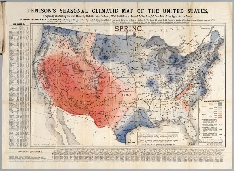
Denison, Charles
Full Title
Spring. Denison's seasonal climatic map of the United States, Graphically illustrating combined humidity statistics with isotherms, wind statistics and seasonal tables, compiled from data of the Signal Service Bureau. By Charles Denison, A.M.M.D, Denver, Col. ... Copyright, 1884, by Charles Denison, A.M.M.D, Denver, Col. Rand McNally & Co. Engr's., Chicago. (to accompany) Descriptive circular of the annual and seasonal climatic maps of the United States.
Publisher
Rand, McNally & Co.
Author
Denison, Charles
Full Title
Summer. Denison's seasonal climatic map of the United States, Graphically illustrating combined humidity statistics with isotherms, wind statistics and seasonal tables, compiled from data of the Signal Service Bureau. By Charles Denison, A.M.M.D, Denver, Col. ... Copyright, 1884, by Charles Denison, A.M.M.D, Denver, Col. Rand McNally & Co. Engr's., Chicago. (to accompany) Descriptive circular of the annual and seasonal climatic maps of the United States.
Publisher
Rand, McNally & Co.
Author
Denison, Charles
Full Title
Autumn. Denison's seasonal climatic map of the United States, Graphically illustrating combined humidity statistics with isotherms, wind statistics and seasonal tables, compiled from data of the Signal Service Bureau. By Charles Denison, A.M.M.D, Denver, Col. ... Copyright, 1884, by Charles Denison, A.M.M.D, Denver, Col. Rand McNally & Co. Engr's., Chicago. (to accompany) Descriptive circular of the annual and seasonal climatic maps of the United States.
Publisher
Rand, McNally & Co.
Author
Denison, Charles
Full Title
Winter. Denison's seasonal climatic map of the United States, Graphically illustrating combined humidity statistics with isotherms, wind statistics and seasonal tables, compiled from data of the Signal Service Bureau. By Charles Denison, A.M.M.D, Denver, Col. ... Copyright, 1884, by Charles Denison, A.M.M.D, Denver, Col. Rand McNally & Co. Engr's., Chicago. (to accompany) Descriptive circular of the annual and seasonal climatic maps of the United States.
Publisher
Rand, McNally & Co.
Author
Denison, Charles
Full Title
Denison's annual climatic map of the United States, Graphically illustrating cloudiness with isotherms, precipitation lines, winds (arrows) and annual tables. Compiled from data of the Signal Service Bureau. by Charles Denison, A.M.M.D, Denver, Col. ... Copyright, 1884, by Charles Denison, A.M.M.D, Denver, Col. Rand McNally & Co. Engr's., Chicago. (to accompany) Descriptive circular of the annual and seasonal climatic maps of the United States.
Publisher
Rand, McNally & Co.
1-42 of 42
|