Search Results:

1831 England, south. World Atlas Southern part of England. Published by D … |

1831 Composite: England, World Atlas (Composite of) England. Published by D. … |

1883 Railway, statistical England, Wales. World Atlas Railway & statistical map of England & W … |

1883 Geological map England, Wales. World Atlas Geological map of England & Wales, with … |

1883 Watershed map England, Wales 1. World Atlas Watershed map of England & Wales. No. 1. … |

1883 Watershed map England, Wales 2. World Atlas Watershed map of England & Wales. No. 2. … |

1883 Watershed map England, Wales 3. World Atlas Watershed map of England & Wales. No. 3. … |

1883 Watershed map England, Wales 4. World Atlas Watershed map of England & Wales. No. 4. … |

1883 Watershed map England, Wales 5. World Atlas Watershed map of England & Wales. No. 5. … |

1883 Watershed map England, Wales 6. World Atlas Watershed map of England & Wales. No. 6. … |

1794 England, Wales (north) World Atlas A new map of England & Wales. (North hal … |

1794 (England, Wales, south) World Atlas (A new map of England & Wales. (South ha … |

1794 Composite: England, Wales. World Atlas (Composite of) A new map of England & Wa … |

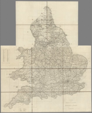
1804 England, Wales. World Atlas England and Wales. From the various surv … |
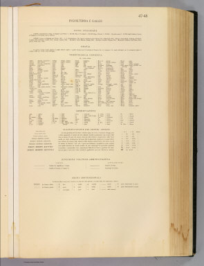
1929 Legend: 47-48. Inghilterra, Galles. World Atlas (Legend to) Inghilterra e Galles, Englan … |

1929 47-48. Inghilterra, Galles. World Atlas Inghilterra e Galles, England and Wales. … |

1804 England, Wales (outline) School Atlas England and Wales. E.P. delint. Mutlow, … |

1804 England, Wales Roman, modern. School Atlas England and Wales Roman and modern. E.P. … |

1820 England, Wales. School Atlas England & Wales. Philad. Published by M. … |

1880 England, Wales. World Atlas County map of England, and Wales. Entere … |

1890 England, Wales. World Atlas County map of England, and Wales. Copyri … |

1895 England, Wales N. World Atlas England and Wales, north. (Published at … |

1895 England, Wales S. World Atlas England and Wales, south. (Published at … |

1821 England, Wales. World Atlas England and Wales. Published by J.V. Sea … |

1810 England, Wales. Manuscript Map England and Wales. (By Frances Bowen. 18 … |

1870 England, Wales. [State Atlas, World Atlas] County map of England and Wales. Entered … |

1850 Composite: England und Wales, Schotland, … World Atlas (Composite of) No. XVII, XIX, XX. Stiele … |

1852 Die Brittischen Inseln und Die Nord-See. … World Atlas No. XVII. Stieler's Hand-Atlas (No. 15a. … |

1852 England und Wales. (England and Wales). World Atlas No. XVIII. Stieler's Hand-Atlas (No. 15b … |
1870 Index Map: Index to the Ordnance Survey … National Atlas (Index Map) Index to the Ordnance Survey … |

1870 Index Map: Index to the Ordnance Survey … National Atlas (Index Map) Index to the Ordnance Survey … |

1857 1. Brentwood. National Atlas 1. Brentwood. |

1858 2. Sheerness. National Atlas 2. Sheerness. |

1863 3. Canterbury. National Atlas 3. Canterbury. |

1858 4. Denge Ness. National Atlas 4. Denge Ness. |

1862 5. Hastings. National Atlas 5. Hastings. |

1860 6. Maidstone. National Atlas 6. Maidstone. |

1860 7. London. National Atlas 7. London. |

1859 8. Dorking. National Atlas 8. Dorking. |

1861 9. Brighton. National Atlas 9. Brighton. |

1853 10. Isle of Wight. National Atlas 10. Isle of Wight. |

1858 11. Winchester. National Atlas 11. Winchester. |

1863 12. Basingstoke. National Atlas 12. Basingstoke. |

1857 13. Oxford. National Atlas 13. Oxford. |

1857 14. Devizes. National Atlas 14. Devizes. |

1859 15. Salisbury. National Atlas 15. Salisbury. |

1858 16. Poole. National Atlas 16. Poole. |

1863 17. Dorchester. National Atlas 17. Dorchester. |

1856 18. Sherborne. National Atlas 18. Sherborne. |

1859 19. Bath & Wells. National Atlas 19. Bath & Wells. |