Who What Where WhenWHEREShow More |
Author
Shell Oil Company
Full Title
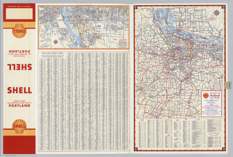
Shell Street Guide and Metropolitan Map of Portland (cover title). Shell Street Map of Portland. 7-DD-1956-1. (inset) Downtown Portland.
Publisher
Shell Oil Company
Author
Shell Oil Company
Full Title
Street Map of Portland (Southern Section). Metropolitan Portland and Vicinity. (Verso to) Shell Street Map of Portland.
Publisher
Shell Oil Company
Author
Shell Oil Company
Full Title
Shell Street Guide of Sacramento (cover title). Shell Street Map of Sacramento. 8-DD-1956-2.
Publisher
Shell Oil Company
Author
Shell Oil Company
Full Title
Street Map of Sacramento (Northern Section). (Verso to) Shell Street Map of Sacramento.
Publisher
Shell Oil Company
Author
Shell Oil Company
Full Title
Shell Map of Metropolitan St. Louis (cover title). Shell Metropolitan St. Louis and Vicinity.
Publisher
Shell Oil Company
Author
Shell Oil Company
Full Title
Sightseeing Guide to St. Louis. Downtown St. Louis. (Verso to) Shell Metropolitan St. Louis and Vicinity.
Publisher
Shell Oil Company
Author
Shell Oil Company
Full Title
Shell Street Guide and Metropolitan Map of San Diego (cover title). Street Map of San Diego. 9-DD-1956-2.
Publisher
Shell Oil Company
Author
Shell Oil Company
Full Title
Street Map of San Diego (Eastern Section). Downtown San Diego. Metropolitan San Diego and Vicinity. (Verso to) Street Map of San Diego.
Publisher
Shell Oil Company
Author
Shell Oil Company
Full Title
Shell Street Guide of San Fernando Valley and Los Angeles Northern Section (cover title). Street Map of San Fernando Valley and Los Angeles Northern Section. 7-DD-1956-2.
Publisher
Shell Oil Company
Author
Shell Oil Company
Full Title
Los Angeles and Vicinity. (Verso to) Street Map of San Fernando Valley and Los Angeles Northern Section.
Publisher
Shell Oil Company
Author
Shell Oil Company
Full Title
Shell Street Guide of San Francisco and Vicinity (cover title). Shell San Francisco and Vicinity. 7-DD-1956-2.
Publisher
Shell Oil Company
Author
Shell Oil Company
Full Title
Downtown San Francisco. Street Map of San Francisco. (Verso to) Shell San Francisco and Vicinity.
Publisher
Shell Oil Company
Author
Shell Oil Company
Full Title
Shell Map of San Jose (cover title). Shell Street Map of San Jose and Vicinity. 01-Y-1951-1.
Publisher
Shell Oil Company
Author
Shell Oil Company
Full Title
Shell San Jose and Vicinity. (Verso to) Shell Street Map of San Jose and Vicinity.
Publisher
Shell Oil Company
Author
Shell Oil Company
Full Title
Shell Street Guide of Seattle and Tacoma (cover title). Shell Street Map of Seattle. 10-DD-1956-2.
Publisher
Shell Oil Company
Author
Shell Oil Company
Full Title
Street Map of Seattle (Northern Section). Street Map of Tacoma. Sightseeing Guide to Seattle. (Verso to) Shell Street Map of Seattle.
Publisher
Shell Oil Company
Author
Shell Oil Company
Full Title
Shell Street Guide and Metropolitan Map of Spokane (cover title). Shell Metropolitan Spokane and Vicinity. 8-DD-1956-1.
Publisher
Shell Oil Company
Author
Shell Oil Company
Full Title
Downtown Spokane. Street Map of Spokane. Sightseeing Guide to Spokane. (Verso to) Metropolitan Spokane and Vicinity.
Publisher
Shell Oil Company
Author
Shell Oil Company
Full Title
Shell Map of Metropolitan Washington, D.C. (cover title). Shell Washington D.C. and Vicinity. 12-DD-1956-1. (inset) Alexandria, Virginia.
Publisher
Shell Oil Company
Author
Shell Oil Company
Full Title
Shell Central Washington (D.C.) 12-DD-1956-1. (Verso to) Shell Washington D.C. and Vicinity.
Publisher
Shell Oil Company
Author
Shell Oil Company
Full Title
Shell Map of British Columbia, Alberta, Saskatchewan and Manitoba (cover title). British Columbia - Alberta. 8-DD-1956-1.
Publisher
Shell Oil Company
Author
Shell Oil Company
Full Title
Shell Manitoba - Saskatchewan. Alaska Highway. Calgary. Edmonton. (Verso to) British Columbia - Alberta.
Publisher
Shell Oil Company
Author
Shell Oil Company
Full Title
Shell Street Guide and Metropolitan Map of Montreal (cover title). Shell Street Map of Montreal. 11-X-1950-1.
Publisher
Shell Oil Company
Author
Shell Oil Company
Full Title
Downtown Montreal. Seeing Montreal. Shell Metropolitan District of Montreal. (Verso to) Shell Street Map of Montreal.
Publisher
Shell Oil Company
Author
Shell Oil Company
Full Title
Shell Map of Ontario (Canada) (cover title). Shell Ontario (Canada). 11-CC-1955-2.
Publisher
Shell Oil Company
Author
Shell Oil Company
Full Title
Northern Ontario. Buffalo - Niagara Falls. Toronto. Windsor. London (Ontario). Kitchener. Ottawa. Hamilton. Kingston. (Verso to) Shell Ontario (Canada).
Publisher
Shell Oil Company
Author
Shell Oil Company
Full Title
Shell Metropolitan Map of Ottawa (cover title). Shell Metropolitan Ottawa and Vicinity. V-1-1948-1.
Publisher
Shell Oil Company
Author
Shell Oil Company
Full Title
Downtown Ottawa. (Verso to) Shell Metropolitan Ottawa and Vicinity.
Publisher
Shell Oil Company
Author
Shell Oil Company
Full Title
Shell Map of Quebec and Maritime Provinces (cover title). Shell Highway Map of Quebec. 12-CC-1955-1. (insets) Western Quebec; Montreal District.
Publisher
Shell Oil Company
Author
Shell Oil Company
Full Title
Shell Maritime Provinces. 11-CC-1955-1. (insets) Quebec; Montreal. (Verso to) Shell Highway Map of Quebec.
Publisher
Shell Oil Company
Author
Shell Oil Company
Full Title
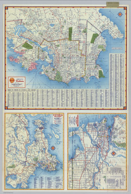
Shell Map of Vancouver and Victoria, B.C. (cover title). Shell Street Map of Vancouver. 10-Y-1951-1.
Publisher
Shell Oil Company
Author
Shell Oil Company
Full Title
Shell Street Map of Victoria. Victoria and Vicinity. Vancouver and Vicinity. (Verso to) Shell Street Map of Vancouver.
Publisher
Shell Oil Company
Author
Shell Oil Company
Full Title
Shell Map of Mexico (cover title). Shell Highway Map of Mexico. 8-DD-1956-1.
Publisher
Shell Oil Company
Author
Shell Oil Company
Full Title
Mexico City. Mexico City - Veracruz. Downtown Mexico City. (Verso to) Shell Highway Map of Mexico.
Publisher
Shell Oil Company
Author
[Humboldt, Alexander von, 1769-1859, Vandermaelen, Philippe, 1795-1869]
Full Title
Partie de l'Amerique Russe. Amer. Sep. no. 14. (with) Profil du Chemin de Carthagene des Indes au Plateau de Santa Fe de Bogota. (Dresse par Ph. Vandermaelen, lithographie par H. Ode. Quatrieme partie. - Amer. sept. Bruxelles. 1827)
Publisher
Ph. Vandermaelen
Author
[Humboldt, Alexander von, 1769-1859, Vandermaelen, Philippe, 1795-1869]
Full Title
Nouvelle Californie. Amer. Sep. no. 46. (with profile) Includes profile: Tableau physique de la pente Occidentale du Plateau de la nouvelle Espagne. Chemin de Mexico a Acapulco, d'apres A. de Humboldt. Dressee et dessinee par Ph. Vandermaelen. Desee. sur pierre et Lith. par H. Ode, mai 1825. (Quatrieme partie. - Amer. sept. Bruxelles. 1827)
Publisher
Ph. Vandermaelen
Author
Colton, G.W.
Full Title
Colton's Georgetown and the City of Washington the Capital of the United States of America. Published by G. W & C. B. Colton & Co., No. 182 William St. New York.
Publisher
G. W & C. B. Colton & Co.
Author
[Fremont, J.C., Preuss, Charles]
Full Title
Topographical Map Of The Road From Missouri To Oregon, Commencing At The Mouth Of The Kansas In The Missouri River And Ending At The Mouth Of The Wallah Wallah In The Columbia. In VII Sections. Section I. From the field notes and journal of Capt. J.C. Fremont, and from sketches and notes made on the ground by his assistant Charles Preuss. Compiled by Charles Preuss, 1846 By order of the Senate of the United States ... Lithogr. by E. Weber & Co. Baltimore ...
Publisher
U.S.
Author
[Fremont, J.C., Preuss, Charles]
Full Title
Topographical Map Of The Road From Missouri To Oregon, Commencing At The Mouth Of The Kansas In The Missouri River And Ending At The Mouth Of The Wallah Wallah In The Columbia. In VII Sections. Section II. From the field notes and journal of Capt. J.C. Fremont, and from sketches and notes made on the ground by his assistant Charles Preuss. Compiled by Charles Preuss, 1846 By order of the Senate of the United States ... Lithogr. by E. Weber & Co. Baltimore ...
Publisher
U.S.
Author
[Fremont, J.C., Preuss, Charles]
Full Title
Topographical Map Of The Road From Missouri To Oregon, Commencing At The Mouth Of The Kansas In The Missouri River And Ending At The Mouth Of The Wallah Wallah In The Columbia. In VII Sections. Section III. From the field notes and journal of Capt. J.C. Fremont, and from sketches and notes made on the ground by his assistant Charles Preuss. Compiled by Charles Preuss, 1846 By order of the Senate of the United States ... Lithogr. by E. Weber & Co. Baltimore ...
Publisher
U.S.
Author
[Fremont, J.C., Preuss, Charles]
Full Title
Topographical Map Of The Road From Missouri To Oregon, Commencing At The Mouth Of The Kansas In The Missouri River And Ending At The Mouth Of The Wallah Wallah In The Columbia. In VII Sections. Section IV. From the field notes and journal of Capt. J.C. Fremont, and from sketches and notes made on the ground by his assistant Charles Preuss. Compiled by Charles Preuss, 1846 By order of the Senate of the United States ... Lithogr. by E. Weber & Co. Baltimore ...
Publisher
U.S.
Author
[Fremont, J.C., Preuss, Charles]
Full Title
Topographical Map Of The Road From Missouri To Oregon, Commencing At The Mouth Of The Kansas In The Missouri River And Ending At The Mouth Of The Wallah Wallah In The Columbia. In VII Sections. Section V. From the field notes and journal of Capt. J.C. Fremont, and from sketches and notes made on the ground by his assistant Charles Preuss. Compiled by Charles Preuss, 1846 By order of the Senate of the United States ... Lithogr. by E. Weber & Co. Baltimore ...
Publisher
U.S.
Author
[Fremont, J.C., Preuss, Charles]
Full Title
Topographical Map Of The Road From Missouri To Oregon, Commencing At The Mouth Of The Kansas In The Missouri River And Ending At The Mouth Of The Wallah Wallah In The Columbia. In VII Sections. Section VI. From the field notes and journal of Capt. J.C. Fremont, and from sketches and notes made on the ground by his assistant Charles Preuss. Compiled by Charles Preuss, 1846 By order of the Senate of the United States ... Lithogr. by E. Weber & Co. Baltimore ...
Publisher
U.S.
Author
Raisz, Erwin
Full Title
33. Roads, Radio, And Television. Sources: Publications of the State Road Department, Tallahassee; Allen Morris, the Florida Handbook, 1961-62, Tallahassee; School of Journalism and Communications, University of Florida, Gainesville. (to accompany) Atlas of Florida by Erwin Raisz and associates with text by John R. Dunkle. Prepared in the Department of Geography, University of Florida. University of Florida Press, Gainesville, 1964. (on verso) 1964 Board of Commissioners of State Institutions of Florida.
Publisher
Un. Of Florida Press
Author
[Brue, Adrien Hubert, 1786-1832, Picquet, C.]
Full Title
Carte particuliere de l'Angleterre, de la Principaute de Galles et de la partie meridionale de l'Ecosse; indiquant toutes les principales routes et les canaux navigables. Par A. Brue, Geographe du Roi. Revue et augmentee par Ch. Picquet, Geographe du Roi &a. Paris, 1840. Chez Chles. Picquet, Quai Conti No. 17, pres du Pont des Arts.
Publisher
C. Picquet
Author
[Brue, Adrien Hubert, 1786-1832, Picquet, C.]
Full Title
Carte physique, hydrographique, routiere, administrative et historique de la France, de la Suisse et d'une partie des etats limitrophes; par A. Brue, Geographe du Roi. Revue, augmentee et publiee (par) Ch. Picquet, Geographe du Roi et de Mgr. le Duc d'Orleans; Quai Conti No. 17, pres du Pont des Arts. Paris, 1840.
Publisher
C. Picquet
Author
[Brue, Adrien Hubert, 1786-1832, Picquet, C.]
Full Title
Carte physique et routiere des vingt-deux cantons de la Suisse, par A. Brue, Geographe du Roi. Revue et augmentee par Ch. Picquet, Geographe du Roi &a. Paris, 1839. Chez Chles. Picquet, Quai Conti No. 17, pres du Pont des Arts.
Publisher
C. Picquet
Author
[Brue, Adrien Hubert, 1786-1832, Picquet, C.]
Full Title
Carte physique, routiere et politique de l'Italie, de la Suisse, du Royaume d'Illyrie, et des autres provinces autrichiennes sur l'Adriatique. Redigee par A. Brue, Geographe du Roi. Revue et augmentee par Chles. Picquet, Geographe du Roi et du Duc d'Orleans. Paris, 1838. Chez Chles. Picquet, Quai Conti No. 17, pres du Pont des Arts.
Publisher
C. Picquet
Author
[Brue, Adrien Hubert, 1786-1832, Picquet, C.]
Full Title
(Carte physique, routiere et politique de l'Italie, de la Suisse, du Royaume d'Illyrie, et des autres provinces autrichiennes sur l'Adriatique). Italie, partie sud. (Redigee par A. Brue, Geographe du Roi. Revue et augmentee par Chles. Picquet, Geographe du Roi et du Duc d'Orleans. Paris, 1838. Chez Chles. Picquet, Quai Conti No. 17, pres du Pont des Arts.)
Publisher
C. Picquet
Author
Brue, Adrien Hubert, 1786-1832
Full Title
Carte particuliere de l'Angleterre, de la Principaute de Galles et de la partie meridionale de l'Ecosse; indiquant toutes les principales routes et les canaux navigables. Par A. Brue, Geographe du Roi. Paris, 1827. Chez l'Auteur, rue des Macons-Sorbonne, no. 9, et chez les principaux m(archan)ds de cartes geographiques.
Publisher
A. Brue
|