|
|
Author
Mitchell, Samuel Augustus
Full Title
Germany.
Publisher
S.A. Mitchell
Author
Finley, Anthony
Full Title
Germany. Published by A. Finley Philada. Young & Delleker Sc.
Publisher
Anthony Finley
Author
Tanner, Henry S.
Full Title
Germany. Engraved by J. & W.W. Warr. Philadelphia: Published by H.S. Tanner. (above neat line) Tanner's Universal Atlas.
Publisher
H.S. Tanner
Author
Johnston, Alexander Keith
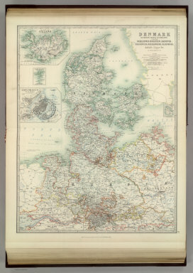
Full Title
Denmark with Northwest portion of the German Empire. ... (with) Island of Iceland. (with) Copenhagen. (with) Faroe Islands. (with) Bornholm. (with) The Elbe from Hamburg to Cuxhaven). By Keith Johnston, F.R.S.E. Keith Johnston's General Atlas. Engraved, Printed, and Published by W. & A.K. Johnston, Edinburgh & London.
Publisher
W.& A.K. Johnston
Author
Johnston, Alexander Keith
Full Title
Empire of Germany (southern portion). By Keith Johnston, F.R.S.E. Keith Johnston's General Atlas. Engraved, Printed, and Published by W. & A.K. Johnston, Edinburgh & London.
Publisher
W.& A.K. Johnston
Author
Johnston, Alexander Keith
Full Title
Empire of Germany (northern portion). (with) Environs of Berlin & Potsdam. The Kingdom of Prussia is Coloured Red. By Keith Johnston, F.R.S.E. Keith Johnston's General Atlas. Engraved, Printed, and Published by W. & A.K. Johnston, Edinburgh & London.
Publisher
W.& A.K. Johnston
Author
Moll, Herman, d. 1732
Full Title
Germany. Divided into circles. Agreeable to modern history. By H. Moll Geographer. (Printed and sold by T. Bowles next ye Chapter House in St. Pauls Church yard, & I. Bowles at ye Black Horse in Cornhill, 1736?)
Publisher
Thos. Bowles and John Bowles
Author
Moll, Herman, d. 1732
Full Title
The north west part of Germany. Containing ye dominions of the Electors of Brunswick, Lunenburg and Cologne, with Westphalia, and the Dutchy of Holstein, Iuliers &c. The Landgraviat of Hessen Cassel, Bishopricks of Munster & Osnabrug &c. Agreeable to modern history. By H. Moll Geographer. (Printed and sold by T. Bowles next ye Chapter House in St. Pauls Church yard, & I. Bowles at ye Black Horse in Cornhill, 1736?)
Publisher
Thos. Bowles and John Bowles
Author
Moll, Herman, d. 1732
Full Title
The N.E. part of Germany. Containing ye dominions of the Electors of Brandenburg and Saxony, the Dutchy of Meklenburg, Pomerania and Silesia &c. By H. Moll Geographer. (Printed and sold by T. Bowles next ye Chapter House in St. Pauls Church yard, & I. Bowles at ye Black Horse in Cornhill, 1736?)
Publisher
Thos. Bowles and John Bowles
Author
Moll, Herman, d. 1732
Full Title
The south west part of Germany. Containing ye dominions of ye Archbishops and Electors of Mentz & Treves; and of ye Elec: Palatine of ye Rhine; with Franconia, Swabia, Alsace and ye Dutchy of Lorrain &c. By H. Moll Geographer. (Printed and sold by T. Bowles next ye Chapter House in St. Pauls Church yard, & I. Bowles at ye Black Horse in Cornhill, 1736?)
Publisher
Thos. Bowles and John Bowles
Author
Moll, Herman, d. 1732
Full Title
The south east part of Germany. Containing ye dominions of the Elector of Bavaria, the Archbishop: of Saltzburg, and the estates of ye House of Austria, viz Bohemia, Moravia, Austria, Styria, Carinthia, Carniola, the Bishop: of Brixen, Trent, and ye County of Tirol &c. By H. Moll Geogr. (Printed and sold by T. Bowles next ye Chapter House in St. Pauls Church yard, & I. Bowles at ye Black Horse in Cornhill, 1736?)
Publisher
Thos. Bowles and John Bowles
Author
Mitchell, Samuel Augustus Jr.
Full Title
Prussia, and the German States. Copyright by S. Augustus Mitchell 1884.
Publisher
Wm. M. Bradley & Bro.
Author
Mitchell, Samuel Augustus
Full Title
A New Map of Germany. By J.H. Young. J.L. Hazzard, Sc. Entered according to Act of Congress in the year 1856 by Charles Desilver in the Clerk's office if the District Court of the Eastern District of Pennsylvania. 55.
Publisher
Charles Desilver.
Author
Delarochette, Louis Stanislas d'Arcy
Full Title
Map of the Empire of Germany, including all the states comprehended under that name: with the Kingdom of Prussia, &c. (Northern section). By L. Delarochette. (T. Kitchin, sculpt.) London, printed for Robt. Sayer, Map & Print Seller, opposite Fetter Lane in Fleet Street, (1790?)
Publisher
Robert Sayer
Author
Delarochette, Louis Stanislas d'Arcy
Full Title
(Map of the Empire of Germany, including all the states comprehended under that name: with the Kingdom of Prussia, &c. Southern section. By L. Delarochette). T. Kitchin, sculpt. (London, printed for Robt. Sayer, Map & Print Seller, opposite Fetter Lane in Fleet Street, 1790?)
Publisher
Robert Sayer
Author
[Schrader, Vivien St Martin, L.]
Full Title
Allemagne, Pologne, Tchecoslovaquie. Carte 29. Dessine par T. Weinreb, la montgne par F. Prudent. Imp. Dufrenoy 2-35. Librarie Hachette. Grave par E. Delaune, la lettre par Er. Dumas-Vorxet .
Publisher
Librairie Hachette
Author
[Schrader, Vivien St Martin, L.]
Full Title
Allemagne du N.O. Carte 30. Dresse par G. Bagge. Imp. Dufrenoy 12-35. Librarie Hachette. Grave par E. Delaune, la lettre par F. Lefevre.
Publisher
Librairie Hachette
Author
[Schrader, Vivien St Martin, L.]
Full Title
Allemagne du Sud, Autriche. Carte 31. Dresse par G. Bagge et D. Aitoff. Imp. Dufrenoy 3-35. Librarie Hachette. Grave par E. Delaune, la lettre par E. Dumas Vorxet.
Publisher
Librairie Hachette
Author
Tanner, Henry S.
Full Title
Germany. Engraved by J. & W.W. Warr. Philadelphia: Published by Carey & Hart. (above neat line) Tanner's Universal Atlas.
Publisher
Carey and Hart
Author
Pinkerton, John, 1758-1826
Full Title
Prussian Dominions. Drawn under the direction of Mr. Pinkerton by L. Hebert. Neele sculpt. 352 Strand. London: published August 1st. 1810, by Cadell & Davies, Strand & Longman, Hurst, Rees, Orme, & Brown, Pater Noster Row.
Publisher
[Cadell and Davies, Longman, Hurst, Rees, Orme, and Brown]
Author
Johnston, Alexander Keith
Full Title
Empire of Germany (northern portion). (with) Environs of Berlin & Potsdam. The Kingdom of Prussia is Coloured Red. By Keith Johnston, F.R.S.E. Keith Johnston's General Atlas. Engraved, Printed, and Published by W. & A.K. Johnston, Edinburgh & London.
Publisher
W.& A.K. Johnston
Author
Vivien de St Martin, L.
Full Title
Carte Generale du Royaume de Prusse et sont comprises Toutes ses nouvelles acquisitions sur le Rohin. Par L. Vivien, Geographe. Grave par Giraldon Bovinet. 1824. A Paris. Chez Menard et Desenne, Rue Git le Coeur, No. 8.
Publisher
Vivien de St Martin, L.
Author
Vivien de St Martin, L.
Full Title
Carte Generale des Etats composant La Confederation Germanique, avec leurs Divisions determinees d'apres les derniers Traites. Par L. Vivien, Geographe. Grave par Giraldon Bovinet. 1824. A Paris. Chez Menard et Desenne, Rue Git le Coeur, No. 8. 1ere Feuille.
Publisher
Vivien de St Martin, L.
Author
Vivien de St Martin, L.
Full Title
Carte Generale des Etats composant La Confederation Germanique, avec leurs Divisions determinees d'apres les derniers Traites. Par L. Vivien, Geographe. Grave par Giraldon Bovinet. 1824. A Paris. Chez Menard et Desenne, Rue Git le Coeur, No. 8. 2eme Feuille.
Publisher
Vivien de St Martin, L.
Author
Vivien de St Martin, L.
Full Title
(Composite of) Carte Generale des Etats composant La Confederation Germanique, avec leurs Divisions determinees d'apres les derniers Traites. Par L. Vivien, Geographe. Grave par Giraldon Bovinet. 1824. A Paris. Chez Menard et Desenne, Rue Git le Coeur, No. 8.
Publisher
Vivien de St Martin, L.
Author
Pinkerton, John, 1758-1826
Full Title
Germany north of the Mayn. Drawn under the direction of Mr. Pinkerton by L. Hebert. Neele sculpt. 352 Strand. London: published 1st Augst. 1810 by Cadell & Davies, Strand & Longman, Hurst, Rees, Orme, & Brown, Paternoster Row.
Publisher
[Cadell and Davies, Longman, Hurst, Rees, Orme, and Brown]
Author
Pinkerton, John, 1758-1826
Full Title
Germany south of the Mayn. Drawn by L. Hebert under the direction of Mr. Pinkerton. Neele sculpt. 352 Strand. London: published 4th. June 1811, by Cadell & Davies, Strand & Longman, Hurst, Rees, Orme, & Brown, Pater-Noster Row.
Publisher
[Cadell and Davies, Longman, Hurst, Rees, Orme, and Brown]
Full Title
Prussia, and the German States. Copyright 1886 by Wm. M. Bradley & Bro.
Publisher
Wm. M. Bradley & Bro.
Author
Jouvet et Cie.
Full Title
Europe Centrale (Partie Occidentale). Atlas St. Cyr. Furne, Jouvet et Cie. Editeurs. Imp. Lemercier et Cie. Paris. La lettre gravee par J. Geisendorfer, 12 r. de l'Abbaye, Paris. (1882)
Publisher
Jouvet et Cie
Author
Jouvet et Cie.
Full Title
Europe Centrale (Partie Centrale). Atlas St. Cyr. Fleur et Dubail. Furne, Jouvet et Cie. Editeurs. Imp. Lemercier et Cie. Paris. Grave par Erhard, 12 r. Duguay-Trouin. Corrige par J. Geisendorfer, 12 r. de l'Abbaye. (1882)
Publisher
Jouvet et Cie
Author
[Lowry, J.W., Sharpe, J.]
Full Title
Sharpe's Corresponding Maps. Prussia - Holland and the German States. London - Published by Chapman and Hall, 186 Strand, 1847. Divisional Series.
Publisher
Chapman & Hall
Author
[Black, Adam & Charles, Hall, Sidney, Hughes, William]
Full Title
Map of Central Europe embracing Germany, Holland, Belgium, France, Switzerland; showing the Roads, Canals, and Railways. By W. Hughes. Drawn & Engraved by W. Hughes; Aldine Chambers, Paternoster Row, London.
Publisher
Adam & Charles Black
Author
[Black, Adam & Charles, Hall, Sidney, Hughes, William]
Full Title
Germany. By W. Hughes. Engraved by S. Hall, Bury Strt. Bloomsbry.
Publisher
Adam & Charles Black
Author
[Black, Adam & Charles, Hall, Sidney, Hughes, William]
Full Title
Prussia. Edinburgh, Published by A. &. C. Black. Engraved by S. Hall, Bury Strt. Bloomsbry.
Publisher
Adam & Charles Black
Author
Johnston, W. & A.K.
Full Title
Empire of Germany (northern portion). (with) Environs of Berlin & Potsdam. The Kingdom of Prussia is Coloured Red. Keith Johnston's General Atlas. June 1910. Engraved, Printed, and Published by W. & A.K. Johnston, Limited, Edinburgh & London.
Publisher
W.& A.K. Johnston
Author
Johnston, W. & A.K.
Full Title
Empire of Germany (southern portion). (with) Frankfurt. (with) Munich. Keith Johnston's General Atlas. Feb. 1912. Engraved, Printed, and Published by W. & A.K. Johnston, Limited, Edinburgh & London.
Publisher
W.& A.K. Johnston
Author
Johnston, W. & A.K.
Full Title
Denmark with Northwest portion of the German Empire. ... (with) Island of Iceland. (with) Copenhagen. (with) (Environs of) Copenhagen. (with) Faroe Islands. (with) Bornholm. (with) The Elbe from Hamburg to Cuxhaven). (with) Kaiser Wilhelm Canal. Keith Johnston's General Atlas. Oct. 1911. Engraved, Printed, and Published by W. & A.K. Johnston, Limited, Edinburgh & London.
Publisher
W.& A.K. Johnston
Author
[Martin, R.M., Tallis, J. & F.]
Full Title
Germany. The Illustrations by N. Whittock & Engraved by J. Rogers. The Map Drawn & Engraved by J. Rapkin.
Publisher
J. & F. Tallis
Author
[Colton, G.W., Fisher, Richard Swainson]
Full Title
Germany.
Publisher
J.H. Colton
Author
Finley, Anthony
Full Title
Germany. Young & Delleker Sc. Published by A. Finley Philada.
Publisher
Anthony Finley
Author
Johnson, A.J.
Full Title
Johnson's Empire of Germany. Published by Alvin J. Johnson & Co., New York. Johnson's Switzerland. Published by A. J. Johnson, New York. 97. 98. Entered according to the Act of Congress, in the year 1866, by A.J. Johnson in the Clerk's Office of the District Court of the United States for the Southern District of New York.
Publisher
Alvin J. Johnson & Co.
Author
Johnson, A.J.
Full Title
Johnson's Sweden and Norway. Published by Alvin J. Johnson & Co., New York. Johnson's Denmark with Sleswick (Schleswig) & Holstein. Published by Alvin J. Johnson & Co., New York. 99. 100. Entered according to the Act of Congress, in the year 1865, by A.J. Johnson in the Clerk's Office of the District Court of the United States for the Southern District of New York.
Publisher
Alvin J. Johnson & Co.
Author
Carey, Mathew
Full Title
Germany.
Publisher
M. Carey and Son
Author
[Gray, Frank Arnold, Gray, Ormando Willis]
Full Title
Germany, Austria, and Switzerland. Drawn by F.A. Gray. Engraved by J.M. Atwood.
Publisher
O.W. Gray & Son
Author
USSR (Union of Soviet Socialist Republics).
Full Title
67-68. North-East France, Belgium, Luxemburg. The World Atlas.
Publisher
USSR
Author
USSR (Union of Soviet Socialist Republics).
Full Title
79-80. Europe, Central. The World Atlas.
Publisher
USSR
|