Who What Where WhenREMOVE |
Author
[Bartholomew, J. G. (John George), 1860-1920, John Bartholomew & Co.]
Full Title
Maritime Provinces & Newfoundland. (with) Halifax. The Edinburgh Geographical Institute, John Bartholomew & Co. "The Times" atlas. (London: The Times, 1922)
Publisher
The Times
Author
[Bartholomew, J. G. (John George), 1860-1920, John Bartholomew and Son]
Full Title
Ontario & Quebec. The Edinburgh Geographical Institute, John Bartholomew & Son, Ltd. "The Times" atlas. (London: The Times, 1922)
Publisher
The Times
Author
[Bartholomew, J. G. (John George), 1860-1920, John Bartholomew and Son]
Full Title
Manitoba & North-west Ontario. The Edinburgh Geographical Institute, John Bartholomew & Son, Ltd. "The Times" atlas. (London: The Times, 1922)
Publisher
The Times
Author
[Bartholomew, J. G. (John George), 1860-1920, John Bartholomew and Son]
Full Title
Alberta & Saskatchewan. The Edinburgh Geographical Institute, John Bartholomew & Son, Ltd. "The Times" atlas. (London: The Times, 1922)
Publisher
The Times
Author
[Bartholomew, J. G. (John George), 1860-1920, John Bartholomew and Son]
Full Title
British Columbia. (with Vancouver Region). The Edinburgh Geographical Institute, John Bartholomew & Son, Ltd. "The Times" atlas. (London: The Times, 1922)
Publisher
The Times
Author
[Bartholomew, J. G. (John George), 1860-1920, John Bartholomew & Co.]
Full Title
United States - eastern section. (with Niagara Falls Region). (with) Density of population. The Edinburgh Geographical Institute, John Bartholomew & Co. "The Times" atlas. (London: The Times, 1922)
Publisher
The Times
Author
[Bartholomew, J. G. (John George), 1860-1920, John Bartholomew & Co.]
Full Title
United States - central section. The Edinburgh Geographical Institute, John Bartholomew & Co. "The Times" atlas. (London: The Times, 1922)
Publisher
The Times
Author
[Bartholomew, J. G. (John George), 1860-1920, John Bartholomew & Co.]
Full Title
United States - western section. (with) The Yosemite Valley. The Edinburgh Geographical Institute, John Bartholomew & Co. "The Times" atlas. (London: The Times, 1922)
Publisher
The Times
Author
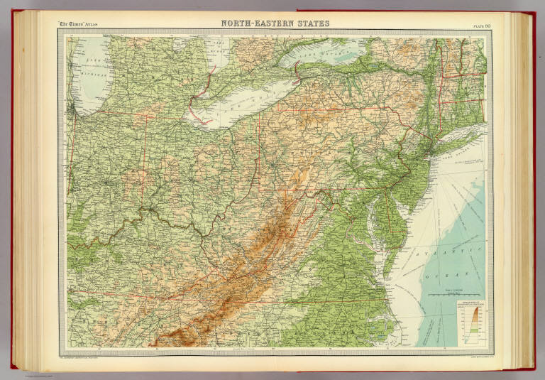
[Bartholomew, J. G. (John George), 1860-1920, John Bartholomew & Co.]
Full Title
North-eastern states. The Edinburgh Geographical Institute, John Bartholomew & Co. "The Times" atlas. (London: The Times, 1922)
Publisher
The Times
Author
[Bartholomew, J. G. (John George), 1860-1920, John Bartholomew & Co.]
Full Title
American cities on uniform scale. The Edinburgh Geographical Institute, John Bartholomew & Co. "The Times" atlas. (London: The Times, 1922)
Publisher
The Times
Author
[Bartholomew, J. G. (John George), 1860-1920, John Bartholomew and Son]
Full Title
South America - southern section. (with) Valparaiso. (with Rio de Janeiro Region). (with) Montevideo. (with Buenos Aires Region). The Edinburgh Geographical Institute, John Bartholomew & Son, Ltd. "The Times" atlas. (London: The Times, 1922)
Publisher
The Times
Author
[Bartholomew, J. G. (John George), 1860-1920, John Bartholomew & Co.]
Full Title
Argentina, Chile, &c. The Edinburgh Geographical Institute, John Bartholomew & Co. "The Times" atlas. (London: The Times, 1922)
Publisher
The Times
Author
[Bartholomew, J. G. (John George), 1860-1920, John Bartholomew and Son]
Full Title
South Pacific Ocean on Mercators projection. The Edinburgh Geographical Institute, John Bartholomew & Son, Ltd. "The Times" atlas. (London: The Times, 1922)
Publisher
The Times
Author
[Bartholomew, J. G. (John George), 1860-1920, John Bartholomew & Co.]
Full Title
North Pacific Ocean on Mercators projection. The Edinburgh Geographical Institute, John Bartholomew & Co. "The Times" atlas. (London: The Times, 1922)
Publisher
The Times
Author
[Bartholomew, J. G. (John George), 1860-1920, John Bartholomew & Co.]
Full Title
Australia - political. (with) Prevailing vegetation. (with) January rainfall. (with) July rainfall. (with) Density of population. The Edinburgh Geographical Institute, John Bartholomew & Co. "The Times" atlas. (London: The Times, 1922)
Publisher
The Times
Author
[Bartholomew, J. G. (John George), 1860-1920, John Bartholomew & Co.]
Full Title
Australia - western section. (with Perth Region). (with Albany Region). The Edinburgh Geographical Institute, John Bartholomew & Co. "The Times" atlas. (London: The Times, 1922)
Publisher
The Times
Author
[Bartholomew, J. G. (John George), 1860-1920, John Bartholomew & Co.]
Full Title
Australia - eastern section. The Edinburgh Geographical Institute, John Bartholomew & Co. "The Times" atlas. (London: The Times, 1922)
Publisher
The Times
Author
[Bartholomew, J. G. (John George), 1860-1920, John Bartholomew & Co.]
Full Title
Victoria & Tasmania. (with) Melbourne. (with Melbourne Region). (with Hobart Region). The Edinburgh Geographical Institute, John Bartholomew & Co. "The Times" atlas. (London: The Times, 1922)
Publisher
The Times
Author
[Bartholomew, J. G. (John George), 1860-1920, John Bartholomew & Co.]
Full Title
New South Wales. (with Commonwealth Territory). (with Sydney Region). The Edinburgh Geographical Institute, John Bartholomew & Co. "The Times" atlas. (London: The Times, 1922)
Publisher
The Times
Author
[Bartholomew, J. G. (John George), 1860-1920, John Bartholomew & Co.]
Full Title
Eastern Queensland. (with Brisbane Region). The Edinburgh Geographical Institute, John Bartholomew & Co. "The Times" atlas. (London: The Times, 1922)
Publisher
The Times
Author
[Bartholomew, J. G. (John George), 1860-1920, John Bartholomew & Co.]
Full Title
South Australia. (with Adelaide Region). The Edinburgh Geographical Institute, John Bartholomew & Co. "The Times" atlas. (London: The Times, 1922)
Publisher
The Times
Author
Mitchell, Samuel Augustus
Full Title
Map of Oregon, Washington, Idaho, and part of Montana. Entered ... 1879 by S. Augustus Mitchell ... Washington. (1880)
Publisher
S.A. Mitchell
Full Title
Territory of Idaho. 1876. (Entered ... 1879 by S. Augustus Mitchell ... Washington. 1880)
Publisher
S.A. Mitchell
Author
Mitchell, Samuel Augustus
Full Title
County map of the state of California. (with) San Francisco. (with) San Francisco Bay and vicinity. Entered ... 1879 by S. Augustus Mitchell ... Washington. (1880)
Publisher
S.A. Mitchell
Author
Mitchell, Samuel Augustus
Full Title
Northwestern America showing the territory ceded by Russia to the United States. Reduced from the map published by the U.S.C.S. Dept. Entered ... 1879 by S. Augustus Mitchell ... Washington. (1880)
Publisher
S.A. Mitchell
Author
Mitchell, Samuel Augustus
Full Title
Map of Mexico, Central America, and the West Indies. (with) Map of the Sandwich Islands. Discovered by Captn. Cook in 1778. (with) Map of the island of Jamaica. (with) Map of the Bermuda Islands. (with) Map of the Panama Railroad. Entered ... 1879 by S. Augustus Mitchell ... Washington. (1880)
Publisher
S.A. Mitchell
Author
Mitchell, Samuel Augustus
Full Title
Cuba. Entered ... 1879 by S. Augustus Mitchell ... Washington. (1880)
Publisher
S.A. Mitchell
Author
[Mitchell, Samuel Augustus, Williams, W. (Wellington)]
Full Title
Map of South America, showing its political divisions. (with) Map showing the proposed Atrato-Inter-Oceanic Canal routes, for connecting the Atlantic and Pacific oceans. Constructed and engraved by W. Williams, Philadelphia. Entered ... 1879 by S. Augustus Mitchell ... Washington. (1880)
Publisher
S.A. Mitchell
Author
Mitchell, Samuel Augustus
Full Title
Map of New Granada, Venezuela and Guiana. (with) Map of Peru, and Equador. (with) Map of the Argentine Confederation. Entered ... 1879 by S. Augustus Mitchell ... Washington. (1880)
Publisher
S.A. Mitchell
Author
Mitchell, Samuel Augustus
Full Title
Map of Brazil, Bolivia, Paraguay, and Uruguay. (with) Map of Chili. (with) Harbor of Bahia. (with) Harbor of Rio Janeiro. (with) Island of Juan Fernandez. Entered ... 1879 by S. Augustus Mitchell ... Washington. (1880)
Publisher
S.A. Mitchell
Author
[Mitchell, Samuel Augustus, Williams, W. (Wellington)]
Full Title
Map of Europe, showing its gt. political divisions. Constructed & engraved by W. Williams, Phila. Entered ... 1879 by S. Augustus Mitchell ... Washington. (1880)
Publisher
S.A. Mitchell
Author
Mitchell, Samuel Augustus
Full Title
County map of England, and Wales. Entered ... 1879 by S. Augustus Mitchell ... Washington. (1880)
Publisher
S.A. Mitchell
Author
Mitchell, Samuel Augustus
Full Title
Ireland in provinces and counties. County map of Scotland. (with) Shetland Islands. Entered ... 1879 by S. Augustus Mitchell ... Washington. (1880)
Publisher
S.A. Mitchell
Author
Mitchell, Samuel Augustus
Full Title
Map of France, Spain, and Portugal. (with) Switzerland in cantons. (with) Island of Corsica. Drawn & engraved by W.H. Gamble. Entered ... 1879 by S. Augustus Mitchell ... Washington. (1880)
Publisher
S.A. Mitchell
Author
Mitchell, Samuel Augustus
Full Title
Russia in Europe, Sweden, and Norway. (with) Map of Denmark. (with) Map of Holland and Belgium. Entered ... 1879 by S. Augustus Mitchell ... Washington. (1880)
Publisher
S.A. Mitchell
Author
Mitchell, Samuel Augustus
Full Title
Prussia and the German States. Entered ... 1879 by S. Augustus Mitchell ... Washington. (1880)
Publisher
S.A. Mitchell
Author
Mitchell, Samuel Augustus
Full Title
Map of the Austrian Empire, Italian States, Turkey in Europe, and Greece. (with) Maltese Islands. Entered ... 1879 by S. Augustus Mitchell ... Washington. (1880)
Publisher
S.A. Mitchell
Full Title
Map of Turkey in Europe. Illustrating the Berlin Congress Treaty, July, 1878. (with) A map showing the relation of Cyprus to the adjacent coasts. (with) Map of Armenia to illustrate articles 58, 59, 60 of the Treaty of Berlin. (By S. Augustus Mitchell. 1880)
Publisher
S.A. Mitchell
Author
[Mitchell, Samuel Augustus, Williams, W. (Wellington)]
Full Title
Map of Asia showing its gt. political divisions, and also the various routes of travel between London & India, China & Japan &c. Constructed & engraved by W. Williams, Phila. Entered ... 1879 by S. Augustus Mitchell ... Washington. (1880)
Publisher
S.A. Mitchell
Author
Mitchell, Samuel Augustus
Full Title
Map of Persia, Arabia, Turkey in Asia, Afghanistan, Beloochistan. Entered ... 1879 by S. Augustus Mitchell ... Washington. (1880)
Publisher
S.A. Mitchell
Author
[Gamble, William H., Mitchell, Samuel Augustus]
Full Title
A new map of Palestine or the Holy Land. (with) Modern Jerusalem. Drawn and engraved by W.H. Gamble, Philada. Entered ... 1879 by S. Augustus Mitchell ... Washington. (1880)
Publisher
S.A. Mitchell
Author
[Mitchell, Samuel Augustus, Williams, W. (Wellington)]
Full Title
Map of Hindoostan, Farther India, China, and Tibet. Constructed & engraved by W. Williams, Phila. Entered ... 1879 by S. Augustus Mitchell ... Washington. (1880)
Publisher
S.A. Mitchell
Author
Mitchell, Samuel Augustus
Full Title
Map of Oceanica, exhibiting its various divisions, island groups &c. (with) Map of the Sandwich Islands. Entered ... 1879 by S. Augustus Mitchell ... Washington. (1880)
Publisher
S.A. Mitchell
Author
[Mitchell, Samuel Augustus, Williams, W. (Wellington)]
Full Title
Map of Africa, showing its most recent discoveries. (with) Island of St. Helena. Constructed & engraved by W. Williams, Philadelphia. Entered ... 1879 by S. Augustus Mitchell ... Washington. (1880)
Publisher
S.A. Mitchell
Author
[Arrowsmith, John, Stanford, Edward]
Full Title
Africa, by J. Arrowsmith. London: Edward Stanford, 55 Charing Cross S.W., Jan. 1st 1878. (1880)
Publisher
S.A. Mitchell
Author
Mitchell, Samuel Augustus
Full Title
Map of the Roman Empire in its greatest extent. (with) Ancient Greece. (By S. Augustus Mitchell. 1880)
Publisher
S.A. Mitchell
Author
Mitchell, Samuel Augustus
Full Title
Palestine under the judges and kings with the distribution of the twelve tribes. The routes of the Israelites from Egypt through the desert, Canaan at the time of the conquest. (with) Environs of Jerusalem. (with) Mountains of Sinai. (By S. Augustus Mitchell. 1880)
Publisher
S.A. Mitchell
Full Title
Western Hemisphere. Copyright 1887 by Wm. M. Bradley & Bro. (1890)
Publisher
John Y. Huber & Co.
Full Title
Eastern Hemisphere. Copyright 1887 by Wm. M. Bradley & Bro. (1890)
Publisher
John Y. Huber & Co.
|