Who What Where WhenWHEREShow More |
Author
Beers, F. W. (Frederick W.)
Full Title
Haddonfield, Camden Co., N.J. Gloucester City, Camden Co., N.J. Burlington City, Burlington Co., N.J. Beverly, Burlington Co., N.J. May's Landing, Atlantic Co., N.J. (1872)
Publisher
Beers, Comstock & Cline
Author
Beers, F. W. (Frederick W.)
Full Title
Topographical map of Salem Co., New Jersey. (1872)
Publisher
Beers, Comstock & Cline
Author
Beers, F. W. (Frederick W.)
Full Title
Cape May City, Cape May Co., Salem, Salem Co., N.J. Vineland, Cumberland Co., N.J. N.J. Millville, Cumberland Co., N.J. Bridgeton, Cumberland Co., N.J. (1872)
Publisher
Beers, Comstock & Cline
Author
Beers, F. W. (Frederick W.)
Full Title
Topographical map of Cumberland Co., New Jersey. (1872)
Publisher
Beers, Comstock & Cline
Author
Beers, F. W. (Frederick W.)
Full Title
Topographical map of Cape May Co., New Jersey. (1872)
Publisher
Beers, Comstock & Cline
Author
Beers, F. W. (Frederick W.)
Full Title
Map of Philadelphia. (1872)
Publisher
Beers, Comstock & Cline
Author
Andreas, A. T. (Alfred Theodore), 1839-1900
Full Title
Sectional Map of Illinois ... 1872.
Publisher
Andreas, Lyter & Co.
Author
Andreas, A. T. (Alfred Theodore), 1839-1900
Full Title
Adams County.
Publisher
Andreas, Lyter & Co.
Author
Andreas, A. T. (Alfred Theodore), 1839-1900
Full Title
Map of Northeast Township.
Publisher
Andreas, Lyter & Co.
Author
Andreas, A. T. (Alfred Theodore), 1839-1900
Full Title
Map of Houston Township.
Publisher
Andreas, Lyter & Co.
Author
Andreas, A. T. (Alfred Theodore), 1839-1900
Full Title
Map of Keene Township.
Publisher
Andreas, Lyter & Co.
Author
Andreas, A. T. (Alfred Theodore), 1839-1900
Full Title
Map of Lima Township.
Publisher
Andreas, Lyter & Co.
Author
Andreas, A. T. (Alfred Theodore), 1839-1900
Full Title
Map of Ursa Township. Map of Mendon Township.
Publisher
Andreas, Lyter & Co.
Author
Andreas, A. T. (Alfred Theodore), 1839-1900
Full Title
Map of Honey Creek Township.
Publisher
Andreas, Lyter & Co.
Author
Andreas, A. T. (Alfred Theodore), 1839-1900
Full Title
Map of Camp Point Township.
Publisher
Andreas, Lyter & Co.
Author
Andreas, A. T. (Alfred Theodore), 1839-1900
Full Title
Map of Camp Point, Camp Point Township. (View) Residence of Origen Wallace.
Publisher
Andreas, Lyter & Co.
Author
Andreas, A. T. (Alfred Theodore), 1839-1900
Full Title
Map of Clayton Township.
Publisher
Andreas, Lyter & Co.
Author
Andreas, A. T. (Alfred Theodore), 1839-1900
Full Title
Map of Clayton. Map of Loraine. Map of Mendon. Map of New Liberty (Liberty). Map of Marcelline.
Publisher
Andreas, Lyter & Co.
Author
Andreas, A. T. (Alfred Theodore), 1839-1900
Full Title
Map of Concord Township.
Publisher
Andreas, Lyter & Co.
Author
Andreas, A. T. (Alfred Theodore), 1839-1900
Full Title
Map of Columbus Township.
Publisher
Andreas, Lyter & Co.
Author
Andreas, A. T. (Alfred Theodore), 1839-1900
Full Title
Map of Burton. Map of Columbus. Map of Laprairie.
Publisher
Andreas, Lyter & Co.
Author
Andreas, A. T. (Alfred Theodore), 1839-1900
Full Title
Map of Gilmer Township.
Publisher
Andreas, Lyter & Co.
Author
Andreas, A. T. (Alfred Theodore), 1839-1900
Full Title
Map of Ellington Township. (inset) Map of Bloomfield.
Publisher
Andreas, Lyter & Co.
Author
Andreas, A. T. (Alfred Theodore), 1839-1900
Full Title
Map of Quincy.
Publisher
Andreas, Lyter & Co.
Author
Andreas, A. T. (Alfred Theodore), 1839-1900
Full Title
Quincy Original and Parts of Its Additions.
Publisher
Andreas, Lyter & Co.
Author
Andreas, A. T. (Alfred Theodore), 1839-1900
Full Title
Map of Melrose Township. Map of Beverly. Map of Kingston.
Publisher
Andreas, Lyter & Co.
Author
Andreas, A. T. (Alfred Theodore), 1839-1900
Full Title
Map of Burton Township.
Publisher
Andreas, Lyter & Co.
Author
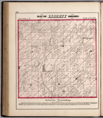
Andreas, A. T. (Alfred Theodore), 1839-1900
Full Title
(View) Map of Liberty Township.
Publisher
Andreas, Lyter & Co.
Author
Andreas, A. T. (Alfred Theodore), 1839-1900
Full Title
Map of McKee Township.
Publisher
Andreas, Lyter & Co.
Author
Andreas, A. T. (Alfred Theodore), 1839-1900
Full Title
Map of Beverly Township.
Publisher
Andreas, Lyter & Co.
Author
Andreas, A. T. (Alfred Theodore), 1839-1900
Full Title
Map of Richfield Township.
Publisher
Andreas, Lyter & Co.
Author
Andreas, A. T. (Alfred Theodore), 1839-1900
Full Title
Map of Payson Township.
Publisher
Andreas, Lyter & Co.
Author
Andreas, A. T. (Alfred Theodore), 1839-1900
Full Title
Map of Payson. Map of Keokuk Junction. Map of Fowler.
Publisher
Andreas, Lyter & Co.
Author
Andreas, A. T. (Alfred Theodore), 1839-1900
Full Title
Map of Coatsburg. Map of Houston. Map of Paloma. Map of Lima. (View) Residence of E. Seymour.
Publisher
Andreas, Lyter & Co.
Author
Andreas, A. T. (Alfred Theodore), 1839-1900
Full Title
Map of Fall Creek Township. Map of Millville. Map of Newtown, Map of Planeville.
Publisher
Andreas, Lyter & Co.
Author
[California Geological Survey, Whitney, J.D.]
Full Title
Map of the Routes from San Francisco to the Yosemite Valley. Prepared to accompany the pocket edition of the Yosemite Guide Book. (State Geol. Survey). 1872.
Publisher
University Press
Author
[California Geological Survey, Whitney, J.D.]
Full Title
Map of the Yosemite Valley, prepared to accompany the pocket edition of the Yosemite Guide Book. (State Geologl. Survey). 1872.
Publisher
University Press
Author
[California Geological Survey, Whitney, J.D.]
Full Title
Map of the Routes from San Francisco to the Yosemite Valley. Prepared to accompany the pocket edition of the Yosemite Guide Book. (State Geol. Survey). 1872.
Publisher
University Press
Author
Wheeler, G.M.
Full Title
Parts Of Eastern And Southern Nevada And Southern Utah, Atlas Sheet No. 58. The Graphic Co. Photo-Lith. 39 & 41 Park Place N.Y. Weyss, Herman & Aguirre Del. Expeditions Of 1869, 1871 & 1872 Under the Command of 1st. Lieut. Geo. M. Wheeler, Corps of Engineers. Geographical Explorations & Surveys West Of The 100th Meridian.
Publisher
U.S.
Author
Wheeler, G.M.
Full Title
Parts Of Eastern & Southern Nevada And Southwestern Utah. Atlas Sheet No. 58. Weyss, Herman & Aguirre Del. Expeditions of 1869, 1871 & 1872 Under the Command of 1st. Lieut. Geo. M. Wheeler, Corps of Engineers, U.S. Army. Explorations & Surveys West Of The One-Hundredth Meridian.
Publisher
U.S.
Author
Wheeler, G.M.
Full Title
Parts Of Eastern & Southeastern Nevada & Southwestern Utah. Atlas Sheet Number 66. Weyss, Herman & Aguirre, Del's. Expeditions of 1869, 1871, 1872. 1st. Lieut. Geo. M. Wheeler, Corps of Engineers, Com'd'g. Explorations & Surveys West Of The One-Hundredth Meridian.
Publisher
U.S.
Author
Wheeler, G.M.
Full Title
Parts Of Eastern Nevada And Western Utah, Atlas Sheet No. 49. The Graphic Co. Photo-Lith. 39 & 41 Park Place, N.Y. Weyss, Herman & Lang Del. Expeditions Of 1869 & 1872 Under the Command of 1st Lieut. Geo. M. Wheeler, Corps of Engineers. Geographical Explorations & Surveys West Of The 100th Meridian.
Publisher
U.S.
Author
Wheeler, G.M.
Full Title
Parts Of Eastern Nevada And Western Utah, Atlas Sheet No. 49. Weyss, Herman & Lang Del. Expeditions Of 1869 & 1872 Under the Command of 1st Lieut. Geo. M. Wheeler, Corps of Engineers, U.S. Army. U.S. Geographical Surveys West Of The 100th Meridian.
Publisher
U.S.
Author
[Stieler, Adolf, Vogel, C.]
Full Title
Stieler's Hand-Atlas ... No. 20. Nord-Ostliches Deutschland.
Publisher
Justus Perthes
Author
[Stieler, Adolf, Vogel, C.]
Full Title
Stieler's Hand-Atlas ... No. 24. Sud-westliches Deutschland und die Schweiz.
Publisher
Justus Perthes
Author
[Berghaus, Hermann, Stieler, Adolf]
Full Title
Stieler's Hand-Atlas ... No. 25. Sud-Ostliches Deutschland ... Italien.
Publisher
Justus Perthes
Author
[Stieler, Adolf, Vogel, C.]
Full Title
Stieler's Hand-Atlas ... No. 26. Der Osterreichisch Ungarische Monarchie. (inset) Wien.
Publisher
Justus Perthes
Author
[Stieler, Adolf, Vogel, C.]
Full Title
Stieler's Hand-Atlas ... No. 30/31. Sud-West Deutchland und Schweiz. (inset) Metz. Strassburg.
Publisher
Justus Perthes
Author
Stieler, Adolf
Full Title
Stieler's Hand-Atlas ... No. 50b. Australien.
Publisher
Justus Perthes
|