|
Full Title
County map of the states of Arkansas, Mississippi and Louisiana. Copyright 1887 by Wm. M. Bradley & Bro. (1890)
Publisher
John Y. Huber & Co.
Full Title
Plan of New Orleans. Copyright 1887(?) by Wm. M. Bradley & Bro. (1890)
Publisher
John Y. Huber & Co.
Full Title
County map of the state of Texas. Showing also portions of the adjoining states and territories. (with) Plan of Galveston and vicinity. Copyright 1887 by Wm. M. Bradley & Bro. (1890)
Publisher
John Y. Huber & Co.
Full Title
County & township map of the states (sic) of Ohio and (sic). Copyright 1887 by Wm. M. Bradley & Bro. (1890)
Publisher
John Y. Huber & Co.
Full Title
Indiana. Copyright 1887 by Wm. M. Bradley & Bro. (1890)
Publisher
John Y. Huber & Co.
Full Title
Plan of Cincinnati and vicinity. Copyright 1887 by Wm. M. Bradley & Bro. (1890)
Publisher
John Y. Huber & Co.
Full Title
County & township map of the state of Illinois. (with) Chicago and vicinity. Copyright 1887 by Wm. M. Bradley & Bro. (1890)
Publisher
John Y. Huber & Co.
Full Title
Chicago. Copyright 1887 by Wm. M. Bradley & Bro. (1890)
Publisher
John Y. Huber & Co.
Full Title
St. Louis. Copyright 1887 by Wm. M. Bradley & Bro. (1890)
Publisher
John Y. Huber & Co.
Full Title
County & township map of the states of Iowa and Missouri. Drawn & engraved by W.H. Gamble, Philadelphia. Copyright 1887 by Wm. M. Bradley & Bro. (1890)
Publisher
John Y. Huber & Co.
Full Title
County and township map of the states of Michigan and Wisconsin. (with) Isle Royale, Michigan. Drawn and engraved by W.H. Gamble, Philadelphia. Copyright 1887 by Wm. M. Bradley & Bro. (1890)
Publisher
John Y. Huber & Co.
Full Title
Plan of the city of Detroit. Copyright 1887 by Wm. M. Bradley & Bro. (1890)
Publisher
John Y. Huber & Co.
Full Title
County map of Minnesota. Copyright 1887 by Wm. M. Bradley & Bro. (1890)
Publisher
John Y. Huber & Co.
Full Title
County & township map of the states of Kansas and Nebraska. Copyright 1887 by Wm. M. Bradley & Bro. (1890)
Publisher
John Y. Huber & Co.
Full Title
County and township map, Montana, Idaho and Wyoming. Copyright 1887 by Wm. M. Bradley & Bro. (1890)
Publisher
John Y. Huber & Co.
Full Title
County and township map of Dakota. Copyright 1887 by Wm. M. Bradley & Bro. (1890)
Publisher
John Y. Huber & Co.
Full Title
Colorado. Copyright 1887 by Wm. M. Bradley & Bro. (1890)
Publisher
John Y. Huber & Co.
Full Title
Indian Territory. Copyright 1887 by Wm. M. Bradley & Bro. (1890)
Publisher
John Y. Huber & Co.
Full Title
County and township map of Utah and Nevada. Copyright 1887 by Wm. M. Bradley & Bro. (1890)
Publisher
John Y. Huber & Co.
Full Title
County and township map of Arizona and New Mexico. Copyright 1887 by Wm. M. Bradley & Bro. (1890)
Publisher
John Y. Huber & Co.
Full Title
County and township map of Oregon and Washington. Copyright 1887 by Wm. M. Bradley & Bro. (1890)
Publisher
John Y. Huber & Co.
Full Title
County map of the state of California. (with) San Francisco. (with) San Francisco Bay and vicinity. Copyright 1886 by Wm. M. Bradley & Bro. (1890)
Publisher
John Y. Huber & Co.
Full Title
Northwestern America showing the territory ceded by Russia to the United States. Reduced from the map published by the U.S.C.S. Dept. Copyright 1887(?) by Wm. M. Bradley & Bro. (1890)
Publisher
John Y. Huber & Co.
Full Title
Map of Mexico, Central America, and the West Indies. (with) Map of the Bermuda Islands. (with) Map of the island of Jamaica. (with) Map of the proposed ship rail road route across the isthmus of Tehuantepec. (with) Map of the Panama Railroad and proposed canal. (with) Map of the proposed Nicaragua Canal route. Copyright 1887 by Wm. M. Bradley & Bro. (1890)
Publisher
John Y. Huber & Co.
Full Title
Cuba. Copyright 1888(?) by Wm. M. Bradley & Bro. (1890)
Publisher
John Y. Huber & Co.
Full Title
Map of South America, showing its political divisions. (with) Map showing the proposed Atrato-Inter-Oceanic Canal routes, for connecting the Atlantic and Pacific oceans. Copyright 1887 by Wm. M. Bradley & Bro. (1890)
Publisher
John Y. Huber & Co.
Full Title
Map of U.S. of Colombia, Venezuela and Guiana. (with) Map of Peru, and Equador. (with) Map of the Argentine Republic. Copyright 1887 by Wm. M. Bradley & Bro. (1890)
Publisher
John Y. Huber & Co.
Full Title
Map of Brazil, Bolivia, Paraguay, and Uruguay. (with) Map of Chili. (with) Harbor of Bahia. (with) Harbor of Rio Janeiro. (with) Island of Juan Fernandez. Copyright 1887 by Wm. M. Bradley & Bro. (1890)
Publisher
John Y. Huber & Co.
Author
Williams, W. (Wellington)
Full Title
Map of Europe, showing its gt. political divisions. Constructed & engraved by W. Williams, Phila. Copyright 1887 by Wm. M. Bradley & Bro. (1890)
Publisher
John Y. Huber & Co.
Full Title
County map of England, and Wales. Copyright 1887 by Wm. M. Bradley & Bro. (1890)
Publisher
John Y. Huber & Co.
Full Title
Ireland in provinces and counties. County map of Scotland. (with) Shetland Islands. Copyright 1887 by Wm. M. Bradley & Bro. (1890)
Publisher
John Y. Huber & Co.
Full Title
France. (with) Environs of Paris. (with) Switzerland in cantons. (with) Corsica. Copyright 1887 by Wm. M. Bradley & Bro. (1890)
Publisher
John Y. Huber & Co.
Full Title
Spain & Portugal. Copyright 1887 by Wm. M. Bradley & Bro. (1890)
Publisher
John Y. Huber & Co.
Full Title
Russia in Europe, Sweden, and Norway. (with) Map of Denmark. (with) Map of Holland and Belgium. Copyright 1887 by Wm. M. Bradley & Bro. (1890)
Publisher
John Y. Huber & Co.
Full Title
Prussia, and the German States. Copyright 1887 by Wm. M. Bradley & Bro. (1890)
Publisher
John Y. Huber & Co.
Full Title
Map of the Austrian Empire, Italian States, Turkey in Europe, and Greece. (with) Maltese Islands. Copyright 1887 by Wm. M. Bradley & Bro. (1890)
Publisher
John Y. Huber & Co.
Author
Williams, W. (Wellington)
Full Title
Map of Asia showing its gt. political divisions, and also various routes of travel between London & India, China & Japan &c. Constructed & engraved by W. Williams, Phila. Copyright 1887 by Wm. M. Bradley & Bro. (1890)
Publisher
John Y. Huber & Co.
Full Title
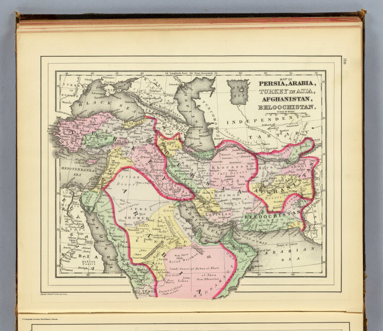
Map of Persia, Arabia, Turkey in Asia, Afghanistan, Beloochistan. Copyright 1887 by Wm. M. Bradley & Bro. (1890)
Publisher
John Y. Huber & Co.
Full Title
A new map of Palestine or the Holy Land. (with) Modern Jerusalem. Drawn and engraved by W.H. Gamble, Philada. Copyright 1887 by Wm. M. Bradley & Bro. (1890)
Publisher
John Y. Huber & Co.
Full Title
Map of Hindoostan, Farther India, China and Tibet. Copyright 1887 by Wm. M. Bradley & Bro. (1890)
Publisher
John Y. Huber & Co.
Full Title
Map of Oceanica, exhibiting its various divisions, island groups &c. (with) Map of the Sandwich Islands. Copyright 1887 by Wm. M. Bradley & Bro. (1890)
Publisher
John Y. Huber & Co.
Full Title
Africa. (with) Lower Egypt or the Delta of the Nile. (with) Island of St. Helena. Copyright 1887 by Wm. M. Bradley & Bro. (1890)
Publisher
John Y. Huber & Co.
Author
[Geological Survey (U.S.), Massachusetts. Topographical Survey Commission]
Full Title
Index map of the 54 atlas sheets of the topographical map of Mass. Published by the Commonwealth under the direction of the Commissioners. Office: Commonwealth Bldg., 11 Mt. Vernon St., Boston, Mass. Preliminary edition, 1890. Forbes Co., Boston & N.Y.
Publisher
Topographical Survey Commission
Author
[Geological Survey (U.S.), Massachusetts. Topographical Survey Commission]
Full Title
Massachusetts-New York. Berlin sheet. Preliminary edition subject to corrections. U.S. Geological Survey, J.W. Powell, Director. State of Massachusetts ... commissioners. Henry Gannett, Chief Geographer. Marcus Baker, geographer in charge. Triangulation by the U.S. Coast and Geodetic Survey and C.C. Bassett. Topography by E.W.F. Natter and C.C. Bassett. Surveyed in 1885-88. Forbes Co., Boston & N.Y. (1890)
Publisher
Topographical Survey Commission
Author
[Geological Survey (U.S.), Massachusetts. Topographical Survey Commission]
Full Title
Massachusetts-New York. Pittsfield sheet. Preliminary edition subject to corrections. U.S. Geological Survey, J.W. Powell, Director. State of Massachusetts ... commissioners. Henry Gannett, Chief Geographer. Marcus Baker, geographer in charge. Triangulation by the U.S. Coast and Geodetic Survey and C.C. Bassett. Topography by by E.W.F. Natter and C.C. Bassett. Surveyed in 1885-8. Forbes Co., Boston & N.Y. (1890)
Publisher
Topographical Survey Commission
Author
[Geological Survey (U.S.), Massachusetts. Topographical Survey Commission]
Full Title
Massachusetts-Connecticut-New York. Sheffield sheet. Preliminary edition subject to corrections. U.S. Geological Survey, J.W. Powell, Director. State of Massachusetts ... commissioners. Henry Gannett, Chief Geographer. Marcus Baker, geographer in charge. Triangulation by S. Borden and H.F. Walling. Topography by E.W.F. Natter. Surveyed in 1884-5. Forbes Co., Boston & N.Y. (1890)
Publisher
Topographical Survey Commission
Author
[Geological Survey (U.S.), Massachusetts. Topographical Survey Commission]
Full Title
Massachusetts. Greylock sheet. Preliminary edition subject to corrections. U.S. Geological Survey, J.W. Powell, Director. State of Massachusetts ... commissioners. Henry Gannett, Chief Geographer. Triangulation by the U.S. Coast and Geodetic and Borden surveys. Topography by W.D. Johnson, R.D. Cummin and W.H. Lovell. Surveyed in 1885. Forbes Co., Boston & N.Y. (1890)
Publisher
Topographical Survey Commission
Author
[Geological Survey (U.S.), Massachusetts. Topographical Survey Commission]
Full Title
Massachusetts. Becket sheet. Preliminary edition subject to corrections. U.S. Geological Survey, J.W. Powell, Director. State of Massachusetts ... commissioners. Henry Gannett, Chief Geographer. Marcus Baker, geographer in charge. Triangulation by the U.S. Coast and Geodetic and Borden surveys. Willard D. Johnson, Topographer in charge. Topography by Robert D. Cummin. Surveyed in 1886. Forbes Co., Boston & N.Y. (1890)
Publisher
Topographical Survey Commission
Author
[Geological Survey (U.S.), Massachusetts. Topographical Survey Commission]
Full Title
Massachusetts. Sandisfield sheet. Preliminary edition subject to corrections. U.S. Geological Survey, J.W. Powell, Director. State of Massachusetts ... commissioners. Henry Gannett, Chief Geographer. Marcus Baker, geographer in charge. Triangulation by the U.S. Coast and Geodetic and Borden surveys. Topography by W.H. Lovell, under direction of Willard D. Johnson, topographer. Surveyed in 1886. Forbes Co., Boston & N.Y. (1890)
Publisher
Topographical Survey Commission
Author
[Geological Survey (U.S.), Massachusetts. Topographical Survey Commission]
Full Title
Massachusetts-Vermont. Hawley sheet. Preliminary edition subject to corrections. U.S. Geological Survey, J.W. Powell, Director. State of Massachusetts ... commissioners. Henry Gannett, Chief Geographer. Marcus Baker, geographer in charge. Triangulation by Borden Survey. Topography by H.L. Smyth, W.H. Lovell and G.H. Page under direction of W.D. Johnson. Surveyed in 1886. Forbes Co., Boston & N.Y. (1890)
Publisher
Topographical Survey Commission
|