|
Full Title
Township 19 South, Township 18 South, Range 31 East, Range 32 East, Tulare Co., California. (Compiled, drawn and published by Thos. H. Thompson, Tulare, Cal. 1892)
Publisher
T.H. Thompson
Full Title
Township 20 South ... Township 18 South, Range 32 East ... Range 35 East, Tulare Co., California. (with) Map of Averill's Subdivision, Tulare County. (Compiled, drawn and published by Thos. H. Thompson, Tulare, Cal. 1892)
Publisher
T.H. Thompson
Full Title
Map of Lemoore, Tulare County. (with) Map of Rio Rey Colony, Tulare County. (with) Township 19 South, Range 19 East. (Compiled, drawn and published by Thos. H. Thompson, Tulare, Cal. 1892)
Publisher
T.H. Thompson
Full Title
Township 19 South, Range 20 East, Tulare Co., California. (Compiled, drawn and published by Thos. H. Thompson, Tulare, Cal. 1892)
Publisher
T.H. Thompson
Full Title
N.E. 1/4 T.19 S., R.20 E., Tulare Co., California. (Compiled, drawn and published by Thos. H. Thompson, Tulare, Cal. 1892)
Publisher
T.H. Thompson
Full Title
Township 19 South, Range 21 East, Tulare Co., California. (Compiled, drawn and published by Thos. H. Thompson, Tulare, Cal. 1892)
Publisher
T.H. Thompson
Full Title
Township 19 South, Range 22 East, Tulare Co., California. (Compiled, drawn and published by Thos. H. Thompson, Tulare, Cal. 1892)
Publisher
T.H. Thompson
Full Title
Township 19 South, Range 23 East, Tulare Co., California. (Compiled, drawn and published by Thos. H. Thompson, Tulare, Cal. 1892)
Publisher
T.H. Thompson
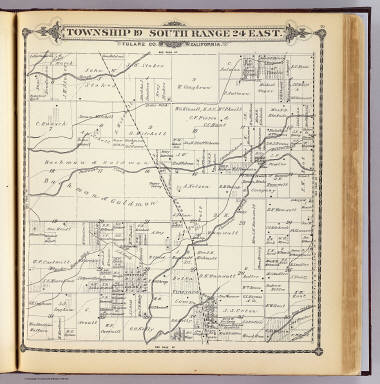
Full Title
Township 19 South, Range 24 East, Tulare Co., California. (Compiled, drawn and published by Thos. H. Thompson, Tulare, Cal. 1892)
Publisher
T.H. Thompson
Full Title
Township 19 South, Range 25 East, Tulare Co., California. (Compiled, drawn and published by Thos. H. Thompson, Tulare, Cal. 1892)
Publisher
T.H. Thompson
Full Title
Township 19 South, Range 26 East, Tulare Co., California. (Compiled, drawn and published by Thos. H. Thompson, Tulare, Cal. 1892)
Publisher
T.H. Thompson
Full Title
Township 19 South, Range 27 East, Tulare Co., California. (Compiled, drawn and published by Thos. H. Thompson, Tulare, Cal. 1892)
Publisher
T.H. Thompson
Full Title
Township 19 South, Range 28 East, Tulare Co., California. (Compiled, drawn and published by Thos. H. Thompson, Tulare, Cal. 1892)
Publisher
T.H. Thompson
Full Title
Township 20 South, Township 21 South, Range 18 East, Range 19 East, Tulare Co., California. (with) Township 21 South, Range 17 East. (Compiled, drawn and published by Thos. H. Thompson, Tulare, Cal. 1892)
Publisher
T.H. Thompson
Full Title
Township 20 South, Township 21 South, Range 20 East, Range 21 East, Tulare Co., California. (with) Map of Plano, Tulare Co. (Compiled, drawn and published by Thos. H. Thompson, Tulare, Cal. 1892)
Publisher
T.H. Thompson
Full Title
Township 20 South, Range 22 East, Tulare Co., California. (Compiled, drawn and published by Thos. H. Thompson, Tulare, Cal. 1892)
Publisher
T.H. Thompson
Full Title
Township 20 South, Range 23 East, Tulare Co., California. (Compiled, drawn and published by Thos. H. Thompson, Tulare, Cal. 1892)
Publisher
T.H. Thompson
Full Title
Township 20 South, Range 24 East, Tulare Co., California. (Compiled, drawn and published by Thos. H. Thompson, Tulare, Cal. 1892)
Publisher
T.H. Thompson
Full Title
Township 20 South, Range 25 East, Tulare Co., California. (Compiled, drawn and published by Thos. H. Thompson, Tulare, Cal. 1892)
Publisher
T.H. Thompson
Full Title
Township 20 South, Range 26 East, Tulare Co., California. (Compiled, drawn and published by Thos. H. Thompson, Tulare, Cal. 1892)
Publisher
T.H. Thompson
Full Title
Township 20 South, Range 27 East, Tulare Co., California. (Compiled, drawn and published by Thos. H. Thompson, Tulare, Cal. 1892)
Publisher
T.H. Thompson
Full Title
Township 20 South, Range 28 East, Tulare Co., California. (Compiled, drawn and published by Thos. H. Thompson, Tulare, Cal. 1892)
Publisher
T.H. Thompson
Full Title
Township 20 South, Range 29 East, Tulare Co., California. (Compiled, drawn and published by Thos. H. Thompson, Tulare, Cal. 1892)
Publisher
T.H. Thompson
Full Title
Township 21 South, Range 22 East, Tulare Co., California. (Compiled, drawn and published by Thos. H. Thompson, Tulare, Cal. 1892)
Publisher
T.H. Thompson
Full Title
Township 21 South, Range 23 East, Tulare Co., California. (Compiled, drawn and published by Thos. H. Thompson, Tulare, Cal. 1892)
Publisher
T.H. Thompson
Full Title
Township 21 South, Range 24 East, Tulare Co., California. (Compiled, drawn and published by Thos. H. Thompson, Tulare, Cal. 1892)
Publisher
T.H. Thompson
Full Title
Township 21 South, Range 25 East, Tulare Co., California. (Compiled, drawn and published by Thos. H. Thompson, Tulare, Cal. 1892)
Publisher
T.H. Thompson
Full Title
Township 21 South, Range 26 East, Tulare Co., California. (Compiled, drawn and published by Thos. H. Thompson, Tulare, Cal. 1892)
Publisher
T.H. Thompson
Full Title
Township 21 South, Range 27 East, Tulare Co., California. (Compiled, drawn and published by Thos. H. Thompson, Tulare, Cal. 1892)
Publisher
T.H. Thompson
Full Title
Map of Porterville, Tulare County. (Compiled, drawn and published by Thos. H. Thompson, Tulare, Cal. 1892)
Publisher
T.H. Thompson
Author
[United States. Army. Corps of Engineers, Williamson, R.S.]
Full Title
Topographical map of California, Nevada, Oregon and part of Idaho. Prepared from field surveys and other reliable data. Under the direction of Bvt. Lt. Col. R.S. Williamson, Corps of Engineers, U.S.A. Drawn by W.B. Hyde. 1867.. Julius Bien & Co., Lith., N.Y. (1891-1895)
Publisher
U.S. Government Printing Office
Author
Arrowsmith, John
Full Title
Mexico, By J. Arrowsmith. (with) Mexico, Shewing its connection with the Ports of Acapulco, Vera Cruz, & Tampico; on double the scale of the Map. (Map) 44. London, Pubd. 15 Feby. 1842, by J. Arrowsmith, 10 Soho Square.
Publisher
John Arrowsmith
Author
[Johnston, Alexander Keith, 1804-1871, Rogers, Henry Darwin]
Full Title
New Orleans. San Francisco. London ... & according to an act of Congress ... 1857, by H.D. Rogers ... Massachusetts. London, John Murray, Albemarle Street, Edinburgh, W. & A.K. Johnston. Engraved by W. & A.K. Johnston, Edinburgh.
Publisher
Edward Stanford
Author
Cornell, S. S. (Sarah S.)
Full Title
Texas. (with) California. Drawn by E. Wells, N.Y. Entered ... 1856, by S.S. Cornell ... Southern District of New York. New York: D. Appleton & Co., 443 & 445 Broadway. (1864)
Publisher
Appleton & Co.
Author
Goddard, George H. (George Henry), 1817-1906
Full Title
Bird's-eye view of the city of San Francisco and surrounding country. Drawing by George H. Goddard, 1868. (1905)
Publisher
City of San Francisco
Full Title
Bird's-eye perspective of the City from Twin Peaks, showing the proposed changes. (By Daniel H. Burnham. Assisted by Edward H. Bennett. 1905)
Publisher
City of San Francisco
Full Title
Bird's-eye perspective of the City from the east, showing the proposed changes. (By Daniel H. Burnham. Assisted by Edward H. Bennett. 1905)
Publisher
City of San Francisco
Full Title
Plan of San Francisco, showing system of circuit and radial arteries, and its communication with San Mateo County. (By Daniel H. Burnham. Assisted by Edward H. Bennett. 1905)
Publisher
City of San Francisco
Full Title
Market Street termination and approach to Twin Peaks. (By Daniel H. Burnham. Assisted by Edward H. Bennett. 1905)
Publisher
City of San Francisco
Full Title
Panhandle, plan of proposed extension from Baker Street to the Civic Center. Panhandle, longitudinal section. (By Daniel H. Burnham. Assisted by Edward H. Bennett. 1905)
Publisher
City of San Francisco
Full Title
Section at Steiner Street, through A and B. Section at Fillmore Street, through C and D. (By Daniel H. Burnham. Assisted by Edward H. Bennett. 1905)
Publisher
City of San Francisco
Full Title
View of Civic Center, looking from the south side of Market Street. (By Daniel H. Burnham. Assisted by Edward H. Bennett. 1905)
Publisher
City of San Francisco
Full Title
Typical plan of playground north of Washington Square. (By Daniel H. Burnham. Assisted by Edward H. Bennett. 1905)
Publisher
City of San Francisco
Author
Burnham, Daniel Hudson
Full Title
Map of the city and county of San Francisco showing the existing highways, park areas and public places. Report of D.H. Burnham, Sept. 1905.
Publisher
City of San Francisco
Author
Burnham, Daniel Hudson
Full Title
Map of the city and county of San Francisco showing areas recommended as necessary for public places, parks, park connections and highways. Report of D.H. Burnham, Sept. 1905.
Publisher
City of San Francisco
Author
Burnham, Daniel Hudson
Full Title
San Francisco plan, showing system of highways, public places, parks, park connections, etc. to serve as a guide for the future development of the city recommended in his Report to the Association for the Improvement and Adornment of San Francisco by D.H. Burnham. September MCMV.
Publisher
City of San Francisco
Author
California. State Earthquake Investigation Commission
Full Title
Geomorphic map of California and Nevada with portions of Oregon and Idaho showing the diastrophic character of the relief, the steep descent from the sub-continental shelf to the floor of the Pacific, and the more important known faults. Earthquake Investigation Commission. Drawn by M. Solem. A. Hoen & Co., Baltimore. (Carnegie Institution of Washington, 1908)
Publisher
Carnegie Institution
Author
California. State Earthquake Investigation Commission
Full Title
Map of a portion of the coast of California showing the San Andreas Rift from Point Arena to Fort Ross and the trace of the fault of April 18, 1906. Earthquake Investigation Commission. Julius Bien & Co., N.Y. (Carnegie Institution of Washington. 1908)
Publisher
Carnegie Institution
Author
[California. State Earthquake Investigation Commission, Matthes, Francois E.]
Full Title
Detail map of a typical portion of the San Andreas Rift near Fort Ross, Sonoma County, California showing its geomorphic features and the trace of the fault by Francois E. Matthes. Earthquake Investigation Commission. A. Hoen & Co., Baltimore. (Carnegie Institution of Washington. 1908)
Publisher
Carnegie Institution
Author
California. State Earthquake Investigation Commission
Full Title
Map of the region about San Francisco Bay showing the relation of the city of San Francisco to the San Andreas Rift, the fault of April 18, 1906 and the fault of October 21, 1868. Earthquake Investigation Commission. Julius Bien & Co., Lith., N.Y. (Carnegie Institution of Washington. 1908)
Publisher
Carnegie Institution
|