1893
13. Woodstock sheet.
State Atlas
No. 13. Connecticut. Woodstock sheet. U.
…
|

1893
14. Putnam sheet.
State Atlas
No. 14. Connecticut-Rhode Island. Putnam
…
|

1893
15. Clove sheet.
State Atlas
No. 15. New York-Connecticut. Clove shee
…
|

1893
16. New Milford sheet.
State Atlas
No. 16. Connecticut. New Milford sheet.
…
|

1893
17. Waterbury sheet.
State Atlas
No. 17. Connecticut. Waterbury sheet. U.
…
|

1893
18. Meriden sheet.
State Atlas
No. 18. Connecticut. Meriden sheet. U.S.
…
|

1827
Massachusetts, Connecticut, and Rhode Is
…
National Atlas
Map of Massachusetts, Connecticut, and R
…
|

1893
19. Middletown sheet.
State Atlas
No. 19. Connecticut. Middletown sheet. U
…
|

1893
20. Gilead sheet.
State Atlas
No. 20. Connecticut. Gilead sheet. U.S.
…
|

1893
21. Norwich sheet.
State Atlas
No. 21. Connecticut. Norwich sheet. U.S.
…
|

1893
22. Moosup sheet.
State Atlas
No. 22. Connecticut-Rhode Island. Moosup
…
|

1893
23. Carmel sheet.
State Atlas
No. 23. New York-Connecticut. Carmel she
…
|

1893
24. Danbury sheet.
State Atlas
No. 24. Connecticut. Danbury sheet. U.S.
…
|

1893
25 Derby sheet.
State Atlas
No. 25. Connecticut. Derby sheet. U.S. G
…
|

1893
26. New Haven sheet.
State Atlas
No. 26. Connecticut. New Haven sheet. U.
…
|

1876
Massachusetts, Rhode Island, and Connect
…
National Atlas
Gray's New Map of Massachusetts, Rhode I
…
|

1893
27 Guilford sheet.
State Atlas
No. 27. Connecticut. Guilford sheet. U.S
…
|

1893
28. Saybrook sheet.
State Atlas
No. 28. Connecticut. Saybrook sheet. U.S
…
|

1893
29. New London sheet.
State Atlas
No. 29. Connecticut. New London sheet. U
…
|

1893
30. Stonington sheet.
State Atlas
No. 30. Conn.-R.I.-N.Y. Stonington sheet
…
|

1893
31. Stamford sheet.
State Atlas
No. 31. New York-Connecticut. Stamford s
…
|

1893
32. Norwalk sheet.
State Atlas
No. 32. Connecticut. Norwalk sheet. U.S.
…
|

1893
33. Bridgeport sheet.
State Atlas
No. 33. Connecticut. Bridgeport sheet. U
…
|

1890
3. Sheffield sheet.
State Atlas
Massachusetts-Connecticut-New York. Shef
…
|

1890
9. Granville sheet.
State Atlas
Massachusetts. Granville sheet. Prelimin
…
|

1890
12. Springfield sheet.
State Atlas
Massachusetts-Connecticut. Springfield s
…
|

1890
15. Palmer sheet.
State Atlas
Mass.-Conn. Palmer sheet. Preliminary ed
…
|

1890
21. Webster sheet.
State Atlas
Massachusetts. Webster sheet. Preliminar
…
|

1890
18. Brookfield sheet.
State Atlas
Massachusetts-Connecticut. Brookfield sh
…
|

1893
Branford, Cheshire, N. Haven.
State Atlas
Borough of Branford, town of Branford, c
…
|

1893
Westville.
State Atlas
Westville, Ward 13, New Haven, West Rock
…
|

1893
Milford.
State Atlas
Milford, town of Milford, county of New
…
|

1893
Naugatuck.
State Atlas
Borough of Naugatuck, town of Naugatuck,
…
|

1893
Ward 15, New Haven.
State Atlas
Ward 15, town of New Haven. (with) Stony
…
|

1893
Meriden north.
State Atlas
North part of the city of Meriden, town
…
|

1893
Tolland Co. S.
State Atlas
South part of Tolland Co., Connecticut.
…
|

1893
Stafford Springs.
State Atlas
Borough of Stafford Springs, town of Sta
…
|

1893
Rockville.
State Atlas
City of Rockville, town of Vernon, Tolla
…
|

1893
Windham Co. N.
State Atlas
North part of Windham Co., Connecticut.
…
|

1891
Map of Connecticut. 58
World Atlas
Map of Connecticut. Copyright 1891 by Ma
…
|

1893
Windham Co. S.
State Atlas
South part of Windham Co., Connecticut.
…
|

1939
Rand McNally Road map: Connecticut, Mass
…
National Atlas
Rand McNally Road map: Connecticut, Mass
…
|

1935
Connecticut.
National Atlas
Connecticut.
|

1845
Connecticut
National Atlas
Connecticut. (By Sidney E. Morse and Sam
…
|

1846
Connecticut.
World Atlas
Connecticut (with) two inset maps: Hartf
…
|

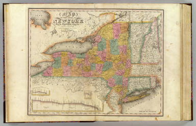
1832
New-York State, surrounding country.
State Atlas
Map of the State of New-York and the sur
…
|

1796
Connecticut.
National Atlas
Connecticut entworfen von D.F. Sotzmann.
…
|

1795
Connecticut.
National Atlas
Connecticut From the best Authorities De
…
|

1889
North Carolina, Connecticut, West Virgin
…
National Atlas
North Carolina, Connecticut, West Virgin
…
|

1831
Map of Massachusetts, Connecticut, and R
…
National Atlas
Map Of Massachusetts, Connecticut And Rh
…
|