Who What Where When |
Author
[Barbie du Bocage, J.G., Dufour, H.]
Full Title
Europe a la fin du Xme Siecle.
Publisher
Maison Basset
Author
[Barbie du Bocage, J.G., Dufour, H.]
Full Title
Empire Francais 1813.
Publisher
Maison Basset
Author
[Tardieu, Ambroise, Vuillemin, A., Duvotenay, Erhard, Testarode, E.]
Full Title
Europe.
Publisher
Furne Et Cie
Author
[Tardieu, Ambroise, Vuillemin, A., Duvotenay, Erhard, Testarode, E.]
Full Title
Europe Centrale.
Publisher
Furne Et Cie
Author
[Tardieu, Ambroise, Vuillemin, A., Duvotenay, Erhard, Testarode, E.]
Full Title
Russie D'Europe.
Publisher
Furne Et Cie
Author
[Tardieu, Ambroise, Vuillemin, A., Duvotenay, Erhard, Testarode, E.]
Full Title
Chemins de Fer de L'Europe.
Publisher
Furne Et Cie
Author
Mitchell, Samuel Augustus Jr.
Full Title
Map of Europe, showing its gt. political divisions. Constructed & Engraved by W.Williams Phila. Entered ... 1876 by S. Augustus Mitchell, . ... Washington.
Publisher
S.A. Mitchell Jr.
Author
Bowen, Emanuel
Full Title
A new and accurate map of Europe. Collected from the best authorities, assisted by the most approv'd modern maps & charts. The whole being regulated & adjusted by astronl. observations, by Emanl. Bowen. (London: Printed for William Innys, Richard Ware, Aaron Ward, J. and P. Knapton, John Clarke, T. Longman and T. Shewell, Thomas Osborne, Henry Whitridge ... M.DCC.XLVII)
Publisher
William Innys [et al.]
Full Title
Mappe-monde 1ere feuille. (Par H. Brue, Ingenieur-Geographe de S.A. Royale. A Paris, Chez Desray ... (et) Goujon ..., 1816. H. Brue dir.)
Publisher
Desray, Libraire-Editeur
Author
Brue, Adrien Hubert, 1786-1832
Full Title
Carte encyprotype de l'Europe reduite de celle sur 4 feuilles du meme auteur. Dediee & presentee a Monsieur. Par H. Brue, Ingenieur-Geographe de S.A. Royale. Brue dirext. A Paris, Chez Desray ... (et) Goujon ..., 1816.
Publisher
Desray, Libraire-Editeur
Author
Brue, Adrien Hubert, 1786-1832
Full Title
Carte encyprotype de l'Europe. Dediee et presentee a Monsieur. Par H. Brue, Ingenieur-Geographe de S.A. Royale. A Paris, Chez Desray ... (et) Goujon ..., 1816.
Publisher
Desray, Libraire-Editeur
Full Title
Europe 2e. feuille. (Par H. Brue, Ingenieur-Geographe de S.A. Royale. A Paris, Chez Desray ... (et) Goujon ..., 1816).
Publisher
Desray, Libraire-Editeur
Full Title
Europe 3e. feuille. Dirigee par H. Brue. (Par H. Brue, Ingenieur-Geographe de S.A. Royale. A Paris, Chez Desray ... (et) Goujon ..., 1816).
Publisher
Desray, Libraire-Editeur
Full Title
Europe 4e. feuille. (Par H. Brue, Ingenieur-Geographe de S.A. Royale. A Paris, Chez Desray ... (et) Goujon ..., 1816).
Publisher
Desray, Libraire-Editeur
Author
Brue, Adrien Hubert, 1786-1832
Full Title
Carte encyprotype de France, contenant toutes les villes du royaume et les villes du premier et du second ordre du Royaume des Pays Bas, de l'Allemagne, de l'Empire d'Autriche, de la Suisse, des Etats du Roi de Sardaigne sur le continent, des duches de Parme et de Toscane, de l'Etat de l'Eglise, de l'lle d'Elbe, &c. avec celle d'une partie de l'Empire Turc, des royaumes de Russe, de Naples, d'Angleterre et d'Espagne jusqu'a Madrid. (with) Paris et ses environs. Dediee et presentee a Monsieur. Par H. Brue, Ingenieur-Geographe de S.A. Royale. H. Brue dirext. A Paris, Chez Desray ... (et) Goujon ..., 1816.
Publisher
Desray, Libraire-Editeur
Author
[Brue, Adrien Hubert, 1786-1832, Herisson, Eustache, b. 1759]
Full Title
Carte geographique et administrative du Royaume de France. Comprenant en outre le Royaume des Pays Bas, l'Allemagne, l'Empire d'Autriche, la Suisse, les Etats du Roi de Sardaigne sur le continent, des duches de Parme et de Toscane, l'Etat de l'Eglise, de l'Ille d'Elbe, les Sept.-Iles Ioniennes en supplement et une partie de l'Empire Turc, des Royaumes de Prusse, de Naples, d'Angleterre, d'Espagne jusqu'a Madrid. (with) Departement de La Seine par H. Brue. Dessinee par Herisson, Ingenieur-Geographe. Troisieme edition. Revue et augmentee par H. Brue, Ingr. Geogphe. de S.A.R. Monsieur. A Paris, Chez Desray ... (et) J. Goujon ..., 1816.
Publisher
Desray, Libraire-Editeur
Full Title
France 2e. feuille. (Dessinee par Herisson, Ingenieur-Geographe. Troisieme edition. Revue et augmentee par H. Brue, Ingr. Geogphe. de S.A.R. Monsieur. A Paris, Chez Desray ... (et) J. Goujon ..., 1816).
Publisher
Desray, Libraire-Editeur
Author
[Marks, A. F. (Firm), Petri, Eduard Iulevic, 1854-1899, Shokalskago,Iu. M.]
Full Title
No.11. Evropa : politicheskaia karta i puti soobschenіya. Izdanie i sobstven, tva. A.F. Marks V. Peterburgi. Pechat. v kartogr. art. zav. A. F. Marksa. (to accompany) Bolshoi vsemirnyi nastolny atlas Marksa. Depechatka 1916 goda.
Publisher
Izd. A.F. Marksa
Author
[Marks, A. F. (Firm), Petri, Eduard Iulevic, 1854-1899, Shokalskago,Iu. M.]
Full Title
No.12. Evropa : raspredelenie narodov po azykam i plemenam. Izdanie i sobstven, tva. A.F. Marks V. Peterburgi. Pechat. v kartogr. art. zav. A. F. Marksa. (to accompany) Bolshoi vsemirnyi nastolny atlas Marksa. Depechatka 1916 goda.
Publisher
Izd. A.F. Marksa
Author
[Marks, A. F. (Firm), Petri, Eduard Iulevic, 1854-1899, Shokalskago,Iu. M.]
Full Title
No.14. Karta Evropeyskaia Rossiia. Obshchiy obzor. PIzdanie i sobstven, A.F. Marksa V. S. Peterburgi. Pechat. V. Kartogr. zav. Tba. A.F. Marks. Izdanie i sobstven, A.F. Marksa V. S. Peterburgi. (to accompany) Bolshoi vsemirnyi nastolny atlas Marksa. Depechatka 1916 goda.
Publisher
Izd. A.F. Marksa
Author
[Marks, A. F. (Firm), Petri, Eduard Iulevic, 1854-1899, Shokalskago,Iu. M.]
Full Title
No.18. Karta Evropeyskaia Rossiia. List 4-j.1909. Izdanie i sobstven, tva. A.F. Marks V. Peterburgi. Pechat. v kartogr. art. zav. A. F. Marksa. (to accompany) Bolshoi vsemirnyi nastolny atlas Marksa. Depechatka 1916 goda.
Publisher
Izd. A.F. Marksa
Author
[Marks, A. F. (Firm), Petri, Eduard Iulevic, 1854-1899, Shokalskago,Iu. M.]
Full Title
No.19. Karta Evropeyskaia Rossiia. List 5-j.1909. Izdanie i sobstven, tva. A.F. Marks V. Peterburgi. Pechat. v kartogr. art. zav. A. F. Marksa. (to accompany) Bolshoi vsemirnyi nastolny atlas Marksa. Depechatka 1916 goda.
Publisher
Izd. A.F. Marksa
Author
Mitchell, Samuel Augustus Jr.
Full Title
Map of Europe, Showing its Gt. Political Divisions. Constructed & Engraved by W. Williams Phila. Entered ... 1867 by S. Augustus Mitchell, Jr. ... Pennsylvania.
Publisher
S.A. Mitchell Jr.
Author
Vandermaelen, Philippe, 1795-1869
Full Title
Carte d'assemblage de l'Europe. (Dresse par Ph. Vandermaelen, lithographie par H. Ode. Premier partie. - Europe. Bruxelles. 1827)
Publisher
Ph. Vandermaelen
Author
Hunt, Marianne
Full Title
Carte de l' Europe. 7 October, 1844. (to accompany) Cours de Geographie. Institution de Mme. Butler. Saint-Omer. Marianne Hunt. 1844.
Publisher
Manuscript. Saint-Omer
Author
Hunt, Marianne
Full Title
(Europe). (to accompany) Cours de Geographie. Institution de Mme. Butler. Saint-Omer. Marianne Hunt. 1844.
Publisher
Manuscript. Saint-Omer
Author
Bowen, Emanuel
Full Title
A new & accurate map of Germany, divided into its circles & drawn from the most approv'd maps &c. and regulated by astronoml. observatns. By Emanl. Bowen. (London: Printed for William Innys, Richard Ware, Aaron Ward, J. and P. Knapton, John Clarke, T. Longman and T. Shewell, Thomas Osborne, Henry Whitridge ... M.DCC.XLVII)
Publisher
William Innys [et al.]
Author
Bowen, Emanuel
Full Title
A new & accurate map of the South East part of Germany, containing the Electorate of Bavaria, A.Bp. of Saltzburg, K. of Bohemia, with the Queen of Hungary's hereditary dominions of Austria, Moravia, Styria, Carinthia, Carniola, Trent, Tirol. &c. Drawn from the best authorities & most approv'd maps, & regulated by astronomical observations. By Emanl. Bowen. (London: Printed for William Innys, Richard Ware, Aaron Ward, J. and P. Knapton, John Clarke, T. Longman and T. Shewell, Thomas Osborne, Henry Whitridge ... M.DCC.XLVII)
Publisher
William Innys [et al.]
Author
Delamarche, Felix.
Full Title
L'Empire Romai et les Barbares du Nord au IVeme Siecle ...1843.
Publisher
F. Delamarche
Author
Delamarche, Felix.
Full Title
Carte de L'Europe etats Barbares au VI eme Siecle ... 1843. (inset) Peuples Barbares.
Publisher
F. Delamarche
Author
Delamarche, Felix.
Full Title
Carte de L'Empire Carlovingien et des Empires Arabes ... 1843. (inset) Partage de L'Empire Carlovingies.
Publisher
F. Delamarche
Author
Delamarche, Felix.
Full Title
Carte de l'Europe ... 1845.
Publisher
F. Delamarche
Author
Arrowsmith, Aaron Jr.
Full Title
Europe. Europa, Cum Insulis et Regionibus intra Paludem Maeotida et Mare Hyrcanum silis. London, Published Jany. 2, 1828 by A. Arrowsmith Hydrographer to His Majesty, No. 10, Soho Square.
Publisher
A. Arrowsmith
Author
Cartee, Cornelius S.
Full Title
Map of Europe. Designed To Accompany Cartee's "Elements Of Physical Geography. Engraved by G.W. Boynton. Entered ... 1856, by Hickling, Swan, And Brown ... Massachusetts. (to accompany) A School Atlas Of Physical Geography ... By Cornelius S. Cartee, A.M. M DCCC LVI.
Publisher
Hickling, Swan, and Brown
Author
[Dower, John, Higgins, W.M.]
Full Title
Europe.
Publisher
[W.S. Orr, Chambers, W. & R.]
Author
Stein, C.G.D.
Full Title
Europa. Herausgegeben von J.C. Hintichs Buchhandler in Leipzig, 1826. Schrift gest. v. Leutemann. (to accompany) Neuer Atlas Der Ganzen Welt.
Publisher
J.C. Hinrichs
Author
[Bradford, Thomas G., Goodrich, S.G.]
Full Title
Europe. Engraved by G.W. Boynton. Entered ... 184 by S.G. Goodrich ... Massachusetts.
Publisher
C.D. Strong
Author
[Bradford, Thomas G., Goodrich, S.G.]
Full Title
Western Europe including The British Islands, France, Spain, Portugal, Holland, Belgium, Denmark. Engraved by G.W. Boynton. Entered ... 184 by S.G. Goodrich ... Massachusetts.
Publisher
C.D. Strong
Author
[Bradford, Thomas G., Goodrich, S.G.]
Full Title
Southern & Middle Europe, including Germany, Austria, Prussia, Switzerland, Italy, Greece, Turkey. Engraved by G.W. Boynton. Entered ... 184 by S.G. Goodrich ... Massachusetts.
Publisher
C.D. Strong
Author
Arrowsmith, John
Full Title
Europe, By J. Arrowsmith. (Map) 3. London, Pubd. 15 Feby. 1842, by J. Arrowsmith, 10 Soho Square.
Publisher
John Arrowsmith
Full Title
Europe. Published by Lincoln & Edmands, Boston, (1819)
Publisher
Lincoln & Edmands
Full Title
Europe. H. Morse Sc. Published by Lincoln & Edmands, Boston. (1832)
Publisher
Lincoln & Edmands
Full Title
Europe. Philad., Published by M. Carey & Son, 1820. (1825)
Publisher
Carey & Lea
Author
Cornell, S. S. (Sarah S.)
Full Title
Europe. Designed to accompany Cornell's High school geography. Entered ... 1855, by S.S. Cornell ... Southern District of New York. New York: D. Appleton & Co., 443 & 445 Broadway. (1864)
Publisher
Appleton & Co.
Author
Cornell, S. S. (Sarah S.)
Full Title
Western, Central & Southern continental Europe. Designed to accompany Cornell's High school geography. Entered ... 1855, by S.S. Cornell ... Southern District of New York. New York: D. Appleton & Co., 443 & 445 Broadway. (1864)
Publisher
Appleton & Co.
Author
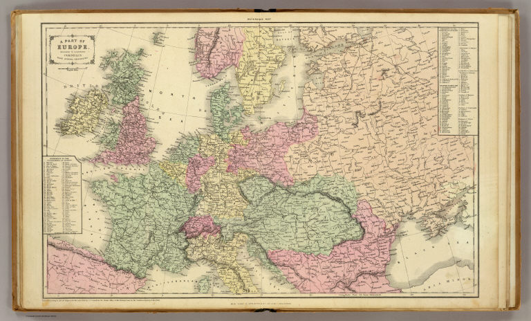
Cornell, S. S. (Sarah S.)
Full Title
A part of Europe. Designed to accompany Cornell's High school geography. Entered ... 1856, by S.S. Cornell ... Southern District of New York. New York: D. Appleton & Co., 443 & 445 Broadway. (1864)
Publisher
Appleton & Co.
Author
[Fitch, George W., Jamison, Joseph]
Full Title
Europe. Drawn by (to be filled in. By George W. Fitch. New York: Sheldon, Blakeman and Company, 115 Nassau Street. Entered ... 1850, by Huntington and Savage ... New York)
Publisher
Blakeman, Sheldon & Co.
Author
Fitch, George W.
Full Title
Southern Europe. Drawn by (to be filled in. By George W. Fitch. New York: Sheldon, Blakeman and Company, 115 Nassau Street. Entered ... 1850, by Huntington and Savage ... New York)
Publisher
Blakeman, Sheldon & Co.
Author
[Gaultier, abbe (Aloisius Edouard Camille), 1746?-1818, Wauthier, J. M.]
Full Title
A plain map or emblematic chart for the geographical game of Europe, according to the method of the Abbe Gaultier. By Mr. Wauthier, his pupil, 1797.
Publisher
Harris and Son
|