|
REFINE
Browse All : Images of Central Europe and Czech Republic and Poland and Netherlands from 1968Author
Bradford, Thomas G.
Full Title
Maine. Entered ... 1838, by T.G. Bradford ... Massachusetts. Engraved by G.W. Boynton.
Publisher
[Weeks, Jordan & Co., Wiley and Putnam.]
Author
Finley, Anthony
Full Title
Map of Maine New Hampshire And Vermont, Compiled From the Latest Authorities. (with) North Part of Maine. D.H. Vance Del. J.H. Young Sc. Philadelphia Published by A. Finley 1826.
Publisher
Anthony Finley
Author
W. & A.K. Johnston Limited
Full Title
United States (Maine).
Publisher
W. & A.K. Johnston Limited
Author
Mitchell, Samuel Augustus
Full Title
A New Map of Maine. Published By S. Augustus Mitchell. N.E. corner of Market & 7th. Streets. Philada. 1848
Publisher
S.A. Mitchell
Author
Mitchell, Samuel Augustus Jr.
Full Title
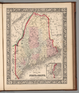
County map of the State of Maine. Entered ... 1860 by S. Augustus Mitchell, Jr. ... Pennsylvania. (inset map) 13. Portland Har. and Vicinity.
Publisher
S.A. Mitchell Jr.
Author
Mitchell, Samuel Augustus Jr.
Full Title
County map of the State of Maine. (with inset map) Portland Har. and vicinity. Entered ... 1874, by S. Augustus Mitchell ... Washington.
Publisher
S.A. Mitchell Jr.
Author
Mitchell, Samuel Augustus Jr.
Full Title
County map of the State of Maine. (with inset map) Fortland Har. and Vicinity. Entered ... 1876 by S. Augustus Mitchell, . ... Washington.
Publisher
S.A. Mitchell Jr.
Author
Mitchell, Samuel Augustus
Full Title
A New Map of Maine.
Publisher
Thomas, Cowperthwait & Co.
Author
Society for the Diffusion of Useful Knowledge (Great Britain)
Full Title
North America Sheet II. East Canada and New Brunswick with Part of New York, Vermont and Maine.
Publisher
Edward Stanford
Author
Mitchell, Samuel Augustus
Full Title
A New Map of Maine. Published by Charles Desilver, No. 251 Market Street. 1857. Entered ... 1856 by Charles Desilver ... Pennsylvania.
Publisher
Charles DeSilver
Author
Johnson, A.J.
Full Title
Johnson's Maine By Johnson & Browning. No. 15.
Publisher
Johnson and Browning
Author
National Map Company
Full Title
Maine. (Copyrighted by) National Map Company, Indianapolis. (to accompany) Official Paved Road and Commercial Survey of the United States.
Publisher
National Map Company
Author
Mitchell, Samuel Augustus Jr.
Full Title
County map of the State of Maine. (inset map) 13. Portland Har. and Vicinity. Entered ... 1867 by S. Augustus Mitchell, Jr. ... Pennsylvania.
Publisher
S.A. Mitchell Jr.
Author
[Hinton, Isaac Taylor, 1799-1847, Simpkin & Marshall]
Full Title
Map of Maine, New Hampshire and Vermont. London, published April 15, 1832 by I.T. Hinton & Simpkin & Marshall. Engraved & printed by Fenner Sears & Co. (1832)
Publisher
[Simpkin & Marshall, Thomas Wardle]
Full Title
Maine. Entered ... 1836, by Eleazer Huntington ... Connecticut.
Publisher
Reed & Barber
Author
Lewis, Samuel
Full Title
Maine. Drawn by S. Lewis. Engd. by Hooker. (Published by John Conrad & Co., Philadelphia. 1804)
Publisher
J. Conrad
Full Title
Maine. (Boston: Published by Thomas & Andrews. 1812)
Publisher
Thomas & Andrews
Author
Poussin, Guillaume Tell, 1794-1876
Full Title
Canal de la Chesapeake a l'Ohio. Plan general du trace et profil du canal. Dessine par le Major Poussin. Grave par (V.?) Adam. (1834)
Publisher
[Libraire Anselin, Libraire Carilian-Goeury]
Author
Goodrich, S.G.
Full Title
Maine. G. Boynton Sc. Entered ... by S.G. Goodrich of Massachusetts. (Costumes) Arabians, Negroes, Japanese, Otaheitans, Algerines, Malays. (Boston: Gray & Bowen ... 1831)
Publisher
Gray & Bowen
Author
Touring club italiano
Full Title
Stati Uniti, United States of America. Maine, Nova Scotia, New Brunswick e parte del Quebec. Propr. Artistico-letteraria del T.C.I. Ufficio cartografico del T.C.I. (1929)
Publisher
Touring club italiano
Full Title
County and township map of the state of Maine. Copyright 1887 by Wm. M. Bradley & Bro. (1890)
Publisher
John Y. Huber & Co.
Full Title
Maine, New Hampshire and Vermont. N. & S.S. Jocelyn Sc. (New-Haven: N. & S.S. Jocelyn. 1823)
Publisher
N. & S.S. Jocelyn
Author
Mitchell, Samuel Augustus
Full Title
County map of the state of Maine. (with) Portland Har. and vicinity. Entered ... 1870 by S. Augustus Mitchell, Jr. ... Pennsylvania.
Publisher
[R.A. Campbell, S.A. Mitchell, Jr.]
Author
Mitchell, Samuel Augustus
Full Title
County map of the state of Maine. (with) Portland Har. and vicinity. Entered ... 1879 by S. Augustus Mitchell ... Washington. (1880)
Publisher
S.A. Mitchell
Author
Carey, Mathew
Full Title
Province of Maine. Engraved by A. Doolittle New haven.
Publisher
Lang and Ustick
Author
Carey, Mathew
Full Title
The Province of Maine, From the best Authorities by Samuel Lewis, 1794. Engraved for Carey's American Edition of Guthrie's Geography improved.
Publisher
Mathew Carey
Author
Carey, Mathew
Full Title
The Province of Maine, From the best Authorities by Samuel Lewis, 1794. Engraved for Carey's American Edition of Guthrie's Geography improved.
Publisher
Mathew Carey
Author
[Scovel, James L., O'Brien, Emmett J]
Full Title
Alpine Glaciation. Youthful Glaciation. Katahdin, Maine. (S) (on opposite page three views) Monumented Upland.
Publisher
John Wiley & Sons Inc.
Author
[Scovel, James L., O'Brien, Emmett J]
Full Title
Continental Glaciation. Eskers-Drumlins. Passadumkeag, Maine. Sun Prairie, Wis. (on opposite page two views) A portion of the Enfiled Horsback ..., and Several drumlins in the vicinity of Mud Lake from the Sun Prairie, Wisconsin ...
Publisher
John Wiley & Sons Inc.
Author
[Scovel, James L., O'Brien, Emmett J]
Full Title
Shorelines. Embayed-Resistant. Boothbay, Maine. (inset) Bath, Maine. Scale 1:250,000. (drawing and view on opposite page).
Publisher
John Wiley & Sons Inc.
Author
Mitchell, Samuel Augustus
Full Title
A New Map of Maine. Philadelphia, Published By Charles Desilver, No. 714 Chesnut Street. Entered according to Act of Congress in the year 1860 by Charles Desilver in the Clerk's office if the District Court of the Eastern District of Pennsylvania. 7.
Publisher
Charles Desilver.
Author
[Rand McNally and Company, State Farm Insurance Companies Travel Bureau]
Full Title
Rand McNally Road map, Maine, New Hampshire, Vermont. Copyright by Rand McNally & Company, Chicago, Ill. Lithographed in the U.S.A. (to accompany) State Farm Road Atlas: United States, Canada, Mexico,Central and South America. Copyright 1940 by Rand McNally & Company, Chicago, Ill.
Publisher
State Farm Insurance Companies Travel Bureau
Author
Greenleaf, Moses, 1777-1834
Full Title
Map of the principal rivers, mountains and highland ranges of the State of Maine, by Moses Greenleaf. 1828. Engraved by Wm. Chapin, N. York for Greenleaf's survey of Maine. Published by Shirley & Hyde, Portland, 1829.
Publisher
Shirley & Hyde
Author
[Bouchette, Joseph, Greenleaf, Moses, 1777-1834]
Full Title
Sketch from Bouchette's maps of Upper & Lower Canada and the District of Gaspe. Exhibiting the true range of highlands dividing the waters of the St. Lawrence & the Atlantic, and the imaginary ranges claimed by the British for the boundary of the State of Main. (By Moses Greenleaf). W. Chapin Sc. N. York. Portland, published by Shirley & Hyde, 1829.
Publisher
Shirley & Hyde
Author
Greenleaf, Moses, 1777-1834
Full Title
Sketch of the imaginary ranges of highlands. Reported by the British surveyors under the Treaty of Ghent, as extending across the State of Maine. (By Moses Greenleaf). W. Chapin Sculpt. N. York. (Portland, published by Shirley & Hyde, 1829)
Publisher
Shirley & Hyde
Author
Greenleaf, Moses, 1777-1834
Full Title
Vertical sections, exhibiting the comparative altitudes of the principal highlands and rivers of the State of Maine. By Moses Greenleaf 1828. Engraved by W. Chapin for Greenleaf's Survey of Maine. Published by Shirley & Hyde, Portland, 1829.
Publisher
Shirley & Hyde
Author
Greenleaf, Moses, 1777-1834
Full Title
Map exhibiting the principal original grants & sales of lands in the State of Maine. By Moses Greenleaf. Engraved by Wm. Chapin, N.Y. for Greenleaf's Survey of Maine. Published by Shirley & Hyde, Portland, 1829.
Publisher
Shirley & Hyde
Author
Greenleaf, Moses, 1777-1834
Full Title
Map of the inhabited part of the State of Maine, exhibiting the progress of its settlement since the year 1778, the Representative Districts since the year 1820, and the population and valuation of taxable property in each District at the year 1820. By Moses Greenleaf. Engraved by William Chapin, N.Y. for Greenleaf's Survey of Maine, 1828. Published by Shirley & Hyde, Portland, 1829.
Publisher
Shirley & Hyde
Author
Carey, Mathew
Full Title
The Province of Maine, From the best Authorities by Samuel Lewis, 1794. W. Barker sculp. Engraved for Carey's American Edition of Guthrie's Geography Improved.
Publisher
M. Carey
Author
Bradstreet Company
Full Title
Maine. (to accompany) Bradstreet's Pocket Atlas Of The United States. Published Exclusively for Macullar, Parker & Company, Boston, Massachusetts ... New York: The Bradstreet Company, 1885. (on verso) Entered ... 1879, by The Bradstreet Company ... Washington.
Publisher
Bradstreet Co.
Author
Tanner, Henry S.
Full Title
Part Of Maine &c. with The Boundary Claimed by GRt. Britain. (to accompany) A New Pocket Atlas of the United States With The Roads and Distances, Designed For the Use of Travelers. By H.S. Tanner. Philadelphia: Published by the Author. 1828. (on verso) ...on the seventeenth day of November ... 1828, Henry S. Tanner ... hath deposited ... a book ... Pennsylvania.
Publisher
H.S.Tanner
Author
Cram, George Franklin
Full Title
Maine.
Publisher
A.C. Shewey and Co.
Author
Bradford, Thomas G.
Full Title
Maine. (to accompany) A Comprehensive Atlas, Geographical, Historical & Commercial. By T.G. Bradford. William D. Ticknor, Boston. Wiley & Long, New-York. Entered ... 1835, by Thos. G. Bradford ... Massachusetts.
Publisher
[William D. Ticknor, Wiley & Long]
Author
[Morse, Sidney E., Breese, S.]
Full Title
Maine. (to accompany) Supplement To The New-York Observer. The Cerographic Atlas Of The United States. By Sidney E. Morse, A.M. And Samuel Breese, A.M. New-York: Published By Sidney E. Morse & Co. 1842. [Entered ... 1841, by Sidney E. Morse and Samuel Breese ... New-York.]
Publisher
Sidney E. Morse & Co.
Author
Gray, O.W.
Full Title
Gray's Atlas Map of Maine.
Publisher
Stedman, Brown & Lyon
Author
Finley, Anthony
Full Title
Map of Maine, New Hampshire, and Vermont, Compliled from the Latest Authorities.
Publisher
Anthony Finley
Author
[Colton, J.H., Gray, O.W.]
Full Title
Maine. Entered ... 1855 by J.H. Colton & Co. ....
Publisher
Stedman & Brown
Author
Cram, George Franklin
Full Title
Cram's Rail Road & County Map of New England.
Publisher
George F. Cram
Author
Appleton, D. & Co.
Full Title
Map of Maine. Copyright 1891 by Matthews-Northrup Co. ... Buffalo, New York. (inset) City of Portland and vicinity. (to accompany) The Library Atlas Of Modern Geography ... New York, D. Appleton And Company 1892. (on upper margin) Maine. 68.
Publisher
D. Appleton & Co.
|