Browse All

1886 Virginia, Delaware, Maryland, and West V … World Atlas Johnson's Virginia, Delaware, Maryland, … |

1831 Map of Virginia and Maryland. National Atlas Map Of Virginia And Maryland Constructed … |

1839 Map of Virginia, Maryland and Delaware. National Atlas Map of Virginia, Maryland and Delaware E … |

1776 Map of the most Inhabited part of Virgin … National Atlas A Map of the most Inhabited part of Virg … |

1956 Shell Highway Map of Delaware - Maryland … National Atlas Shell Map of Delaware - Maryland, Virgin … |

1956 Shell Highway Map of Delaware - Maryland … National Atlas Shell Highway Map of Delaware - Maryland … |

1886 Delaware, Maryland, Virginia. World Atlas Colton's Delaware, Maryland, Virginia an … |

1874 Dela., Md., Va., W. Va., D.C. National Atlas Asher & Adams' Delaware, Maryland, Virgi … |

1864 Virginia, Delaware, and Maryland World Atlas Johnson's Virginia, Delaware, and Maryla … |

1874 Planche II. Virginie et Maryland. Enviro … Military Atlas Planche II. Virginie et Maryland. (inset … |

1875 Planche XVI. Antietam (Maryland). Cedar … Military Atlas Planche XVI. Antietam (Maryland). Cedar … |

1837 Virginia and Maryland [National Atlas, School Atlas] Virginia and Maryland |

1870 Virginia, Delaware, Maryland and West Vi … World Atlas Johnson's Virginia, Delaware, Maryland & … |

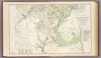
1895 N.E. Virginia, Washington 1. Military Atlas Surveys for military defenses. Map of no … |
1895 N.E. Virginia, Washington 2. Military Atlas Surveys for military defenses. Map of no … |

1895 Mil. depts. of Wash., Penn., Annapolis, … Military Atlas Part of map of portions of the military … |

1895 Antietam, Suffolk, Gettysburg. Military Atlas Map of the battle of the Antietam fought … |

1895 Harper's Ferry, Hagerstown, Funkstown, W … Military Atlas Military map showing the topographical f … |

1895 Orange Co., Va., Mine Run, Rapidan River … Military Atlas Map of Orange County &c., Va. embracing … |

1895 Upper Potomac McCoys Ferry-Conrads Ferry … Military Atlas Engineer Office, Military Division of th … |

1895 2d Corps A.N. Va., camps, pickets, route … Military Atlas No. 1. Map from Maj. A.H. Campbell's sur … |

1895 Belle Grove battle. Military Atlas No. 29. Sketch of the battle of Belle Gr … |

1895 Hanging Rock; Monocacy. Military Atlas No. 10. Map of engagement at Hanging Roc … |

1895 Winchester, Cedar Run, Port Republic, Va … Military Atlas Map of route of the Army of the Valley f … |

1895 Washington, Richmond. Military Atlas Defenses of Washington. Extract of milit … |

1895 Alleghanies, Valley of Virginia. Military Atlas A map of a line of defenses in the Alleg … |

1895 Route, Gettysburg campaign. Military Atlas Route map of Gettysburg campaign. Prepar … |

1874 Virginia, Delaware, Maryland, and West V … World Atlas Johnson's Virginia, Delaware, Maryland, … |

1833 Virginia, Maryland, Delware. World Atlas Virginia, Maryland, Delware. By H.S. Tan … |

1875 Delaware, Maryland, Virginia, West Virgi … [Commercial Reference Book, National Atl Asher & Adams' Delaware, Maryland, Virgi … |

1852 Coast of Delaware, Maryland, pt. of Virg … Chart Atlas Sea Coast of Delaware, Maryland and part … |

1927 Del., Md., Va., W. Va. National Atlas Rand McNally junior auto road map Delawa … |

1927 Philadelphia, Pittsburgh, Richmond, Balt … National Atlas Philadelphia and vicinity. Pittsburgh an … |

1826 Map of Virginia and Maryland. National Atlas Map Of Virginia And Maryland Contrusted … |

1906 Virginia, West Virginia, Maryland, Delaw … World Atlas Virginia, West Virginia, Maryland, Delaw … |

1823 Virginia, Maryland and Delaware. World Atlas Virginia, Maryland and Delaware By H.S. … |

1850 Country between Washington (DC) & Manass … World Atlas Country between Washington (DC) & Manass … |

1850 Virginia and Maryland. World Atlas Smith's Topographical Map of Virginia an … |

1895 Gen. map I. Military Atlas General topographical map. Sheet I. Juli … |

1895 Gen. map II. Military Atlas General topographical map. Sheet II. Jul … |

1831 Virginia, Maryland. National Atlas Map of the states of Virginia and Maryla … |

1827 Virginie, Pensylvanie. Physical Atlas Carte des montagnes coupees par des rivi … |

1883 E. United States 7. World Atlas Eastern United States. No. 7. Letts's po … |

1863 (Virginia, Maryland, Delaware) School Atlas (Map of Virginia, Maryland and Delaware. … |

1890 Del., Md., Va., W. Va. World Atlas County map of the states of Delaware, Ma … |

1823 Virginia, Md., Del. National Atlas Virginia, Maryland and Delaware. (with D … |

1824 Virginia, Maryland and Delaware. World Atlas Virginia, Maryland and Delaware By H.S. … |

1833 Virginia, Maryland and Delaware. World Atlas Virginia, Maryland and Delaware By H.S. … |

1813 Map of the American Coast, from Lynhaven … National Atlas Map of the American Coast, from Lynhaven … |

1758 Pennsylvania, Maryland And Virginia World Atlas Pennsylvania, Maryland And Virginia. (to … |