Browse All

1831 Map of Virginia and Maryland. National Atlas Map Of Virginia And Maryland Constructed … |

1839 Map of Virginia, Maryland and Delaware. National Atlas Map of Virginia, Maryland and Delaware E … |

1856 Delaware And Maryland. (with) District o … World Atlas Delaware And Maryland. (with) District o … |

1856 City Of Baltimore Maryland. World Atlas City Of Baltimore Maryland. Published by … |

1796 States of Maryland and Delaware. National Atlas The States of Maryland and Delaware, fro … |

1776 Map of the most Inhabited part of Virgin … National Atlas A Map of the most Inhabited part of Virg … |

1823 Maryland. [Manuscript Map, National Atlas] Maryland. |

1867 Schonberg's Map of Pennsylvania, New Jer … National Atlas Schonberg's Map of Pennsylvania, New Jer … |

1956 Shell Highway Map of Delaware - Maryland … National Atlas Shell Map of Delaware - Maryland, Virgin … |

1956 Shell Highway Map of Delaware - Maryland … National Atlas Shell Highway Map of Delaware - Maryland … |

1889 Maryland and Delaware. World Atlas Maryland and Delaware, Engraved Exclusiv … |

1886 Baltimore, Maryland. World Atlas Colton's Baltimore, Maryland. Published … |

1886 Delaware, Maryland, Virginia. World Atlas Colton's Delaware, Maryland, Virginia an … |

1874 Delaware and Maryland. World Atlas Colton's Delaware And Maryland. (Inset) … |

1866 Delaware and Maryland. World Atlas Colton's Delaware and Maryland. (inset) … |

1866 Baltimore, Maryland. World Atlas Colton's City of Baltimore, Maryland. Pu … |

1874 Dela., Md., Va., W. Va., D.C. National Atlas Asher & Adams' Delaware, Maryland, Virgi … |

1865 Maryland and Delaware. Ohio and Indiana. World Atlas Maryland and Delaware. Ohio and Indiana. |

1901 Maryland and Delaware. World Atlas Maryland and Delaware. (inset) Baltimore … |

1853 A New Map of Maryland and Delaware World Atlas A New Map of Maryland and Delaware, with … |

1874 County Map of Maryland and Delaware. Cou … National Atlas County Map of Maryland and Delaware. Cou … |

1864 Virginia, Delaware, and Maryland World Atlas Johnson's Virginia, Delaware, and Maryla … |

1864 Delaware and Maryland World Atlas Johnson's Delaware and Maryland By Johns … |

1855 A new map of Maryland and Delaware World Atlas A new map of Maryland and Delaware, with … |

1873 Delaware, Maryland, Virginia, West Virgi … World Atlas Map of Delaware, Maryland, Virginia, Wes … |

1953 Delaware. Maryland. District of Columbia … World Atlas Delaware. Maryland. U.S. States. Distric … |

1816 Maryland World Atlas Maryland. (Engraved by) W. Barker, sculp … |

1845 Maryland, Delaware, D.C. National Atlas Maryland and Delaware. (with) District o … |

1874 Planche II. Virginie et Maryland. Enviro … Military Atlas Planche II. Virginie et Maryland. (inset … |

1875 Planche XVI. Antietam (Maryland). Cedar … Military Atlas Planche XVI. Antietam (Maryland). Cedar … |

1875 Planche XXIV. Vallee du Monocacy et Cont … Military Atlas Planche XXIV. Vallee du Monocacy et Cont … |

1837 Maryland and Delaware. [National Atlas, School Atlas] Map of Maryland and Delaware. |

1837 Virginia and Maryland [National Atlas, School Atlas] Virginia and Maryland |

1869 Antietam. Military Atlas Antietam. Prepared by Bvt. Brig. Gen N. … |

1870 Delaware and Maryland. World Atlas Johnson's Delaware and Maryland. (inset) … |

1870 Virginia, Delaware, Maryland and West Vi … World Atlas Johnson's Virginia, Delaware, Maryland & … |

1846 Maryland, Delaware. World Atlas Neueste Karte von Maryland und Delaware … |

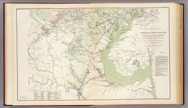
1895 N.E. Virginia, Washington 1. Military Atlas Surveys for military defenses. Map of no … |
1895 N.E. Virginia, Washington 2. Military Atlas Surveys for military defenses. Map of no … |

1895 Mil. depts. of Wash., Penn., Annapolis, … Military Atlas Part of map of portions of the military … |

1895 Antietam, Suffolk, Gettysburg. Military Atlas Map of the battle of the Antietam fought … |

1895 Antietam, Harper's Ferry, Sharpsburg. Military Atlas Antietam. Prepared by Bvt. Brig. Gen. N. … |

1895 Harper's Ferry, Hagerstown, Funkstown, W … Military Atlas Military map showing the topographical f … |

1895 Orange Co., Va., Mine Run, Rapidan River … Military Atlas Map of Orange County &c., Va. embracing … |

1895 Texas, pt. of N.M. Military Atlas Map of Texas and part of New Mexico, com … |

1895 Upper Potomac McCoys Ferry-Conrads Ferry … Military Atlas Engineer Office, Military Division of th … |

1895 2d Corps A.N. Va., camps, pickets, route … Military Atlas No. 1. Map from Maj. A.H. Campbell's sur … |

1895 Belle Grove battle. Military Atlas No. 29. Sketch of the battle of Belle Gr … |

1895 Hanging Rock; Monocacy. Military Atlas No. 10. Map of engagement at Hanging Roc … |

1895 Winchester, Cedar Run, Port Republic, Va … Military Atlas Map of route of the Army of the Valley f … |