|
Author
[Barbie du Bocage, J.G., Dufour, H.]
Full Title
Mexique. (inset) Guatemala.
Publisher
Maison Basset
Author
[Tardieu, Ambroise, Vuillemin, A., Duvotenay, Erhard, Testarode, E.]
Full Title
Etats-Unis & Mexique.
Publisher
Furne Et Cie
Author
Mitchell, Samuel Augustus Jr.
Full Title
Map of Mexico, Central America, and the West Indies. Entered ... 1877 by S. Augustus Mitchell, . ... Washington. (with four insets: Map of the Island of Jamaica; Map of the Sandwich Island. Discovered by Captn. Cook in 1778; Map of the Bermuda Islands; Map of the Panama Railrod.
Publisher
S.A. Mitchell Jr.
Author
Brue, Adrien Hubert, 1786-1832
Full Title
Carte encyprotype de l'Amerique Septentrionale, dediee et presentee a Monsieur. Par H. Brue, Ingenieur-Geographe de S.A. Royale. 1ere feuille. Dirige par H. Brue. A Paris, Chez Desray ... (et) J. Goujon ..., 1815.
Publisher
Desray, Libraire-Editeur
Author
Mitchell, Samuel Augustus Jr.
Full Title
Map of Mexico, Central America, and the West Indies. Constructed & Engraved by W. Williams Philadelphia. (inset maps) 55. Map of the Island of Cuba. 56. Map of the Island of Jamaica. 57. Map of Bermuda Islands. Map of the Panama Railroad. 58. Entered ... 1867 by S. Augustus Mitchell, Jr. ... Pennsylvania.
Publisher
S.A. Mitchell Jr.
Author
Johnson, A.J.
Full Title
Johnson's Mexico By Johnson & Browning. (with) Territory And Isthmus Of Tehuantepec. No. 49.
Publisher
Johnson and Browning
Author
[Dower, John, Higgins, W.M.]
Full Title
Mexico & Guatemala.
Publisher
[W.S. Orr, Chambers, W. & R.]
Author
[Johnston, Alexander Keith, 1804-1871, Rogers, Henry Darwin]
Full Title
Mexico. Southern States. By Prof. H.D. Rogers & A. Keith Johnston, F.R.S.E. Entered in Sta. Hall. London ... & according to an act of Congress ... 1857, by H.D. Rogers ... Massachusetts. London, John Murray, Albemarle Street, Edinburgh, W. & A.K. Johnston. Engraved by W. & A.K. Johnston, Edinburgh.
Publisher
Edward Stanford
Author
Arrowsmith, John
Full Title
Mexico, By J. Arrowsmith. (with) Mexico, Shewing its connection with the Ports of Acapulco, Vera Cruz, & Tampico; on double the scale of the Map. (Map) 44. London, Pubd. 15 Feby. 1842, by J. Arrowsmith, 10 Soho Square.
Publisher
John Arrowsmith
Author
Jefferys, Thomas
Full Title
The Western Coast of Louisiana and the Coast of New Leon. By Thos. Jefferys, Geographer to His Majesty. London, printed for Robt. Sayer, Map & Printseller, no. 53 Fleet Street, as the Act directs 20th Feby. 1775.
Publisher
Sayer and Bennett
Author
Jefferys, Thomas
Full Title
The coast of Mexico from Laguna de Esmotes to Punta Brava. By Thos. Jefferys, Geographer to His Majesty. London, printed for Robt. Sayer, Map & Printseller, no. 53 in Fleet Street, as the Act directs 20 Feby. 1775.
Publisher
Sayer and Bennett
Author
Jefferys, Thomas
Full Title
The coast of Yucatan from Campeche to Bahia del Ascension; with the west end of Cuba. By Thos. Jefferys, Geographer to His Majesty. London, printed for Robt. Sayer, Map & Printseller, no. 53 Fleet Street, as the Act directs 20th. Feby. 1775.
Publisher
Sayer and Bennett
Author
Jefferys, Thomas
Full Title
The Coast of New Spain from Neuva (i.e., Nueva) Vera Cruz to Triste Island. By Thos. Jeffreys, Geographer to His Majesty. London, printed for Robt. Sayer, Map & Printseller, no. 53 Fleet Street, as the Act directs 20th Feby. 1775.
Publisher
Sayer and Bennett
Author
Cornell, S. S. (Sarah S.)
Full Title
Mexico, Yucatan, Balize & Central America. Designed to accompany Cornell's High school geography. Entered ... 1855, by S.S. Cornell ... Southern District of New York. New York: D. Appleton & Co., 443 & 445 Broadway. (1864)
Publisher
Appleton & Co.
Author
[Fitch, George W., Layfield, Frank H.]
Full Title
Mexico and Guatimala. Drawn by (to be filled in. By George W. Fitch. New York: Sheldon, Blakeman and Company, 115 Nassau Street. Entered ... 1850, by Huntington and Savage ... New York)
Publisher
Blakeman, Sheldon & Co.
Full Title
Mexico and Guatimala. J.H. Young Sc. (Philadelphia: John Grigg, No. 9 North Fourth Street. 1830)
Publisher
John Grigg
Full Title
United States. Engraved for Morse's School geography. (Published by Richardson & Lord. Sold also by Collins & Hannay, New-York, 1828)
Publisher
Richardson & Lord
Author
Thomson, John
Full Title
Spanish North America. Drawn and engraved for Thomson's New general atlas, 1814.
Publisher
[Baldwin, Cradock, and Joy, John Cumming, John Thomson]
Author
[Lapie, Alexandre Emile, Lapie, M. (Pierre), 1779-1850]
Full Title
Carte des Etats-Unis du Mexique. (with) Carte du Guatemala ou Provinces-Unies de l'Amerique Centrale. Dressee par M. Lapie, 1er. Geographe du Roi et M. Lapie fils, Geographe de S.A.R.M. le Dauphin. Paris, 1829. Chez Eymery Fruger et Cie., Rue Mazarine No. 30. La gravure dirigee et executee par Lallemand.
Publisher
Eymery Fruger et Cie
Author
[Covens et Mortier, Lisle, Guillaume de, 1675-1726]
Full Title
Carte du Mexique et de la Floride, des Terres Angloises et des Isles Antilles, du cours et des environs de la Riviere de Mississipi. Dressee sur un grand nombre de memoires principalement sur ceux de Mrs. d'Iberville et le Sueur. Par Guillaume Del'Isle, Geographe de l'Academie Royale des Sciences. A Amsterdam, Chez Jean Covens & Corneille Mortier. Avec privilege. I. Stemmers Senior sculp. (Title in upper margin:) Tabula geographica Mexicae et Floridae &c. 1722.
Publisher
Covens & Mortier
Author
Lizars, Daniel
Full Title
Mexico & Guatimala. Published by D. Lizars, Edinburgh. (1831?)
Publisher
[John Hamilton, W. Curry, Jun. & Co., Whittaker, Treacher & Co.]
Author
[Bartholomew, J. G. (John George), 1860-1920, John Bartholomew & Co.]
Full Title
Mexico & Central America. The Edinburgh Geographical Institute, John Bartholomew & Co. "The Times" atlas. (London: The Times, 1922)
Publisher
The Times
Author
Letts, Son & Co.
Full Title
United States, West & Mexico, North. Letts's popular atlas. Letts, Son & Co. Limited, London. (1883)
Publisher
Letts, Son & Co.
Author
Letts, Son & Co.
Full Title
Mexico, South; and Central America. Letts's popular atlas. Letts, Son & Co. Limited, London. (1883)
Publisher
Letts, Son & Co.
Author
Kino, Eusebio Francisco
Full Title
(A new map of North America, with the West India Islands. South half). (with) The passage by land to California discover'd by Father Eusebius Francis Kino a Jesuit, between the years 1692 and 1701 before which and for a considerable time since California has always been described in all charts & maps as an island. (Divided according to the Preliminary Articles of Peace, signed at Versailles, 20 Jan. 1783, wherein are particularly distinguished the United States and the several provinces, governments &c. which compose the British Dominions, laid down according to the latest surveys, and corrected from the original materials of Goverr. Pownall, Membr. of Parliamt. London, Published by Laurie & Whittle, No. 53, Fleet Street, 12th May, 1794)
Publisher
Laurie & Whittle
Author
[Anville, Jean Baptiste Bourguignon d, 1697-1782, Robert Laurie & James Whittle]
Full Title
A new and complete map of the West Indies. Comprehending all the coasts and islands known by that name. By Monsr. Danville; with several emendations and improvements. London, Published by Laurie & Whittle, 53 Fleet Street, 12th May, 1794.
Publisher
Laurie & Whittle
Full Title
Spanish dominions in North America. From various authorities. (Published by John Conrad & Co., Philadelphia. 1804)
Publisher
J. Conrad
Full Title
Spanish Dominions in North America. From various authorities. (Boston: Published by Thomas & Andrews. 1812)
Publisher
Thomas & Andrews
Author
Goodrich, S.G.
Full Title
Western States. United States. G. Boynton Sc. Entered ... by S.G. Goodrich of Massachusetts. (Boston: Gray & Bowen ... 1831)
Publisher
Gray & Bowen
Author
Goodrich, S.G.
Full Title
Mexico, Guatemala & West Indies. North America. G. Boynton Sc. Entered ... by S.G. Goodrich of Massachusetts. (Boston: Gray & Bowen ... 1831)
Publisher
Gray & Bowen
Author
Mitchell, Samuel Augustus
Full Title
Map of the United States. Engraved to illustrate Mitchell's school and family geography. (with) Map of Mexico and Guatimala engraved to illustrate Mitchell's school and family geography. Engraved by W. Williams. Entered ... 1839 by S. Augustus Mitchell ... Connecticut.
Publisher
Thomas, Cowperthwait & Co.
Author
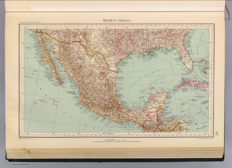
Touring club italiano
Full Title
Messico, Mexico. Propr. Artistico-letteraria del T.C.I. Ufficio cartografico del T.C.I. (1929)
Publisher
Touring club italiano
Author
Touring club italiano
Full Title
Messico Centrale, Mexico central. Propr. Artistico-letteraria del T.C.I. Ufficio cartografico del T.C.I. (1929)
Publisher
Touring club italiano
Author
Mitchell, Samuel Augustus
Full Title
Map of Mexico, Central America, and the West Indies. (with) Map of the Sandwich Islands. Discovered by Captn. Cook in 1778. (with) Map of the island of Jamaica. (with) Map of the Bermuda Islands. (with) Map of the Panama Railroad. Entered ... 1879 by S. Augustus Mitchell ... Washington. (1880)
Publisher
S.A. Mitchell
Full Title
Map of Mexico, Central America, and the West Indies. (with) Map of the Bermuda Islands. (with) Map of the island of Jamaica. (with) Map of the proposed ship rail road route across the isthmus of Tehuantepec. (with) Map of the Panama Railroad and proposed canal. (with) Map of the proposed Nicaragua Canal route. Copyright 1887 by Wm. M. Bradley & Bro. (1890)
Publisher
John Y. Huber & Co.
Full Title
North America. (with) Southern Mexico. (Published at the office of "The Times," London, 1895)
Publisher
The Times
Author
Lisle, Guillaume de, 1675-1726
Full Title
Carte du Mexique et de la Floride, des Terres Angloises et des Isles Antilles, du cours et des environs de la Riviere de Mississipi. Dressee sur un grand nombre de memoires principalemt. sur ceux de Mrs. d'Iberville et le Sueur. Par Guillaume Del'Isle, Geographe de l'Academie Royale des Sciences. A Paris, chez l'Auteur sur le Quai de l'Horloge, (avec) Privilege du Roy po. 20. ans, 1703 (1708 or later)
Publisher
Guillaume DeLisle, Quai de l'Horloge
Full Title
United States. Annin & Smith Sc., Boston. (Boston: Published by Richardson & Lord. 1820)
Publisher
Richardson & Lord
Author
Clouet, J. B. L. (Jean-Baptiste Louis), b. 1730
Full Title
Du Mexique. (with) La Terre Ferme. (1787)
Publisher
Mondhare et Jean
Author
[Mitchell, Samuel Augustus, Williams, W. (Wellington)]
Full Title
Map of Mexico, Central America, and the West Indies. (with) Map of the island of Cuba. (with) Map of the island of Jamaica. (with) Map of the Bermuda Islands. (with) Map of the Panama Railroad. Constructed & engraved by W. Williams, Philadelphia. Entered ... 1870 by S. Augustus Mitchell, Jr. ... Pennsylvania.
Publisher
[R.A. Campbell, S.A. Mitchell, Jr.]
Author
Greenleaf, Jeremiah
Full Title
The United States Of Mexico. (with) Guatemala or the United Provinces Of Central America.
Publisher
G.R. French
Author
Fenner, Rest.
Full Title
Mexico & Guatamala (sic). Fenner Sc., Paternoster Row. (London, Joseph Thomas, 1835)
Publisher
Joseph Thomas
Author
[Bowen, Emanuel, Gibson, John]
Full Title
Mexico Or New Spain. (to accompany) Atlas Minimus or a New Set of Pocket Maps of the Several Empires, Kingdoms and States of the Known World, with Historical Extracts relative to each. Drawn and Engraved by J. Gibson from the Best Authorities, Revis'd, Corrected and Improv'd by Eman: Bowen Geographer to His Majesty.
Publisher
J. Newberry
Author
[Andree, Richard, Scobel, Albert]
Full Title
Vereinigte Staaten von Nordamerika. Okt. 1905. (inset: nebenkarte) Hawaii-Inseln.
Publisher
Velhagen & Klasing
Author
[Andree, Richard, Scobel, Albert]
Full Title
Sudwestliche Vereinigte Staaten und Nordliches Mexico. Mai 1905. Bearb. v. R. Kocher, u. E. Umbreit, Lithorgr. v. A. Wagner, M. grosse u. G. Kirchner. Flachentreue Azimut-Projektion (Hauptpunkt 38 (degree) n. Br., 96 (degree) w., L.). (inset: nebenkarte) Das Mittlere Mexico.
Publisher
Velhagen & Klasing
Author
Mitchell, Samuel Augustus
Full Title
Map of the Republic of Mexico Compiled by W.H. Holmes. Published By C. Desilver, No. 714 Chesnut Street, Philadelphia. Entered according to Act of Congress in the year 1859 by Charles Desilver in the Clerk's office if the District Court of the Eastern District of Pennsylvania.
Publisher
Charles Desilver.
Author
[Matthews-Northrup Division, J.W. Clement Co.]
Full Title
Mexico. Copyright, J.W. Clement Co., Matthews-Northrup Works, Buffalo, N.Y. (inset map) Central Part of Mexico.
Publisher
World Publishing Company
Author
Stieler, Adolf
Full Title
Verein-Staaten Von Nord-America, Mexico, Yucatan U. A. Entw. u. gez. von Fr. v. Stulpnagel. Nachtr. bis 1873. Gestochen v. C. Metzeroth.
Publisher
Justus Perthes
Author
[Rand McNally and Company, State Farm Insurance Companies Travel Bureau]
Full Title
Rand McNally Road map, Mexico. Copyright by Rand McNally & Company, Chicago, Ill. Lithographed in the U.S.A. (inset map) Mexico D.F. and Vicinity. (to accompany) State Farm Road Atlas: United States, Canada, Mexico,Central and South America. Copyright 1940 by Rand McNally & Company, Chicago, Ill.
Publisher
State Farm Insurance Companies Travel Bureau
Author
[Geographisches Institut (Weimar, Germany), Kiepert, Heinrich, 1818-1899]
Full Title
Mexico, Texas und Californien. (with) Die Republiken von Central-America im Maasstab der Hauptkarte. (with) Haupt-Gold-District in Californien im doppelten maastab der Hauptkarte... (with) Plateau von Mexico ... Bearbeitet und gezeichnet von H. Kiepert. Situation und Schrift gestochen von K. Madel, Terrain von C. Jungmann. Weimar, Verlag des Geographischen Instituts, 1855.
Publisher
Weimar Geo Inst.
|