Who What Where WhenREMOVE |
Author
Seaman, James V.
Full Title
South America. Published by J.V. Seaman, 296 Pearl St., N. York. (1821)
Publisher
James V. Seaman
Author
Clouet, J. B. L. (Jean-Baptiste Louis), b. 1730
Full Title
Du Mexique. (with) La Terre Ferme. (1787)
Publisher
Mondhare et Jean
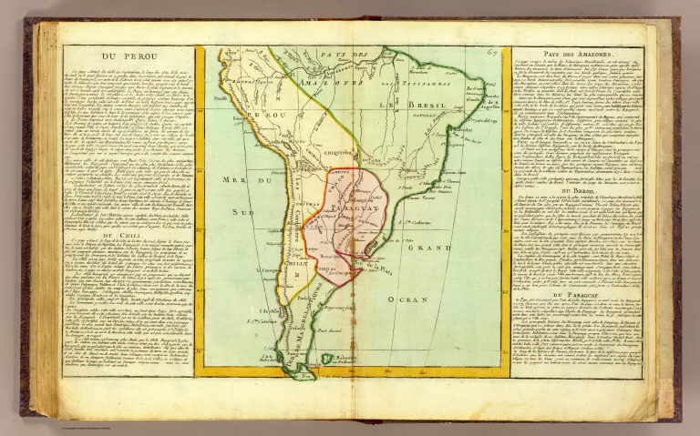
Author
Clouet, J. B. L. (Jean-Baptiste Louis), b. 1730
Full Title
Du Perou, du Chili, Pays des Amazones, du Bresil, du Paraguay. (1787)
Publisher
Mondhare et Jean
Author
Woodbridge, William C.
Full Title
South America. Entered ... 1821 by William C. Woodbridge of the state of Connecticut. (1824?)
Publisher
Oliver D. Cook & Sons
Full Title
South America. H. Morse, Sc. Published by Cummings, Hilliard & Co., Boston. (1826)
Publisher
Hilliard, Gray, Little and Wilkins
Author
[Mitchell, Samuel Augustus, Williams, W. (Wellington)]
Full Title
Map of South America, showing its political divisions. (with) Map showing the proposed Atrato-Inter Oceanic Canal routes, for connecting the Atlantic and Pacific Oceans. Constructed and engraved by W. Williams, Philadelphia. Entered ... 1870 by S. Augustus Mitchell, Jr. ... Pennsylvania.
Publisher
[R.A. Campbell, S.A. Mitchell, Jr.]
Author
Mitchell, Samuel Augustus
Full Title
Map of New Granada, Venezuela and Guiana. (with) Map of Peru, and Equador. (with) Map of the Argentine Confederation. Entered ... 1870 by S. Augustus Mitchell, Jr. ... Pennsylvania.
Publisher
[R.A. Campbell, S.A. Mitchell, Jr.]
Author
Mitchell, Samuel Augustus
Full Title
Map of Brazil, Bolivia, Paraguay, and Uruguay. (with) Map of Chili. (with) Harbor of Bahia. (with) Harbor of Rio Janeiro. (with) Island of Juan Fernandez. Entered ... 1870 by S. Augustus Mitchell, Jr. ... Pennsylvania.
Publisher
[R.A. Campbell, S.A. Mitchell, Jr.]
Full Title
Sud-America. (Efter Stielers Hand-Atlas. Stockholm, J.L. Brudin, 1852)
Publisher
J.L. Brudin
Author
Greenleaf, Jeremiah
Full Title
South America.
Publisher
G.R. French
Author
Greenleaf, Jeremiah
Full Title
United Provinces, Chili & Patagonia.
Publisher
G.R. French
Author
Fenner, Rest.
Full Title
South America. Fenner Sc., Paternoster Row. (London, Joseph Thomas, 1835)
Publisher
Joseph Thomas
Author
Fenner, Rest.
Full Title
Colombia. Fenner Sc., Paternoster Row. (London, Joseph Thomas, 1835)
Publisher
Joseph Thomas
Author
Fenner, Rest.
Full Title
Peru, Chili, La Plata &c. Fenner Sc., Paternoster Row. (London, Joseph Thomas, 1835)
Publisher
Joseph Thomas
Author
Carey, Mathew
Full Title
A Map Of South America According to the best Authorities. Engraved for Carey's American Edition of Guthrie's Geography improved.
Publisher
M. Carey
Author
[Stieler, Adolf, Stulpnagel, F.v.]
Full Title
No. LV. Stieler's Hand-Atlas (No. 49a). Sud-Amerika.
Publisher
Justus Perthes
Author
[Stieler, Adolf, Stulpnagel, F.v.]
Full Title
No. LX. Stieler's Hand-Atlas (No. 49b). Sud-Amerika in zwei Blattern.
Publisher
Justus Perthes
Author
Stieler, Adolf
Full Title
No. LXI. Stieler's Hand-Atlas (No. 49c). Sud-Amerika in zwei Blattern. (insets) Bay von Rio de Janiero. Rio de Janiero.
Publisher
Justus Perthes
Author
Stieler, Adolf
Full Title
Stieler's Hand-Atlas (No. 41a). Amerika.
Publisher
Justus Perthes
Author
[Stieler, Adolf, Stulpnagel, Friedr. v.]
Full Title
No. LV. Stieler's Hand-Atlas (No. 49a). Sud-Amerika.
Publisher
Justus Perthes
Author
[Stieler, Adolf, Stulpnagel, F.v.]
Full Title
No. LX. Stieler's Hand-Atlas (No. 49b). Sud-Amerika in zwei Blattern.
Publisher
Justus Perthes
Author
Stieler, Adolf
Full Title
No. LXI. Stieler's Hand-Atlas (No. 49c). Sud-Amerika in zwei Blattern. (insets) Bay von Rio de Janiero. Rio de Janiero.
Publisher
Justus Perthes
Author
Tanner, Henry S.
Full Title
South America and West Indies. With Improvements to 1823. Engraved & Published by H.S. Tanner, Philadelphia. Entered ... 8th day of June, 1818, by Tanner, Vallance, Kearney & Co. ... Pennsylvania. American Atlas.
Publisher
Henry Tanner
Author
Tanner, Henry S.
Full Title
South America and West Indies. 1818. (northern section) Drawn, Engraved & Published by Tanner, Vallance, Kearney & Co. Philadelphia. American Atlas.
Publisher
Henry Tanner
Author
Tanner, Henry S.
Full Title
South America and West Indies. 1818. (southern section) Drawn, Engraved & Published by Tanner, Vallance, Kearney & Co. Philadelphia. Entered ... 8th day of June, 1818, by Tanner, Vallance, Kearney & Co. ... Pennsylvania. American Atlas.
Publisher
Henry Tanner
Author
Carey, Mathew
Full Title
A Map Of South America According to the best Authorities. Engraved for Carey's American Edition of Guthrie's Geography improved.
Publisher
Mathew Carey
Author
[Bowen, Emanuel, Gibson, John]
Full Title
South America. (to accompany) Atlas Minimus or a New Set of Pocket Maps of the Several Empires, Kingdoms and States of the Known World, with Historical Extracts relative to each. Drawn and Engraved by J. Gibson from the Best Authorities, Revis'd, Corrected and Improv'd by Eman: Bowen Geographer to His Majesty.
Publisher
J. Newberry
Author
Carey, Mathew
Full Title
A Map Of South America According to the best Authorities. Engraved for Carey's American Edition of Guthrie's Geography improved.
Publisher
Mathew Carey
Author
[Andree, Richard, Scobel, Albert]
Full Title
Ubersichtskarte von Sudamerika. (insets: nebenkarten) Das Mittlere Chile ; Mundungsgebiet des Rio de la Plata.
Publisher
Velhagen & Klasing
Author
[Andree, Richard, Scobel, Albert]
Full Title
Sudamerika, Nordliche Halfte. Bearb. v. Dr. E. Friedrich u. E. Umbreit. Litogr. v. W. Ketterer u. G. Kirchner. (inset: nebenkarte) Archip. de Colon (Galapagos Ins.).
Publisher
Velhagen & Klasing
Author
[Andree, Richard, Scobel, Albert]
Full Title
Sudamerika, Sudliche Halfte. Okt. 1905. Bearb. v. Dr. E. Friedrich u. E. Umbreit. Litogr. v. W. Ketterer u. G. Kirchner. Flachentreue Azimutaler Entwurf. (inset: nebenkarte) Rio de Janeiro ; Sudl. Brasilien.
Publisher
Velhagen & Klasing
Author
[Codazzi, Agustín, 1793-1859, Paz, Manuel María, 1820-1902]
Full Title
Mapa que contiene una parte de las Republicas del Ecuador, Peru y Bolivia para servir a la historia de las campanas del ejercito Colombiano en el alto y bajo Peru, 1823 a 1826. Grabado por Erhard Hermanos, 8 Calle Nicole, Paris. (to accompany) Atlas geografico e historico de la Republica de Colombia (Antigua Nueva Granada).
Publisher
A. Lahure
Author
[Codazzi, Agustín, 1793-1859, Paz, Manuel María, 1820-1902]
Full Title
Division politica de Colombia en 1824. Grabado por Erhard Hermanos, 8 Calle Nicole, Paris. (to accompany) Atlas geografico e historico de la Republica de Colombia (Antigua Nueva Granada).
Publisher
A. Lahure
Author
[Codazzi, Agustín, 1793-1859, Paz, Manuel María, 1820-1902]
Full Title
Carta de la Nueva Granada: dividida en provincias; 1832 a 1856; Uti-possidetis de 1810. Grabado por Erhard Hermanos, 8 Calle Nicole, Paris. (to accompany) Atlas geografico e historico de la Republica de Colombia (Antigua Nueva Granada).
Publisher
A. Lahure
Author
[Codazzi, Agustín, 1793-1859, Paz, Manuel María, 1820-1902]
Full Title
Carta de la Republica de Colombia (Antigua Nueva Granada) : dividida en departmentos ; 1886. Grabado por Erhard Hermanos, 8 Calle Nicole, Paris. (to accompany) Atlas geografico e historico de la Republica de Colombia (Antigua Nueva Granada).
Publisher
A. Lahure
Author
[Codazzi, Agustín, 1793-1859, Paz, Manuel María, 1820-1902]
Full Title
Carta que representa el sistema orografico y las vertientes y hoyas hidrograficas de Colombia. Grabado por Erhard Hermanos, 8 Calle Nicole, Paris. (to accompany) Atlas geografico e historico de la Republica de Colombia (Antigua Nueva Granada).
Publisher
A. Lahure
Author
[Codazzi, Agustín, 1793-1859, Paz, Manuel María, 1820-1902]
Full Title
Carta de Colombia que representa los territorios que han existido desde 1843 hasta 1886 hoy extinguidos. Grabado por Erhard Hermanos, 8 Calle Nicole, Paris. (to accompany) Atlas geografico e historico de la Republica de Colombia (Antigua Nueva Granada).
Publisher
A. Lahure
Author
[Codazzi, Agustín, 1793-1859, Paz, Manuel María, 1820-1902]
Full Title
Carta geologica de Colombia : Venezuela y Ecuador. Grabado por Erhard Hermanos, 8 Calle Nicole, Paris. (to accompany) Atlas geografico e historico de la Republica de Colombia (Antigua Nueva Granada).
Publisher
A. Lahure
Author
[Codazzi, Agustín, 1793-1859, Paz, Manuel María, 1820-1902]
Full Title
Carta postal y telegrafica de la Republica de Colombia (Antigua Nueva Granada). Grabado por Erhard Hermanos, 8 Calle Nicole, Paris. (to accompany) Atlas geografico e historico de la Republica de Colombia (Antigua Nueva Granada).
Publisher
A. Lahure
Author
[Codazzi, Agustín, 1793-1859, Paz, Manuel María, 1820-1902]
Full Title
Carta de Colombia la division eclesiastica. Grabado por Erhard Hermanos, 8 Calle Nicole, Paris. (to accompany) Atlas geografico e historico de la Republica de Colombia (Antigua Nueva Granada).
Publisher
A. Lahure
Author
Mitchell, Samuel Augustus
Full Title
South America. Entered according to Act of Congress in the year 1860 by Charles Desilver in the Clerk's office if the District Court of the Eastern District of Pennsylvania. 42.
Publisher
Charles Desilver.
Author
[Johnston, Alexander Keith, 1804-1871, Rogers, Henry Darwin]
Full Title
The physical features of North & South America, showing the mountains, table-lands, plains & slopes. By A.K. Johnston, F.R.S.E. with original sections by H.D. Rogers. Engraved & printed by W. & A.K. Johnston. William Blackwood & Sons, Edinburgh & London. (1856)
Publisher
William Blackwood & Sons
Author
Debenham, Frank
Full Title
South America. (Copyright) G.P. Ltd. (with inset map)Tierra del Fuego. (view) West of Andes.
Publisher
Simon and Schuster
Author
Debenham, Frank
Full Title
South America. (Pictorial map).
Publisher
Simon and Schuster
Author
Debenham, Frank
Full Title
The Northern Half of South America. (Copyright) G.P. Ltd.
Publisher
Simon and Schuster
Author
Debenham, Frank
Full Title
The Southern Half of South America. (Copyright) G.P. Ltd. (inset) The southernmost tip of South America ...
Publisher
Simon and Schuster
Author
[Berghaus, Heinrich, Johnston, Alexander Keith, 1804-1871]
Full Title
The river systems of America, extended from the designs of Professor Berghaus, with additions of detailed maps of some of the principal hydrographical phenomena of the New World by A.K. Johnston, F.R.G.S. Corrected to 1855. Engraved by W. & A.K. Johnston. William Blackwood & Sons, Edinburgh & London. (1856)
Publisher
William Blackwood & Sons
Author
[Matthews-Northrup Division, J.W. Clement Co.]
Full Title
South America. Copyright, J.W. Clement Co., Matthews-Northrup Works, Buffalo, N.Y. (inset map) Puerto Rico and the Virgin Islands.
Publisher
World Publishing Company
Author
Rand McNally & Company
Full Title
Rand McNally Popular map of South America. Copyright by Rand McNally & Company, Chicago. Made in U.S.A.
Publisher
Rand McNally & Company
Author
[Rand McNally and Company, State Farm Insurance Companies Travel Bureau]
Full Title
Map of South and Central America. Showing proposed Inter-American Highway. Copyright by Rand McNally & Company, Chicago. Made in U.S.A. (to accompany) State Farm Road Atlas: United States, Canada, Mexico,Central and South America. Copyright 1940 by Rand McNally & Company, Chicago, Ill.
Publisher
State Farm Insurance Companies Travel Bureau
|