Who What Where WhenREMOVE |
Author
Colton, G.W.
Full Title
Minnesota. Published By J.H. Colton & Co. No. 172 William St. New York. Entered ... 1855 by J.H. Colton & Co. ... New York. No. 49.
Publisher
J.H. Colton
Author
Asher & Adams
Full Title
Asher & Adams' Dakota. Entered according to Act of Congress in the year 1874 by Asher & Adams ... at Washington. (New York, 1874)
Publisher
Asher and Adams
Author
Shell Oil Company
Full Title
Shell Map of North Dakota, South Dakota (cover title). Shell Highway Map of South Dakota. 9-W 1949-1.
Publisher
Shell Oil Company
Author
Vandermaelen, Philippe, 1795-1869
Full Title
Partie des Etats Unis. Amer. Sep. no. 40. Dessinee par H. Ghiesbreght. (Dresse par Ph. Vandermaelen, lithographie par H. Ode. Quatrieme partie. - Amer. sept. Bruxelles. 1827)
Publisher
Ph. Vandermaelen
Author
Cram, George Franklin
Full Title
Railroad and County Map of Dakota. Geo. F. Cram. Engraver and Publisher, Chicago.
Publisher
George F. Cram
Author
Colton, G.W.
Full Title
Colton's Dakota. Published By G. W & C. B. Colton & Co. No. 182 William St. New York.
Publisher
G. W & C. B. Colton & Co.
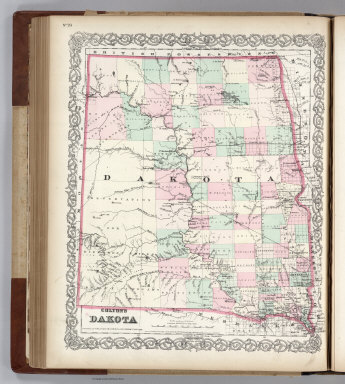
Author
Colton, G.W.
Full Title
Colton's Dakota. Published By G. W & C. B. Colton & Co. No. 172 William St. New York.
Publisher
G. W & C. B. Colton & Co.
Author
Colton, G.W.
Full Title
Colton's Map of Kansas, Nebraska, Dakota & Indian Territory. Published by G.W. & C.B. Colton & Co., No. 172 William St. New York.
Publisher
G.W. & C.B. Colton
Author
Cram, George Franklin
Full Title
South Dakota.
Publisher
George F. Cram
Author
Mitchell, Samuel Augustus Jr.
Full Title
County Map of Colorado, Wyoming, Dakota, Montana.
Publisher
Ziegler & McCurdy
Author
Johnson, A.J.
Full Title
Johnson's Nebraska, Dakota, Colorado, Idaho, Kansas. By Johnson And Ward.
Publisher
Johnson and Ward
Author
Johnson, A.J.
Full Title
Johnson's Minnesota and Dakota By Johnson and Ward.
Publisher
Johnson and Ward
Author
[Jones, C.H., Hamilton, T.H., Williams, J.David]
Full Title
Map of Nebraska, Dakota, Montana, and Wyoming
Publisher
J. David Williams
Author
[Bayer, Herbert, Container Corporation of America]
Full Title
North Dakota. South Dakota. U.S. States.
Publisher
Container Corporation of America
Author
[Lloyd, H.H., Warner & Beers]
Full Title
Atlas of the United States, Map of the Territory of Dakota, and the States of Minnesota, and Nebraska. Warner & Beers, Publishers. From H.H. Lloyd & Co.'s Atlas of the United States.
Publisher
Warner & Beers
Author
Page, H.R. & Co.
Full Title
Page's Map of Dakota, 1885. Copyrighted 1880 by H.R. (Page).
Publisher
H.R. Page & Co.
Author
Johnson, A.J.
Full Title
Johnson's Nebraska, Dakota, Idaho, Montana and Wyoming. Entered ... 1865.
Publisher
A.J. Johnson
Author
[Michler, Nathaniel, United States. War Department]
Full Title
Fredericksburg. Prepared by Bvt. Brig. Gen. N. Michler ... by order of ... A.A. Humphreys. 1867. (with) Map exhibiting the route of the Sioux Expedition under the command of Brig. Gen. H.H. Sibley, 1863. Compiled and projected by John H. Wagner ... (with) Map of the fight of the 14th A.C. at Buzzard Roost, Ga., February 24th, 25th and 26th, 1864 by Theo. Wiseman, A.A. ... (with) Sketch of battle of Big Mound, fought July 24th, 1863 by the expeditionary forces commanded by Brigadier General H.H. Sibley. Sketched and drawn by Joseph McCloud. (with) Sketch of the battle at Dead Buffalo Lake, July 26th, 1863, commanded by Brig. Gen. H.H. Sibley. (with) Map accompanying report of the battle of Dry Fork Creek, Mo., on the 5th of July, 1861 ... report of Capt. T.W. Sweeny ... Julius Bien & Co., Lith., N.Y. (1891-1895)
Publisher
U.S. Government Printing Office
Author
Asher & Adams
Full Title
Asher & Adams' Dakota. Entered according to Act of Congress 1875 by Asher & Adams in the Office of the Librarian of Congress at Washington.
Publisher
Asher & Adams.
Author
Cram, George Franklin
Full Title
South Dakota. Geo. F. Cram, Engineer, Chicago. (1909)
Publisher
E.A. Davis
Author
Rand McNally and Company
Full Title
Rand McNally junior auto road map South Dakota. Copyright by Rand McNally & Company, Chicago, Ill. (1927)
Publisher
Rand McNally
Author
[Geographical and Geological Survey of the Rocky Mountain Region (U.S.), Jenney, Walter Proctor, 1849-1921, Newton, Henry, 1845-1877]
Full Title
Bird's eye view of the Black Hills to illustrate the geological structure. Dept. of the Interior, U.S.G. and G. Survey, J.W. Powell, in charge. Geology of the Black Hills by Henry Newton, E.M. (Julius Bien, Lith. New York, 1879)
Publisher
Julius Bien
Author
[Geographical and Geological Survey of the Rocky Mountain Region (U.S.), Jenney, Walter Proctor, 1849-1921, M'Gillycuddy, V. T., Mahlo, Emil, 1851-1904, Newton, Henry, 1845-1877, Tuttle, H. P.]
Full Title
Map of the Black Hills of Dakota, from explorations made in 1873. W.P. Jenney, Engineer of Mines, in charge. H. Newton, Engineer of Mines, geologist. V.T. M'Gillycuddy, M.D., topographer. H.P. Tuttle, A.M., astronomer. Drawn by Emil Mahlo. Dept. of the Interior, U.S.G. and G. Survey, J.W. Powell, in charge. Geology of the Black Hills by Henry Newton, E.M. (Julius Bien, Lith. New York, 1879)
Publisher
Julius Bien
Author
[Geographical and Geological Survey of the Rocky Mountain Region (U.S.), Newton, Henry, 1845-1877]
Full Title
Geological map of the Black Hills of Dakota by Henry Newton, E.M. Dept. of the Interior, U.S.G. and G. Survey, J.W. Powell, in charge. Geology of the Black Hills by Henry Newton, E.M. (Julius Bien, Lith. New York, 1879)
Publisher
Julius Bien
Author
Page, H.R. & Co.
Full Title
Page's Map of Dakota, 1886. Copyrighted 1880.
Publisher
H.R. Page & Co.
Author
Mitchell, Samuel Augustus Jr.
Full Title
Map of Kansas, Nebraska and Colorado. Showing also the southern portion of Dacotah. Drawn & Engraved by W.H. Gamble Philada. Entered ... 1861 by S. Augustus Mitchell, Jr. ... Pennsylvania.
Publisher
S.A. Mitchell Jr.
Author
Mitchell, Samuel Augustus Jr.
Full Title
County map of Colorado, Wyoming, Dakota, Montana. Entered ... 1874, by S. Augustus Mitchell ... Washington.
Publisher
S.A. Mitchell Jr.
Author
Mitchell, Samuel Augustus Jr.
Full Title
North and South Dakota. Entered ... 1877 by S. Augustus Mitchell, . ... Washington. (inset map): Plan of Charleston.
Publisher
S.A. Mitchell Jr.
Author
Mitchell, Samuel Augustus
Full Title
Map of Minnesota Territory.
Publisher
Thomas, Cowperthwait & Co.
Author
Mitchell, Samuel Augustus Jr.
Full Title
County map of Colorado, Wyoming, Dakota, Montana. Entered ... 1877 by S. Augustus Mitchell, . ... Washington.
Publisher
S.A. Mitchell Jr.
Author
Mitchell, Samuel Augustus Jr.
Full Title
Map of Kansas, Nebraska and Colorado. Showing the Southern Portion of Dacotah. Drawn and Engraved by W.H. Gamble Philada. Entered ... 1867 by S. Augustus Mitchell, Jr. ... Pennsylvania.
Publisher
S.A. Mitchell Jr.
Author
Johnson, A.J.
Full Title
Johnson's Minnesota And Dakota By Johnson & Browning. No. 45.
Publisher
Johnson and Browning
Author
National Map Company
Full Title
South Dakota. (Copyrighted by) National Map Company, Indianapolis. (to accompany) Official Paved Road and Commercial Survey of the United States.
Publisher
National Map Company
Author
Cram, George Franklin
Full Title
Cram's Rail Road & Township Map of Dakota. Published by Geo. F. Cram. Proprietor of the Western Map Depot. 66, Lake St. Chicago Ills. 1875.
Publisher
Cram Atlas Company
Full Title
County and township map of Dakota. Copyright 1887 by Wm. M. Bradley & Bro. (1890)
Publisher
John Y. Huber & Co.
Full Title
Territory of Dakota. (By S. Augustus Mitchell. 1880)
Publisher
S.A. Mitchell
Author
[USGS (U.S. Geological Survey), Walcott, Charles D., Herron, W.H.]
Full Title
Plate CXLI. Newcastle Quadrangle, Wyoming - South Dakota, Land Classification and Density of Standing Timber. Julis Bien & Co. Lith. N.Y.
Publisher
Government Printing Office
Author
[Scovel, James L., O'Brien, Emmett J]
Full Title
Horizontal Strata. Elmira, N. Y. (on the opposite page)Sheep Mountain table, S.D. 1:24,000. (on top of the page) Dendritic Drainage. (inset view) South Dakota Badlands.(Courtesy of Barnum Brown Collection ...)
Publisher
John Wiley & Sons Inc.
Author
Mitchell, Samuel Augustus
Full Title
Map of Minnesota and Dakota. Published By Charles Desilver, No. 714 Chesnut Street, Philadelphia. Entered according to Act of Congress in the year 1860 by Charles Desilver in the Clerk's office if the District Court of the Eastern District of Pennsylvania. 36.
Publisher
Charles Desilver.
Author
Stieler, Adolf
Full Title
Vereinigte Staaten Von Nord-Amerika In 6 Blattern, Bl. 2. Petermann. Bearbeitet v. H. Habenicht. Gest v. Eberhardt, Kuhn, Metzeroth & Weiler. Gotha: Justus Perthes. 1873.
Publisher
Justus Perthes
Author
[Rand McNally and Company, State Farm Insurance Companies Travel Bureau]
Full Title
Rand McNally Road map, South Dakota. Copyright by Rand McNally & Company, Chicago, Ill. Lithographed in the U.S.A. (to accompany) State Farm Road Atlas: United States, Canada, Mexico,Central and South America. Copyright 1940 by Rand McNally & Company, Chicago, Ill.
Publisher
State Farm Insurance Companies Travel Bureau
Author
Bradstreet Company
Full Title
Dakota. (to accompany) Bradstreet's Pocket Atlas Of The United States. Published Exclusively for Macullar, Parker & Company, Boston, Massachusetts ... New York: The Bradstreet Company, 1885. (on verso) Entered ... 1879, by The Bradstreet Company ... Washington.
Publisher
Bradstreet Co.
Author
[Taylor, Frank J., White, Ruth Taylor]
Full Title
South Dakota.
Publisher
Little, Brown, and Company
Author
Cram, George Franklin
Full Title
Dakota.
Publisher
A.C. Shewey and Co.
Author
[Colton, G.W., Colton, C.B.]
Full Title
Gray's Atlas Map of Dakota. 1873. Entered ... 1873 by G.W. & C.B. Colton ....
Publisher
Stedman, Brown & Lyon
Author
[Gray, Frank A., Gray, O.W.]
Full Title
Gray's New Map of Dakota with Part of Manitoba, Etc. by Frank A. Gray. Copyright 1883 by O.W. Gray & Son.
Publisher
Stedman & Brown
Author
Cram, George Franklin
Full Title
Cram's Rail Road & Township Map of Dakota.
Publisher
George F. Cram
Author
Appleton, D. & Co.
Full Title
Map of South Dakota and North Dakota. Copyright 1891 by Matthews-Northrup Co. ... Buffalo, New York. (to accompany) The Library Atlas Of Modern Geography ... New York, D. Appleton And Company 1892. (on upper margin) South Dakota and North Dakota 97
Publisher
D. Appleton & Co.
Author
[Rand McNally and Company, State Farm Insurance Companies Travel Bureau]
Full Title
Rand McNally Road map: South Dakota. Copyright by Rand McNally & Company, Chicago, Ill. Lithorgaphed in the U.S.A. U.3608. (to accompany) State Farm road atlas : United States, Canada, Mexico.
Publisher
State Farm Insurance Companies Travel Bureau
|