Who What Where WhenREMOVE |
Author
D.F. Robinson & Co.
Full Title
Eastern States. Entered according to Act. of Congress Nov. 20th 1829 by D.F. Robinson & Co. of the state of Connecticut.
Publisher
Robinson, Pratt & Co.
Full Title
Middle States. Entered according to act of Congress. (1837)
Publisher
Robinson, Pratt & Co.
Author
Goodrich, S.G.
Full Title
Connecticut. New-England. G. Boynton Sc. Entered ... by S.G. Goodrich of Massachusetts. (Boston: Gray & Bowen ... 1831)
Publisher
Gray & Bowen
Author
Goodrich, S.G.
Full Title
Middle States. Southern States. G. Boynton Sc. Entered ... by S.G. Goodrich of Massachusetts. (Boston: Gray & Bowen ... 1831)
Publisher
Gray & Bowen
Author
Mitchell, Samuel Augustus
Full Title
Map of the New England or Eastern States. Engraved to illustrate Mitchell's school and family geography. (with) Map of New Brunswick, Nova Scotia and Newfoundland &c. (with) Vicinity of Boston & Providence. (with) Vicinity of New Haven & Hartford. Drawn and engraved by J.H. Young. Entered ... 1844 by S. Augustus Mitchell ... Eastern District of Pennsylvania.
Publisher
Thomas, Cowperthwait & Co.
Author
Mitchell, Samuel Augustus
Full Title
Map of the Middle States and part of the southern. Engraved to illustrate Mitchell's school and family geography. Entered ... 1839 by S. Augustus Mitchell ... Connecticut.
Publisher
Thomas, Cowperthwait & Co.
Author
Touring club italiano
Full Title
Stati Uniti, United States of America. Ohio, Pennsylvania, New York, Vermont, New Hampshire, West Virginia, Virginia, North Carolina. Propr. Artistico-letteraria del T.C.I. Ufficio cartografico del T.C.I. (1929)
Publisher
Touring club italiano
Author
Touring club italiano
Full Title
Stati Uniti, United States of America, Massachusetts, Connecticut, Rhode Island, New Jersey, Delaware, Maryland, con parte di Pennsylvania, New York, Vermont, New Hampshire. Propr. Artistico-letteraria del T.C.I. Ufficio cartografico del T.C.I. (1929)
Publisher
Touring club italiano
Author
Gannett, Henry, 1846-1914
Full Title
Map showing the position of the center of population at the close of each decade from 1790 to 1900 and the location of the median point in 1880, 1890 and 1900. Compiled by Henry Gannett, Geographer. (United States Census Office, 1903). Julius Bien & Co., N.Y.
Publisher
U.S. Census Office
Full Title
The death rate due to consumption per 100,000 of population 1900 (New York, New Jersey, New England. Prepared under the supervision of Henry Gannett, Geographer of the Twelfth Census. United States Census Office, 1903). Julius Bien & Co., N.Y.
Publisher
U.S. Census Office
Full Title
The death rate due to cancer and tumor per 100,000 of population 1900 (New York, New Jersey, New England. Prepared under the supervision of Henry Gannett, Geographer of the Twelfth Census. United States Census Office, 1903). Julius Bien & Co., N.Y.
Publisher
U.S. Census Office
Full Title
The death rate due to diphtheria and croup per 100,000 of population 1900 (New York, New Jersey, New England. Prepared under the supervision of Henry Gannett, Geographer of the Twelfth Census. United States Census Office, 1903). Julius Bien & Co., N.Y.
Publisher
U.S. Census Office
Author
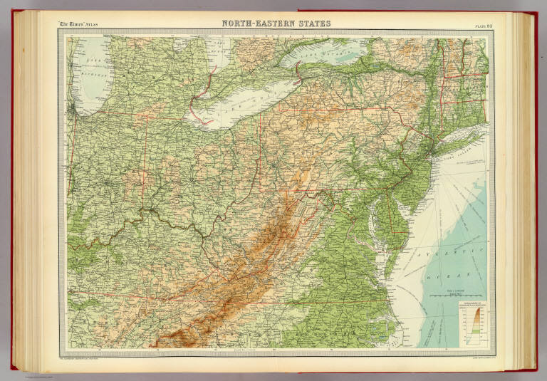
[Bartholomew, J. G. (John George), 1860-1920, John Bartholomew & Co.]
Full Title
North-eastern states. The Edinburgh Geographical Institute, John Bartholomew & Co. "The Times" atlas. (London: The Times, 1922)
Publisher
The Times
Full Title
The death rate due to influenza per 100,000 of population 1900 (New York, New Jersey, New England. Prepared under the supervision of Henry Gannett, Geographer of the Twelfth Census. United States Census Office, 1903). Julius Bien & Co., N.Y.
Publisher
U.S. Census Office
Full Title
The death rate due to typhoid fever per 100,000 of population 1900 (New York, New Jersey, New England. Prepared under the supervision of Henry Gannett, Geographer of the Twelfth Census. United States Census Office, 1903). Julius Bien & Co., N.Y.
Publisher
U.S. Census Office
Full Title
United States, western. United States, north-eastern. (with Environs of New York City. Published at the office of "The Times," London, 1895)
Publisher
The Times
Full Title
Die Nordost-Staaten der Union. (Richard Andree. Herausgegeben von der Geographischen Anstalt von Velhagen & Klasing in Leipzig. 1881)
Publisher
Velhagen & Klasing
Author
Tanner, Henry S.
Full Title
Map Of The States Of Maine, New Hampshire, Vermont, Massachusetts, Connecticut & Rhode Island By H.S. Tanner. (with) North Part of Maine. Engraved & Published by H.S. Tanner, Philadelphia. Entered ... 14th day of Novr. 1820 by H.S. Tanner ... Pennsylvania. American Atlas.
Publisher
Henry Tanner
Author
Stieler, Adolf
Full Title
Vereinigte Staaten Von Nord-Amerika In 6 Blattern, Bl. 3. Petermann. Bearbeitet v. H. Habenicht. Gest v. Eberhardt, Kuhn, Metzeroth & Weiler. Gotha: Justus Perthes. 1873.
Publisher
Justus Perthes
Author
Melish, John
Full Title
D: (Untitled outline map of the United States).
Publisher
(John Melish)
Author
Tanner, Henry S.
Full Title
Map Of The States Of Maine, New Hampshire, Vermont, Massachusetts, Connecticut & Rhode Island By H.S. Tanner. Improved To 1825. (with) North Part of Maine. American Atlas. Engraved & Published by H.S. Tanner, Philadelphia. Entered ... 14th day of Novr. 1820 by H.S. Tanner ... Pennsylvania.
Publisher
Henry Tanner
Author
[Gray, Ormando Willis, Walling, H. F.]
Full Title
Map of New England with adjacent portions of New York & Canada. (with) 15 miles around Boston. H.F. Walling & O.W. Gray, Boston, 1871.
Publisher
Stedman, Brown & Lyon
Author
Bradford, Thomas G.
Full Title
Michigan and the Great Lakes. G.W. Boynton & Co. Sc. (to accompany) A Comprehensive Atlas, Geographical, Historical & Commercial. By T.G. Bradford. William D. Ticknor, Boston. Wiley & Long, New-York. Entered ... 1835, by Thos. G. Bradford ... Massachusetts.
Publisher
[William D. Ticknor, Wiley & Long]
Author
[Johnston, Alexander Keith, 1804-1871, Rogers, Henry Darwin]
Full Title
States Of Maine, N. Hampshire, Vermont, Massachusetts, Rhode Island, Connecticut, New York, Pennsylvania, And New Jersey. By Prof. H.D. Rogers & A. Keith Johnston, F.R.S.E. Entered in Sta. Hall. London ... & according to an act of Congress ... 1857, by H.D. Rogers ... Massachusetts. London, John Murray, Albemarle Street, Edinburgh, W. & A.K. Johnston. Engraved by W. & A.K. Johnston, Edinburgh.
Publisher
Edward Stanford
Author
Bowen, Emanuel
Full Title
A new and accurate map of New Jersey, Pensilvania, New York and New England, with the adjacent countries. Drawn from surveys, assisted by the most approved modern maps & charts, and regulated by astronomical observations. By Eman. Bowen. (London: Printed for William Innys, Richard Ware, Aaron Ward, J. and P. Knapton, John Clarke, T. Longman and T. Shewell, Thomas Osborne, Henry Whitridge ... M.DCC.XLVII)
Publisher
William Innys [et al.]
Author
Mitchell, Samuel Augustus
Full Title
Map of the New England or Eastern States. Engraved to Illustrate Mitchell's School and Family Geography. No. 6. Engraved by J.H. Young. Entered ... 1839, by S. Augustus Mitchell ... Connecticut.
Publisher
Thomas, Cowperthwait & Co.
Author
Robert Sayer and John Bennett (Firm)
Full Title
A General Map of the Northern British Colonies in America, which comprehends the Province of Quebec, the Government of Newfoundland, Nova-Scotia, New-England and New-York. from the Maps Published by the Admiralty and Board of Trade, Regulated by the Astronomic and Trigonometric Observations of Major Holland, and Corrected from Governor Pownall's Late Map 1776. London: Printed for Robt. Sayer & Jno. Bennett ... 14th August 1776.
Publisher
Sayer and Bennett
Author
Robert Sayer and John Bennett (Firm)
Full Title
A General Map of the Middle British Colonies, in America. containing Virginia, Maryland, the Delaware Counties, Pennsylvania and New Jersey. With the addition of New York, and of the Greatest Part of New England, as also of the Bordering Parts of the Province of Quebec, improved from several Surveys made after the late War, and Corrected from Governor Pownall's Late Map 1776. (with) A Sketch of the Upper Parts of Canada. London: Printed for R. Sayer & J. Bennett ... 15th October 1776.
Publisher
Sayer and Bennett
Author
Tanner, Henry S.
Full Title
Map Of The States Of Maine, New Hampshire, Vermont, Massachusetts, Connecticut & Rhode Island By H.S. Tanner. (with) North Part of Maine. Engraved & Published by H.S. Tanner, Philadelphia. Entered ... 14th day of Novr. 1820 by H.S. Tanner ... Pennsylvania. American Atlas.
Publisher
Henry Tanner
Author
Mitchell, Samuel Augustus
Full Title
County Map Of The States Of New York, New Hampshire, Vermont. Massachusetts, Rhode Id. And Connecticut. 13. Constructed & Engraved by W. Williams Philadelphia. (with) two inset maps: Harbor And Vicinity Of New York. 14. Harbor And Vicinity Of Boston. 15. Entered ... 1860, by S. Augustus Mitchell, Jr. ... Pennsylvania.
Publisher
S.A. Mitchell, Jr.
Author
Lange, Henry, 1821-1893.
Full Title
Vermont, Neu Hampshire, Massachusetts, Connecticut u. Rhode Island. Maine. H. Lange's Atlas v. Nord Amerika Blatt II. Braunschweig: Verlag v. George Westermann. Lith. Anst. von L. Kraatz in Berlin.
Publisher
George Westermann.
Author
Moll, Herman, d. 1732
Full Title
New England, New York, New Jersey and Pensilvania. By H. Moll, Geographer. (Printed and sold by Tho: Bowles next ye Chapter House in St. Pauls Church Yard, & Ino: Bowles at ye Black Horse in Cornhill, 1736?)
Publisher
Thos. Bowles and John Bowles
Author
Popple, Henry
Full Title
A Map of the British Empire in America with the French and Spanish Settlements adjacent thereto. by Henry Popple. (Sheet 6).
Publisher
Willm. Henry Toms & R.W. Seale.
Author
Popple, Henry
Full Title
A Map of the British Empire in America with the French and Spanish Settlements adjacent thereto. by Henry Popple. (Sheet 7).
Publisher
Willm. Henry Toms & R.W. Seale.
Author
Popple, Henry
Full Title
A Map of the British Empire in America with the French and Spanish Settlements adjacent thereto. by Henry Popple. (Sheet 6).
Publisher
Willm. Henry Toms & R.W. Seale
Author
Popple, Henry
Full Title
A Map of the British Empire in America with the French and Spanish Settlements adjacent thereto. by Henry Popple. (Sheet 7).
Publisher
Willm. Henry Toms & R.W. Seale
Author
Pinkerton, John, 1758-1826
Full Title
United States of America, northern part. Drawn under the direction of Mr. Pinkerton by L. Hebert. Neele sculpt. 352 Strand. London: published 2d. April 1810 by Cadell & Davies, Strand & Longman, Hurst, Rees, Orme, & Brown, Pater Noster Row.
Publisher
[Cadell and Davies, Longman, Hurst, Rees, Orme, and Brown]
Author
[Robert de Vaugondy, Didier, 1723-1786, Robert de Vaugondy, Gilles, 1688-1766]
Full Title
Partie de l'Amerique Septentrionale, qui comprend le Cours de l'Ohio, la Nlle. Angleterre, la Nlle. York, le New Jersey, la Pensylvanie, le Maryland, la Virginie, la Caroline. Par le Sr. Robert de Vaugondy Geographe ordinaire du Roi. Avec Privilege 1755. M.C. Haussard fecit. (with) Supplement pour la Caroline.
Publisher
[Boudet, Les Auteurs]
|