Who What Where WhenWHEREWHO
|
REFINE
Browse All : Atlas Map of World from 1850
1-23 of 23
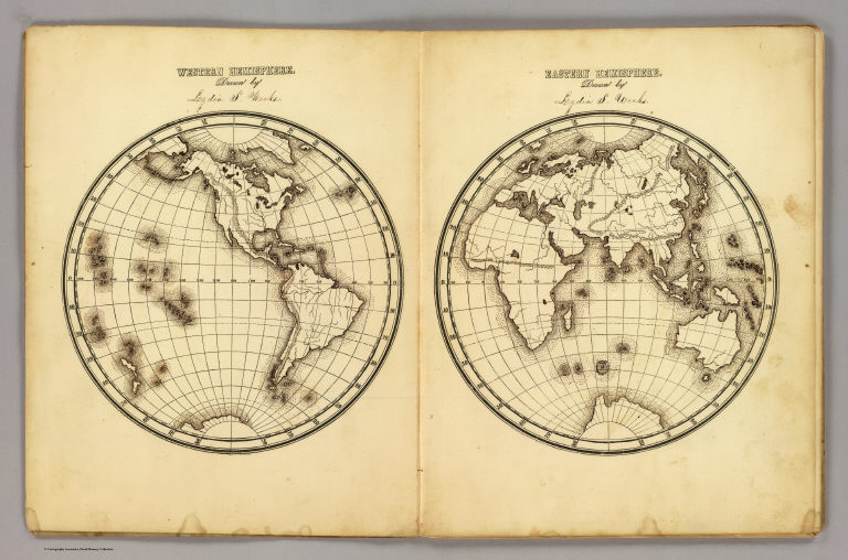
Author
[Fitch, George W., Weeks, Lydia S.]
Full Title
Western Hemisphere ... Eastern Hemisphere drawn by (to be filled in. By George W. Fitch. New York: Sheldon, Blakeman and Company, 115 Nassau Street. Entered ... 1850, by Huntington and Savage ... New York)
Publisher
Blakeman, Sheldon & Co.
Author
[Andriveau-Goujon, J., Bruguiere, Louis]
Full Title
Tableau comparatif de la forme et de la hauteur des principales montagnes du globe terrestre, dedie a Monsieur le Baron, Alexdre. de Humboldt. A Paris, chez J. Andriveau-Goujon, Rue du Bac, no. 17. Par son tres humble et tres obeissant serviteur Louis Bruguiere. Grave par Ambroise Tardieu. (1850)
Publisher
J. Andriveau-Goujon
Author
[Petermann, Augustus., Milner, Thomas]
Full Title
Geology. No. 1 & 2. Orographical Map of the Globe, Showing the Configuration & Physiography of Its Surface Constructed by Augustus Petermann, F.R.G.S. Engraved by John Dower, Pentonville, London. London: Published by Orr and Compy. Amen Corner, Paternoster Row.
Publisher
William S. Orr & Co.
Author
[Petermann, Augustus., Milner, Thomas]
Full Title
Geology. No. 3. Map of the World showing the distribution of Active Volcanoes and the Regions Visited by Earthquakes. Constructed by Augustus Petermann, F.R.G.S. London. Published by Orr and Compy., Amen Corner, Paternoster Row. (inset) Sketch of the extent and intensity of the Earthquake on the Rhine July 29, 1846....
Publisher
William S. Orr & Co.
Author
[Petermann, Augustus., Milner, Thomas]
Full Title
Hydrography. No. 4 & 5. Hydrographical Map of the World Chiefly with regard to the Division of the Ocean and the Boundaries of the River Systems. Constructed by Augustus Petermann, F.R.G.S. Engraved by John Dower, Pentonville, London. London: Published by Orr and Compy. Amen Corner, Paternoster Row.
Publisher
William S. Orr & Co.
Author
[Petermann, Augustus., Milner, Thomas]
Full Title
Hydrography. No. 6. Hydrographical Map of the World Showing the Currents, Temperature, etc. of the Ocean. Constructed by Augustus Petermann, F.R.G.S. Engraved by John Dower, Pentonville, London. London: Published by Orr and Compy. Amen Corner, Paternoster Row.
Publisher
William S. Orr & Co.
Author
[Petermann, Augustus., Milner, Thomas]
Full Title
Meteorology. No. 7. Meteorological Map of the World Showing the Distribution of the Temperature of the Air. Constructed by Augustus Petermann, F.R.G.S. Engraved by John Dower, Pentonville, London. London: Published by Orr and Compy. Amen Corner, Paternoster Row.
Publisher
William S. Orr & Co.
Author
[Petermann, Augustus., Milner, Thomas]
Full Title
Meteorology. No. 8. Map of the World showing the Distribution of the Winds and their Influence on Navigation. Constructed by Augustus Petermann, F.R.G.S. Engraved by John Dower, Pentonville, London. London: Published by Orr and Compy. Amen Corner, Paternoster Row.
Publisher
William S. Orr & Co.
Author
[Petermann, Augustus., Milner, Thomas]
Full Title
Meteorology. No.9. Hydrographic Map showing the distribution of the Rain over the Globe. Constructed by Augustus Petermann, F.R.G.S. Engraved by John Dower, Pentonville, London. London: Published by Orr and Compy. Amen Corner, Paternoster Row.
Publisher
William S. Orr & Co.
Author
[Petermann, Augustus., Milner, Thomas]
Full Title
Botanical Geography. No. 10. Botanical Map Showing the Distribution & Cultivation of some of the Most Important Plants over the Globe. Constructed by Augustus Petermann, F.R.G.S. Engraved by John Dower, Pentonville, London. London: Published by Orr and Compy. Amen Corner, Paternoster Row.
Publisher
William S. Orr & Co.
Author
[Petermann, Augustus., Milner, Thomas]
Full Title
Zoological Geography. No. 11. Zoological Map Showing the Distribution of the Principal Mammiferous Animals (Class Mammalia) Over the Globe. Constructed by Augustus Petermann, F.R.G.S. Engraved by John Dower, Pentonville, London. London: Published by Orr and Compy. Amen Corner, Paternoster Row.
Publisher
William S. Orr & Co.
Author
[Petermann, Augustus., Milner, Thomas]
Full Title
Zoological Geography. No. 12. Zoological Map Showing the Distribution of the Principal Birds and Reptiles (Aves et Reptilia) Over the Globe. Constructed by Augustus Petermann, F.R.G.S. Engraved by John Dower, Pentonville, London. London: Published by Orr and Compy. Amen Corner, Paternoster Row.
Publisher
William S. Orr & Co.
Author
[Petermann, Augustus., Milner, Thomas]
Full Title
Ethnography. No. 13. Ethnographical Map of the World showing the distribution of the Human Race in the Middle of the 19th Century. Constructed by Augustus Petermann, F.R.G.S. Engraved by John Dower, Pentonville, London. London: Published by Orr and Compy. Amen Corner, Paternoster Row.
Publisher
William S. Orr & Co.
Author
[Petermann, Augustus., Milner, Thomas]
Full Title
General Physical Geography. No.14. Physical Map of the British Isles. Showing their orography, climatology, and some Botantical and Zoological Features. Constructed by Augustus Petermann, F.R.G.S. Engraved by John Dower, Pentonville, London. London: Published by Orr and Compy. Amen Corner, Paternoster Row.
Publisher
William S. Orr & Co.
Author
[Petermann, Augustus., Milner, Thomas]
Full Title
Physical Map of Palestine and the Adjacent Countries. Constructed by Augustus Petermann, F.R.G.S. Engraved by John Dower, Pentonville, London. London: Published by Orr and Compy. Amen Corner, Paternoster Row.
Publisher
William S. Orr & Co.
Author
Arrowsmith, Aaron Jr.
Full Title
World on Globular Projection. Arrowsmith, Hydrographer to His Majesty. Re- Published, Jany st. 1845, by G.F. Cruchley, Mapseller, 81 Fleet Street, London. (to accompany) Outlines Of The World. By A. Arrowsmith, Hydrographer to His Majesty. 1850.
Publisher
G.F. Cruchley
Author
Arrowsmith, Aaron Jr.
Full Title
World on Mercator Projection. Re- Published, Jany st. 1845, by G.F. Cruchley, Mapseller, 81 Fleet Street, London. (to accompany) Outlines Of The World. By A. Arrowsmith, Hydrographer to His Majesty. 1850.
Publisher
G.F. Cruchley
Author
Stieler, Adolf
Full Title
No. VI. Stieler's Hand-Atlas No. 8. Planiglob der Antipoden.
Publisher
Justus Perthes
Author
Stieler, Adolf
Full Title
No.IX. Stieler's Hand-Atlas No. 10. Die bekannteren Hohwn uber der Meeresflache in Transparenten Profilen. (Mountains).
Publisher
Justus Perthes
Author
Bromme, Traugott
Full Title
42. Die ozeanischen Entdeckungen und die um die Kunde des Erdballs verdienten Forscher und Reisenden, vom Jahre 840-1850. Entworfen von Tr. Bromme. Ausgefuhrt v. E. Winckelmann. Stuttgart. Verlag von Krais & Hoffman. (to accompany) Atlas zur Physik der Welt. (with second title page) Atlas zu Alex. v. Humboldt's Kosmos ... Bromme.
Publisher
Krais & Hoffman
Author
Andriveau-Goujon, J.
Full Title
Carte generale du monde ancien, representant l'ensemble des connaissances geographiques des grecs et des romains. Publiee par J. Andriveau-Goujon, Rue du Bac, no. 17, Paris, 1845.
Publisher
J. Andriveau-Goujon
Author
Andriveau-Goujon, J.
Full Title
Terre suivant la projection de Mercator, et conforme a l'etat actuel des connaissances geographiques. Publiee par J. Andriveau-Goujon, Rue du Bac, no. 17, Paris, 1849. Ecrit par P. Rousset.
Publisher
J. Andriveau-Goujon
1-23 of 23
|